|
Hyūga, Miyazaki
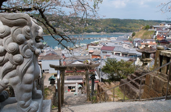
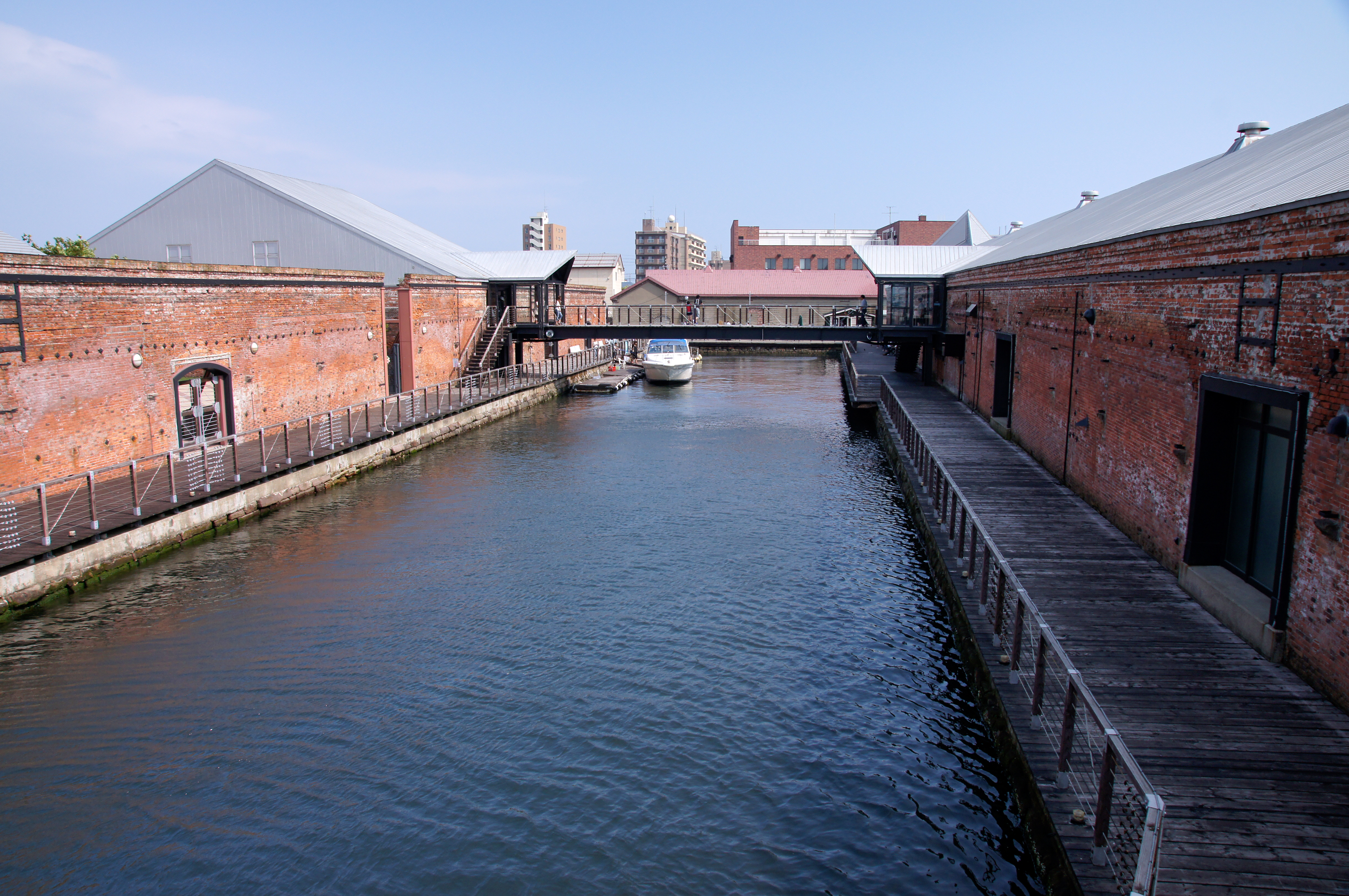
is a port city in Miyazaki Prefecture, Japan. The city was founded on April 1, 1951, with the joint merger of Tomishima Town and Iwawaki Village. , the city has an estimated population of 60,037 making it the 4th largest city in Miyazaki Prefecture. It has a population density of 178 persons per km2 and a total area of 336.94 km2. On February 25, 2006, the town of Tōgō (from Higashiusuki District) was merged into Hyūga. Hyūga is a port city known for the production of Go stones and for beaches, many of which are popular surfing spots History Archaeologists working in Hyūga have reported finding artifacts such as stone tools and stone piles from as much as 30,000 years ago, the Japanese Paleolithic period. There is also evidence of inhabitation during the Jōmon period. Archaeological digs uncovering pottery from this time period continue today in parts of the city. Origin of name Hyuga City took its name from , the historical name of what is now Miyazaki Prefecture. ... [...More Info...] [...Related Items...] OR: [Wikipedia] [Google] [Baidu] |
Cities Of Japan
A is a local administrative unit in Japan. Cities are ranked on the same level as and , with the difference that they are not a component of . Like other contemporary administrative units, they are defined by the Local Autonomy Law of 1947. City status Article 8 of the Local Autonomy Law sets the following conditions for a municipality to be designated as a city: *Population must generally be 50,000 or greater (原則として人口5万人以上) *At least 60% of households must be established in a central urban area (中心市街地の戸数が全戸数の6割以上) *At least 60% of households must be employed in commerce, industry or other urban occupations (商工業等の都市的業態に従事する世帯人口が全人口の6割以上) *Any other conditions set by prefectural ordinance must be satisfied (他に当該都道府県の条例で定める要件を満たしていること) The designation is approved by the prefectural governor and the Minister for Internal ... [...More Info...] [...Related Items...] OR: [Wikipedia] [Google] [Baidu] |
Hyūga Province
was an old province of Japan on the east coast of Kyūshū, corresponding to the modern Miyazaki Prefecture. Nussbaum, Louis-Frédéric. (2005). "''Hyūga''" in . It was sometimes called or . Hyūga bordered on Bungo, Higo, Ōsumi, and Satsuma Province. The ancient capital was near Saito. History In the ''Kojiki'' and the '' Nihon Shoki'', Hyūga is called of Tsukushi-no-shima (Kyushu), along the provinces of Tsukushi, Toyo and Hi. In the 3rd month of the 6th year of the '' Wadō'' era (713), the land of Hyūga was administratively separated from Ōsumi Province (大隅国). In that same year, Empress Genmei's ''Daijō-kan'' continued to organize other cadastral changes in the provincial map of the Nara period. Titsingh, Isaac. (1834). During the Sengoku period, the area was often divided into a northern fief around Agata castle (near modern Nobeoka), and a southern fief around Obi castle, near modern Nichinan. The southern fief was held by the Shimazu clan of n ... [...More Info...] [...Related Items...] OR: [Wikipedia] [Google] [Baidu] |
Groups Of Traditional Buildings
is a Japanese category of historic preservation introduced by a 1975 amendment of the law which mandates the protection of groups of traditional buildings which, together with their environment, form a beautiful scene. They can be post towns, castle towns, mining towns, merchant quarters, ports, farming or fishing villages, etc. The Japanese government's Agency for Cultural Affairs recognizes and protects the country's cultural properties under the Law for the Protection of Cultural Properties. Municipalities can designate items of particular importance as and approve measures to protect them. Items of even higher importance are then designated by the central government. The Agency for Cultural Affairs then provides guidance, advice, and funds for repairs and other work. Additional support is given in the form of preferential tax treatment. As of May 31, 2021, 126 districts have been classified as Important Preservation Districts for Groups of Traditional Buildings. List of Imp ... [...More Info...] [...Related Items...] OR: [Wikipedia] [Google] [Baidu] |
Yamato Province
was a province of Japan, located in Kinai, corresponding to present-day Nara Prefecture in Honshū. Nussbaum, Louis-Frédéric (2005). "Yamato" in . It was also called . Yamato consists of two characters, 大 "great", and 和 " Wa". At first, the name was written with one different character (), but due to its offensive connotation, for about ten years after 737, this was revised to use more desirable characters () (see Names of Japan). The final revision was made in the second year of the Tenpyō-hōji era (c. 758). It is classified as a great province in the ''Engishiki''. The Yamato Period in the history of Japan refers to the late Kofun Period (c. 250–538) and Asuka Period (538–710). Japanese archaeologists and historians emphasize the fact that during the early Kofun Period the Yamato Kingship was in close contention with other regional powers, such as Kibi Province near present-day Okayama Prefecture. Around the 6th century, the local chieftainship gained national cont ... [...More Info...] [...Related Items...] OR: [Wikipedia] [Google] [Baidu] |
Jimmu
was the legendary first emperor of Japan according to the '' Nihon Shoki'' and ''Kojiki''. His ascension is traditionally dated as 660 BC.Kelly, Charles F"Kofun Culture" April 27, 2009.* Kitagawa, Joseph (1987). : "emphasis on the undisrupted chronological continuity from myths to legends and from legends to history, it is difficult to determine where one ends and the next begins. At any rate, the first ten legendary emperors are clearly not reliable historical records." * Boleslaw Szczesniak, "The Sumu-Sanu Myth: Notes and Remarks on the Jimmu Tenno Myth", in '''', Vol. 10, No. 1/2 (Winter 1954), pp. 107–26. . . In |
Washi
is traditional Japanese paper. The term is used to describe paper that uses local fiber, processed by hand and made in the traditional manner. ''Washi'' is made using fibers from the inner bark of the gampi tree, the mitsumata shrub (''Edgeworthia chrysantha''), or the paper mulberry (''kōzo'') bush. As a Japanese craft, it is registered as a UNESCO intangible cultural heritage. ''Washi'' is generally tougher than ordinary paper made from wood pulp, and is used in many traditional arts. Origami, Shodō, and Ukiyo-e were all produced using ''washi''. ''Washi'' was also used to make various everyday goods like clothes, household goods, and toys, as well as vestments and ritual objects for Shinto priests and statues of Buddha. It was even used to make wreaths that were given to winners in the 1998 Winter Paralympics. ''Washi'' is also used to repair historically valuable cultural properties, paintings, and books at museums and libraries around the world, such as the Louvre ... [...More Info...] [...Related Items...] OR: [Wikipedia] [Google] [Baidu] |
Edo Period
The or is the period between 1603 and 1867 in the history of Japan, when Japan was under the rule of the Tokugawa shogunate and the country's 300 regional '' daimyo''. Emerging from the chaos of the Sengoku period, the Edo period was characterized by economic growth, strict social order, isolationist foreign policies, a stable population, perpetual peace, and popular enjoyment of arts and culture. The period derives its name from Edo (now Tokyo), where on March 24, 1603, the shogunate was officially established by Tokugawa Ieyasu. The period came to an end with the Meiji Restoration and the Boshin War, which restored imperial rule to Japan. Consolidation of the shogunate The Edo period or Tokugawa period is the period between 1603 and 1867 in the history of Japan, when Japan was under the rule of the Tokugawa shogunate and the country's regional '' daimyo''. A revolution took place from the time of the Kamakura shogunate, which existed with the Tennō's court, to the Tok ... [...More Info...] [...Related Items...] OR: [Wikipedia] [Google] [Baidu] |
Japan Meteorological Agency
The , abbreviated JMA, is an agency of the Ministry of Land, Infrastructure, Transport and Tourism. It is charged with gathering and providing results for the public in Japan that are obtained from data based on daily scientific observation and research into natural phenomena in the fields of meteorology, hydrology, seismology and volcanology, among other related scientific fields. Its headquarters is located in Minato, Tokyo. JMA is responsible for gathering and reporting weather data and forecasts for the general public, as well as providing aviation and marine weather. JMA other responsibilities include issuing warnings for volcanic eruptions, and the nationwide issuance of earthquake warnings of the Earthquake Early Warning (EEW) system. JMA is also designated one of the Regional Specialized Meteorological Centers of the World Meteorological Organization (WMO). It is responsible for forecasting, naming, and distributing warnings for tropical cyclones in the Northwestern ... [...More Info...] [...Related Items...] OR: [Wikipedia] [Google] [Baidu] |
Humid Subtropical Climate
A humid subtropical climate is a zone of climate characterized by hot and humid summers, and cool to mild winters. These climates normally lie on the southeast side of all continents (except Antarctica), generally between latitudes 25° and 40° and are located poleward from adjacent tropical climates. It is also known as warm temperate climate in some climate classifications. Under the Köppen climate classification, ''Cfa'' and ''Cwa'' climates are either described as humid subtropical climates or warm temperate climates. This climate features mean temperature in the coldest month between (or ) and and mean temperature in the warmest month or higher. However, while some climatologists have opted to describe this climate type as a "humid subtropical climate", Köppen himself never used this term. The humid subtropical climate classification was officially created under the Trewartha climate classification. In this classification, climates are termed humid subtropical when the ... [...More Info...] [...Related Items...] OR: [Wikipedia] [Google] [Baidu] |
Hyūgashi Station
is a passenger railway station located in the city of Hyūga, Miyazaki, Japan. It is operated by Kyushu Railway Company (JR Kyushu) and is on the Nippō Main Line. Hyūgashi Station is located at the heart of Hyuga, Miyazaki. The current station is a timber-steel hybrid structure built in 2008 by Naito Architecture & Associates. It was built as a functional train station and also with the intention of being a symbol of the city. Lines The station is served by the Nippō Main Line and is located 276.7 km from the starting point of the line at . Layout The station consists of an island platform serving two tracks at grade. The station building was constructed over a period of more than 10 years with the cooperation of architecture and urban experts, railway officials, government officials, and citizens, including architect Hiroshi Naito and Osamu Shinohara of the University of Tokyo. Cedar was used because there was a strong request from the local community for it to be u ... [...More Info...] [...Related Items...] OR: [Wikipedia] [Google] [Baidu] |
Municipal Mergers And Dissolutions In Japan
can take place within one municipality or between multiple municipalities and are required to be based upon consensus. History There have been waves of merger activity between Japanese municipalities. The first merger, known as , had happened in the period from 1888 to 1889, when the modern municipal system was established. Before the mergers, existing municipalities were the direct successors of spontaneous hamlets called , or villages under the han system. The rump han system is still reflected in the postal system for rural areas as postal units called . The mergers slashed ‘natural settlements’ (shizen sh¯uraku) that existed at the time from 71,314 to 15,859 cities, towns and villages, justified at the time by the increased scale and relevance of the resulting respective autonomous governing bodies. The second peak, called , took place over the period from 1953 to 1956. It reduced the number of cities, towns and villages by over half, from 9,868 to 3,472 with purposes ... [...More Info...] [...Related Items...] OR: [Wikipedia] [Google] [Baidu] |


