|
Hunza
{{disambig, geo ...
Hunza may refer to: * Hunza, Iran * Hunza Valley, an area in the Gilgit-Baltistan region of Pakistan ** Hunza (princely state), a former principality ** Hunza District, a recently established district ** Hunza River, a waterway ** Hunza Peak, a mountain ** Hunza people, also known as Burusho, the inhabitants of the valley ** Hunza, a variety of the Burushaski language ** Upper Hunza, another name for Gojal, a valley situated in the far north of Pakistan * Tunja, a city in Colombia See also * Hanza (other) *Naltar Valley The Naltar Valley () is a valley situated about from the city of Gilgit in Gilgit-Baltistan, Gilgit−Baltistan, Pakistan. It is a forested region known for its dramatic mountain scenery and for its three lakes: Strangi Lake, Blue Lake, and Bo ... [...More Info...] [...Related Items...] OR: [Wikipedia] [Google] [Baidu] |
Hunza Valley
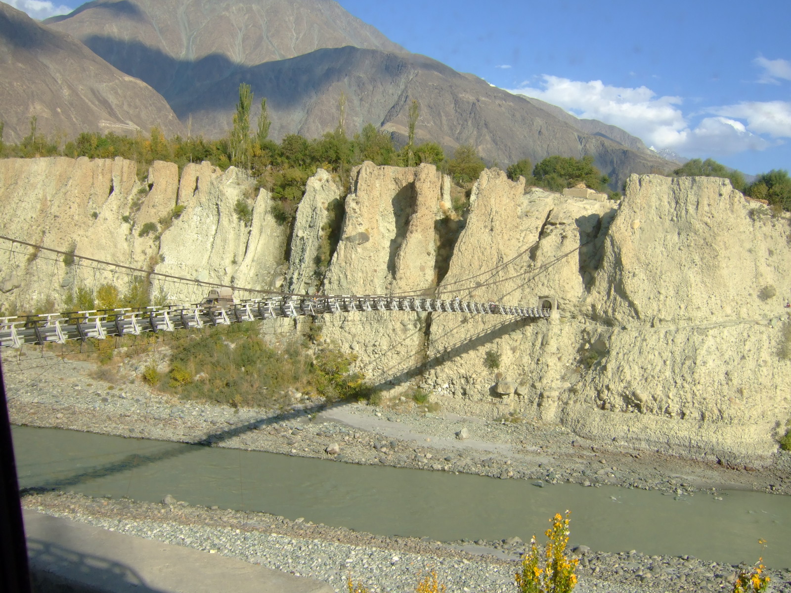
The Hunza Valley ( bsk, , Wakhi: '; ur, ) is a mountainous valley in the northern part of the Gilgit-Baltistan region of Pakistan, formed by the Hunza River, bordering Ishkoman to the northwest, Shigar to the southeast, Afghanistan's Wakhan Corridor to the north, and the Xinjiang region of China to the northeast. Geography The Hunza Valley is a mountainous valley in the northern part of the Gilgit-Baltistan region of Pakistan, formed by the Hunza River, bordering Ishkoman to the northwest, Shigar to the southeast, Afghanistan's Wakhan Corridor to the north and the Xinjiang region of China to the northeast. The Hunza Valley floor is at an elevation of 2,438 meters (7,999 feet). Geographically, the Hunza Valley consists of three regions: Upper Hunza ( Gojal), Central Hunza, and Lower Hunza ( Shinaki). History Buddhism, and to a lesser extent, Bön, were the main religions in the area. The region has several surviving Buddhist archaeological sites, such as the ... [...More Info...] [...Related Items...] OR: [Wikipedia] [Google] [Baidu] |
Hunza (princely State)
Hunza (, ur, ), also known as Kanjut (; ), was a principality and then later a princely state in a subsidiary alliance with British India from 1892 to August 1947, for three months was unaligned, and then from November 1947 until 1974 was a princely state of Pakistan. Hunza covered territory now forming the northernmost part of Gilgit-Baltistan, Pakistan. The princely state bordered the Gilgit Agency to the south, the former princely state of Nagar to the east, Xinjiang, China to the northeast and Afghanistan to the northwest. The state capital was Baltit (also known as Karimabad). The princely state of Hunza now is the Hunza District in Pakistan. History Hunza was an independent principality for centuries. It was ruled by the Mirs of Hunza, who took the title of Thum. The Hunzai's were tributaries and allies to China, acknowledging China as suzerain since 1760 or 1761. Hunza rulers claimed descent from Alexander the Great, and viewed themselves and the Emperor ... [...More Info...] [...Related Items...] OR: [Wikipedia] [Google] [Baidu] |
Gojal
Gojal ( Wakhi: , Kyrgyz: ), also called Upper Hunza, is situated in the north western part of Pakistan. It borders China at the Khunjerab Pass, and Afghanistan at the Chapursan valley. In 2019, Gojal Valley became the second Sub-Division within the Hunza District. It is geographically the largest subdivision of the Gilgit-Baltistan. Gojal or Upper Hunza is composed of a number of large and small valleys sharing borders with Central Hunza in the South, China in the north-east, and Afghanistan in the north-west. Aeenabad is the first village of Gojal, Upper Hunza. Except for the Shimshal, Misgar, and Chipursan valleys, all the villages of Gojal, Upper Hunza can be seen from the Karakoram Highway (KKH), which crosses ''Gojal'', entering China at the Khunjerab Pass. The Gojal region has 20,000 Ismaili residents. History The valleys and villages of Gojal were settled over time by people from surrounding regions. Kyrgyz nomads initially used the areas in Upper Gojal as winter pas ... [...More Info...] [...Related Items...] OR: [Wikipedia] [Google] [Baidu] |
Hunza People
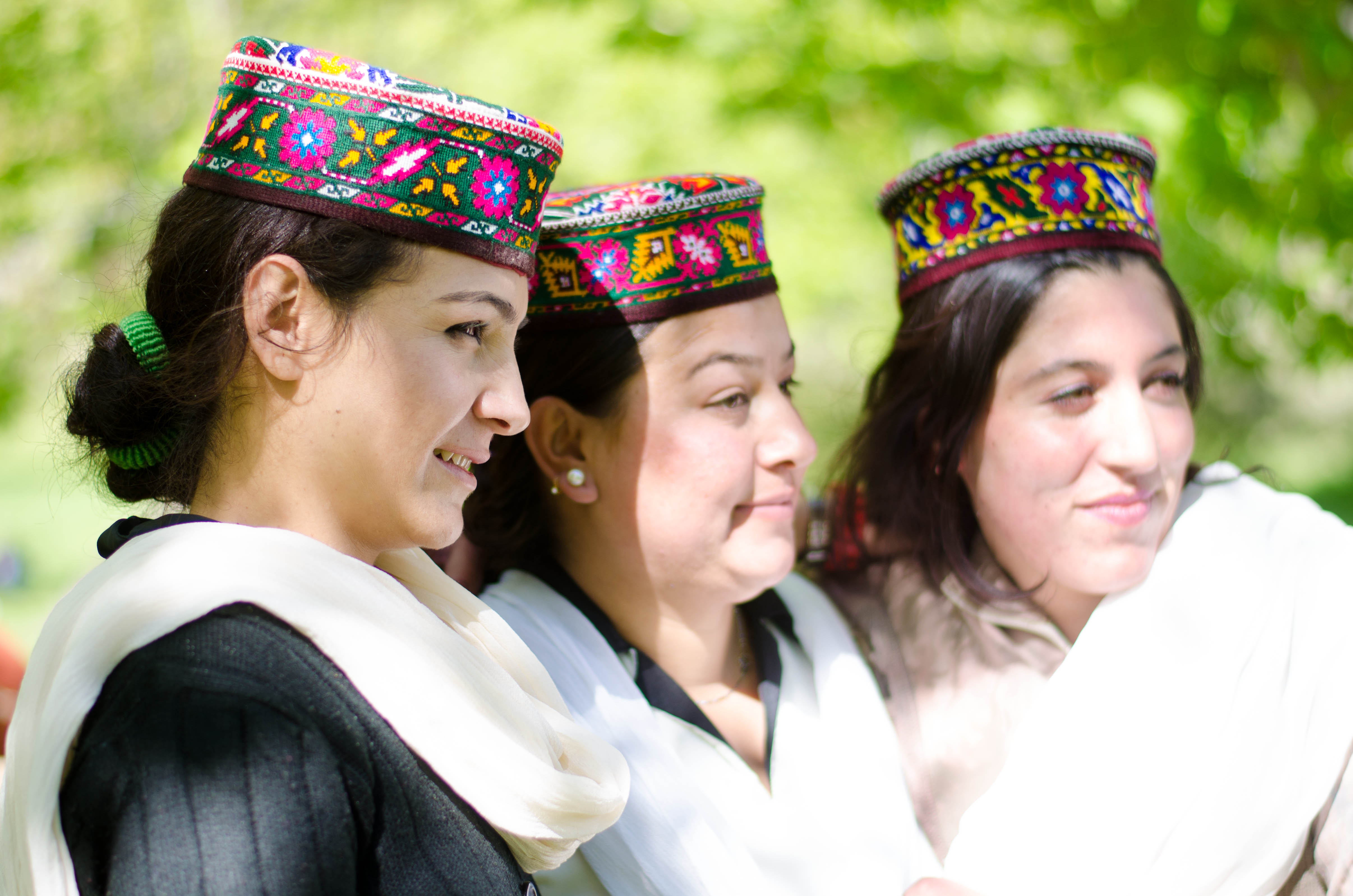
The Burusho, or Brusho, also known as the Botraj, are an ethnolinguistic group indigenous to the Yasin, Hunza, Nagar, and other valleys of Gilgit–Baltistan in northern Pakistan, as well as in Jammu and Kashmir, India. Their language, Burushaski, has been classified as a language isolate. Although their origins are unknown, it is claimed that the Burusho people "were indigenous to northwestern India and were pushed higher into the mountains by the movements of the Indo-Aryans, who traveled southward sometime around 1800 B.C." History Prior to the modern era, the area in which most Burusho now live was part of the independent state of Chitral. The state was a hereditary monarchy, controlled by the Karur dynasty, and headed by a ''mir'' (a title usually translated as king). In 1947, it became part of Pakistan. The construction of the Karakoram Highway during the 1970s brought more extensive contact with the outside world. Many traders, preachers, tourists, and others h ... [...More Info...] [...Related Items...] OR: [Wikipedia] [Google] [Baidu] |
Hunza District
The Hunza District ( ur, ) is one of the 14 districts of the Pakistani province of Gilgit-Baltistan. It was established in 2015 by the division of the Hunza–Nagar District in accordance with a government decision to establish more administrative units in Gilgit-Baltistan. The district headquarters is the town of Karimabad. Geography The Hunza District is bounded on the north and east by the Kashgar Prefecture of China's Xinjiang Uyghur Autonomous Region, on the south by the Nagar District and the Shigar District, on the west by the Ghizer District, and on the north-west by the Wakhan District of Afghanistan's Badakhshan Province. The Hunza District represents the northernmost region of the Indian subcontinent. It is home to the historic passes through the Karakoram Mountains (the Killik, Mintaka, Khunjerab, and Shimshal passes) through which trade and religion passed between Central Asia, China, and India for centuries. The present-day Karakoram Highway passes through t ... [...More Info...] [...Related Items...] OR: [Wikipedia] [Google] [Baidu] |
Hunza River
Hunza River ( ur, ) is the principal river of Hunza in Gilgit–Baltistan, Pakistan It is formed by the confluence of the Chapursan and Khunjerab ''nalas'' (gorges) which are fed by glaciers. It is joined by the Gilgit River and the Naltar River, before it flows into the Indus River. The river cuts through the Karakoram range, flowing from north to south. The Karakoram Highway (N-35) runs along the Hunza River valley, switching to the Khunjerab River valley at the point of confluence, eventually reaching the Khunjerab Pass at the border with China Xinjiang. The river is dammed for part of its route. The Attabad landslide disaster in January 2010 completely blocked the Hunza Valley. A new lake — now called the Attabad Lake or Gojal Lake — which extends 30 kilometers and rose to a depth of 400 feet, was formed as the Hunza River backed-up. Karakorum Area Development Organization (KADO), Aliabad The landslide completely covered sections of the Karakoram Highway. The Hunz ... [...More Info...] [...Related Items...] OR: [Wikipedia] [Google] [Baidu] |
Burushaski
Burushaski (; ) is a language isolate spoken by Burusho people, who reside almost entirely in northern Gilgit-Baltistan, Pakistan, with a few hundred speakers in northern Jammu and Kashmir, India. In Pakistan, Burushaski is spoken by people in Hunza District, Nagar District, northern Gilgit District, the Yasin valley in the Gupis-Yasin District and the Ishkoman valley of the northern Ghizer District. Their native region is located in northern Gilgit–Baltistan and borders with the Pamir corridor to the north. In India, Burushaski is spoken in Botraj Mohalla of the Hari Parbat region in Srinagar. Other names for the language are ''Biltum'', ''Khajuna'', ''Kunjut'', ''Brushaski'', ''Burucaki'', ''Burucaski'', ''Burushaki'', ''Burushki'', ''Brugaski'', ''Brushas'', ''Werchikwar'' and ''Miśa:ski''. Classification Attempts have been made to establish links between Burushaski and several different language families, although none has been accepted by a majority of linguists. Fol ... [...More Info...] [...Related Items...] OR: [Wikipedia] [Google] [Baidu] |
Tunja
Tunja () is a city on the Eastern Ranges of the Colombian Andes, in the region known as the Altiplano Cundiboyacense, 130 km northeast of Bogotá. In 2018 it had a population of 172,548 inhabitants. It is the capital of Boyacá department and the Central Boyacá Province. Tunja is an important educational centre of well-known universities. In the time before the Spanish conquest of the Muisca, there was an indigenous settlement, called Hunza, seat of the ''hoa'' Eucaneme, conquered by the Spanish conquistadors on August 20, 1537. The Spanish city was founded by captain Gonzalo Suárez Rendón on August 6, 1539, exactly one year after the capital Santafé de Bogotá. The city hosts the most remaining Muisca architecture: Hunzahúa Well, Goranchacha Temple and Cojines del Zaque. Tunja is a tourist destination, especially for religious colonial architecture, with the Casa Fundador Gonzalo Suárez Rendón as oldest remnant. In addition to its religious and historical sites it ... [...More Info...] [...Related Items...] OR: [Wikipedia] [Google] [Baidu] |
Hunza Peak
Hunza Peak () lies in the westernmost subrange of the Karakoram range in Pakistan, along with the Ladyfinger Peak (Bublimating). It lies on the southwest ridge of the Ultar Sar massif, the most southeasterly of the major groups of the Batura Muztagh. The whole massif rises precipitously above the Hunza Valley to the southeast. This peak has at least two known routes, both climbed in 1991. Both routes were done in alpine style, the first by a Swedish expedition and the second by a British team, which included Caradog Jones and Mick Fowler. While nearby Ladyfinger Peak has little prominence above the saddle with Hunza Peak, it is a sharp, relatively snowless rock spire among the peaks around it. __NOTOC__ See also * Hunza * List of Mountains in Pakistan * Highest Mountains of the World Notes # These coordinates are the coordinates of the Bublimating The Bublimotin, Bubli Motin, Bublimating or Ladyfinger Peak ( ur, لیڈی فنگر), is a distinctive rock spire in the Batur ... [...More Info...] [...Related Items...] OR: [Wikipedia] [Google] [Baidu] |
Hunza, Iran
Hunza ( fa, هونزا, also Romanized as Hūnzā; also known as Khūnzā) is a village in Simakan Rural District, in the Central District of Bavanat County, Fars Province, Iran Iran, officially the Islamic Republic of Iran, and also called Persia, is a country located in Western Asia. It is bordered by Iraq and Turkey to the west, by Azerbaijan and Armenia to the northwest, by the Caspian Sea and Turkmeni .... At the 2006 census, its population was 194, in 38 families. References Populated places in Bavanat County {{Bavanat-geo-stub ... [...More Info...] [...Related Items...] OR: [Wikipedia] [Google] [Baidu] |
Hanza (other)
Hanza may refer to: * Hanza, Kerman, Anduhjerd Rural District, Shahdad District, Kerman County, Kerman Province, Iran * Hanza, Rabor, Hanza Rural District, Hanza District, Rabor County, Kerman Province, Iran * Hanza, Yazd, Miankuh Rural District, Central District of Mehriz County, Yazd Province, Iran * Hanza Tower Hanza Tower is a skyscraper in Szczecin, Poland, located at the 50 Wyzwolenia Avenue, in the Śródmieście-Północ municipal neighbourhood. The building is 125 m tall, making it the tallest building in the city. It has 34 floors, including 4 un ..., skyscraper in Szczecin, Poland * '' Boscia senegalensis'', a plant See also * Hunza (other) {{Disambiguation, geo ... [...More Info...] [...Related Items...] OR: [Wikipedia] [Google] [Baidu] |


.png)


