|
Hundred Of Pucklechurch
Pucklechurch was an ancient hundred of Gloucestershire, England. Hundreds originated in the late Saxon period as a subdivision of a county and lasted as administrative divisions until the 19th century. The hundred comprised the ancient parishes of Pucklechurch, Syston, Cold Ashton, Westerleigh and Abson.The National Gazetteer of Great Britain and Ireland , 1868, via GENUKI At the time of the , the hundred contained Pucklechurch, Syston and Cold Ashton, plus Codrington and part of |
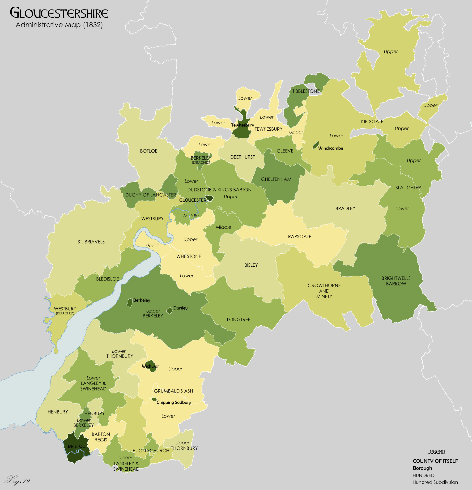
Gloucestershire 1832 Map
Gloucestershire ( abbreviated Glos) is a Counties of England, county in South West England. The county comprises part of the Cotswold Hills, part of the flat fertile valley of the River Severn and the entire Forest of Dean. The county town is the City status in the United Kingdom, city of Gloucester and other principal towns and villages include Cheltenham, Cirencester, Kingswood, South Gloucestershire, Kingswood, Bradley Stoke, Stroud, Thornbury, Gloucestershire, Thornbury, Yate, Tewkesbury, Bishop's Cleeve, Churchdown, Brockworth, Winchcombe, Dursley, Cam, Gloucestershire, Cam, Berkeley, Gloucestershire, Berkeley, Wotton-under-Edge, Tetbury, Moreton-in-Marsh, Fairford, Lechlade, Northleach, Stow-on-the-Wold, Chipping Campden, Bourton-on-the-Water, Stonehouse, Gloucestershire, Stonehouse, Nailsworth, Minchinhampton, Painswick, Winterbourne, Gloucestershire, Winterbourne, Frampton Cotterell, Coleford, Gloucestershire, Coleford, Cinderford, Lydney and Rodborough and Cainscros ... [...More Info...] [...Related Items...] OR: [Wikipedia] [Google] [Baidu] |
Westerleigh
Westerleigh is a clustered village and civil parish (which includes Henfield) in South Gloucestershire, England, it contains sources of the Frome and has an endpoint of the Frome Valley Walkway. It is north of the M4, south of Yate and north-east of the city of Bristol. In the south it includes a steep hill of its own from the crest of the Cotswold hills which is designated an AONB. Background The village is first mentioned in a Saxon document of 887AD. At that time it was probably just a clearing in the woods with possibly a wooden church. Westerleigh is mentioned in the Domesday Book of 1086. In medieval times the village would probably have been a green with the houses and church around it, and prosperous. The northern wall and porch of St James church is from the 13th century, as is the carved stone pulpit. The church was rebuilt in the perpendicular style, with the tower (once used as the village lock up) added at a later date. The 700th anniversary was celebrat ... [...More Info...] [...Related Items...] OR: [Wikipedia] [Google] [Baidu] |
Langley And Swinehead Hundred
Langley and Swinehead was an ancient hundred of Gloucestershire, England. Hundreds originated in the late Saxon period as a subdivision of a county and lasted as administrative divisions until the 19th century. Langley and Swinehead was divided into two divisions - Upper and Lower - the Upper division comprised the four ancient parishes of Bitton, Doynton, Frampton-Cotterell and Winterbourne and part of the parish of Alveston. The Lower division comprised the three ancient parishes of Littleton-upon-Severn, Olveston and Rockhampton, the remainder of Alveston and part of the parish of Almondsbury.The National Gazetteer of Great Britain and Ireland , 1868, via GENUKI At the time of the |
Doynton
Doynton is a village in South Gloucestershire, England. The population of this village taken at the 2011 census was 320. Setting Doynton is a village situated on the lower slopes of the Cotswolds, approximately two miles south-east of Pucklechurch. The River Boyd passes through the northern part of Doynton. The village is essentially linear in character with houses lining the four main roads into the village. Doynton lies within the Cotswold Area of Outstanding Natural Beauty. The village Doynton has a pub called The Cross House, and a village hall. There is also a park and playing field. The village church is Holy Trinity Church which is noted for its herringbone masonry (around 12th century) on the south wall. The historic core of Doynton was designated a conservation area in February 1983. The area of Doynton Mill and its immediate surroundings to the north of the village are not longer part of it as they are used for light industrial purposes. Doynton has a number of 17th ... [...More Info...] [...Related Items...] OR: [Wikipedia] [Google] [Baidu] |
Wapley
Wapley is a rural village in South Gloucestershire South Gloucestershire is a unitary authority area in the ceremonial county of Gloucestershire, South West England. Towns in the area include Yate, Chipping Sodbury, Thornbury, Filton, Patchway and Bradley Stoke, the latter three forming part ..., England. See also * Do not stand at my grave and weep References External links Villages in South Gloucestershire District {{SouthGloucestershire-geo-stub ... [...More Info...] [...Related Items...] OR: [Wikipedia] [Google] [Baidu] |
Codrington, South Gloucestershire
Codrington is a settlement in South Gloucestershire, England. It is located near Junction 18 of the M4 motorway south of Wapley and Yate. Codrington is a hamlet situated alongside the B4465 road. It was formerly in the civil parish of Wapley-cum-Codrington in the hundred (county division), hundred of Grumbald's Ash. It is now in Dodington, Gloucestershire, Dodington parish, under the administration of the unitary authority of South Gloucestershire. It had one pub, the Wishing Well, which was formerly the Codrington Arms. The pub was linked to the Codrington Family, who used to be based at Codrington Court before moving to nearby Dodington Park. The area also has a Baptist church in Wapley Road. Now the area is best known for its golf course on the outskirts called The Players Club. The hamlet is mentioned in Lemon Jelly's "Ramblin' Man (Lemon Jelly song), Ramblin' Man". References External links Codrington Baptist Church Villages in South Gloucestershire District {{ ... [...More Info...] [...Related Items...] OR: [Wikipedia] [Google] [Baidu] |
Domesday Book
Domesday Book () – the Middle English spelling of "Doomsday Book" – is a manuscript record of the "Great Survey" of much of England and parts of Wales completed in 1086 by order of King William I, known as William the Conqueror. The manuscript was originally known by the Latin name ''Liber de Wintonia'', meaning "Book of Winchester", where it was originally kept in the royal treasury. The '' Anglo-Saxon Chronicle'' states that in 1085 the king sent his agents to survey every shire in England, to list his holdings and dues owed to him. Written in Medieval Latin, it was highly abbreviated and included some vernacular native terms without Latin equivalents. The survey's main purpose was to record the annual value of every piece of landed property to its lord, and the resources in land, manpower, and livestock from which the value derived. The name "Domesday Book" came into use in the 12th century. Richard FitzNeal wrote in the ''Dialogus de Scaccario'' ( 1179) that the book ... [...More Info...] [...Related Items...] OR: [Wikipedia] [Google] [Baidu] |
Abson
Abson is a small village in South Gloucestershire, England, it forms part of the civil parish of Wick and Abson. Location Abson is located on a minor road between the villages of Wick and Pucklechurch. It is a mainly nucleated in pattern with some additional outlying farms and settlements. The centre of the village is a small village green and the church. Abson is part of the Church of England parish of Wick and Abson, and is part of the parliamentary constituency of Thornbury and Yate. History The name Abson is a corruption of Abbots Ton - a place belonging to the Abbot. This was the Abbot of Glastonbury, as the manor of Pucklechurch (including Abson and other surrounding villages) was given to the Abbot after the murder of King Edmund at neighbouring Pucklechurch. In the 16th century the village was called Abston, and was since shortened to Abson. Blue Lodge, one of the houses, was once the home of Anna Sewell, author of Black Beauty. Whilst staying there she witne ... [...More Info...] [...Related Items...] OR: [Wikipedia] [Google] [Baidu] |
Cold Ashton
Cold Ashton is a village in South Gloucestershire, England. It is located north of Bath, near the junction between the A46 and A420 roads. The village church has a 14th-century tower and the rest of the church was rebuilt in the 16th century by Thomas Key, its rector. It had a population of 221 according to the 2011 census. In the 1870s, Cold Ashton was described as A parish in Chipping-Sodbury district, Gloucester; on the verge of the county, under the Cotswolds, 5¾ miles N of Bath r. station. It includes the village of Pennsylvania; and its Post Town is Marshfield under Chippenham. Acres, 2,300.Now, Cold Ashton is described asA small village which, due to its setting, exhibits an air of tranquillity and pleasant isolation. The stone-walled main street together with the close alignment of the manor house, the Old Rectory and the courthouse, give the village an intimate character. History Originally the property of Bath Abbey, Cold Ashton then became entirely owned by Wil ... [...More Info...] [...Related Items...] OR: [Wikipedia] [Google] [Baidu] |
Hundred (county Subdivision)
A hundred is an administrative division that is geographically part of a larger region. It was formerly used in England, Wales, some parts of the United States, Denmark, Southern Schleswig, Sweden, Finland, Norway, the Bishopric of Ösel–Wiek, Curonia, the Ukrainian state of the Cossack Hetmanate and in Cumberland County, New South Wales, Cumberland County in the British Colony of New South Wales. It is still used in other places, including in Australia (in South Australia and the Northern Territory). Other terms for the hundred in English and other languages include ''#wapentake, wapentake'', ''herred'' (Danish and Bokmål, Bokmål Norwegian), ''herad'' (Nynorsk, Nynorsk Norwegian), ''hérað'' (Icelandic), ''härad'' or ''hundare'' (Swedish), ''Harde'' (German), ''hiird'' (North Frisian language, North Frisian), ''satakunta'' or ''kihlakunta'' (Finnish), ''kihelkond'' (Estonian), ''kiligunda'' (Livonian), ''cantref'' (Welsh) and ''sotnia'' (Slavic). In Ireland, a similar subdi ... [...More Info...] [...Related Items...] OR: [Wikipedia] [Google] [Baidu] |
Syston
Syston ( ) is a town and civil parish in the district of Charnwood in Leicestershire, England. The population was 11,508 at the 2001 census, rising to 12,804 at the 2011 census. Overview There has been a settlement on the site for over 1,000 years, the earliest records being in the Domesday Book as ''Sitestone''. The Roman road known as the Fosse Way passes through Syston, which is now largely a commuter town for the city of Leicester. Only the village of Thurmaston to the south separates it from Leicester. The large and impressive Church of St Peter and St Paul is the most ancient building in Syston, built in pink granite and white limestone with a proud west tower topped by a lozenge frieze, battlements and pinnacles. The church mostly dates from the 15th century but there is a 13th-century sedilia in the chancel and a tomb recess in the south aisle of the early 14th century. The stone arcading inside the nave has striking Perpendicular Gothic panelling which is also see ... [...More Info...] [...Related Items...] OR: [Wikipedia] [Google] [Baidu] |
Pucklechurch
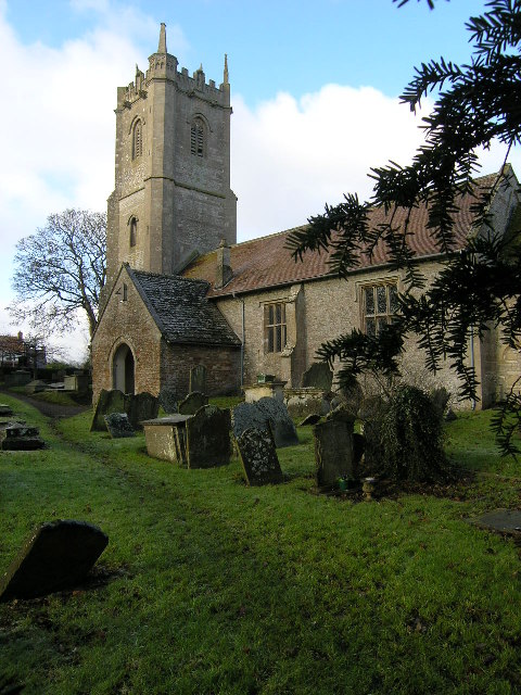
Pucklechurch is a large village and civil parish in South Gloucestershire, England. It has a current population of about 3000. The village dates back over a thousand years and was once the site of a royal hunting lodge, as it adjoined a large forest. A Royal Air Force station called RAF Pucklechurch existed until 1959, when the site was transferred to HM Prison Service. Geography Bordering at its western boundary the Bristol Semi-Ring Road, the village forms a large eastern cluster of development on a raised area of land in the parish, the northern half of which has 14 listed buildings including the church. All of the main development of the village is on a knoll or escarpment which descends steeply in the west, and in a few places has long views of the Cotswolds east and land in between. It is located ENE of the city of Bristol and NW of the city of Bath. Through the far north of the parish which is farmland from the village centre the busy M4 motorway passes. History ... [...More Info...] [...Related Items...] OR: [Wikipedia] [Google] [Baidu] |


.jpg)

