|
Hucknall Railway Station
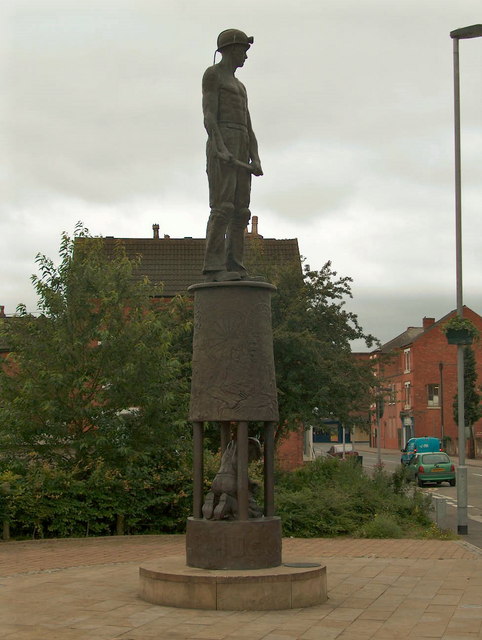
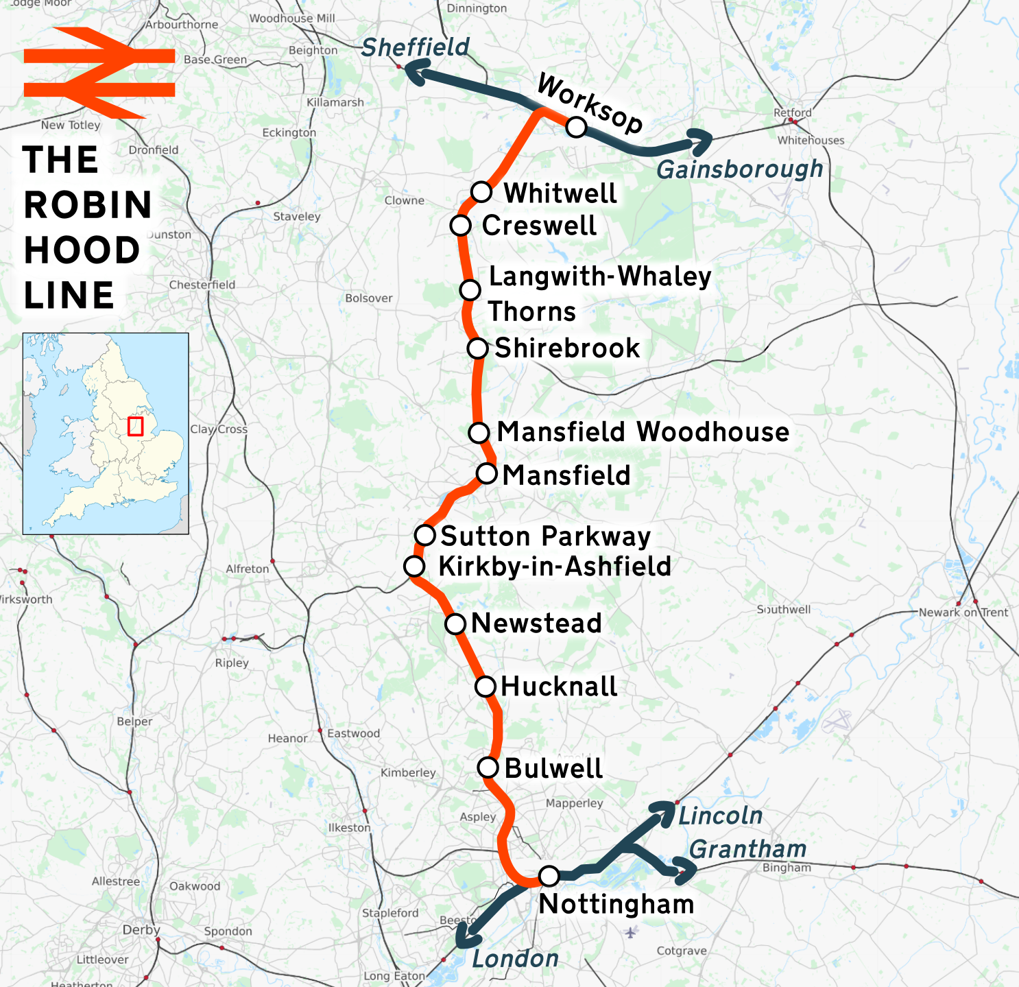
Hucknall station, also formerly known as Hucknall Byron station, is a railway station and tram stop in Hucknall, Nottinghamshire, England. It is located on the Robin Hood railway line north of Nottingham and is also the northern terminus of the Nottingham Express Transit (NET) tram system. The station has park and ride facilities, with nearly 450 parking spaces for use by both tram and train passengers. TrentBarton Connect Red/Blue bus services connect passengers to the town centre and the western estates, stopping adjacent to the tramstop. TrentBarton 141 service connect passengers to the town centre, the eastern estate and the surrounding villages, stopping on the roadbridge above the station, or adjacent to the Tesco Extra. The Tesco Extra and the Ashgate Retail Park (Argos, Home Bargains and Kennelgate) are located close to the station. History Hucknall station first opened, as ''Hucknall'', on 2 October 1848, with the opening of the Midland Railway's line from Nottingham ... [...More Info...] [...Related Items...] OR: [Wikipedia] [Google] [Baidu] |
Hucknall
Hucknall, formerly Hucknall Torkard, is a market town in the Ashfield district of Nottinghamshire, England. It lies 7 miles north of Nottingham, 7 miles south-east of Kirkby-in-Ashfield, 9 miles from Mansfield and 10 miles south of Sutton-in-Ashfield. It is the second largest town in the Ashfield district after Sutton-in-Ashfield. Hucknall is north-west of Nottingham, on the west bank of the Leen Valley, on land which rises from the Trent Valley in the south and extends northwards to Kirkby-in-Ashfield. The Whyburn or Town Brook flows through the town centre. Farleys Brook marks its southern boundary. Due to the mass amount of housing and industrial estates along the southside of the town. Hucknall is contiguous with the wider City of Nottingham with the suburbs of Bulwell and Bestwood Village both to the south and southeast. The town's highest point is Long Hill, at above sea level, with views over the city and Trent Valley, which descends to 22–24 metres (72–79&nbs ... [...More Info...] [...Related Items...] OR: [Wikipedia] [Google] [Baidu] |
Park And Ride
A park and ride, also known as incentive parking or a commuter lot, is a parking lot with public transport connections that allows commuting, commuters and other people heading to city centres to leave their vehicles and transfer to a bus, Rail transport, rail system (rapid transit, light rail, or commuter rail), or carpool for the remainder of the journey. The vehicle is left in the parking lot during the day and retrieved when the owner returns. Park and rides are generally located in the suburbs of metropolitan areas or on the outer edges of large cities. A park and ride that only offers parking for meeting a carpool and not connections to public transport may also be called a park and pool. Park and ride is abbreviated as "P+R" on road signs in some countries, and is often styled as "Park & Ride" in marketing. Adoption In Sweden, a tax has been introduced on the benefit of free or cheap parking paid by an employer, if workers would otherwise have to pay. The tax has reduced ... [...More Info...] [...Related Items...] OR: [Wikipedia] [Google] [Baidu] |
Beeston, Nottinghamshire
Beeston is a town in the Borough of Broxtowe, Nottinghamshire, England, south-west of Nottingham city centre. To its north-east is the University of Nottingham's main campus, University Park. The pharmaceutical and retail chemist group Boots has its headquarters east of the centre of Beeston, on the border with Broxtowe and the City of Nottingham. To the south lie the River Trent and the village of Attenborough, with extensive wetlands. Origins of the name The earliest name of the settlement was ''Bestune'', recorded in the Domesday Book of 1086. The name derives from the Old English words ''bēos'' (bent-grass) and ''tūn'' (farmstead, settlement). Although the idea that the name derives from the Old English ''bēo'' (bee) is popular locally, this is impossible as the plural form of ''bēo'' would be ''bēon'', resulting in an "n" to historical spellings of the name. The local pastures are still referred to in the name Beeston Rylands. The putative "bee" derivation encour ... [...More Info...] [...Related Items...] OR: [Wikipedia] [Google] [Baidu] |
Butler's Hill Tram Stop
Butler's Hill is a tram stop on the Nottingham Express Transit network, serving the suburb of Butler's Hill, Ashfield in Nottinghamshire, England. The station is situated on the long single line section between Bulwell and Hucknall, which runs alongside the Robin Hood Line. Like all the other intermediate stops on this section, the stop has a passing loop with an island platform situated between the two tracks of the loop. With the opening of NET's phase two, Butler's Hill is now on NET line 1, which runs from Hucknall through the city centre to Beeston and Chilwell. Trams run at frequencies that vary between four and eight trams per hour, depending on the day and time of day. The tram stop should not be confused with the former Butler's Hill railway station, which was situated on the, now closed, Great Northern Railway's Nottingham to Shirebrook line, some to the north-west of the tram stop. The Robin Hood line that passes alongside the stop was originally the former Midla ... [...More Info...] [...Related Items...] OR: [Wikipedia] [Google] [Baidu] |
Ashfield District
Ashfield () is a local government district in Nottinghamshire, England. The population of Ashfield was 127,200 in 2018. The district is mostly urban and forms part of both the Nottingham and Mansfield Urban Areas. There are three towns in the district; Sutton-in-Ashfield, Kirkby-in-Ashfield and Hucknall. The district was formed on 1 April 1974, under the Local Government Act 1972, by the merger of urban districts of Hucknall, Kirkby-in-Ashfield, Sutton-in-Ashfield and parts of Basford Rural District, namely the parishes of Annesley, Felley and Selston. The largest settlement is Sutton-in-Ashfield. Towns and villages in the district include the following: * Annesley * Annesley Woodhouse * Hucknall * Huthwaite * Jacksdale * Kirkby-in-Ashfield * Selston * Skegby * Sutton-in-Ashfield * Stanton Hill * Teversal * Underwood Politics Elections to the district are held every 4 years, with currently 35 councillors being elected from 23 wards. Since 2018 the council has been l ... [...More Info...] [...Related Items...] OR: [Wikipedia] [Google] [Baidu] |
Robin Hood Line
The Robin Hood Line is a railway line running from Nottingham to Worksop, Nottinghamshire, in the United Kingdom. The stations between Shirebrook and Whitwell (inclusive) are in Derbyshire. Passenger services are operated by East Midlands Railway. The line in its present form opened to passengers in stages between 1993 and 1998. Following the Beeching cuts of the 1960s, the line had been freight-only. The cuts had left Mansfield as one of the largest towns in Britain without a railway station. History The majority of the current Robin Hood Line re-uses the former Midland Railway (MR) route from Nottingham to Worksop. However, due to rationalisation leading to track removal in order to save the costs of maintaining the tunnel north of Annesley, the through route was severed in the 1970s. Northwards from Nottingham, the freight-only line remained intact as far as Newstead, where it had served the now closed Newstead Colliery. Southwards from Worksop, the line followed the ... [...More Info...] [...Related Items...] OR: [Wikipedia] [Google] [Baidu] |
British Rail
British Railways (BR), which from 1965 traded as British Rail, was a state-owned company that operated most of the overground rail transport in Great Britain from 1948 to 1997. It was formed from the nationalisation of the Big Four British railway companies, and was privatised in stages between 1994 and 1997. Originally a trading brand of the Railway Executive of the British Transport Commission, it became an independent statutory corporation in January 1963, when it was formally renamed the British Railways Board. The period of nationalisation saw sweeping changes in the railway. A process of dieselisation and electrification took place, and by 1968 steam locomotives had been entirely replaced by diesel and electric traction, except for the Vale of Rheidol Railway (a narrow-gauge tourist line). Passengers replaced freight as the main source of business, and one-third of the network was closed by the Beeching cuts of the 1960s in an effort to reduce rail subsidies. On privatis ... [...More Info...] [...Related Items...] OR: [Wikipedia] [Google] [Baidu] |
Hucknall Central Railway Station
Hucknall Central railway station, originally known as Hucknall Town, was a station in Hucknall on the Great Central Railway's main line from Manchester to London. Construction Hucknall Central was of the larger 'town' variety of stations on the Great Central main line, with access to the island platform being via a footbridge from the booking hall which sat on the eastern side of the line. More comprehensive passenger facilities were provided at Hucknall, similar to Loughborough Central and Rugby Central stations, though not quite as lavish as in those cases. The station was constructed circa 1896-1898 by the contractors Logan and Hemmingway. History The station opened as Hucknall Town on 15 March 1899 as part of the Great Central Railway's London extension. Soon after grouping as part of the London and North Eastern Railway The London and North Eastern Railway (LNER) was the second largest (after LMS) of the " Big Four" railway companies created by the Railways Act ... [...More Info...] [...Related Items...] OR: [Wikipedia] [Google] [Baidu] |
Great Central Railway
The Great Central Railway in England was formed when the Manchester, Sheffield and Lincolnshire Railway changed its name in 1897, anticipating the opening in 1899 of its London Extension. On 1 January 1923, the company was grouped into the London and North Eastern Railway. History New name On assuming its new title, the Great Central Railway had a main line from Manchester London Road Station via , Sheffield Victoria, and Grimsby to . A second line left the line at Penistone and served , and Scunthorpe, before rejoining the Grimsby line at . Other lines linked Sheffield to Barnsley (via ) and Doncaster (via Rotherham) and also and Wrawby Junction. Branch lines in north Lincolnshire ran to Barton-upon-Humber and New Holland and served ironstone quarries in the Scunthorpe area. In the Manchester area, lines ran to Stalybridge and Glossop. In the 1890s, the MS&LR began constructing its Derbyshire lines, the first part of its push southwards. Leaving its east–west mai ... [...More Info...] [...Related Items...] OR: [Wikipedia] [Google] [Baidu] |
Hucknall Town Railway Station
Hucknall Town railway station was a railway station on the Great Northern Railway's Nottingham to Shirebrook line. It served the market town of Hucknall in Nottinghamshire Nottinghamshire (; abbreviated Notts.) is a landlocked county in the East Midlands region of England, bordering South Yorkshire to the north-west, Lincolnshire to the east, Leicestershire to the south, and Derbyshire to the west. The traditi ..., England. History Present day No trace of the station remains. The site is now occupied by the annexed petrol station of a supermarket built on the former trackbed. References Disused railway stations in Nottinghamshire Railway stations in Great Britain opened in 1882 Railway stations in Great Britain closed in 1931 Former Great Northern Railway stations Ashfield District {{EastMidlands-railstation-stub ... [...More Info...] [...Related Items...] OR: [Wikipedia] [Google] [Baidu] |
Great Northern Railway (Great Britain)
The Great Northern Railway (GNR) was a British railway company incorporated in 1846 with the object of building a line from London to York. It quickly saw that seizing control of territory was key to development, and it acquired, or took leases of, many local railways, whether actually built or not. In so doing, it overextended itself financially. Nevertheless, it succeeded in reaching into the coalfields of Nottinghamshire, Derbyshire and Yorkshire, as well as establishing dominance in Lincolnshire and north London. Bringing coal south to London was dominant, but general agricultural business, and short- and long-distance passenger traffic, were important activities too. Its fast passenger express trains captured the public imagination, and its Chief Mechanical Engineer Nigel Gresley became a celebrity. Anglo-Scottish travel on the East Coast Main Line became commercially important; the GNR controlled the line from London to Doncaster and allied itself with the North Ea ... [...More Info...] [...Related Items...] OR: [Wikipedia] [Google] [Baidu] |
Mansfield
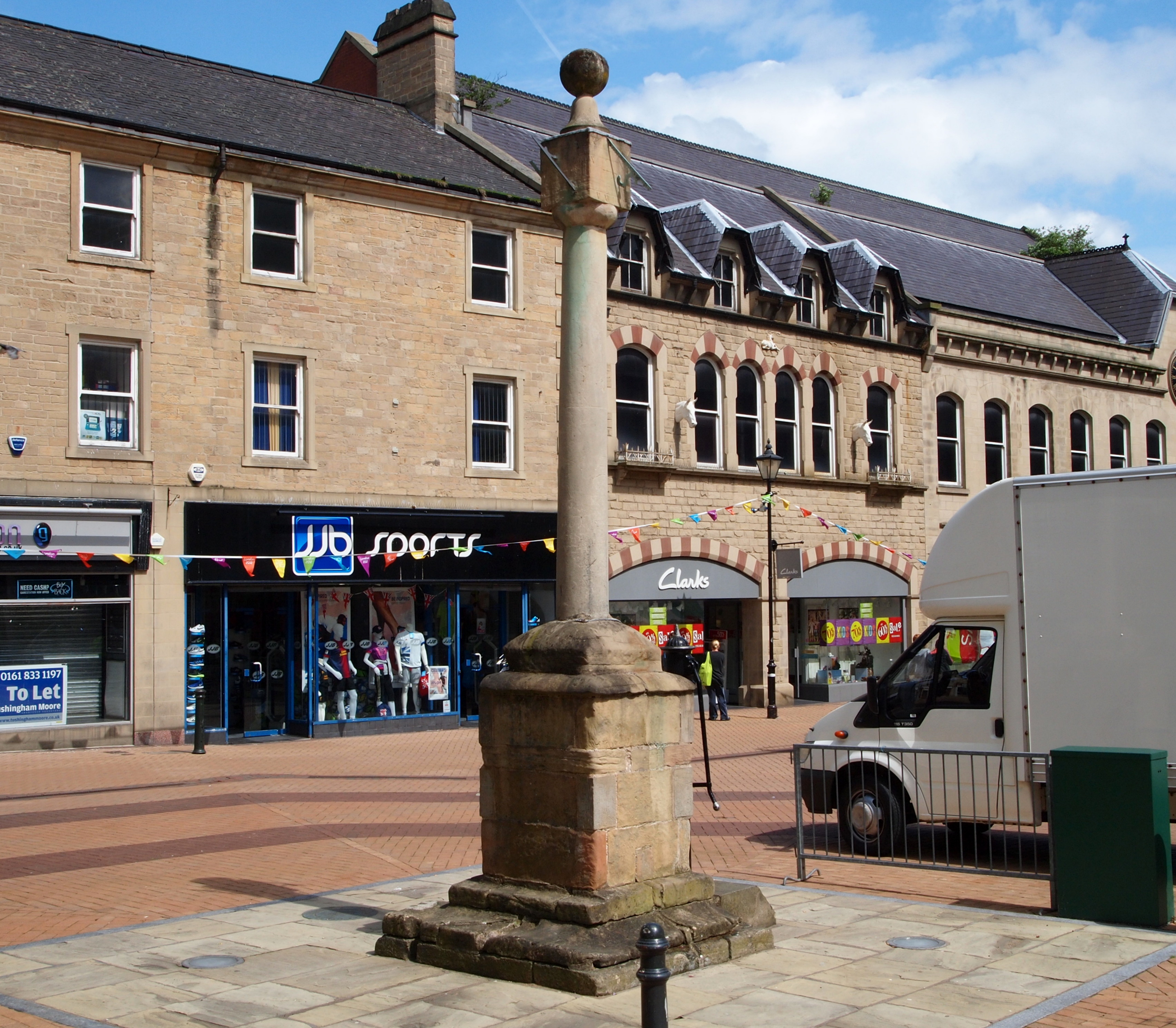
Mansfield is a market town and the administrative centre of Mansfield District in Nottinghamshire, England. It is the largest town in the wider Mansfield Urban Area (followed by Sutton-in-Ashfield). It gained the Royal Charter of a market town in 1227. The town lies in the Maun Valley, north of Nottingham and near Sutton-in-Ashfield. Most of the 109,000 population live in the town itself (including Mansfield Woodhouse), with Warsop as a secondary centre. Mansfield is the one local authority in Nottinghamshire with a publicly elected mayor. History Roman to Mediaeval Period Settlement dates to the Roman period. Major Hayman Rooke in 1787 discovered a villa between Mansfield Woodhouse and Pleasley; a cache of denarii was found near King's Mill in 1849. Early English royalty stayed there; Mercian Kings used it as a base to hunt in Sherwood Forest. The Royal Manor of Mansfield was held by the King. In 1042 Edward the Confessor possessed a manor in Mansfield. William the Conqu ... [...More Info...] [...Related Items...] OR: [Wikipedia] [Google] [Baidu] |


.jpg)

