|
Huatulco
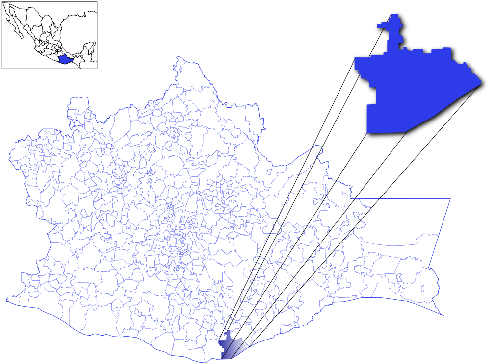
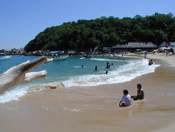
Huatulco (; ''wah-TOOL-coh''), formally Bahías de Huatulco, centered on the town of La Crucecita, is a tourist development in Mexico. It is located on the Pacific coast in the state of Oaxaca. Huatulco's tourism industry is centered on its nine bays, thus the name Bahias de Huatulco, but has since been unofficially shortened to simply Huatulco. Huatulco has a wide variety of accommodation from rooms for rent, small economy hotels, luxury villas, vacation condominia, bed and breakfasts, as well as several luxury resorts standing on or near the shores of Tangolunda Bay. The Camino Real Zaashila (formerly the Omni Zaashila), Quinta Real Huatulco, Las Brisas (formerly a Club Med), Dreams Resort & Spa (formerly the Royal Maeva then the Gala hotel), and the Barceló (formerly the Sheraton hotel) are examples of the most popular larger resorts in the area. Huatulco is located where the foothills of the Sierra Madre del Sur mountains meet the Pacific Ocean, approximately east of Acapu ... [...More Info...] [...Related Items...] OR: [Wikipedia] [Google] [Baidu] |
Oaxaca
Oaxaca ( , also , , from nci, Huāxyacac ), officially the Free and Sovereign State of Oaxaca ( es, Estado Libre y Soberano de Oaxaca), is one of the 32 states that compose the political divisions of Mexico, Federative Entities of Mexico. It is divided into municipalities of Oaxaca, 570 municipalities, of which 418 (almost three quarters) are governed by the system of (customs and traditions) with recognized local forms of self-governance. Its capital city is Oaxaca de Juárez. Oaxaca is in southwestern Mexico. It is bordered by the states of Guerrero to the west, Puebla to the northwest, Veracruz to the north, and Chiapas to the east. To the south, Oaxaca has a significant coastline on the Pacific Ocean. The state is best known for #Indigenous peoples, its indigenous peoples and cultures. The most numerous and best known are the Zapotec peoples, Zapotecs and the Mixtecs, but there are sixteen that are officially recognized. These cultures have survived better than most others ... [...More Info...] [...Related Items...] OR: [Wikipedia] [Google] [Baidu] |
Santa María Huatulco
Santa María Huatulco is a town and municipality in Oaxaca in south-western Mexico. It is part of the Pochutla District in the east of the Costa Region. The meaning of Huatulco, or Guatulco Coatulco is, "where they worship the tree", referring to an ancient legend. Geography The municipality covers an area of 579.22 km² at an average of 220 meters above sea level. The Magdalena and Cruz rivers combine in the municipality to form the Huatulco river. Its ecosystem is lowland deciduous and includes mahogany, cedar, cashew and many other species of tree. Wildlife includes squirrel, opossum, skunk, raccoon, coati, ringtail, armadillos, ocelots and white-tailed deer. History Hernán Cortés conquered the town of Huatulco on 8 January 1539. Demographics As of 2005, the municipality had a total population of 33,194 of which 1,119 spoke an indigenous language. The population includes many migrants from other areas drawn by the tourist business. Economic activities by numbers em ... [...More Info...] [...Related Items...] OR: [Wikipedia] [Google] [Baidu] |
Huatulco National Park
Huatulco National Park, also known as Bahias de Huatulco National Park is a national park of Oaxaca, Mexico. It was initially declared a protected area and later decreed as a National Park on July 24, 1998. Located in the Municipality of Santa María Huatulco, to the west of Cruz Huatulco, it extends to an area of . Flora and fauna In the low lands of the park, there are 9,000 species of plants (about 50% of the species are reported throughout the country) in the forest and mangroves in the coastal belt. Vegetation is dominated by the low tropical dry forest in 80% of the area with the unusual feature of high trees. Fauna species have been identified as 264, which includes armadillos and white-tailed deer. Bird species are counted at 701, which include hummingbirds, pelicans and hawks. The reptile species are counted to be 470, which include black iguana, salamanders and snakes. Dolphins, whales and turtle Turtles are an order of reptiles known as Testudines, character ... [...More Info...] [...Related Items...] OR: [Wikipedia] [Google] [Baidu] |
La Crucecita, Oaxaca
La Crucecita, along with Tangolunda and Santa Cruz comprise the resort area known as Huatulco, in the Mexican state of Oaxaca. It is the community closest to the bays but it is only from Federal Highway 200. It has grown along with the development of tourism in the area. The community is within the Santa María Huatulco municipality, which is part of the Pochutla District in the Costa Region of Oaxaca. The town church, called ''Parroquia Nuestra Señora de Guadalupe y de la Santa Cruz'', is located in front of the park in the center of town. In the cupola of the church is painted a tall image of the Virgin of Guadalupe Our Lady of Guadalupe ( es, Nuestra Señora de Guadalupe), also known as the Virgin of Guadalupe ( es, Virgen de Guadalupe), is a Catholic title of Mary, mother of Jesus associated with a series of five Marian apparitions, which are believed t ..., which is the largest in the world. References Populated places in Oaxaca Populated coastal places in Me ... [...More Info...] [...Related Items...] OR: [Wikipedia] [Google] [Baidu] |
Zipolite
Playa Zipolite is a beach community located in San Pedro Pochutla municipality on the southern coast of Oaxaca state in Mexico between Huatulco and Puerto Escondido. Zipolite is best known as being Mexico’s first and only legal public nude beach and for retaining much of the hippie culture that made it notable in the 1970s. The beach is currently popular with foreign tourists, especially backpackers, who stay in one of the many rustic cabins or camping spaces that line the beach. Name origin The origin of the name ''Zipolite'' has been lost over time. Translated from Zapotec, it means "beach of the dead". Some versions have that referring to dangerous underwater currents just offshore. Locals say the Zapotecs offered the bodies of their dead to the sea, and it is the consequence for why the beach was unoccupied until alternative foreigners started arriving here in 1969. Other versions has it coming from the Nahuatl word ''sipolitlan'' or ''zipotli'', meaning "bumpy place ... [...More Info...] [...Related Items...] OR: [Wikipedia] [Google] [Baidu] |
World Network Of Biosphere Reserves In Latin America And The Caribbean
Under UNESCO’s Man and the Biosphere Programme, there are 125 biosphere reserves recognized as part of the World Network of Biosphere Reserves in Latin America and the Caribbean (as of April, 2016). These are distributed across 21 countries in the region. The list Below is the list of biosphere reserves in Latin America and the Caribbean, organized by country/territory, along with the year these were designated as part of the World Network of Biosphere Reserves. Argentina * San Guillermo (1980) * Laguna Blanca (1982) * Costero del Sur (1984) * Ñacuñán (1986) * Pozuelos (1990) * Yabotí (1995) * Mar Chiquita (1996) * Delta del Paraná (2000) * Riacho Teuquito (2000) * Laguna Oca del Río Paraguay (2001) * Las Yungas (2002) * Andino Norpatagonica (2007) ** Lanín National Park ** Nahuel Huapi National Park ** Los Arrayanes National Park ** Lago Puelo National Park ** Los Alerces National Park * Pereyra Iraola (2007) * Valdés (2014) * Patagonia Azul (2015) Bolivia * P ... [...More Info...] [...Related Items...] OR: [Wikipedia] [Google] [Baidu] |
Puerto Escondido, Oaxaca
Puerto Escondido (English: "Hidden Port") is a small port and tourist center in the municipality of San Pedro Mixtepec Distrito 22 in the Mexican state of Oaxaca. Prior to the 1930s, there was no town. The bay had been used as a port intermittently to ship coffee, but there was no permanent settlement due to the lack of potable water. The name "Puerto Escondido" had roots in the legend of a woman who escaped her captors and hid here. The Nahuatl word for this area was Zicatela, meaning “place of large thorns". Today, it refers to the area's most famous beach. Puerto Escondido is one of the most important tourist attractions on the Oaxacan coast. It caters to a more downscale and eclectic clientele than neighboring Huatulco, mostly surfers, backpackers and Mexican families. The main attractions are the beaches: Zicatela Beach hosts major surfing competitions, while other beaches have gentle waves. A large lagoon area to the west of the town is popular for fishing and birdwatch ... [...More Info...] [...Related Items...] OR: [Wikipedia] [Google] [Baidu] |
2006 In Mexico
This is a list of events that happened in 2006 in Mexico. Incumbents Federal government President * President **Vicente Fox , until November 30 **Felipe Calderón , starting December 1 Cabinet * Interior Secretary (SEGOB) **Santiago Creel, until November 30 ** Francisco Javier Ramírez Acuña, starting December 1 * Secretary of Foreign Affairs (SRE) ** Luis Ernesto Derbez, until November 30 **Patricia Espinosa, starting December 1 * Communications Secretary (SCT) ** Pedro Cerisola, until November 30 **Luis Téllez, starting December 1 * Education Secretary (SEP) ** Reyes Tamez, until November 30 **Josefina Vázquez Mota, starting December 1 * Secretary of Defense (SEDENA) **Gerardo Clemente Vega, until November 30 **Guillermo Galván Galván, starting December 1 * Secretary of Navy (SEMAR) **Marco Antonio Peyrot González, until November 30 **Mariano Francisco Saynez Mendoza, starting December 1 * Secretary of Labor and Social Welfare (STPS) ** Francisco Javier Salazar Sá ... [...More Info...] [...Related Items...] OR: [Wikipedia] [Google] [Baidu] |
Bali
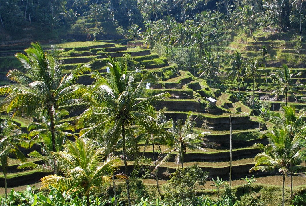
Bali () is a province of Indonesia and the westernmost of the Lesser Sunda Islands. East of Java and west of Lombok, the province includes the island of Bali and a few smaller neighbouring islands, notably Nusa Penida, Nusa Lembongan, and Nusa Ceningan to the southeast. The provincial capital, Denpasar, is the most populous city in the Lesser Sunda Islands and the second-largest, after Makassar, in Eastern Indonesia. The upland town of Ubud in Greater Denpasar is considered Bali's cultural centre. The province is Indonesia's main tourist destination, with a significant rise in tourism since the 1980s. Tourism-related business makes up 80% of its economy. Bali is the only Hindu-majority province in Indonesia, with 86.9% of the population adhering to Balinese Hinduism. It is renowned for its highly developed arts, including traditional and modern dance, sculpture, painting, leather, metalworking, and music. The Indonesian International Film Festival is held every year in Bal ... [...More Info...] [...Related Items...] OR: [Wikipedia] [Google] [Baidu] |
Green Globe
Green is the color between cyan and yellow on the visible spectrum. It is evoked by light which has a dominant wavelength of roughly 495570 nm. In subtractive color systems, used in painting and color printing, it is created by a combination of yellow and cyan; in the RGB color model, used on television and computer screens, it is one of the additive primary colors, along with red and blue, which are mixed in different combinations to create all other colors. By far the largest contributor to green in nature is chlorophyll, the chemical by which plants photosynthesize and convert sunlight into chemical energy. Many creatures have adapted to their green environments by taking on a green hue themselves as camouflage. Several minerals have a green color, including the emerald, which is colored green by its chromium content. During post-classical and early modern Europe, green was the color commonly associated with wealth, merchants, bankers, and the gentry, while red ... [...More Info...] [...Related Items...] OR: [Wikipedia] [Google] [Baidu] |
Isthmus Of Tehuantepec
The Isthmus of Tehuantepec () is an isthmus in Mexico. It represents the shortest distance between the Gulf of Mexico and the Pacific Ocean. Before the opening of the Panama Canal, it was a major overland transport route known simply as the Tehuantepec Route. The name is taken from the town of Santo Domingo Tehuantepec in the state of Oaxaca; this was derived from the Nahuatl term (" jaguar mountain"). Geography The isthmus includes the part of Mexico lying between the 94th and 96th meridians west longitude, or the southeastern parts of Veracruz and Oaxaca, including small areas of Chiapas and Tabasco. The states of Tabasco and Chiapas are east of the isthmus, with Veracruz and Oaxaca on the west. At its narrowest point, the isthmus is across from gulf to gulf, or to the head of Laguna Superior on the Pacific coast. The Sierra Madre del Sur mountain range breaks down at this point into a broad, plateau-like ridge, whose elevation, at the highest point reached by the ... [...More Info...] [...Related Items...] OR: [Wikipedia] [Google] [Baidu] |


