|
Hoshiarpur District
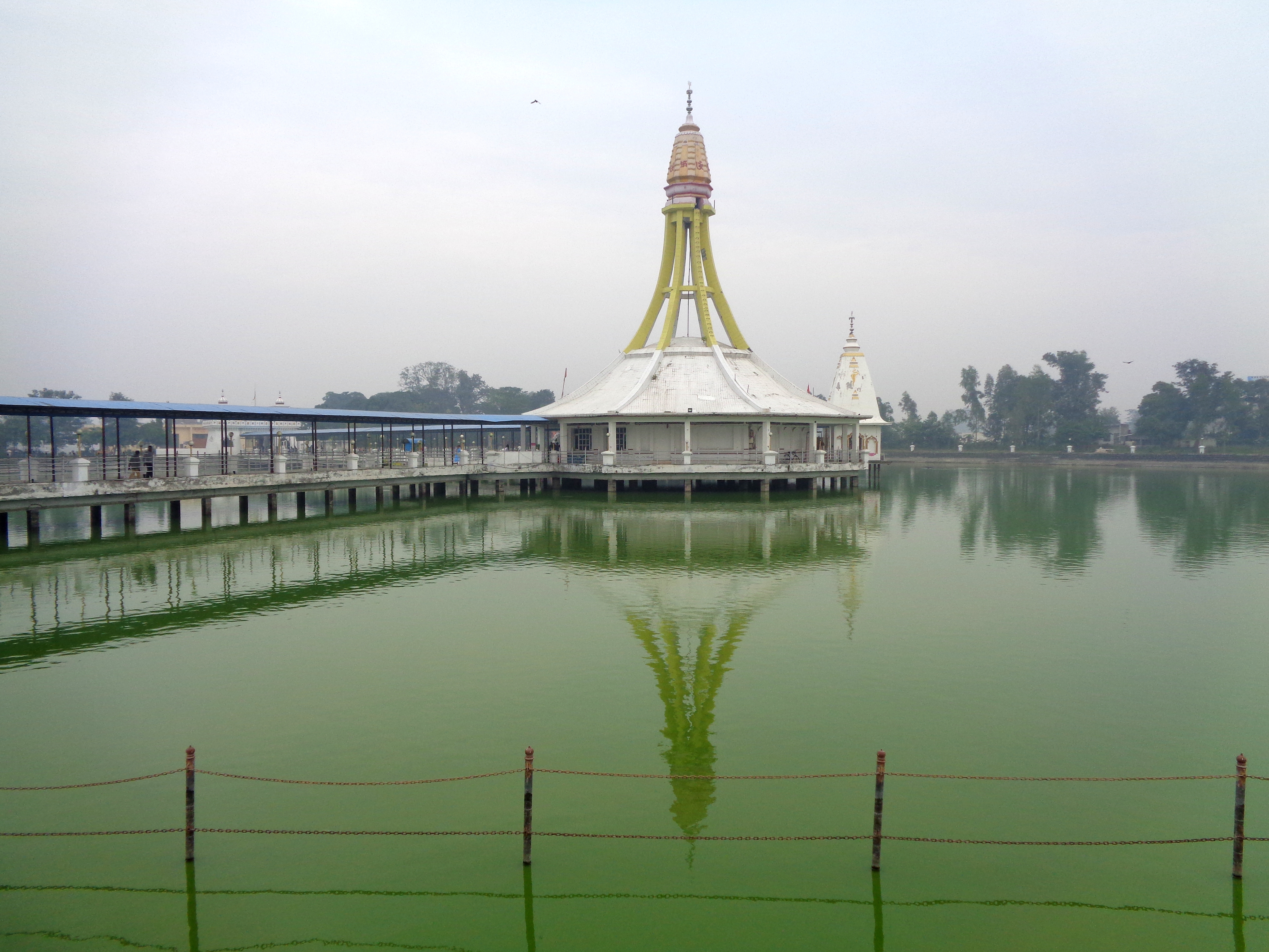
Hoshiarpur district is a district of Punjab, India, Punjab state in northern India. Hoshiarpur, one of the oldest districts of Punjab, is located in the North-east part of the Punjab state and shares common boundaries with Gurdaspur district in the north-west, Jalandhar district and Kapurthala district in south-west, Kangra district and Una district of Himachal Pradesh in the north-east. Hoshiarpur district comprises 4 sub-divisions, 10 community development blocks, 9 urban local bodies and 1417 villages. The district has an area of 3365 km2. and a population of 1,586,625 persons as per census 2011. Hoshiarpur along with the districts of Nawanshehar, Kapurthala and parts of Jalandhar represents one of the cultural region of Punjab called Doaba or the Bist Doab - the tract of land between two rivers namely Beas and Sutlej. The area along with the Shivalik foothills on the right side of Chandigarh-Pathankot road in Hoshiarpur is submountainous and this part of the district is ... [...More Info...] [...Related Items...] OR: [Wikipedia] [Google] [Baidu] |
List Of Districts Of Punjab, India
A district of the Punjab state of India is an administrative geographical unit, headed by a District Magistrate or Deputy Commissioner, an officer belonging to the Indian Administrative Service. The District Magistrate or the Deputy Commissioner is assisted by a number of officers belonging to Punjab Civil Service and other state services. There are 23 Districts in Punjab, after Malerkotla district bifurcated from Sangrur district as the 23rd district on 14 May 2021 Overview Senior Superintendent of Police, an officer belonging to the Indian Police Service is entrusted with the responsibility of maintaining law and order and related issues in the districts of the state. He is assisted by the officers of the Punjab Police and other services. Division Forest Officer, an officer belonging to the Indian Forest Service is responsible for managing the forests, environment and wildlife related issues of the districts. He is assisted by the officers of the Department of Forest and ... [...More Info...] [...Related Items...] OR: [Wikipedia] [Google] [Baidu] |
Jaswan
Jaswan was a precolonial Indian state centred at Rajpur Jaswan, in modern-day Punjab and Himachal Pradesh, commanded by the Jaswal Rajput clan. It was founded in 1170 AD by Raja Purab Chand, a cadet of the Katoch lineage, ancient royal family of Kangra. History Early history According to legend Jaswan state was founded in 1170 by Raja Purab Chand from the Kangra Royal Family. British Raj In 1815, the Sikh maharaja Ranjit Singh ordered all his available forces to assemble at Sialkot. The raja of Jaswan, Ummed Singh (1800–1849), failed to obey the summons and was fined a sum beyond his means. The raja was forced to relinquish his state to the Sikh emperor, and accepted a jagir of 21 villages and 12,000 Rs per annum. In 1848, he joined the Sikh in an unsuccessful revolt against the British. His palaces were plundered and razed to the ground, and his territory annexed. He was stripped of his title and exiled to Almora, where he died a year later. In 1877, the jagir in Jaswan ... [...More Info...] [...Related Items...] OR: [Wikipedia] [Google] [Baidu] |
Datarpur
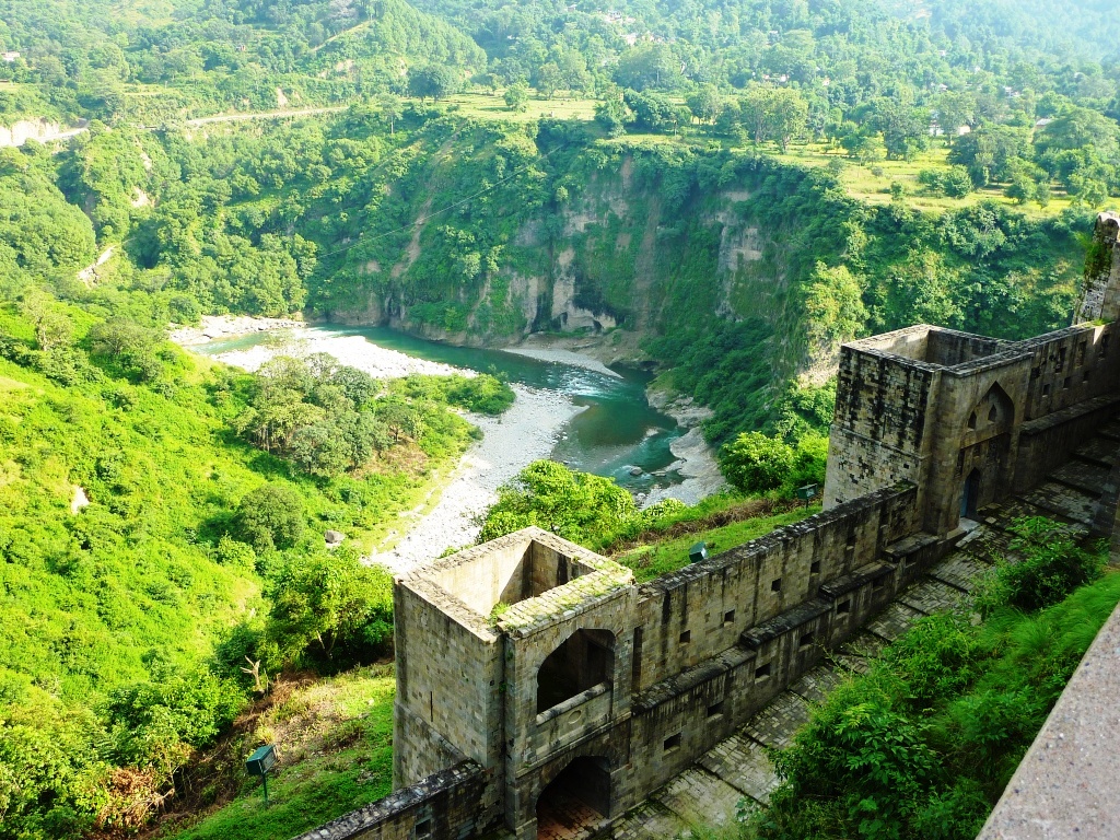
Datarpur is a village situated in Mukerian Tehsil, Hoshiarpur District, Punjab (India). Datarpur State was a small precolonial Indian hill state in the Lower Himalayas. The state was founded around 1550 and was annexed by the British in 1849. Nearest city to the village is Talwara, famous for a hydro power project owned by BBMB. From ancient times Datarpur has been the center of business and education in the area. Datarpur is famous for its spiritual centers, ancient Dushera Festival and market. Spiritual places Datarpur has spiritual centers including: *1) Darbar Shri Bawa Lal Dyal ji (one of 22 ancient gaddis of bawa lal ji) *2) Mandir Shri Sesh Nag ji (4 km from datarpur in Bindraban Village ) *3 ) Prachin Sankatmochan Hanuman ji Mandir . *4) Darbar Baba Dayalu Ji Maharaj (6 km from datarpur in Fatehpur Village ) *5) Baba Ishwar Das ji (3 km from Datarpur in Repur Village) & more History Datarpur State was founded in the middle of the sixteenth century by R ... [...More Info...] [...Related Items...] OR: [Wikipedia] [Google] [Baidu] |
Jalandhar
Jalandhar is the third most-populous city in the Indian state of Punjab and the largest city in Doaba region. Jalandhar lies alongside the Grand Trunk Road and is a well-connected rail and road junction. Jalandhar is northwest of the state capital Chandigarh, south-east of Amritsar and north of Ludhiana. Jalandhar is about 381 km (230 miles) from national capital Delhi. The famous road NH1 crosses from Jalandhar. History The history of Jalandhar District comprises three periods — ancient, medieval and modern. The city may be named after Jalandhara, a Nath Guru, who was from here. . The city was founded by Devasya Verma as mentioned in Vedas. Other possibilities include that it was the capital of the kingdom of Lava, son of Rama or that the name derives from the vernacular term ''Jalandhar'', meaning area inside the water, i.e., tract lying between the two rivers Satluj and Beas. The whole of Punjab and the area of present Jalandhar District was part of the Indus ... [...More Info...] [...Related Items...] OR: [Wikipedia] [Google] [Baidu] |
Katoch
Katoch is a Chandravanshi Rajput clan. Their traditional area of residence was in the Trigarta Kingdom, based at Jalandhar and at Kangra Fort in the Indian state of Himachal Pradesh. They descent from the Trigarta dynasty mentioned in the Mahabharata. Famous subclans came into existence from Katoch Rajputs are Dadwal Dynasty, Guleria Dynasty, Sibaia Dynasty, Chib Dynasty, Jaswal Dynasty. Etymology There are two possible origins for the word ''Katoch''. Members of the clan say it comes from the words ''Kat'' (army) and ''uch'' (upper class) but other sources say that it comes from ''kot'' (fort). The Kangra fort was known as Nagarkot or Kot Kangra, and since the administrators/rulers resided within that particular ''kot'' they were vernacularly called "Kot'ch" or कोटच, which means ''those within the fort''. This over time became Katoch. History The main branch of the Katoch clan were the rulers of the Kangra State, which was, by some accounts, the most prominent kingd ... [...More Info...] [...Related Items...] OR: [Wikipedia] [Google] [Baidu] |
Sikh Empire
The Sikh Empire was a state originating in the Indian subcontinent, formed under the leadership of Maharaja Ranjit Singh, who established an empire based in the Punjab. The empire existed from 1799, when Maharaja Ranjit Singh captured Lahore, to 1849, when it was defeated and conquered in the Second Anglo-Sikh War. It was forged on the foundations of the Khalsa from a collection of autonomous Sikh ''misls''. At its peak in the 19th century, the Empire extended from the Khyber Pass in the west to western Tibet in the east, and from Mithankot in the south to Kashmir in the north. It was divided into four provinces: Lahore, in Punjab, which became the Sikh capital; Multan, also in Punjab; Peshawar; and Kashmir from 1799 to 1849. Religiously diverse, with an estimated population of 3.5 million in 1831 (making it the 19th most populous country at the time), Amarinder Singh's The Last Sunset: The Rise and Fall of the Lahore Durbar it was the last major region of the Indian subc ... [...More Info...] [...Related Items...] OR: [Wikipedia] [Google] [Baidu] |
Chintpurni
Chintpurni is a small town in the Una district of Himachal Pradesh about 40 km (25 miles) north of Una, not far from the border with the Indian state of Punjab. The elevation is about 977 meters (about 3,200 feet). It is home to the Maa Chintpurni Temple which is a major pilgrimage site as one of the Shakti Peethas in India. The Hindu genealogy registers at Chintpurni, Himachal Pradesh are kept here. North of Chintpurni are the western Himalayas. Chintpurni lies within the much lower Shiwalik (or Shivalik) range. The temple houses the Chintpurni shakti peeth (Chhinnamastika shakti peeth). The legend behind the Shakti Peetha is part of the Shaktism tradition which tells the story of the self-immolation of the goddess Sati. Vishnu had to cut her body into 51 body parts, which fell on Earth and became sacred sites. The legend of Chhinnamasta Devi is apparently also part of the Shaktism tradition in Chintpurni. Here, Chhinnamasta is interpreted as the severed-headed one as ... [...More Info...] [...Related Items...] OR: [Wikipedia] [Google] [Baidu] |
Mukerian
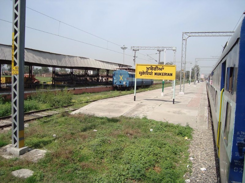
Mukerian is a city and municipal council of Hoshiarpur district in Punjab, India. Mukerian is located on National Highway 44 and state highway 15 about north of New Delhi.It is a Sub-district headquarters situated on Jalandhar-jammu railway line and is connected by road with Jalandhar, Hoshiarpur, Talwara, Gurdaspur and Pathankot. National Highway-44 also passes through here. Geography Mukerian is located at . It has an average elevation of . Demographics The Mukerian Municipal Council has population of 129,841 In Mukerian Municipal Council, Female Sex Ratio is of 921 against state average of 895. Moreover Child Sex Ratio in Mukerian is around 802 compared to Punjab state average of 846. Literacy rate of Mukerian city is 88.07 % higher than state average of 75.84 %. In Mukerian, Male literacy is around 90.31 % while female literacy rate is 85.68 %. History The Mukerian city is a marks the easternmost border of Alexander the Great's conquests in 326 BCE at banks of bias ... [...More Info...] [...Related Items...] OR: [Wikipedia] [Google] [Baidu] |
Dasuya
Dasuya (Dasua) is a town and a municipal council in Hoshiarpur district in the state of Punjab, India. It is one of the major subdivisions with 398 villages under its jurisdiction. History According to a report by ''The Tribune'' newspaper in 1977, the town is referred to in the ancient Indian epic, the ''Mahabharata'', as being the seat of king Virata. In recognition of this, Dasuya is still referred to as ''Virat Ki Nagri'' today. In the closing decade of the fourteenth century, Dasuya at least twice witnessed the passage of an army during the struggle against the Muslim conquerors, Abu Bakar and Amir Taimur. Later, in December 1557, the army of the incumbent Sultan Akbar, led by his governor of Lahore, Khizr Khan, camped at the town while dealing successfully with a threat posed by Sikandar Sur. More recently, Dasuya featured in debates related to the emergence of Himachal Pradesh. Verma has noted that "Perhaps no other State of India has suffered as many territorial and ... [...More Info...] [...Related Items...] OR: [Wikipedia] [Google] [Baidu] |
Anandpur Sahib
Anandpur Sahib, sometimes referred to simply as Anandpur (lit. "city of bliss"), is a city in Rupnagar district (Ropar), on the edge of Shivalik Hills, in the Indian state of Punjab. Located near the Sutlej River, the city is one of the most sacred places in Sikhism, being the place where the last two Sikh Gurus, Guru Tegh Bahadur and Guru Gobind Singh, lived. It is also the place where Guru Gobind Singh founded the Khalsa Panth in 1699. The city is home to Takhat Sri Kesgarh Sahib, Third of the five Takhts in Sikhism. The city is a pilgrimage site in Sikhism. It is the venue of the largest annual Sikh gathering and festivities during Hola Mohalla in the spring season.Gurmukh Singh (2009)Anandpur Sahib Encyclopedia of Sikhism, Editor in Chief: Harbans Singh, Punjab University Location Anandpur Sahib is located on National Highway 503 that links Kiratpur Sahib and Chandigarh to Nangal, Una and further Kangra, Himachal Pradesh. It is situated near the Sutlej river, the longe ... [...More Info...] [...Related Items...] OR: [Wikipedia] [Google] [Baidu] |
Dera
Dera, Dero, Daro, Dhoro, Dahar or Dehra is a word in several languages of South Asia, whose meaning is 'camp', 'mound' or 'settlement'. It appears in the names of a number of places. Geography India * Dera, Himachal Pradesh * Dera Bassi, Mohali district, Punjab * Dera Baba Nanak, Gurdaspur district, Punjab * Dera Baba Jaimal Singh, Amritsar district, Punjab * Dera Baba Murad Shah, Nakodar, Punjab * Dera Baba Vadbhag Singh, Una district, Himachal Pradesh * Dera Doon, capital of Uttarakhand * Dera Sach Khand Ballan, Jalandhar district, Punjab * Dera Sacha Sauda, Sirsa district, Haryana * Dera Sar, Jain temples in Gujarat and Rajasthan * Dera Kanjli, Kapurthala district, Punjab * Dera Gopipur, Kangra district, Himachal Pradesh * Gola Dhoro, Kutch district, Gujarat * Kerala-no-dhoro, Saurashtra, Gujarat * Damajino Dero, Vadodara district, Gujarat Iran * Dera, Iran, a village in Kerman Province, Iran * Dera, Kohgiluyeh and Boyer-Ahmad, a village in Kohgiluyeh and Boyer-Ahm ... [...More Info...] [...Related Items...] OR: [Wikipedia] [Google] [Baidu] |
Beas River
The Beas River (Sanskrit: ; Hyphasis in Ancient Greek) is a river in north India. The river rises in the Himalayas in central Himachal Pradesh, India, and flows for some to the Sutlej River in the Indian state of Punjab. Its total length is and its drainage basin is large. As of 2017, the river is home to a tiny isolated population of the Indus dolphin. Etymology Veda Vyasa, the author of Indian epic Mahabharata, is the eponym of the river Beas; he is said to have created it from its source lake, the Beas Kund. Before Veda Vyasa, the Vipasa river was known as Saraswati. Rishi Vashishta, the great grandfather of Vyasa tried to jump into this river from an overlooking hillock, to sacrifice his soul. He tied himself with several cords to drown himself. However, the river altered form to become a sandbed, saving him. And in this course, the cords got broken, so Vashishta named the river Vipasa, which means cord-breaker. On account of this incident, the great Rishi opted to ... [...More Info...] [...Related Items...] OR: [Wikipedia] [Google] [Baidu] |


