|
Horns Mill, Hertford
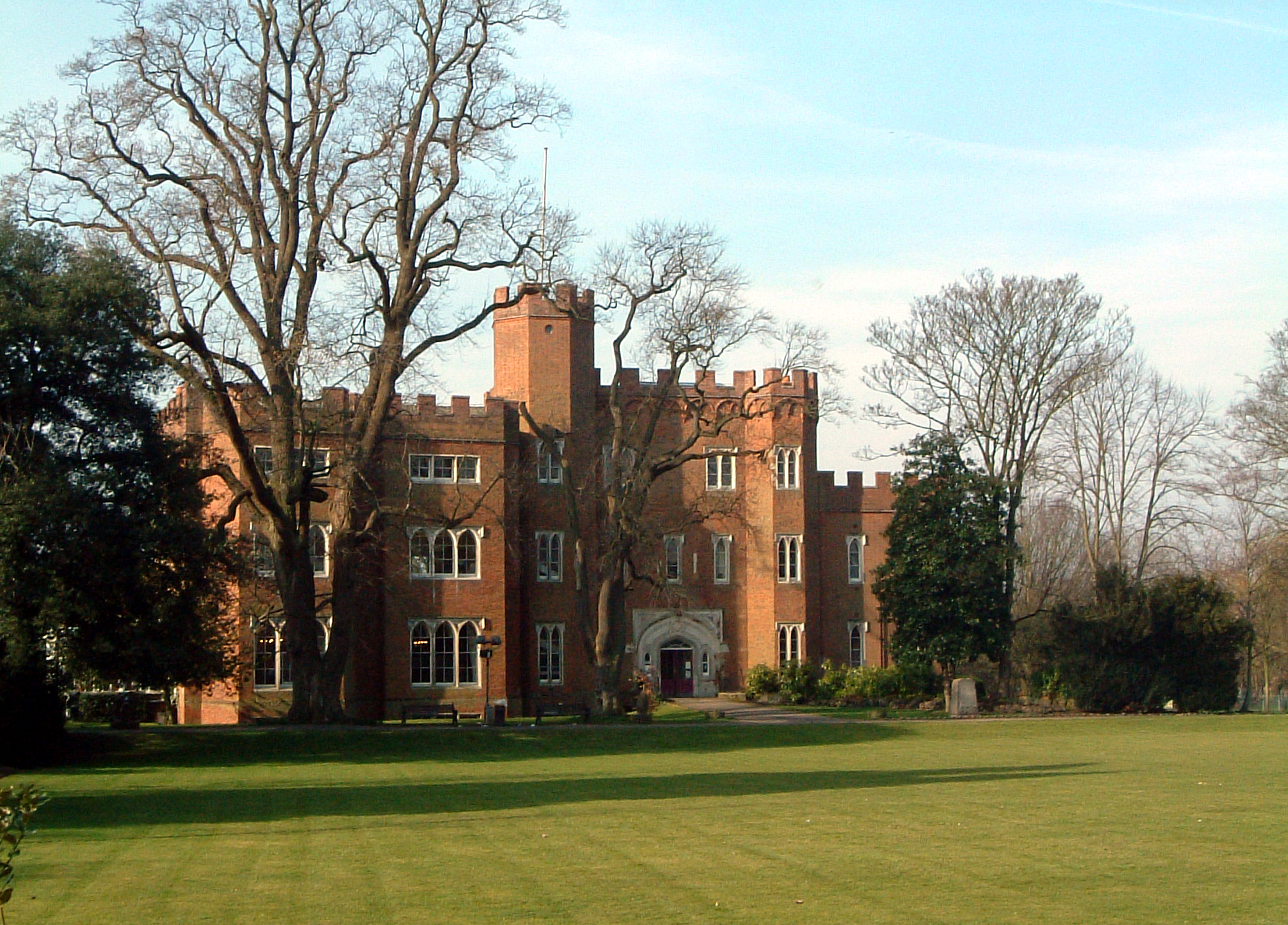
Horns Mill is an area and suburb of south Hertford, Hertfordshire. History Horn's Mill was at the foot of Bullock's Lane. The mill ground corn, crushed oil seeds and ground bones for fertiliser. Production ceased in the late nineteenth century and the premises were sold to leather-dresser William Webb. Chamois leather was produced at first but later a glove making business was established. This closed in 1971. The site is now occupied by housing in Waterdale, Tanners Close and Glovers Close. The original mill was a watermill which was located on a cut from the upper section of the River Lea. The mill has long since been demolished, leaving only a set of sluice gates. Present The area is now populated by four main housing estates generally known as Pearson Avenue or 'the old estate', Hornsmill or 'the new estate', Tanners Crescent and Mandeville Road. There are two grocery shops - one houses a post office, modern community centre a children's park with some facilities for younger ... [...More Info...] [...Related Items...] OR: [Wikipedia] [Google] [Baidu] |
Hertford
Hertford ( ) is the county town of Hertfordshire, England, and is also a civil parish in the East Hertfordshire district of the county. The parish had a population of 26,783 at the 2011 census. The town grew around a ford on the River Lea, near its confluences with the rivers Mimram, Beane, and Rib. The Lea is navigable from the Thames up to Hertford. Fortified settlements were established on each side of the ford at Hertford in 913AD. The county of Hertfordshire was established at a similar time, being named after and administered from Hertford. Hertford Castle was built shortly after the Norman Conquest in 1066 and remained a royal residence until the early seventeenth century. Hertfordshire County Council and East Hertfordshire District Council both have their main offices in the town and are major local employers, as is McMullen's Brewery, which has been based in the town since 1827. The town is also popular with commuters, being only north of central London and connect ... [...More Info...] [...Related Items...] OR: [Wikipedia] [Google] [Baidu] |
Richard Hale School
Richard Hale School is a boys' secondary school located in Hertford in the south east of England. In the 2014–2015 academic year, the school had over 1,000 pupils including students attending the optional sixth form, which is also open to girls. History The school was founded as "Richard Hale's School" on 16 April 1617 by the affluent merchant Richard Hale, who wished to ''"erect a grammar school for the instruction of children in the Latin tongue and other literature in the town of Hertford".'' The original school building was in use for 313 years from 1617 to 1930, and still stands near to All Saints' Church. For most of its life the school was known as the "Hertford Grammar School" until 1967, when it was renamed to coincide with the 350th anniversary. It began the transition to a comprehensive school in 1975, a process completed when the last grammar intake left in 1981. New buildings were built in 1977, the gym was built in 1978 and the Sixth form centre from 2009 to 201 ... [...More Info...] [...Related Items...] OR: [Wikipedia] [Google] [Baidu] |
Geography Of Hertford
Geography (from Greek: , ''geographia''. Combination of Greek words ‘Geo’ (The Earth) and ‘Graphien’ (to describe), literally "earth description") is a field of science devoted to the study of the lands, features, inhabitants, and phenomena of Earth. The first recorded use of the word γεωγραφία was as a title of a book by Greek scholar Eratosthenes (276–194 BC). Geography is an all-encompassing discipline that seeks an understanding of Earth and its human and natural complexities—not merely where objects are, but also how they have changed and come to be. While geography is specific to Earth, many concepts can be applied more broadly to other celestial bodies in the field of planetary science. One such concept, the first law of geography, proposed by Waldo Tobler, is "everything is related to everything else, but near things are more related than distant things." Geography has been called "the world discipline" and "the bridge between the human and ... [...More Info...] [...Related Items...] OR: [Wikipedia] [Google] [Baidu] |
Hamlets In Hertfordshire
A hamlet is a human settlement that is smaller than a town or village. Its size relative to a parish can depend on the administration and region. A hamlet may be considered to be a smaller settlement or subdivision or satellite entity to a larger settlement. The word and concept of a hamlet has roots in the Anglo-Norman settlement of England, where the old French ' came to apply to small human settlements. Etymology The word comes from Anglo-Norman ', corresponding to Old French ', the diminutive of Old French ' meaning a little village. This, in turn, is a diminutive of Old French ', possibly borrowed from (West Germanic) Franconian languages. Compare with modern French ', Dutch ', Frisian ', German ', Old English ' and Modern English ''home''. By country Afghanistan In Afghanistan, the counterpart of the hamlet is the qala (Dari: قلعه, Pashto: کلي) meaning "fort" or "hamlet". The Afghan ''qala'' is a fortified group of houses, generally with its own commu ... [...More Info...] [...Related Items...] OR: [Wikipedia] [Google] [Baidu] |
Horns Mill Weir
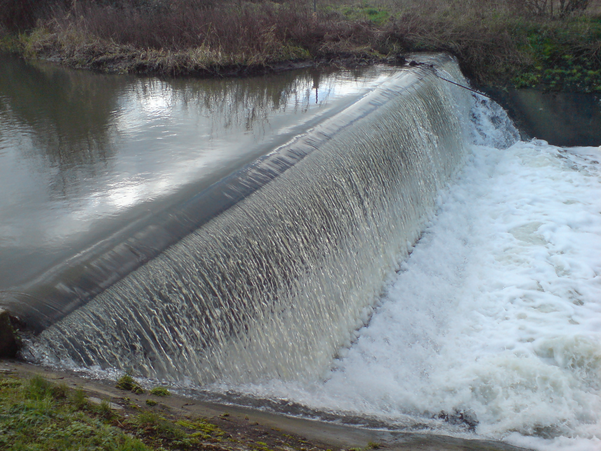
Horns Mill Weir is a weir A weir or low head dam is a barrier across the width of a river that alters the flow characteristics of water and usually results in a change in the height of the river level. Weirs are also used to control the flow of water for outlets of l ... on the River Lea, next to Horns Mill, Hertford. Weirs on the River Lea Weirs in Hertfordshire {{Hertfordshire-geo-stub ... [...More Info...] [...Related Items...] OR: [Wikipedia] [Google] [Baidu] |
Bayford Brook
Bayford Brook is a minor tributary of the River Lea. It forms in the hills near Bayford, Hertfordshire and joins the River Lea at Horns Mill Weir. The brook is mostly dry during periods of little rain, as it has a steady gradient with few pools to collect water. The brook is most easily viewed towards its northernmost point where is runs between the two parallel Brickendon Lanes before disappearing into a culvert (illustrated in the photograph). It can also be clearly seen to the left of Brickendon Lane heading away from Hertford at coordinates 51.781884,-0.081008 Rivers of Hertfordshire Tributaries of the River Lea 1Bayford {{England-river-stub ... [...More Info...] [...Related Items...] OR: [Wikipedia] [Google] [Baidu] |
.jpg)

.jpg)


