|
Honister Pass
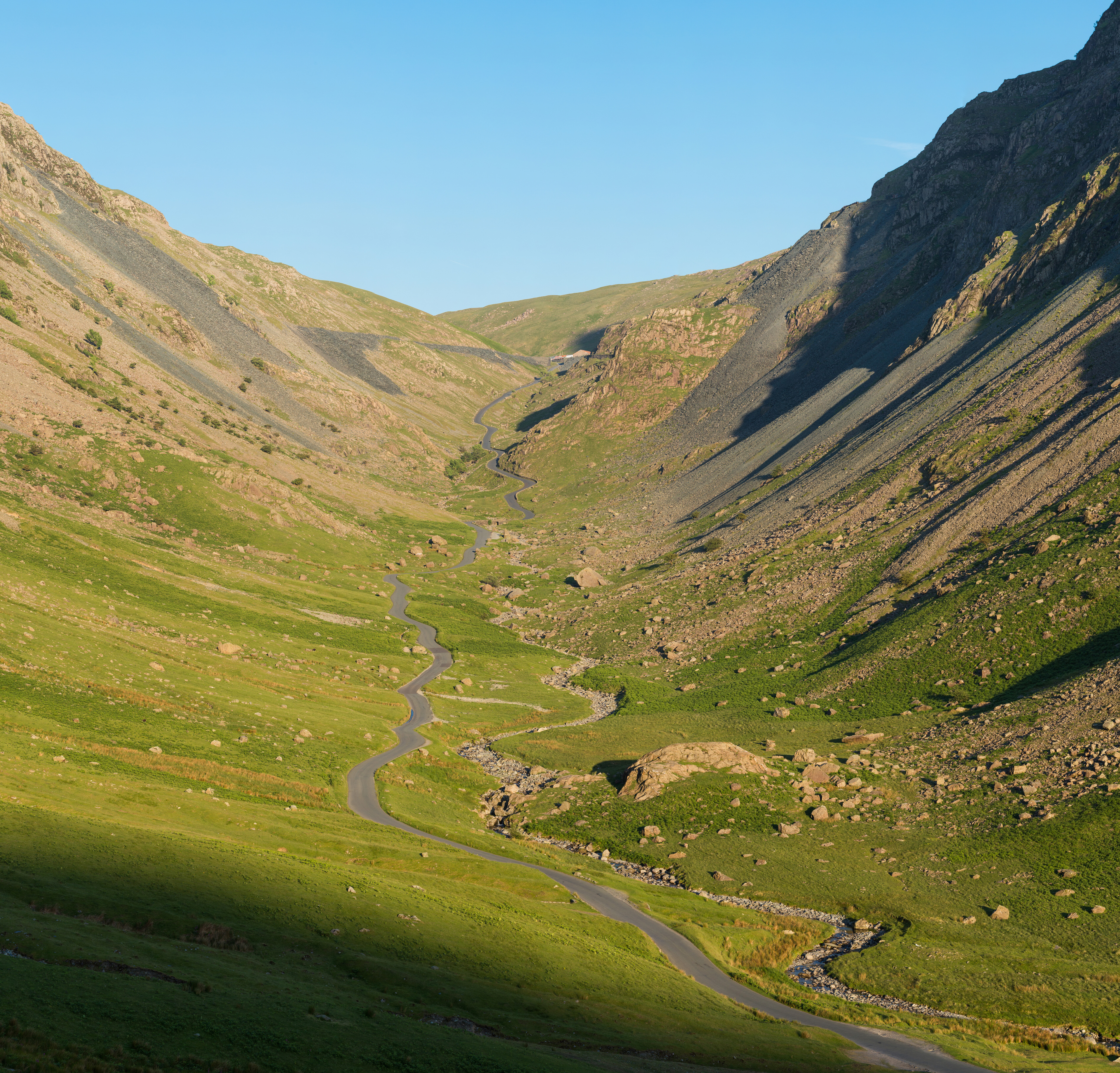
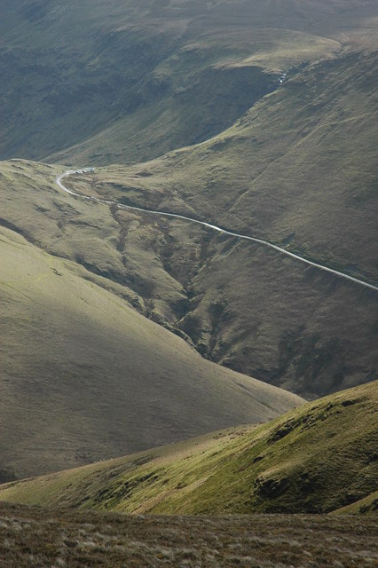
Honister Pass is a mountain pass in the English Lake District. It is located on the B5289 road, linking Seatoller, in the valley of Borrowdale, to Gatesgarth at the southern end of Buttermere. The pass reaches an altitude of , making it one of the highest in the region, and also one of the steepest, with gradients of up to 1-in-4 (25%). The saddle at the watershed is known as Honister Hause, using the Cumbrian word ''hause'' for such a feature. Honister Pass is one of three passes that link the tourist area around Keswick, including Derwent Water and Borrowdale, with the valley of the River Cocker, including the lakes of Buttermere, Crummock Water and Loweswater. From north to south these passes are Whinlatter Pass, Newlands Pass and Honister Pass. Honister Slate Mine and Honister Hause Youth Hostel are located at the summit of the pass. Footpaths lead from the summit of the pass to Fleetwith Pike to the west, Grey Knotts to the south, and Dale Head to the north. Honis ... [...More Info...] [...Related Items...] OR: [Wikipedia] [Google] [Baidu] |
Derwent Water
Derwentwater, or Derwent Water, is one of the principal bodies of water in the Lake District National Park in north west England. It lies wholly within the Borough of Allerdale, in the county of Cumbria. The lake occupies part of Borrowdale and lies immediately south of the town of Keswick. It is both fed and drained by the River Derwent. It measures approximately long by wide and is some deep. There are several islands within the lake, one of which is inhabited. Derwentwater is a place of considerable scenic value. It is surrounded by hills (known locally as fells), and many of the slopes facing Derwentwater are extensively wooded. A regular passenger launch operates on the lake, taking passengers between various landing stages. There are seven lakeside marinas, the most popular stops being Keswick, Portinscale and the Lodore Falls, from which boats may be hired. Recreational walking is a major tourist activity in the area and there is an extensive network of foot ... [...More Info...] [...Related Items...] OR: [Wikipedia] [Google] [Baidu] |
List Of Hill Passes Of The Lake District
Hill passes of the Lake District were originally used by people in one valley travelling to another nearby without having to go many miles around a steep ridge of intervening hills. Historically, in the Lake District of northwest England, travel on foot or by pony was difficult because of the region's steep-sided valleys so tracks across the ridges were created taking the easiest route over passes – often, but not always, via a col. Since Roman times long-distance travel had tended to be along ridges. From the 19th century these passes and ridge routes were brought back into use when recreational hill walking become popular. Forty hill passes within the Lake District National Park are listed here, using criteria for selecting the major routes. Background The Lake District National Park was created in 1951 covering an area of over and, although its population is only 42,000, over 10 million visitors arrive each year, mostly attracted by the lakes and fells. Geology Abou ... [...More Info...] [...Related Items...] OR: [Wikipedia] [Google] [Baidu] |
Dale Head
Dale Head is a fell in the north-western sector of the Lake District, in northern England. It is 753 metres or 2,470 feet above sea level and stands immediately north of Honister Pass, the road between Borrowdale and Buttermere. Topography The North-Western Fells occupy the area between the rivers Derwent and Cocker, a broadly oval swathe of hilly country, elongated on a north-south axis. Two roads cross from east to west, dividing the fells into three convenient groups. Dale Head is the highest fell in the southern sector. Dale Head is the apex of two hill ridges. The principal ridge descends from Dale Head to the north-east and forms several other fells, each given a chapter by Alfred Wainwright in his Pictorial Guides to the Lakeland Fells. These are High Spy, Maiden Moor and Catbells (alternative spelling, Cat Bells). This ridge forms the western side of Borrowdale and overlooks Derwent Water. The other ridge descends to the north-west and includes the fells o ... [...More Info...] [...Related Items...] OR: [Wikipedia] [Google] [Baidu] |
Grey Knotts
Grey Knotts is a fell in the English Lake District. It is situated one kilometre south of the B5289 road as it crosses the Honister Pass. It is well seen from mid- Borrowdale as it rises above Seatoller. Grey Knotts reaches a height of 697 metres (2287 feet) and is part of a ridge which ascends from the woodland behind Seatoller and continues south-west and then south for four kilometres to Great Gable. The fell's name really only applies to the summit rocks, but has been adopted for the entire fell with the high ground in this area, locally known as Seatoller Fell on Ordnance Survey maps. Topography Grey Knotts is a "Wainwright" fell and also qualifies as a Nuttall, but this must be considered a borderline case, as it barely has the required 15 metres of prominence to the adjoining higher fell of Brandreth. All the highlights of Grey Knotts are situated on the eastern (Borrowdale) side of the fell, Raven Crag, known as Gillercombe Buttress to rock climbers. It is ... [...More Info...] [...Related Items...] OR: [Wikipedia] [Google] [Baidu] |
Fleetwith Pike
Fleetwith Pike is a fell in the English Lake District in the county of Cumbria which reaches a height of 648 metres (2,126 feet). The fell is a well-known feature of the area as it casts an imposing presence over Buttermere and the Honister Pass on the B5289 motor road between Borrowdale and Buttermere. Topography Fleetwith Pike is the north-western shoulder of Grey Knotts. It is bounded by Honister Pass to the north and Warnscale Bottom to the south-west, their two streams uniting beneath the fell in Buttermere. The north west ridge rising almost from the lakeshore at Gatesgarth is named Fleetwith Edge, and is a striking feature from any direction. The top of the fell is situated directly at the top of the edge, while a lower summit stands to the east atop Honister Crag. Fleetwith Pike is lined on all sides by impressive crags, other than for the broad plateau leading across the Drum House to Grey Knotts. Slate extraction The side of the fell which overlooks Hon ... [...More Info...] [...Related Items...] OR: [Wikipedia] [Google] [Baidu] |
Trail
A trail, also known as a path or track, is an unpaved lane or small road usually passing through a natural area. In the United Kingdom and the Republic of Ireland, a path or footpath is the preferred term for a pedestrian or hiking trail. The term is also applied in North America to routes along rivers, and sometimes to highways. In the US, the term was historically used for a route into or through wild territory used by explorers and migrants (e.g. the Oregon Trail). In the United States, "trace" is a synonym for trail, as in Natchez Trace. Some trails are dedicated only for walking, cycling, horse riding, snowshoeing or cross-country skiing, but not more than one use; others, as in the case of a bridleway in the UK, are multi-use and can be used by walkers, cyclists and equestrians alike. There are also unpaved trails used by dirt bikes and other off-road vehicles, and in some places, like the Alps, trails are used for moving cattle and other livestock. Usage In Austra ... [...More Info...] [...Related Items...] OR: [Wikipedia] [Google] [Baidu] |
Youth Hostel
A hostel is a form of low-cost, short-term shared sociable lodging where guests can rent a bed, usually a bunk bed in a dormitory, with shared use of a lounge and sometimes a kitchen. Rooms can be mixed or single-sex and have private or shared bathrooms. Private rooms may also be available, but the property must offer dormitories to be considered a hostel. Hostels are popular forms of lodging for backpackers. They are part of the sharing economy. Benefits of hostels include lower costs and opportunities to meet people from different places, find travel partners, and share travel ideas. Some hostels, such as Zostel in India or Hostelling International, cater to a niche market of travelers. For example, one hostel might feature in-house social gatherings such as movie nights or communal dinners, another might feature local tours, one might be known for its parties, and another might have a quieter place to relax in serenity, or be located on the beach. Newer hostels focus on a more ... [...More Info...] [...Related Items...] OR: [Wikipedia] [Google] [Baidu] |
Honister Slate Mine
The Honister Slate Mine in Cumbria is the last working slate mine in England. Quarrying for Westmorland green slate has been taking place in the area since 1728. Apart from the mining it is also a popular tourist attraction in the Lake District National Park. History Opencast quarrying had been carried out at Honister since the late 17th century. But as capacity increased, the site's underground workings were extensively expanded. 19th century By 1870 Honister's underground workings stretched under Honister Crag with intermediate workings on the opposite side of the valley at Yew Crags. Smaller-scale underground workings on Dubbs Moor, together with a small opencast quarry. Packhorse teams had been used to remove the finished slate on sleds from mines. This involved bringing the loads down steep paths that traversed the cliffs to the top of Honister Pass (The Hause). Dubbs mine was known for its 'smaller metal' (metal being the terminology for slate), in that smaller pi ... [...More Info...] [...Related Items...] OR: [Wikipedia] [Google] [Baidu] |
Newlands Pass
The Newlands Pass, also known as Newlands Hause, is a mountain pass in the English Lake District. It is located on an unclassified road linking the Newlands Valley, to the west of Keswick and Derwent Water, with the village of Buttermere. The highest point on the pass is at an altitude of , and it has gradients of 1 in 4 on both sides. The Newlands Pass is one of three passes that link the tourist area around Keswick, including Derwent Water and Borrowdale, with the valley of the River Cocker, including the lakes of Buttermere, Crummock Water and Loweswater. From north to south these passes are the Whinlatter Pass, the Newlands Pass, and the Honister Pass Honister Pass is a mountain pass in the English Lake District. It is located on the B5289 road, linking Seatoller, in the valley of Borrowdale, to Gatesgarth at the southern end of Buttermere. The pass reaches an altitude of , making it .... The Moss Force Waterfall falls down the southern side of Newlands ... [...More Info...] [...Related Items...] OR: [Wikipedia] [Google] [Baidu] |
Whinlatter Pass
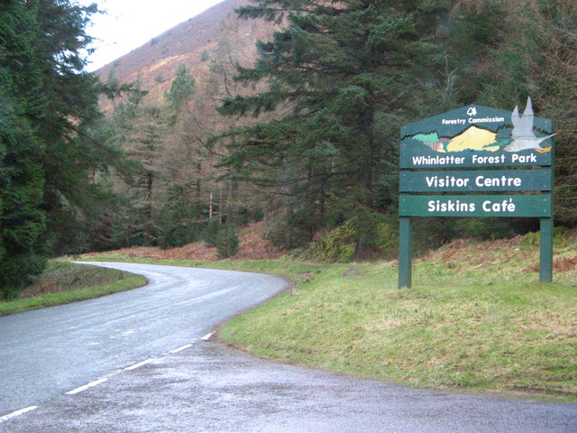
The Whinlatter Pass is a mountain pass in the English Lake District. It is located on the B5292 road linking Braithwaite, to the west of Keswick, with High Lorton to the south of Cockermouth. To the north the pass is flanked by Whinlatter fell, while to the south the Whiteside, Hopegill Head and Grisedale Pike fells borders the pass. From the top of the pass, paths climb Whinlatter and Grisedale Pike. There is also a Forestry Commission tourist centre there. The Whinlatter Pass is one of three passes that link the tourist area around Keswick, including Derwent Water and Borrowdale, with the valley of the River Cocker, including the lakes of Buttermere, Crummock Water and Loweswater. From north to south these passes are the Whinlatter Pass, the Newlands Pass, and the Honister Pass. The Whinlatter Pass can be icy in winter, but it is a less severe route than the other two passes. The Pass was used for the first King of the Mountains climb on the second stage of the 2016 ... [...More Info...] [...Related Items...] OR: [Wikipedia] [Google] [Baidu] |
Loweswater
Loweswater is one of the smaller lakes in the English Lake District. The village of Loweswater is situated to the east of the lake. Geography The lake is not far from Cockermouth and is also easily reached from elsewhere in West Cumbria. The group of fells to the south of Loweswater is known as the Loweswater Fells and consists of Mellbreak, Gavel Fell, Blake Fell, Hen Comb and Burnbank Fell. To the north of the lake lies the Fellbarrow range. The lake is unusual in the radial drainage pattern of the Lake District in draining towards the centre of the Lake District: its outfall, Dub Beck, becomes Park Beck and runs east or south-east into the north end of Crummock Water, close to that lake's exit. By way of the River Cocker and River Derwent, Loweswater's contents eventually reach the sea at Workington. The immediate vicinity of Loweswater consists mainly of rolling hills, in contrast to the rocky mountains found elsewhere in the Lake District (though Mellbreak, part ... [...More Info...] [...Related Items...] OR: [Wikipedia] [Google] [Baidu] |


.jpg)


