|
Hong Kong Units
Hong Kong has three main systems of units of measurement in current use: * The Chinese units of measurement of the Qing Empire (no longer in widespread use in mainland China); * British Imperial units; and * The metric system. In 1976 the Hong Kong Government started the conversion to the metric system, and as of 2012 measurements for government purposes, such as road signs, are almost always in metric units. However, all three systems are officially permitted for trade, and in the wider society a mixture of all three systems prevails. Length The metric system is used for all official purposes in Hong Kong, however, the imperial system is sometimes used in informal situations. The Chinese system's most commonly used units were ( li), ( tseung/cheung), ( tsek/chek), (tsun/chun), (fen/fan) in descending scale order. The legal units for trade include , and only, but they are no longer in daily use, with the words and commonly understood as the imperial measure foot () an ... [...More Info...] [...Related Items...] OR: [Wikipedia] [Google] [Baidu] |
HK Sheung Wan Queen&
Hong Kong ( (US) or (UK); , ), officially the Hong Kong Special Administrative Region of the People's Republic of China (abbr. Hong Kong SAR or HKSAR), is a List of cities in China, city and Special administrative regions of China, special administrative region of China on the eastern Pearl River Delta in South China. With 7.5 million residents of various nationalities in a territory, Hong Kong is one of the List of countries and dependencies by population density, most densely populated places in the world. Hong Kong is also a major global financial centre and one of the Global city, most developed cities in the world. Hong Kong was established as a British Hong Kong, colony of the British Empire after the Qing dynasty, Qing Empire ceded Hong Kong Island from Bao'an County, Xin'an County at the end of the First Opium War in 1841 then again in 1842.. The colony expanded to the Kowloon Peninsula in 1860 after the Second Opium War and was further extended when Britain obtaine ... [...More Info...] [...Related Items...] OR: [Wikipedia] [Google] [Baidu] |
Mile
The mile, sometimes the international mile or statute mile to distinguish it from other miles, is a British imperial unit and United States customary unit of distance; both are based on the older English unit of length equal to 5,280 English feet, or 1,760 yards. The statute mile was standardised between the British Commonwealth and the United States by an international agreement in 1959, when it was formally redefined with respect to SI units as exactly . With qualifiers, ''mile'' is also used to describe or translate a wide range of units derived from or roughly equivalent to the Roman mile, such as the nautical mile (now exactly), the Italian mile (roughly ), and the Chinese mile (now exactly). The Romans divided their mile into 5,000 Roman feet but the greater importance of furlongs in Elizabethan-era England meant that the statute mile was made equivalent to or in 1593. This form of the mile then spread across the British Empire, some successor states of which ... [...More Info...] [...Related Items...] OR: [Wikipedia] [Google] [Baidu] |
East Rail Line
The East Rail line () is one of ten lines of the Mass Transit Railway (MTR) system in Hong Kong. It used to be one of the three lines of the Kowloon–Canton Railway (KCR) network. It was known as the KCR British Section () from 1910 to 1996, and the KCR East Rail () from 1996 to 2007. East Rail was the only railway line of the Kowloon-Canton Railway Corporation (KCRC) following the closure of the Sha Tau Kok Railway and before the construction of ''KCR West Rail'' (later renamed West Rail line, now part of the Tuen Ma line). The railway line starts at Admiralty on Hong Kong Island and branches in the north at Sheung Shui to terminate at Lo Wu or Lok Ma Chau stations. Both are border crossing points into Shenzhen. All of the stations on the line except Admiralty, Exhibition Centre and Hung Hom are at-grade or elevated. The distance between Hung Hom and Lo Wu stations is . The total distance of the line (including the Lok Ma Chau Spur line) is approximately , making it the seco ... [...More Info...] [...Related Items...] OR: [Wikipedia] [Google] [Baidu] |
CDW Building
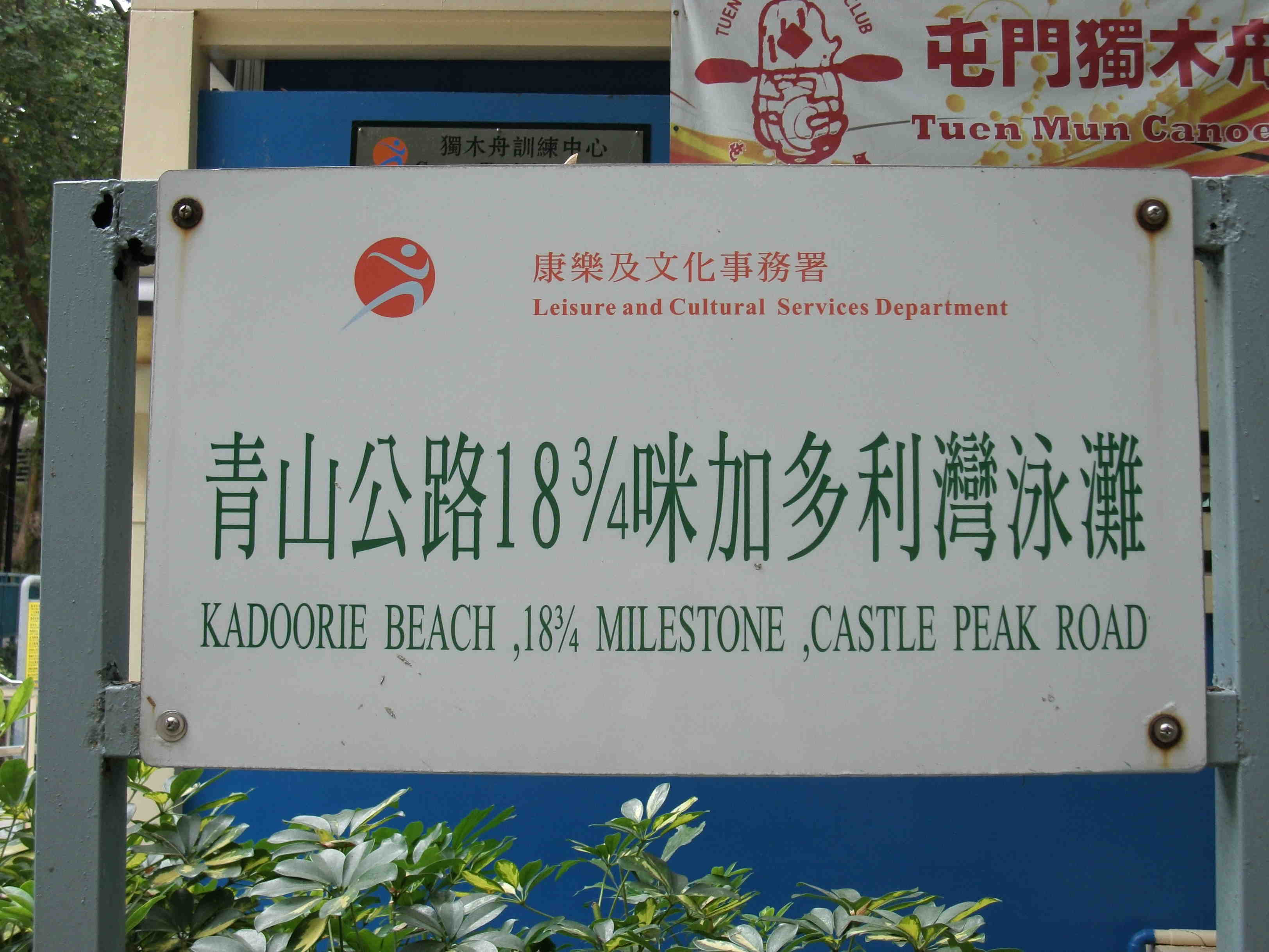
CDW Building (Chinese: 中染大廈) is located at 388 Castle Peak Road, Tsuen Wan, Hong Kong, and is wholly owned by HKR International Ltd. It was built in 1982 as an industrial building. Across the years, CDW Building underwent a number of refurbishment works. At present, the building comprises an office tower and a shopping mall named 8½ shopping mall, with total GFA of approximately 90,600 square metres. Shopping mall (8½) When Castle Peak Road was built in the early 20th century, addresses were marked in miles from a theoretical origin point, namely the Tsim Sha Tsui Ferry Pier Star Ferry Pier, Tsim Sha Tsui, or Tsim Sha Tsui Ferry Pier, is a pier located on reclaimed land at the southernmost tip of Tsim Sha Tsui on Kowloon Peninsula in Hong Kong. It is commonly known as Star Ferry Pier () in Tsim Sha Tsui. Star Ferry .... Some addresses along the road (particularly in the rural areas) still comprise the nearest milepost. The CDW Building, located on Castle Peak ... [...More Info...] [...Related Items...] OR: [Wikipedia] [Google] [Baidu] |
Kadoorie Beach
Kaddouri ( ar, خضوري, derived from "green", ''akhdar'' in Arabic; he, כדורי (transliterated; does not mean ''green'', which would be ירוק, yarok)) and many other transliterations, is an Arabic surname. People with the surname include: * Badr El Kaddouri (born 1981), Moroccan footballer * Elie Kedourie (1926–1992), British historian * Majid Khadduri (1909-2007), Iraqi academic * Omar El Kaddouri (born 1990), Belgian footballer * Sylvia Kedourie (1925–2016), British historian Others * Kadoorie family, Mizrahi Jewish family originally from Baghdad, then Bombay, Shanghai, and finally Hong Kong ** Ellis Kadoorie (1865–1922), philanthropist and businessman *** Kadoorie Agricultural High School and youth village in Israel, founded by Sir Ellis Kadoorie *** Palestine Technical University - Kadoorie, the Arab twin institution of the Jewish Kadoorie Agricultural School ** Elly Kadoorie (1867–1944), philanthropist and businessman ** Lawrence Kadoorie, Baron Kadoori ... [...More Info...] [...Related Items...] OR: [Wikipedia] [Google] [Baidu] |
Milepost
A milestone is a numbered marker placed on a route such as a road, railway line, canal or boundary. They can indicate the distance to towns, cities, and other places or landmarks; or they can give their position on the route relative to some datum location. On roads they are typically located at the side or in a median or central reservation. They are alternatively known as mile markers, mileposts or mile posts (sometimes abbreviated MPs). A "kilometric point" is a term used in metricated areas, where distances are commonly measured in kilometres instead of miles. "Distance marker" is a generic unit-agnostic term. Milestones are installed to provide linear referencing points along the road. This can be used to reassure travellers that the proper path is being followed, and to indicate either distance travelled or the remaining distance to a destination. Such references are also used by maintenance engineers and emergency services to direct them to specific points where th ... [...More Info...] [...Related Items...] OR: [Wikipedia] [Google] [Baidu] |
Star Ferry
The Star Ferry is a passenger ferry service operator and tourist attraction in Hong Kong. Its principal routes carry passengers across Victoria Harbour, between Hong Kong Island, and Kowloon. The service is operated by the Star Ferry Company, which was founded in 1888 as the Kowloon Ferry Company, and adopted its present name in 1898. With a fleet of twelve ferries, the company operates two routes across the harbour, carrying over 70,000 passengers per day, or 26 million per year. Even though the harbour is crossed by railway and road tunnels, the Star Ferry continues to provide a scenic yet inexpensive mode of harbour crossing. The company's main route runs between Central and Tsim Sha Tsui. It was rated first in the "Top 10 Most Exciting Ferry Rides" poll by SATW (Society of American Travel Writers) in February 2009. History Before the steam ferry service was first established, people would cross the harbour in sampans. In 1870, a man named Grant Smith brought ... [...More Info...] [...Related Items...] OR: [Wikipedia] [Google] [Baidu] |
Tsim Sha Tsui
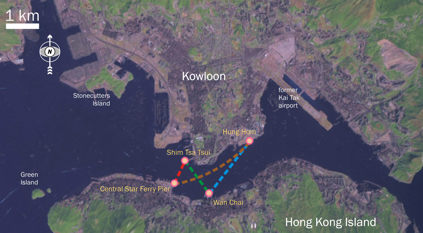
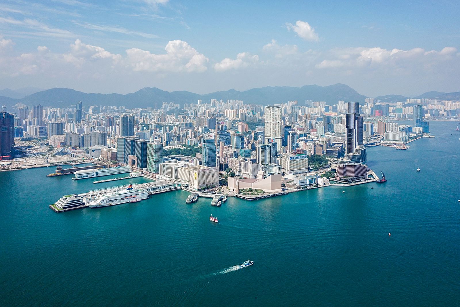
Tsim Sha Tsui, often abbreviated as TST, is an list of areas of Hong Kong, urban area in southern Kowloon, Hong Kong. The area is administratively part of the Yau Tsim Mong District. Tsim Sha Tsui East is a piece of land reclaimed from the Hung Hom Bay now east of Tsim Sha Tsui. The area is bounded north by Austin Road and in the east by Hong Chong Road and Cheong Wan Road. Geographically, Tsim Sha Tsui is a cape (geography), cape on the tip of the Kowloon Peninsula pointing towards Victoria Harbour, opposite Central, Hong Kong, Central. Several villages had been established in this location before Kowloon Convention of Peking, was ceded to the British Empire in 1860. The name ''Tsim Sha Tsui'' in Cantonese language, Cantonese means ''sharp spit (landform), sandspit''. It was also known as Heung Po Tau (), i.e. a port for exporting Aquilaria sinensis, incense tree. Tsim Sha Tsui is a Tourism in Hong Kong, major tourist hub in Hong Kong, with many high-end shops, bars, pubs an ... [...More Info...] [...Related Items...] OR: [Wikipedia] [Google] [Baidu] |
Clear Water Bay Road
Clear Water Bay Road () is a major road from Choi Hung Interchange in Ngau Chi Wan to Clear Water Bay, Sai Kung District. It also is a route to Sai Kung Town and Tseung Kwan O via Hiram's Highway and Hang Hau Road / Ying Yip Road respectively. An expressway deviation, New Clear Water Bay Road (), bypasses a steep, winding, 1 in 6 alignment of Clear Water Bay Road near Shun Lee and Fei Ngo Shan. In 1932, Clear Water Bay Road began from Kowloon City. In 1963, part of the road was renamed Choi Hung Road and Prince Edward Road East. Description Clear Water Bay Road begins at Ngau Chi Wan at the junction with Lung Cheung Road, Prince Edward Road East and Kwun Tong Road near MTR Choi Hung station Choi Hung () is a station on the Hong Kong MTR in Ngau Chi Wan. The station is named after the nearby Choi Hung Estate, a public housing estate. History Choi Hung station was opened when Modified Initial System opened on 1 October 1979. Li .... It then is bypassed by the newer d ... [...More Info...] [...Related Items...] OR: [Wikipedia] [Google] [Baidu] |
Tai Po Road
Tai Po Road is the second longest road in Hong Kong (after Castle Peak Road). It spans from Sham Shui Po in Kowloon to Tai Po in the New Territories of Hong Kong. Initially, the road was named Frontier Road. Location The road begins at Nathan Road near Sham Shui Po, runs through the valley between Golden Hill and Beacon Hill, and connects to Sha Tin. It then continues northward along Sha Tin Hoi and Tai Po Hoi. History Built in 1902, Tai Po Road is one of the earliest major roads in the New Territories. Until the completion of the Lion Rock Tunnel in 1967, Tai Po Road was the main road connecting the New Territories with Kowloon.Cheng Siu Kei"Making of a New Town: Urbanisation in Tai Po" ''Tai Po Book'' p. 271 Before the construction of the Fanling Highway in the 1980s, the road connected Fanling and Sheung Shui. On 10 February 2018, at approximately 18:13 HKT, a Kowloon Motor Bus (KMB) double-decker bus flipped onto its side on Tai Po Road. The crash killed 19 people and ... [...More Info...] [...Related Items...] OR: [Wikipedia] [Google] [Baidu] |
Castle Peak Road
Castle Peak Road is the longest road in Hong Kong. Completed in 1920, it runs in the approximate shape of an arc of a semi-circle. It runs West from Tai Po Road in Sham Shui Po, New Kowloon, to Tuen Mun, then north to Yuen Long then east to Sheung Shui, in the very north of the New Territories. It is divided into 22 sections. It serves south, west and north New Territories, being one of the most distant roads in early Hong Kong. Name The road was named after Castle Peak, a peak in the western New Territories. The area to the east of the peak was hence named Castle Peak. Later at the dawn of the development of new town, the area was renamed to its old name, Tuen Mun. The road was originally known in Chinese as ''Tsing Shan To'' () for its entire length. The Chinese name of the section of the road in the New Territories was later changed to ''Tsing Shan Kung Lo'' () Lit. "Castle Peak public road" or "Castle Peak Highway". In everyday conversation, however, the term ''Tsing Sha ... [...More Info...] [...Related Items...] OR: [Wikipedia] [Google] [Baidu] |
New Territories
The New Territories is one of the three main regions of Hong Kong, alongside Hong Kong Island and the Kowloon Peninsula. It makes up 86.2% of Hong Kong's territory, and contains around half of the population of Hong Kong. Historically, it is the region described in the Convention for the Extension of Hong Kong Territory. According to that treaty, the territories comprise the mainland area north of Boundary Street on the Kowloon Peninsula and south of the Sham Chun River (which is the border between Hong Kong and Mainland China), as well as over 200 outlying islands, including Lantau Island, Lamma Island, Cheung Chau, and Peng Chau in the territory of HK. Later, after New Kowloon was defined from the area between the Boundary Street and the Kowloon Ranges spanned from Lai Chi Kok to Lei Yue Mun, and the extension of the urban areas of Kowloon, New Kowloon was gradually urbanised and absorbed into Kowloon. The New Territories now comprises only the mainland north of th ... [...More Info...] [...Related Items...] OR: [Wikipedia] [Google] [Baidu] |


