|
Honey War
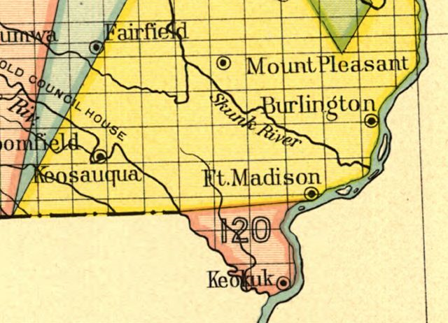
The Honey War was a bloodless territorial dispute in 1839 between Iowa Territory and Missouri over their border. The dispute over a strip running the entire length of the border, caused by unclear wording in the Missouri Constitution on boundaries, misunderstandings over the survey of the Louisiana Purchase, and a misreading of Native American treaties, was ultimately decided by the United States Supreme Court in Iowa's favor. The decision was to affirm a nearly jog in the nearly straight line border between extreme southeast Iowa and northeast Missouri at Keokuk, Iowa that is now Iowa's southernmost point. Before the issue was settled, militias from both sides faced each other at the border, a Missouri sheriff collecting taxes in Iowa was incarcerated, and three trees containing beehives were cut down. Timeline *1803: Louisiana Purchase *1804: Treaty of St. Louis – Sac and Fox tribes cede Missouri from the mouth of the Gasconade River through Illinois and Wisconsin *180 ... [...More Info...] [...Related Items...] OR: [Wikipedia] [Google] [Baidu] |
Iowa Territory
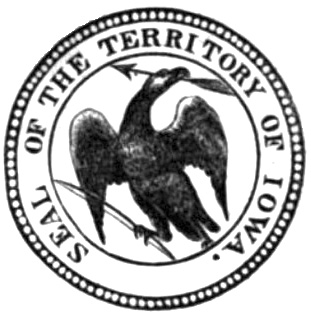
The Territory of Iowa was an organized incorporated territory of the United States that existed from July 4, 1838, until December 28, 1846, when the southeastern portion of the territory was admitted to the Union as the state of Iowa. The remainder of the territory would have no organized territorial government until the Minnesota Territory was organized on March 3, 1849. History Most of the area in the territory was originally part of the Louisiana Purchase and was a part of the Missouri Territory. When Missouri became a state in 1821, this area (along with the Dakotas) effectively became unorganized territory. The area was closed to white settlers until the 1830s, after the Black Hawk War ended. It was attached to the Michigan Territory on June 28, 1834. At an extra session of the Sixth Legislative Assembly of Michigan held in September, 1834, the Iowa District was divided into two counties by running a line due west from the lower end of Rock Island in the Mississippi Rive ... [...More Info...] [...Related Items...] OR: [Wikipedia] [Google] [Baidu] |
Treaty Of Fort Clark
The Treaty of Fort Clark (also known as the Treaty with the Osage or the Osage Treaty) was signed at Fort Osage (then called Fort Clark) on November 10, 1808, (ratified on April 28, 1810) in which the Osage Nation ceded all the land east of the fort in Missouri and Arkansas north of the Arkansas River to the United States. The Fort Clark treaty and the Treaty of St. Louis in which the Sac (tribe) and Fox (tribe) ceded northeastern Missouri along with northern Illinois and southern Wisconsin were the first two major treaties in the newly acquired Louisiana Purchase. The affected tribes, upset with the terms, were to side with the British in the War of 1812. Following the settlement of that war, John C. Sullivan for the United States was to survey the ceded land in 1816 (adjusting it 23 miles westward to the mouth of the Kansas River to create the Indian Boundary Line west of which and south of which virtually all tribes were to be removed in the Indian Removal Act in 1830. Ba ... [...More Info...] [...Related Items...] OR: [Wikipedia] [Google] [Baidu] |
Half Breed Tract
A Half-Breed Tract was a segment of land designated in the western states by the United States government in the 19th century specifically for Métis of American Indian and European or European-American ancestry, at the time commonly known as half-breeds. The government set aside such tracts in several parts of the Midwestern prairie region, including in Iowa Territory, Nebraska Territory, Kansas Territory, Minnesota Territory, and Wisconsin Territory. Overview Historically, the mixed-blood population in the ''Pays d'en Haut'' region surrounding the Great Lakes were typically the descendants of Native American women and White men, often men of French-Canadian or Scots (including Orcadian) origin, who dominated early fur trapping and trade. These men lived far from other Europeans. Others had fathers who were American trappers and traders. The children typically grew up in their mother's tribes, where the fathers and families were offered protection if not full membership. As ... [...More Info...] [...Related Items...] OR: [Wikipedia] [Google] [Baidu] |
Des Moines Rapids
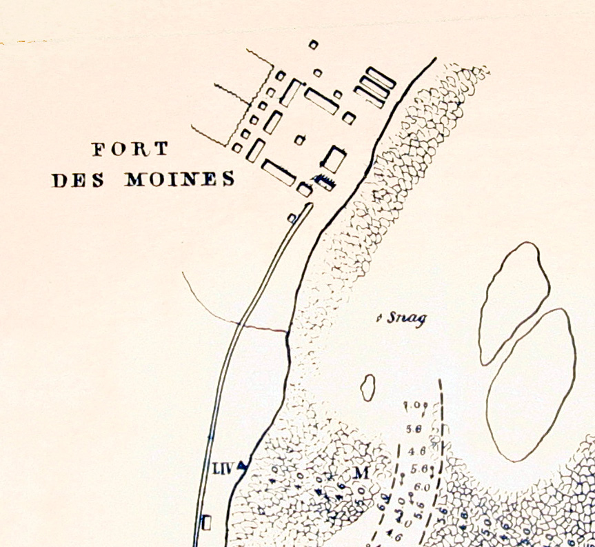
The Des Moines Rapids between Nauvoo, Illinois and Keokuk, Iowa-Hamilton, Illinois is one of two major rapids on the Mississippi River that limited Steamboat traffic on the river through the early 19th century. The rapids just above the confluence of the Des Moines River were to contribute to the Honey War in the 1830s between Missouri and Iowa over the Sullivan Line that separates the two states. Various attempts to make the river navigable started in 1837 when a channel was blasted through the rapids by U.S. Army Corps of Engineers team led by Robert E. Lee. A canal around the rapids was built in 1877. It is now obliterated by Lock and Dam No. 19. The other major rapids barring traffic on the Mississippi is the Rock Island Rapids. The Mississippi in its natural state widens from to in width at Nauvoo as it drops over over shallow limestone rocks to the confluence with Des Moines. According to records its mean depth through the rapids was and "much less" in man ... [...More Info...] [...Related Items...] OR: [Wikipedia] [Google] [Baidu] |
Farmington, Iowa
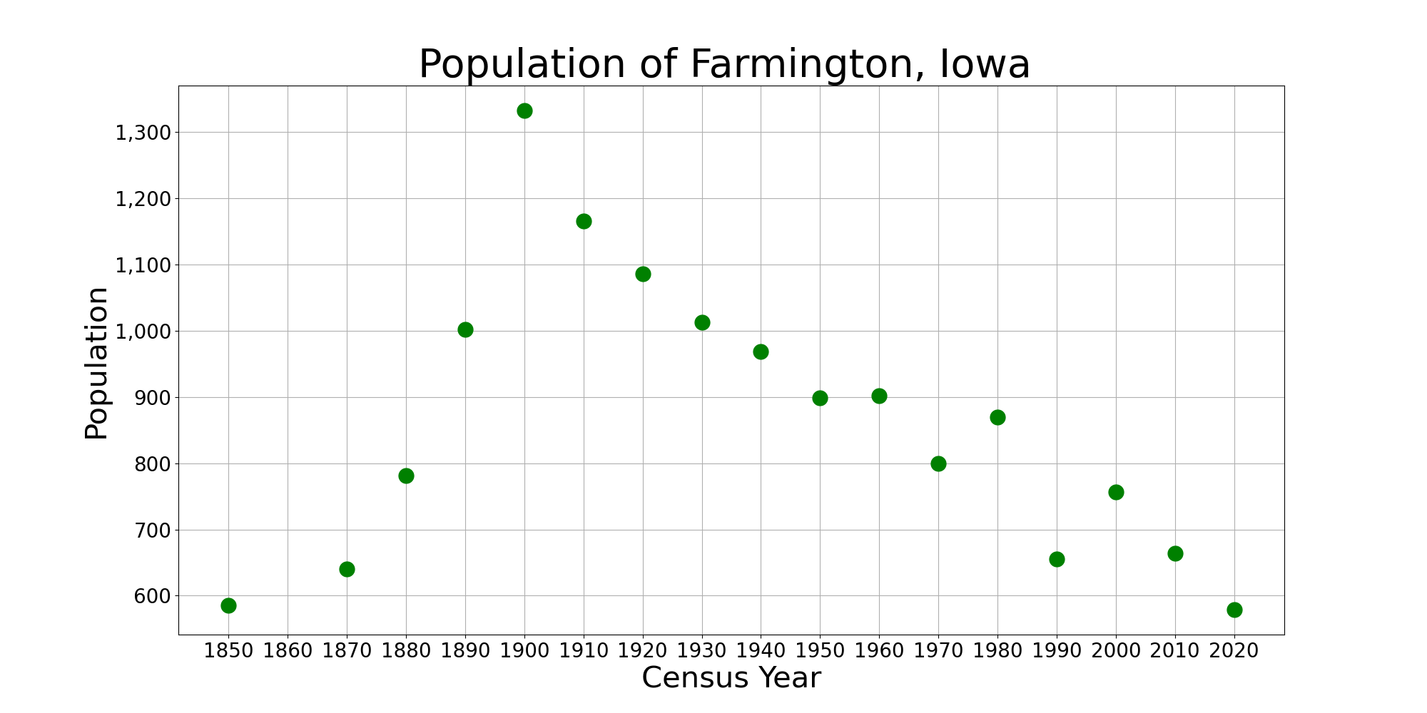
Farmington is a city in Van Buren County, Iowa, Van Buren County, Iowa, United States. The population was 579 at the time of the 2020 United States Census, 2020 census. History Farmington was laid out in 1839. It was named after Farmington, Connecticut. The town was incorporated on January 11, 1841. Farmington has suffered from several major floods of the Des Moines River, most notably in 1993, when a "500-year-flood" caused major damage to the buildings near the river, including a one-block area bordered by Walnut, Second, and Third Streets. The houses in this block were subsequently razed, and the property was purchased by the City of Farmington to create "Wild Rose City Park." Geography Farmington is located at (40.6397, -91.7394), on the left (east) bank of the Des Moines River. According to the United States Census Bureau, the city has a total area of , all land. Demographics 2010 census As of the census of 2010, there were 664 people, 299 households, and 170 families ... [...More Info...] [...Related Items...] OR: [Wikipedia] [Google] [Baidu] |
Sheridan, Missouri
Sheridan is a city in northwest Worth County, Missouri, United States, near the Platte River. The population was 195 at the 2010 census. History A post office called Sheridan has been in operation since 1887. Sheridan was the name of a local family. Geography Sheridan is located on Missouri Route 246 one mile east of the Worth county line and 3.5 miles south of the Missouri-Iowa state line. The Platte River flows past one-half mile to the east.''Missouri Atlas & Gazetteer,'' DeLorme, 1st ed., 198, p. 14 According to the United States Census Bureau, the city has a total area of , all land. Demographics 2010 census As of the census of 2010, there were 195 people, 98 households, and 52 families residing in the city. The population density was . There were 141 housing units at an average density of . The racial makeup of the city was 95.4% White, 1.5% Asian, 1.0% from other races, and 2.1% from two or more races. Hispanic or Latino of any race were 1.5% of the population. There ... [...More Info...] [...Related Items...] OR: [Wikipedia] [Google] [Baidu] |
Kansas City, Missouri
Kansas City (abbreviated KC or KCMO) is the largest city in Missouri by population and area. As of the 2020 census, the city had a population of 508,090 in 2020, making it the 36th most-populous city in the United States. It is the central city of the Kansas City metropolitan area, which straddles the Missouri–Kansas state line and has a population of 2,392,035. Most of the city lies within Jackson County, with portions spilling into Clay, Cass, and Platte counties. Kansas City was founded in the 1830s as a port on the Missouri River at its confluence with the Kansas River coming in from the west. On June 1, 1850, the town of Kansas was incorporated; shortly after came the establishment of the Kansas Territory. Confusion between the two ensued, and the name Kansas City was assigned to distinguish them soon after. Sitting on Missouri's western boundary with Kansas, with Downtown near the confluence of the Kansas and Missouri Rivers, the city encompasses about , making ... [...More Info...] [...Related Items...] OR: [Wikipedia] [Google] [Baidu] |
Kansas River
The Kansas River, also known as the Kaw, is a river in northeastern Kansas in the United States. It is the southwesternmost part of the Missouri River drainage, which is in turn the northwesternmost portion of the extensive Mississippi River drainage. Its two names both come from the Kanza (Kaw) people who once inhabited the area; ''Kansas'' was one of the anglicizations of the French transcription ''Cansez'' () of the original '' kką:ze''. The city of Kansas City, Missouri, was named for the river, as was later the state of Kansas. The river valley averages in width, with the widest points being between Wamego and Rossville, where it is up to wide, then narrowing to or less in places below Eudora and De Soto. Much of the river's watershed is dammed for flood control, but the Kansas River is generally free-flowing and has only minor obstructions, including diversion weirs and one low-impact hydroelectric dam. Course Beginning at the confluence of the Republican and ... [...More Info...] [...Related Items...] OR: [Wikipedia] [Google] [Baidu] |
Indian Boundary Line (1816)
Indian or Indians may refer to: Peoples South Asia * Indian people, people of Indian nationality, or people who have an Indian ancestor ** Non-resident Indian, a citizen of India who has temporarily emigrated to another country * South Asian ethnic groups, referring to people of the Indian subcontinent, as well as the greater South Asia region prior to the 1947 partition of India * Anglo-Indians, people with mixed Indian and British ancestry, or people of British descent born or living in the Indian subcontinent * East Indians, a Christian community in India Europe * British Indians, British people of Indian origin The Americas * Indo-Canadians, Canadian people of Indian origin * Indian Americans, American people of Indian origin * Indigenous peoples of the Americas, the pre-Columbian inhabitants of the Americas and their descendants ** Plains Indians, the common name for the Native Americans who lived on the Great Plains of North America ** Native Americans in the U ... [...More Info...] [...Related Items...] OR: [Wikipedia] [Google] [Baidu] |
Treaties Of Portage Des Sioux
The Treaties of Portage des Sioux were a series of treaties at Portage des Sioux, Missouri in 1815 that officially were supposed to mark the end of conflicts between the United States and Native Americans at the conclusion of the War of 1812. Although the treaties were ostensibly to "restore to such Tribes or Nations respectively all the possessions, rights, and privileges which they may have enjoyed or been entitled to in 1811" which was required in Article IX of the Treaty of Ghent which ended the war, they were to be used to affirm and consolidate earlier treaties in which the United States had secured vast territory of the Midwest from tribes in agreements that had earlier not been signed by all the appro ... [...More Info...] [...Related Items...] OR: [Wikipedia] [Google] [Baidu] |
Treaty Of Ghent
The Treaty of Ghent () was the peace treaty that ended the War of 1812 between the United States and the United Kingdom. It took effect in February 1815. Both sides signed it on December 24, 1814, in the city of Ghent, United Netherlands (now in Belgium). The treaty restored relations between the two parties to '' status quo ante bellum'' by restoring the pre-war borders of June 1812. The treaty was approved by the British Parliament and signed into law by the Prince Regent (the future King George IV) on December 30, 1814. It took a month for news of the treaty to reach the United States, during which American forces under Andrew Jackson won the Battle of New Orleans on January 8, 1815. The treaty did not take effect until the U.S. Senate ratified it unanimously on February 16, 1815. U.S. President James Madison signed the treaty and exchanged final ratified copies with the British ambassador on February 17, 1815. The treaty began more than two centuries of mostly-peaceful rela ... [...More Info...] [...Related Items...] OR: [Wikipedia] [Google] [Baidu] |
War Of 1812
The War of 1812 (18 June 1812 – 17 February 1815) was fought by the United States of America and its indigenous allies against the United Kingdom and its allies in British North America, with limited participation by Spain in Florida. It began when the United States declared war on 18 June 1812 and, although peace terms were agreed upon in the December 1814 Treaty of Ghent, did not officially end until the peace treaty was ratified by Congress on 17 February 1815. Tensions originated in long-standing differences over territorial expansion in North America and British support for Native American tribes who opposed US colonial settlement in the Northwest Territory. These escalated in 1807 after the Royal Navy began enforcing tighter restrictions on American trade with France and press-ganged men they claimed as British subjects, even those with American citizenship certificates. Opinion in the US was split on how to respond, and although majorities in both the House and ... [...More Info...] [...Related Items...] OR: [Wikipedia] [Google] [Baidu] |


