|
Hollandsche IJzeren Spoorweg-Maatschappij
The Hollandsche IJzeren Spoorweg-Maatschappij () or HSM (''Hollands Iron Railway-Company'') was the first railway company in the Netherlands founded on 8 August 1837 as a private company, starting operation in 1839 with a line between Amsterdam and Haarlem. The company remained operational until 1938, when it merged with the Maatschappij tot Exploitatie van Staatsspoorwegen (SS) to form the Nederlandse Spoorwegen (NS). History The first line constructed was a line following the straight route of the Haarlemmertrekvaart canal, connecting Amsterdam with Haarlem, which opened on 20 September 1839. The line was quickly expanded to follow the Leidsevaart canal and reached Leiden in 1842, The Hague in 1843, and Rotterdam in 1847. Because this line is the oldest line in the Netherlands, it is now known as the Old Line. This line was originally built to Dutch broad gauge , but was converted to in 1866. The line started at the Amsterdam d'Eenhonderd Roe station on the west side of A ... [...More Info...] [...Related Items...] OR: [Wikipedia] [Google] [Baidu] |
Maatschappij Tot Exploitatie Van Staatsspoorwegen
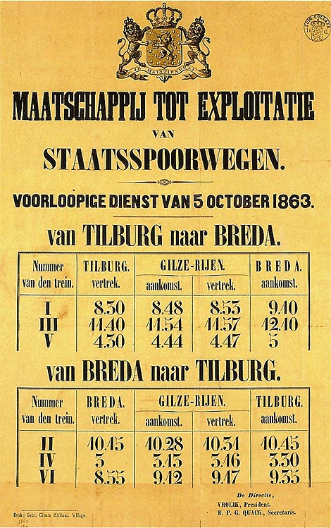
The Maatschappij tot Exploitatie van Staatsspoorwegen () or SS (''Company for the Exploitation of the State Railways'') was a private railroad founded to use the government funded railways. The company existed until 1938, when it formally merged with the Hollandsche IJzeren Spoorweg-Maatschappij (HSM) to form the Nederlandse Spoorwegen. The SS was, along with the HSM, the largest railroad company in the Netherlands. In the 19th century, the government constructed a number of state railroads, the '' staatslijnen'', to (major) cities and regions not yet served by the other railroads, but for which it was deemed important to connect them to the country's rail network. These lines were primarily located outside of the relatively densely populated Holland region, where the HSM ran services on the main lines. The SS was then founded as a private company to use these lines. In 1890 the SS began to use the lines previously run by the defunct Nederlandsche Rhijnspoorweg-Maatschappij, and ... [...More Info...] [...Related Items...] OR: [Wikipedia] [Google] [Baidu] |
Rotterdam Delftsche Poort Railway Station
Rotterdam Delftsche Poort was a railway station of the Hollandsche IJzeren Spoorweg-Maatschappij in Rotterdam, Netherlands located on the Oude Lijn from Amsterdam Willemspoort station to Rotterdam. The station was located east of the present-day Rotterdam Centraal. History The first station Delftsche Poort opened in 1847 completing the railway line between Amsterdam and Rotterdam. The station was designed by Frederik Willem Conrad. The second station Delftsche Poort opened in 1877 connection the Rotterdam with Dordrecht. This station was located slightly north-west to the former station. Image:Station Rotterdam Delftse Poort 1920.jpg, The second railway station Delftsche Poort in 1920 See also * Rotterdam Centraal railway station Rotterdam Centraal railway station () is the main railway station of the city Rotterdam in South Holland, Netherlands. The station received an average of 112,000 passengers daily in 2019. The current station building, located at Station Sq ... [...More Info...] [...Related Items...] OR: [Wikipedia] [Google] [Baidu] |
Zuiderzee
The Zuiderzee or Zuider Zee (; old spelling ''Zuyderzee'' or ''Zuyder Zee'') was a shallow bay of the North Sea in the northwest of the Netherlands, extending about 100 km (60 miles) inland and at most 50 km (30 miles) wide, with an overall depth of about 4 to 5 metres (13–16 feet) and a coastline of about 300 km (200 miles). It covered . Its name is Dutch for "southern sea", indicating that the name originates in Friesland, to the north of the Zuiderzee (cf. North Sea). In the 20th century the majority of the Zuiderzee was closed off from the North Sea by the construction of the Afsluitdijk, leaving the mouth of the inlet to become part of the Wadden Sea. The salt water inlet changed into a fresh water lake now called the IJsselmeer (IJssel Lake) after the river that drains into it, and by means of drainage and polders, an area of some was reclaimed as land. This land eventually became the province of Flevoland, with a population of nearly 400,000 (2011) ... [...More Info...] [...Related Items...] OR: [Wikipedia] [Google] [Baidu] |
Leeuwarden
Leeuwarden (; fy, Ljouwert, longname=yes /; Town Frisian: ''Liwwadden''; Leeuwarder dialect: ''Leewarden'') is a city and municipality in Friesland, Netherlands, with a population of 123,107 (2019). It is the provincial capital and seat of the Provincial Council of Friesland. It is located about 50 km west of Groningen and 110 km north east from the Dutch capital Amsterdam (as the crow flies). The region has been continuously inhabited since the 10th century. It came to be known as Leeuwarden in the early 9th century AD and was granted city privileges in 1435. It is the main economic hub of Friesland, situated in a green and water-rich environment. Leeuwarden is a former royal residence and has a historic city centre, many historically relevant buildings, and a large shopping centre with squares and restaurants. Leeuwarden was awarded the title European Capital of Culture for 2018. The Elfstedentocht (Eleven Cities Tour), an ice skating tour passing the eleven cities of Fri ... [...More Info...] [...Related Items...] OR: [Wikipedia] [Google] [Baidu] |
Nijmegen
Nijmegen (;; Spanish and it, Nimega. Nijmeegs: ''Nimwèège'' ) is the largest city in the Dutch province of Gelderland and tenth largest of the Netherlands as a whole, located on the Waal river close to the German border. It is about 60 km south east of Utrecht and 50 km north east of Eindhoven. Nijmegen is the oldest city in the Netherlands, the second to be recognized as such in Roman times, and in 2005 celebrated 2,000 years of existence. Nijmegen became a free imperial city in 1230 and in 1402 a Hanseatic city. Since 1923 it has been a university city with the opening of a Catholic institution now known as the Radboud University Nijmegen. The city is well known for the International Four Days Marches Nijmegen event. Its population in 2022 was 179,000; the municipality is part of the Arnhem–Nijmegen metropolitan area, with 736,107 inhabitants in 2011. Population centres The municipality is formed by the city of Nijmegen, incorporating the former villages of Ha ... [...More Info...] [...Related Items...] OR: [Wikipedia] [Google] [Baidu] |
Apeldoorn
Apeldoorn (; Dutch Low Saxon: ) is a municipality and city in the province of Gelderland in the centre of the Netherlands. It is located about 60 km east of Utrecht, 60 km west of Enschede, 25 km north of Arnhem and 35 km south of Zwolle. The municipality of Apeldoorn, including villages like Beekbergen, Loenen (Apeldoorn), Loenen, Ugchelen and Hoenderloo, had a population of 165,525 on 1 December 2021. The western half of the municipality lies on the Veluwe ridge, with the eastern half in the IJssel valley. The city of Apeldoorn The oldest known reference to Apeldoorn, then called Appoldro, dates from the 8th century. The settlement came into being at the point where the old road from Amersfoort to Deventer crossed that from Arnhem to Zwolle. A 1740 map refers to it as A''pp''eldoorn.Stenvert, R. et al. (2000). ''Monumenten in Nederland: Gelderland'', p. 14 and 68–77. Zwolle: Waanders Uitgevers. Close by is the favourite country-seat of the royal family of the Ne ... [...More Info...] [...Related Items...] OR: [Wikipedia] [Google] [Baidu] |
Amersfoort
Amersfoort () is a city and municipality in the province of Utrecht, Netherlands, about 20 km from the city of Utrecht and 40 km south east of Amsterdam. As of 1 December 2021, the municipality had a population of 158,531, making it the second-largest of the province and fifteenth-largest of the country. Amersfoort is also one of the largest Dutch railway junctions with its three stations— Amersfoort Centraal, Schothorst and Vathorst—due to its location on two of the Netherlands' main east to west and north to south railway lines. The city was used during the 1928 Summer Olympics as a venue for the modern pentathlon events. Amersfoort marked its 750th anniversary as a city in 2009. Population centres The municipality of Amersfoort consists of the following cities, towns, villages and districts: Bergkwartier, Bosgebied, Binnenstad, Hoogland, Hoogland-West, Kattenbroek, Kruiskamp, de Koppel, Liendert, Rustenburg, Nieuwland, Randenbroek, Schuilenburg, Schothorst, Soesterkw ... [...More Info...] [...Related Items...] OR: [Wikipedia] [Google] [Baidu] |
Zutphen
Zutphen () is a city and municipality located in the province of Gelderland, Netherlands. It lies some 30 km northeast of Arnhem, on the eastern bank of the river Ijssel at the point where it is joined by the Berkel. First mentioned in the 11th century, the place-name appears to mean "south fen" ( in modern Dutch). In 2005, the municipality of Zutphen was merged with the municipality of Warnsveld, retaining its name. In , the municipality had a population of . History In about 300 AD, a Germanic settlement was the first permanent town on a complex of the low river dunes. Whereas many such settlements were abandoned in the early Middle Ages, Zutphen, on its strategic confluence of IJssel and Berkel, stayed. After the incorporation of the IJssel lands in Charlemagne's Francia, Zutphen became a local centre of governance under the Count of Zutphen. The Normans raided and ravaged it in 882. Afterwards, a circular fortress was built to protect the budding town against Viking ... [...More Info...] [...Related Items...] OR: [Wikipedia] [Google] [Baidu] |
Utrecht (city)
Utrecht ( , , ) is the fourth-largest city and a municipality of the Netherlands, capital and most populous city of the province of Utrecht. It is located in the eastern corner of the Randstad conurbation, in the very centre of mainland Netherlands, about 35 km south east of the capital Amsterdam and 45 km north east of Rotterdam. It has a population of 361,966 as of 1 December 2021. Utrecht's ancient city centre features many buildings and structures, several dating as far back as the High Middle Ages. It has been the religious centre of the Netherlands since the 8th century. It was the most important city in the Netherlands until the Dutch Golden Age, when it was surpassed by Amsterdam as the country's cultural centre and most populous city. Utrecht is home to Utrecht University, the largest university in the Netherlands, as well as several other institutions of higher education. Due to its central position within the country, it is an important hub for both rail and road ... [...More Info...] [...Related Items...] OR: [Wikipedia] [Google] [Baidu] |
Zandvoort
Zandvoort () is a municipality in the province of North Holland, Netherlands. It is one of the major beach resorts of the Netherlands; it has a long sandy beach. It is bordered by coastal dunes of Zuid-Kennemerland National Park and the Amsterdam water supply dunes. It hosts the country's most prominent motor racing circuit, Circuit Zandvoort. The municipality of extends to take in Bentveld; it had a population of 16,954 in 2017. A nudist bathing section of the beach begins about 2 km to the south, with six eateries, which extends kilometers further. History Zandvoort is known to exist in 1100, called ''Sandevoerde'' (a combination of "sand" and "''voorde''", meaning ford; compare English '' Sandford''). Until 1722 the area was under the control of the Lords of Brederode. The village was dependent on fishing for many centuries until the 19th century when it started to transform itself into a seaside resort, following the pattern set by similar towns in the United Kingd ... [...More Info...] [...Related Items...] OR: [Wikipedia] [Google] [Baidu] |
Uitgeest
Uitgeest () is a municipality and a town in the Netherlands, in the province of North Holland. Population centres The municipality of Uitgeest consists of the following cities, towns, villages and/or districts: Topography ''Dutch topographic map of the municipality of Uitgeest, June 2015'' Local government The municipal council of Uitgeest consists of 15 seats, which are divided as follows: Tourist information No less than five windmills can be seen in the polder landscape surrounding the village. Uitgeest was the birthplace (in 1550) of Cornelis Corneliszoon, inventor of the wind-powered sawmill. An industrial heritage park, centered on sawmill De Hoop, is under construction. The village has a Reformed church dating back to the early 14th Century and lakeside marina. The outdoor kart-racing track of 670m had to make room for development of houses, so one tourist attraction has been lost. Fort along Den Ham (between Uitgeest and Krommenie) was one of the 42 forts o ... [...More Info...] [...Related Items...] OR: [Wikipedia] [Google] [Baidu] |


.jpg)

