|
Holderness
Holderness is an area of the East Riding of Yorkshire, on the north-east coast of England. An area of rich agricultural land, Holderness was marshland until it was drained in the Middle Ages. Topographically, Holderness has more in common with the Netherlands than with other parts of Yorkshire. To the north and west are the Yorkshire Wolds. Holderness generally refers to the area between the River Hull and the North Sea. The Prime Meridian passes through Holderness just to the east of Patrington and through Tunstall to the north. From 1974 to 1996 Holderness lay within the Borough of Holderness in Humberside. It gave its name to a wapentake until the 19th century, when its functions were replaced by other local government bodies, particularly after the 1888 Local Government Act. The city of Kingston upon Hull lies in the south-west corner of Holderness and Bridlington borders the north-east but both are usually considered separately. The main towns include Withernsea, Hornsea ... [...More Info...] [...Related Items...] OR: [Wikipedia] [Google] [Baidu] |
East Riding Of Yorkshire
The East Riding of Yorkshire, or simply East Riding or East Yorkshire, is a ceremonial county and unitary authority area in the Yorkshire and the Humber region of England. It borders North Yorkshire to the north and west, South Yorkshire to the south-west, and Lincolnshire to the south. The coastal towns of Bridlington, Hornsea and Withernsea are popular with tourists, the town of Howden contains Howden Minster, Market Weighton, Pocklington, Brough, Hedon and Driffield are market towns with markets held throughout the year and Hessle and Goole are important port towns for the county. The port city of Kingston upon Hull is an economic, transport and tourism centre which also receives much sea freight from around the world. The current East Riding of Yorkshire came into existence in 1996 after the abolition of the County of Humberside. The county's administration is in the ancient market town of Beverley. The landscape is mainly rural, consisting of rolling hills, valley ... [...More Info...] [...Related Items...] OR: [Wikipedia] [Google] [Baidu] |
Hornsea
Hornsea is a seaside town and civil parishes in England, civil parish in the East Riding of Yorkshire, England. The settlement dates to at least the early medieval period. The town was expanded in the Victorian era with the coming of the Hull and Hornsea Railway in 1864. In the First World War the Mere was briefly the site of RNAS Hornsea Mere, a seaplane base. During the Second World War the town and beach was heavily fortified against invasion. The civil parish encompasses Hornsea town; the natural lake, Hornsea Mere; as well as the lost or deserted villages of ''Hornsea Beck'', ''Northorpe'' and ''Southorpe''. Structures of note in the parish include the medieval parish church of St Nicholas, Bettison's Folly, Hornsea Mere and the sea front promenade. The economy includes a mix of tourism and small manufacturing. Most notably, Hornsea Pottery was established in Hornsea in 1949 and closed in 2000. Modern Hornsea still functions as a coastal resort, and has large caravan site ... [...More Info...] [...Related Items...] OR: [Wikipedia] [Google] [Baidu] |
Holderness (borough)
{{EastRiding-geo-stub ...
Holderness was a local government district and borough in northern England, named for the Holderness peninsula. It was formed on 1 April 1974 along with the non-metropolitan county of Humberside in which it was situated. It was formed from part of the administrative county of Yorkshire, East Riding, namely: *The municipal borough of Hedon, *The urban districts of Hornsea and Withernsea, *The Holderness Rural District. On 1 April 1996, Humberside and the borough were abolished, and it became part of the new unitary East Riding of Yorkshire. References Former non-metropolitan districts of Humberside Former boroughs in England borough A borough is an administrative division in various English-speaking countries. In principle, the term ''borough'' designates a self-governing walled town, although in practice, official use of the term varies widely. History In the Middle Ag ... [...More Info...] [...Related Items...] OR: [Wikipedia] [Google] [Baidu] |
Patrington
Patrington is a village and civil parish in the East Riding of Yorkshire, England, in an area known as Holderness, south-east of Hedon, south-east of Kingston upon Hull and south-west of Withernsea on the A1033. Along with Winestead, it was a seat of the ancient Hildyard/Hilliard/Hildegardis family. The Prime Meridian passes just to the east of Patrington. The civil parish is formed by the villages of Patrington and Winestead and the hamlet of Patrington Haven and at the 2011 census, had a population of 2,059, an increase on the 2001 UK census figure of 1,949. RAF Patrington, built during the Second World War, was a radar station and used for ground-controlled interception. In 1955, following the building of a new RAF station at nearby Holmpton, the radar site closed, being surplus to requirements. The new radar site at Holmpton was later renamed RAF Patrington. Patrington was served from 1854 to 1964 by Patrington railway station on the Hull and Holderness Railway. ... [...More Info...] [...Related Items...] OR: [Wikipedia] [Google] [Baidu] |
Withernsea
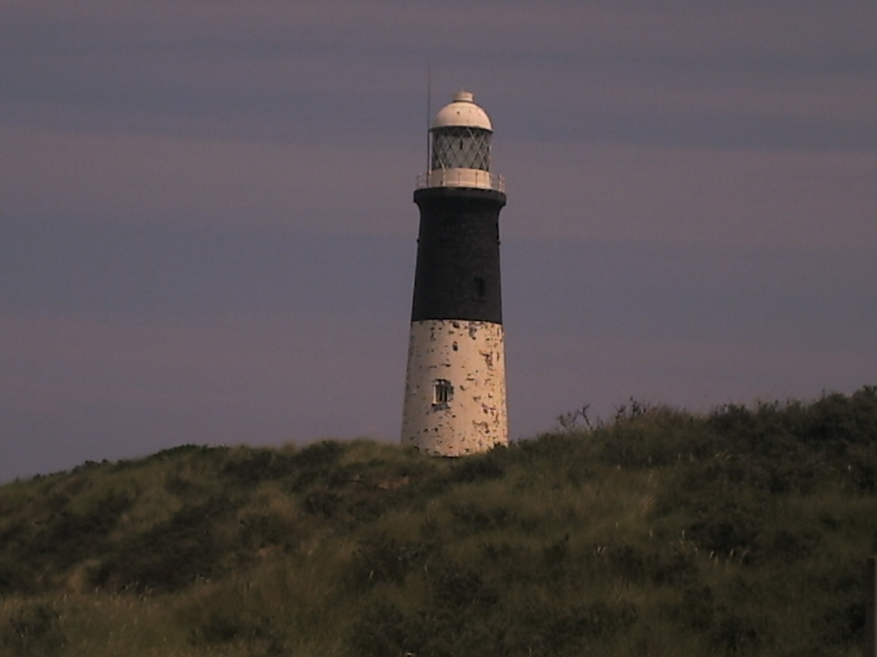
Withernsea is a seaside resort and civil parish in Holderness, East Riding of Yorkshire, England. Its white inland lighthouse, rising around above Hull Road, now houses a museum to 1950s actress Kay Kendall, who was born in the town. The Prime Meridian crosses the coast north-west of Withernsea. At the 2011 UK census, Withernsea had a population of 6,159, an increase on the 2001 UK census figure of 5,980. Withernsea education system consists of both Withernsea High School, and Withernsea Primary School. History Like many seaside resorts, Withernsea has a wide promenade which reaches north and south from Pier Towers, the historic entrance to the pier, built in 1877 at a cost of £12,000. The pier was originally long, but was gradually reduced in length through several impacts by local ships, starting with the ''Saffron'' in 1880 before the collision by an unnamed ship in 1888, again by a Grimsby fishing boat and again by the ''Henry Parr'' in 1893, leaving the once gr ... [...More Info...] [...Related Items...] OR: [Wikipedia] [Google] [Baidu] |
Hedon
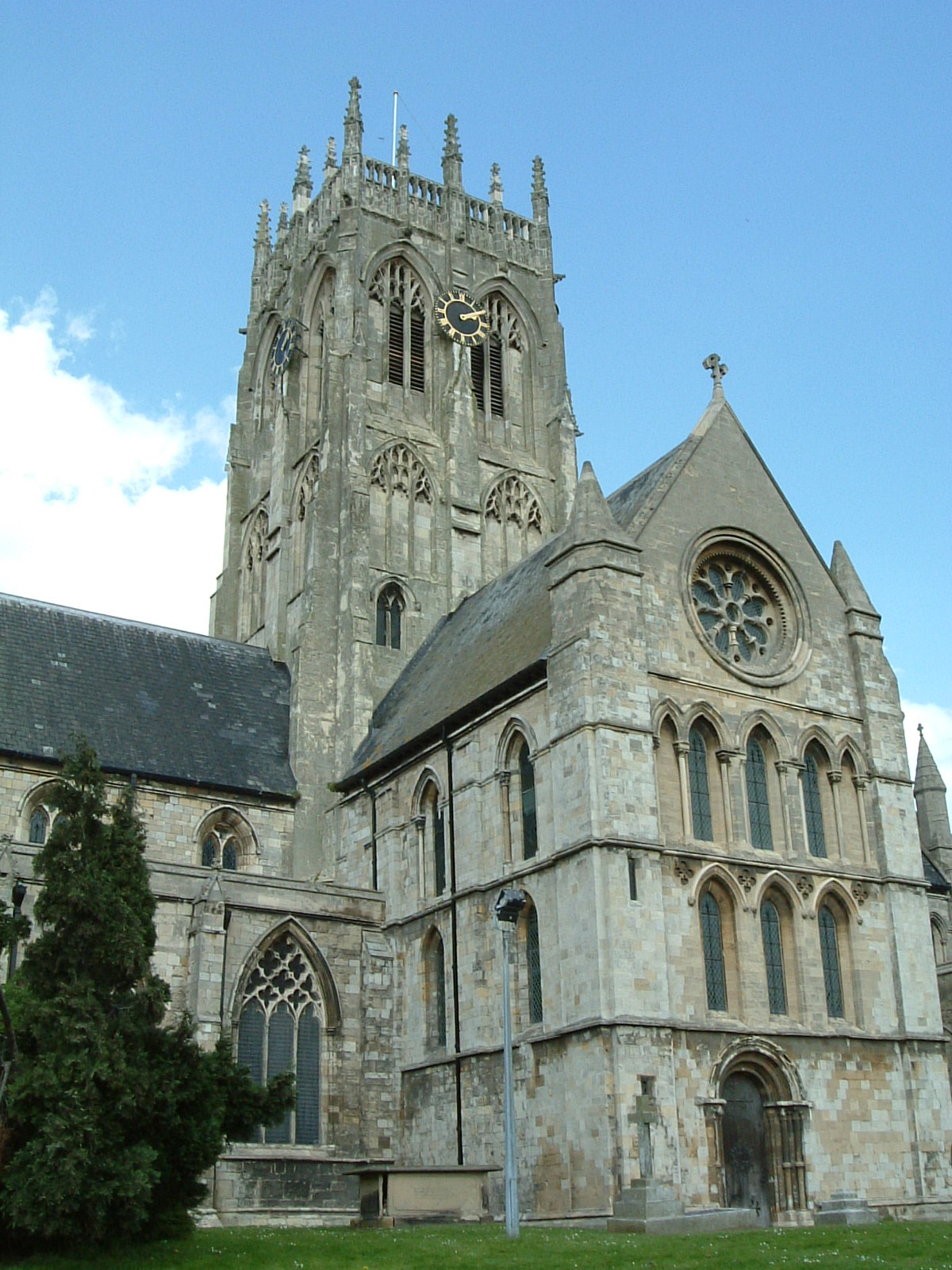
Hedon is a town and civil parish in Holderness in the East Riding of Yorkshire, England. It is situated approximately east of Hull city centre. It lies to the north of the A1033 road at the crossroads of the B1240 and B1362 roads. It is particularly noted for the parish church of St. Augustine, known as the 'King of Holderness', which is a Grade I listed building. In 1991, the town had a population of 6,066, which had risen to 6,332 by the time of the 2001 UK census. By the 2011 UK census, Hedon parish had a population of 7,100, History Hedon is not mentioned in the ''Domesday Book'' which leads to the belief that it was a new town created by the Normans as a port. Hedon was at its most prosperous in the 12th and 13th centuries and at one time was the 11th largest port in England. The decline of the port came with the development of the port of Hull and the building of larger ships which were unable to get up the small river to Hedon. Hedon was given its first charter ... [...More Info...] [...Related Items...] OR: [Wikipedia] [Google] [Baidu] |
Beverley
Beverley is a market town, market and minster (church), minster town and a civil parishes in England, civil parish in the East Riding of Yorkshire, England, of which it is the county town. The town centre is located south-east of York's centre and north-west of Kingston upon Hull, City of Hull. The town is known for Beverley Minster, Beverley Westwood, Beverley Bar, North Bar (a 15th-century gate) and Beverley Racecourse. It inspired the naming of the city of Beverly, Massachusetts, which in turn was the impetus for Beverly Hills, California.Marc Wanamaker, ''Early Beverly Hills'', Mount Pleasant, South Carolina: Arcadia Publishing, 2005, pp. 17–1/ref> The town was listed in the 2018 ''Sunday Times'' report on Best Places to Live in northern England. The town was originally known as ''Inderawuda'' and was founded around 700 AD by Saint John of Beverley during the time of the Angles, Anglian kingdom of Northumbria. After a period of Viking control, it passed to the Hous ... [...More Info...] [...Related Items...] OR: [Wikipedia] [Google] [Baidu] |
River Hull
The River Hull is a navigable river in the East Riding of Yorkshire in Northern England. It rises from a series of springs to the west of Driffield, and enters the Humber Estuary at Kingston upon Hull. Following a period when the Archbishops of York charged tolls for its use, it became a free navigation. The upper reaches became part of the Driffield Navigation from 1770, after which they were again subject to tolls, and the section within the city of Hull came under the jurisdiction of the Port of Hull, with the same result. Most of its course is through low-lying land that is at or just above sea level, and regular flooding has been a long-standing problem along the waterway. Drainage schemes to alleviate it were constructed on both sides of the river. The Holderness Drainage scheme to the east was completed in 1772, with a second phase in 1805, and the Beverley and Barmston Drain to the west was completed in 1810. Since 1980, the mouth of the river has been protected by a tid ... [...More Info...] [...Related Items...] OR: [Wikipedia] [Google] [Baidu] |
Spurn Head
Spurn is a narrow sand tidal island located off the tip of the coast of the East Riding of Yorkshire, England that reaches into the North Sea and forms the north bank of the mouth of the Humber Estuary. It was a spit with a semi-permanent connection to the mainland, but a storm in 2013 made the road down to the end of Spurn impassable to vehicles at high tide. The island is over long, almost half the width of the estuary at that point, and as little as wide in places. The southernmost tip is known as Spurn Head or Spurn Point and is the home to an RNLI lifeboat station and two disused lighthouses. It forms part of the civil parish of Easington. Spurn Head covers above high water and of foreshore. It has been owned since 1960 by the Yorkshire Wildlife Trust and is a designated national nature reserve, heritage coast and is part of the Humber Flats, Marshes and Coast Special Protection Area. History Spurn Head was known to classical authors, such as Ptolemy as ''Oce ... [...More Info...] [...Related Items...] OR: [Wikipedia] [Google] [Baidu] |
Humberside
Humberside () was a non-metropolitan and ceremonial county in Northern England from 1 April 1974 until 1 April 1996. It was composed of land from either side of the Humber Estuary, created from portions of the East Riding of Yorkshire, West Riding of Yorkshire, and the northern part of Lindsey, Lincolnshire. The county council's headquarters was County Hall at Beverley, inherited from East Riding County Council. Its largest settlement and only city was Kingston upon Hull. Other notable towns included Goole, Beverley, Scunthorpe, Grimsby, Cleethorpes and Bridlington. The county stretched from Wold Newton in its northern tip to a different Wold Newton at its most southern point. Humberside bordered North Yorkshire to the north and west, South Yorkshire and Nottinghamshire to the south-west, and Lincolnshire to the south. It faced east towards the North Sea. Humberside was abolished on 1 April 1996, with four unitary authorities being formed: North Lincolnshire, North East ... [...More Info...] [...Related Items...] OR: [Wikipedia] [Google] [Baidu] |
Hull Paragon Interchange
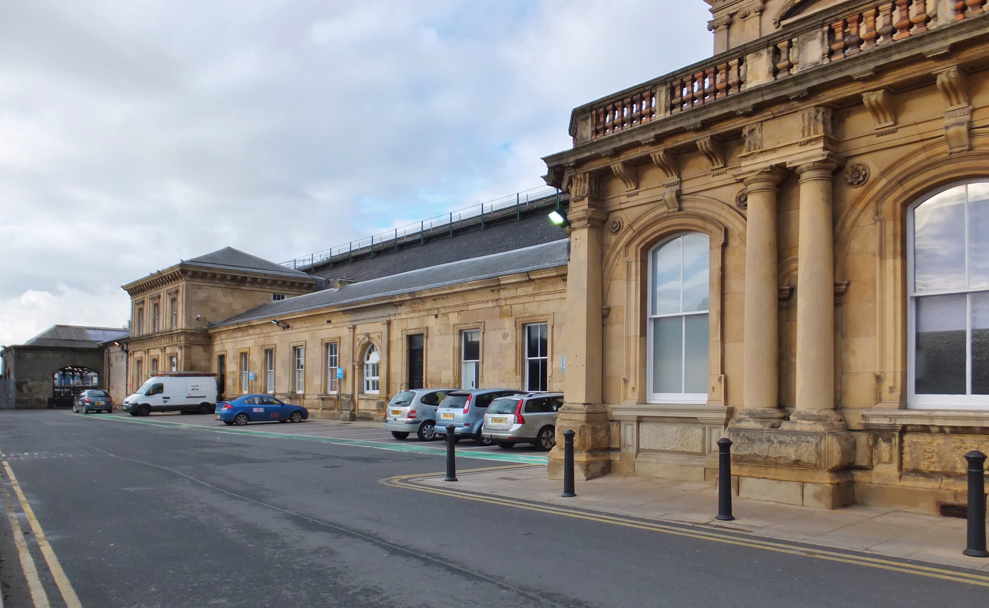
Hull Paragon Interchange is a transport interchange providing rail, bus and coach services located in the city centre of Kingston upon Hull, England. The G. T. Andrews-designed station was originally named ''Paragon Station'', and together with the adjoining Station Hotel, it opened in 1847 as the new Hull terminus for the growing traffic of the York and North Midland (Y&NMR) leased to the Hull and Selby Railway (H&S). As well as trains to the west, the station was the terminus of the Y&NMR and H&S railway's Hull to Scarborough Line. From the 1860s the station also became the terminus of the Hull and Holderness and Hull and Hornsea railways. At the beginning of the 20th century the North Eastern Railway (NER) expanded the trainshed and station to the designs of William Bell, installing the present five arched span platform roof. In 1962 a modernist office block Paragon House was installed above the station main entrance, replacing a 1900s iron canopy; the offices ... [...More Info...] [...Related Items...] OR: [Wikipedia] [Google] [Baidu] |
Yorkshire Wolds
The Yorkshire Wolds are low hills in the counties of the East Riding of Yorkshire and North Yorkshire in north-eastern England. The name also applies to the district in which the hills lie. On the western edge, the Wolds rise to an escarpment which then drops sharply to the Vale of York. The highest point on the escarpment is Bishop Wilton Wold (also known as Garrowby Hill), which is above sea level. To the north, on the other side of the Vale of Pickering, lie the North York Moors, and to the east the hills flatten into the plain of Holderness. The largest town in the Wolds is Driffield, with other places including Pocklington, Thixendale and Kilham, the original 'capital' of the Wolds. The highest village on the Yorkshire Wolds is Fridaythorpe at above sea level. The market town of Beverley lies on the eastern slopes, along with the civil parish of Molescroft. Geology The hills are formed from a series of pure marine limestones formed during the Cretaceous period, kno ... [...More Info...] [...Related Items...] OR: [Wikipedia] [Google] [Baidu] |


Apr2006.jpg)