|
Hohe Egge (Upland)
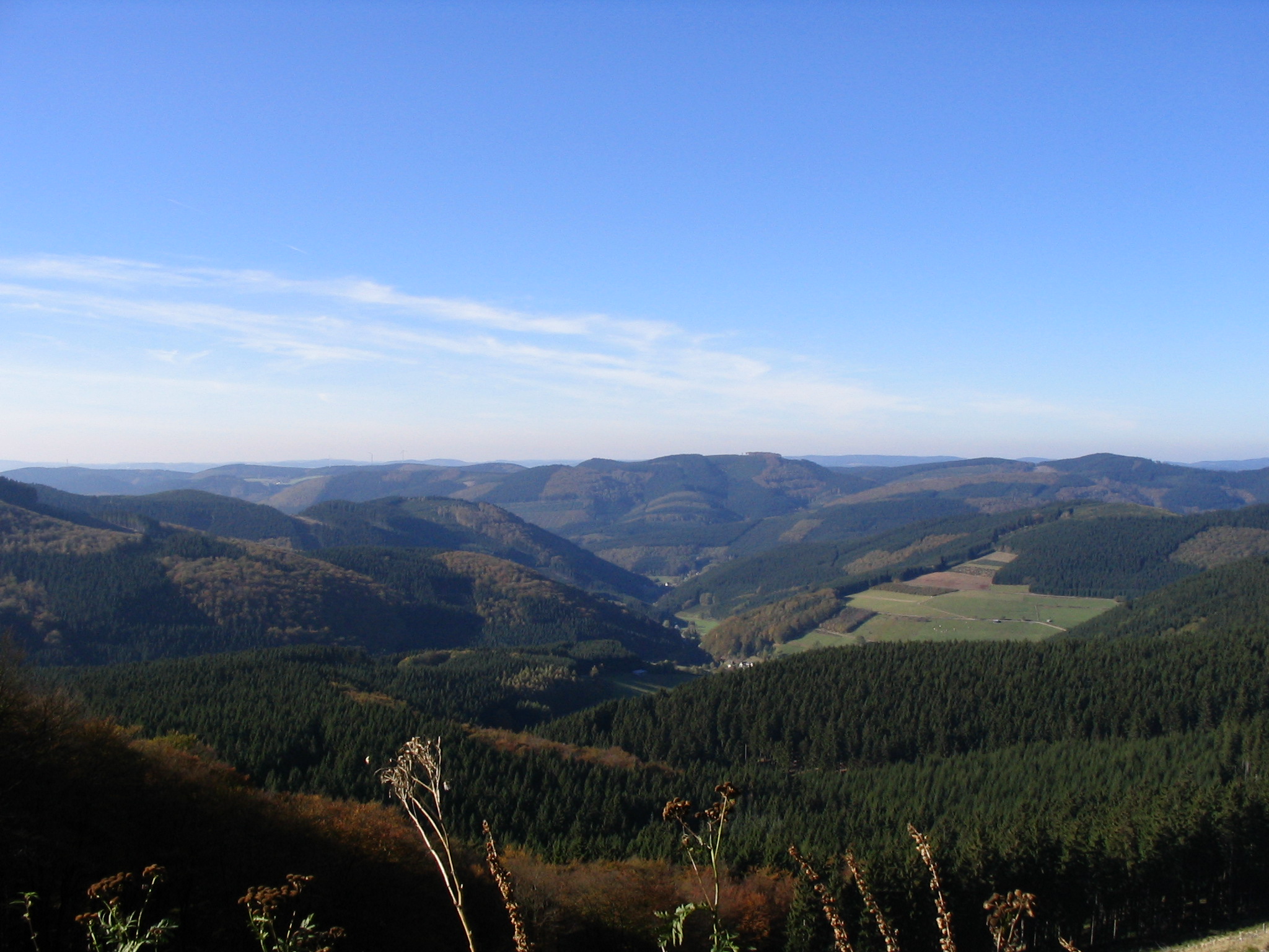
The Hohe Egge near Ottlar in the North Hessian county of Waldeck-Frankenberg is a hill, ,{{GeoQuelle, DE, BFN-Karten in the Upland in the Rothaar mountains. Location The ''Hohe Egge'' lies in the Upland, the northeastern foothills of the Rothaar mountains, in the Diemelsee Nature Park between Willingen and Diemelsee reservoir. Its summit rises 850 metres southeast of the village church of Ottlar, 2.5 km southwest of Giebringhausen and 2.2 km northwest of Deisfeld, which are all in the municipality of Diemelsee, and 1.9 km (both as the crow flies) north-northeast of Hemmighausen, which is in the municipality of Willingen. The hills is on the territory of Diemelsee; a tip of Willingen's territory also extends into it in the south. The northern spur of the ''Hohe Egge'' is called the ''Harberg'' (554.3 m), its eastern spur is the ''Niegelscheid'' (580.7 m) and its southern spur is unnamed (601.0 m). The Diemel runs past the hill to the ea ... [...More Info...] [...Related Items...] OR: [Wikipedia] [Google] [Baidu] |
Upland (hill Range)
The Upland ( Low German for ''Oberland'' "highland") is a low mountain region forming the northeastern part of the High Sauerland and belongs the German state of Hesse, unlike the remainder of the High Sauerland which lies in Westphalia. The Upland falls within the district of Waldeck-Frankenberg, in North Hesse and corresponds to the territory of the municipality of Willingen. Geography The historic Upland lies in the southwestern area of the Diemelsee Nature Park at an average height of 500 to 700 m above NN. The northwestern and southwestern parts are almost entirely forested, whilst the centre, the area formally defined as a natural region called ''Upland'' (see below), only has islands of woods around some of the peaks. Natural regions The historic Upland lies predominantly in the northwestern Rothaar Mountains mountain range with smaller elements also in the East Sauerland foothills. It incorporates the natural region of Upland, as well as the (northeastern) half of th ... [...More Info...] [...Related Items...] OR: [Wikipedia] [Google] [Baidu] |
As The Crow Flies
__NOTOC__ The expression ''as the crow flies'' is an idiom for the most direct path between two points, rather similar to "in a beeline". This meaning is attested from the early 19th century, and appeared in Charles Dickens's 1838 novel '' Oliver Twist'': Crows do conspicuously fly alone across open country, but neither crows nor bees (as in "beeline") fly in particularly straight lines.Villazon, Luis.“Do crows actually fly in a straight line?” BBC Focus (August 30, 2017). While crows do not swoop in the air like swallows or starlings, they often circle above their nests. One suggested origin of the term is that before modern navigational methods were introduced, cages of crows were kept upon ships and a bird would be released from the crow's nest when required to assist navigation, in the hope that it would fly directly towards land. However, the earliest recorded uses of the term are not nautical in nature, and the crow's nest of a ship is thought to derive from its sha ... [...More Info...] [...Related Items...] OR: [Wikipedia] [Google] [Baidu] |
Mountains Of Hesse
A mountain is an elevated portion of the Earth's crust, generally with steep sides that show significant exposed bedrock. Although definitions vary, a mountain may differ from a plateau in having a limited summit area, and is usually higher than a hill, typically rising at least 300 metres (1,000 feet) above the surrounding land. A few mountains are isolated summits, but most occur in mountain ranges. Mountains are formed through tectonic forces, erosion, or volcanism, which act on time scales of up to tens of millions of years. Once mountain building ceases, mountains are slowly leveled through the action of weathering, through slumping and other forms of mass wasting, as well as through erosion by rivers and glaciers. High elevations on mountains produce colder climates than at sea level at similar latitude. These colder climates strongly affect the ecosystems of mountains: different elevations have different plants and animals. Because of the less hospitable terrain and ... [...More Info...] [...Related Items...] OR: [Wikipedia] [Google] [Baidu] |
East Sauerland Foothills
East or Orient is one of the four cardinal directions or points of the compass. It is the opposite direction from west and is the direction from which the Sun rises on the Earth. Etymology As in other languages, the word is formed from the fact that east is the direction where the Sun rises: ''east'' comes from Middle English ''est'', from Old English ''ēast'', which itself comes from the Proto-Germanic *''aus-to-'' or *''austra-'' "east, toward the sunrise", from Proto-Indo-European *aus- "to shine," or "dawn", cognate with Old High German ''*ōstar'' "to the east", Latin ''aurora'' 'dawn', and Greek ''ēōs'' 'dawn, east'. Examples of the same formation in other languages include Latin oriens 'east, sunrise' from orior 'to rise, to originate', Greek ανατολή anatolé 'east' from ἀνατέλλω 'to rise' and Hebrew מִזְרָח mizraḥ 'east' from זָרַח zaraḥ 'to rise, to shine'. ''Ēostre'', a Germanic goddess of dawn, might have been a personificatio ... [...More Info...] [...Related Items...] OR: [Wikipedia] [Google] [Baidu] |
Natural Region
A natural region (landscape unit) is a basic geographic unit. Usually, it is a region which is distinguished by its common natural features of geography, geology, and climate. From the ecology, ecological point of view, the naturally occurring flora and fauna of the region are likely to be influenced by its geographical and geological factors, such as soil and water resources, water availability, in a significant manner. Thus most natural regions are homogeneous ecosystems. Human impact can be an important factor in the shaping and destiny of a particular natural region. Main terms The concept "natural region" is a large basic geographical unit, like the vast boreal forest region. The term may also be used generically, like in alpine tundra, or specifically to refer to a particular place. The term is particularly useful where there is no corresponding or coterminous official region. The Fens of eastern England, the Thai highlands, and the Pays de Bray in Normandy, are examples o ... [...More Info...] [...Related Items...] OR: [Wikipedia] [Google] [Baidu] |
High Sauerland
Hochsauerlandkreis (meaning “High Sauerland District” in German) is a Kreis (district) in the east of North Rhine-Westphalia, Germany. Neighboring districts are Soest, Paderborn, Höxter, Waldeck-Frankenberg, Siegen-Wittgenstein, Olpe, Märkischer Kreis. The district is named “High Sauerland” because two of the highest mountains of the Sauerland mountainous landscape, Langenberg and Kahler Asten are in its territory. With 2,766 ft / 843 m (Langenberg) and 2,762 ft / 842 m (Kahler Asten) these are also the highest mountains of North Rhine-Westphalia. History The district was established in 1975 in the reorganization of the districts in North Rhine-Westphalia by merging the previous districts Arnsberg, Brilon and Meschede. Geography Geographically the district covers a big part of the Sauerland mountains, including the highest and third highest elevation – the Langenberg near Olsberg with 2,766 ft / 843 m, and the better known Kahler Asten with ... [...More Info...] [...Related Items...] OR: [Wikipedia] [Google] [Baidu] |
Rothaar Mountains
The Rothaar Mountains (german: Rothaargebirge, , also ''Rotlagergebirge''), or Rothaar, is a low mountain range reaching heights of up to 843.1 m in North Rhine-Westphalia and Hesse, Germany. It is believed that its name must once have been ''Rod-Hard-Gebirge'', or "the cleared forest mountain range", as the range has nothing whatsoever to do with the colour red (''rot'' in German), nor with hair (''Haar''). Geography Location The thickly wooded Rothaar, rich in mineral deposits, is found (mostly) in Westphalia sandwiched between the Sauerland Mountain Range to the north, the Upland mountain range (northeastern foothills of the Rothaar) to the northeast, Wittgenstein Land to the southeast and the Siegerland to the southwest. The range's southeastern foothills are lies in Hesse, and is the only part that lies outside of Westphalia. It stretches from the upper Eder and the Lenne from the ''Kahler Asten'' (841 m) southwest of the Winterberg Tableland (''Winterber ... [...More Info...] [...Related Items...] OR: [Wikipedia] [Google] [Baidu] |
Süder Uplands
The Süder Uplands (1997) by Verlag Siedlungsforschung, p. 47, Retrieved 15 May 2014. (german: Süderbergland, sometimes ''Südergebirge'' i.e. Süder Hills), form a major natural region (no. 33 or D38) of the in the German states of and northwestern |
Holzbach (Diemel)
Holzbach is a small river of Hesse, Germany. It is a left tributary of the Diemel near Giebringhausen. See also *List of rivers of Hesse A list of rivers of Hesse, Germany: A *Aar, tributary of the Dill *Aar, tributary of the Lahn *Aar, tributary of the Twiste * Aarbach * Affhöllerbach * Ahlersbach, tributary of the Kinzig in Schlüchtern-Herolz * Ahlersbach, tributary of the Ki ... Rivers of Hesse Rivers of Germany {{Hesse-river-stub ... [...More Info...] [...Related Items...] OR: [Wikipedia] [Google] [Baidu] |
Diemel
The Diemel is a river in Hesse and North Rhine-Westphalia, Germany. It is a left tributary of the Weser. Route The source of the Diemel is near Willingen, in Sauerland. The Diemel flows generally northeast through the towns Marsberg, Warburg, and Trendelburg. It flows into the Weser in Bad Karlshafen Bad Karlshafen () is a baroque, thermal salt spa town in the district of Kassel, in Hesse, Germany. It has 2300 inhabitants in the main ward of Bad Karlshafen, and a further 1900 in the medieval village of Helmarshausen. It is situated at the co .... References Rivers of Hesse Rivers of North Rhine-Westphalia Sauerland Rivers of Germany {{Hesse-river-stub ... [...More Info...] [...Related Items...] OR: [Wikipedia] [Google] [Baidu] |
Diemelsee (village)
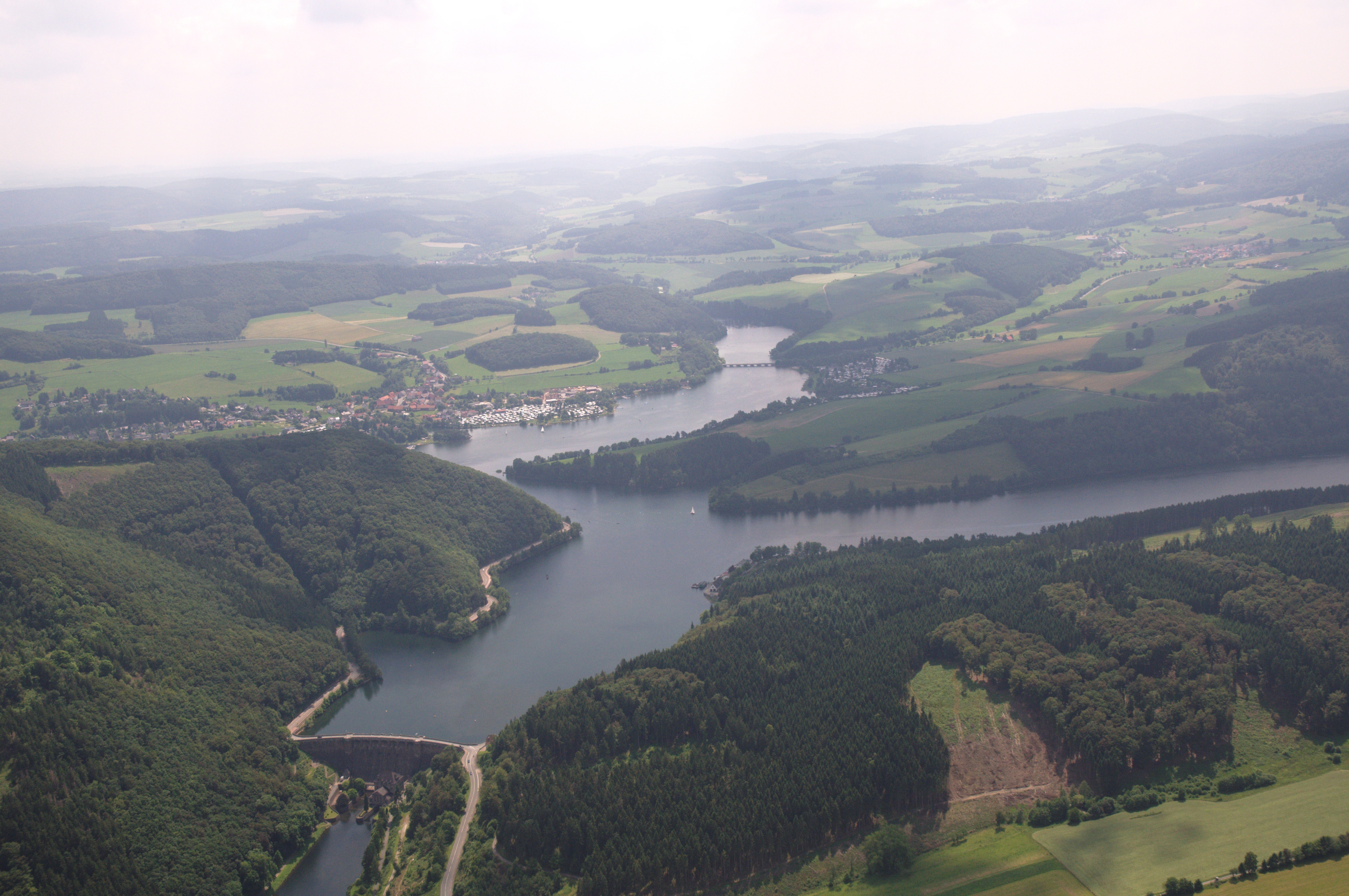
Diemelsee is a municipality in Waldeck-Frankenberg in northwest Hesse, Germany, and is part of the low mountain region called Upland. Adorf is the seat of this municipality. Geography Location Diemelsee lies on the river Diemel in the Diemelsee Nature Park just upstream from and southwest of the Diemelsee reservoir. The town of Korbach is found about 10 km to the southeast, and the town of Paderborn 39 km to the north. Neighbouring communities Diemelsee borders in the north on the town of Marsberg (Hochsauerlandkreis in North Rhine-Westphalia), in the northeast on the town of Bad Arolsen, in the east on the community of Twistetal, in the south on the town of Korbach, in the southwest on the community of Willingen (all in Waldeck-Frankenberg), and in the west on the town of Brilon (Hochsauerlandkreis). Constituent communities The community of Diemelsee came into being as part of municipal reform in 1971 through the voluntary merger of the following 13 centres: *Adorf * ... [...More Info...] [...Related Items...] OR: [Wikipedia] [Google] [Baidu] |
Rothaar
The Rothaar Mountains (german: Rothaargebirge, , also ''Rotlagergebirge''), or Rothaar, is a low mountain range reaching heights of up to 843.1 m in North Rhine-Westphalia and Hesse, Germany. It is believed that its name must once have been ''Rod-Hard-Gebirge'', or "the cleared forest mountain range", as the range has nothing whatsoever to do with the colour red (''rot'' in German), nor with hair (''Haar''). Geography Location The thickly wooded Rothaar, rich in mineral deposits, is found (mostly) in Westphalia sandwiched between the Sauerland Mountain Range to the north, the Upland mountain range (northeastern foothills of the Rothaar) to the northeast, Wittgenstein Land to the southeast and the Siegerland to the southwest. The range's southeastern foothills are lies in Hesse, and is the only part that lies outside of Westphalia. It stretches from the upper Eder and the Lenne from the ''Kahler Asten'' (841 m) southwest of the Winterberg Tableland (''Winterbe ... [...More Info...] [...Related Items...] OR: [Wikipedia] [Google] [Baidu] |


