|
Hochschober Hut
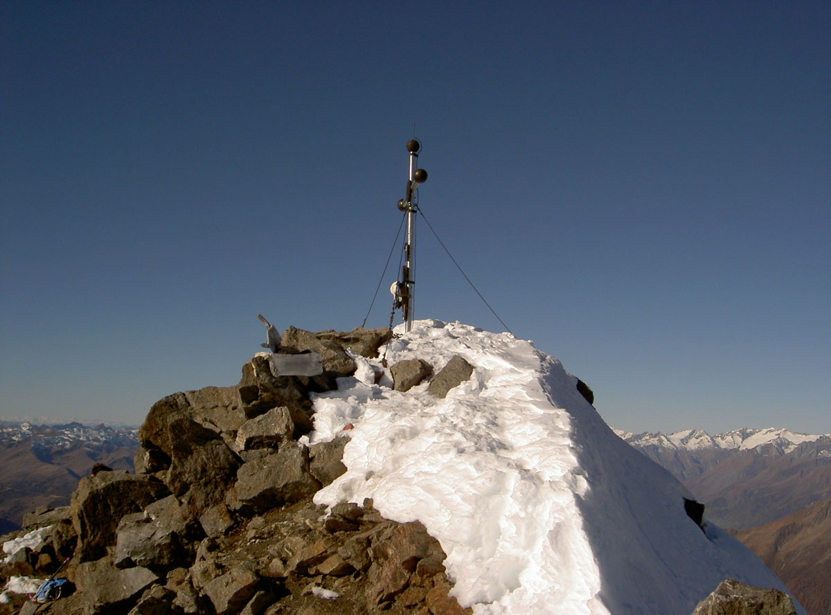
The Hochschober () is the mountain that gives its name to the Schober Group in the High Tauern, although the summit is only the fourth highest in the group. This may have arisen because the north face of the mountain is an impressive sight from Kals. The easiest ascent is via the (2,322 m) from the south to the Staniskascharte notch (2,936 m) and along the western arête. There is another route of comparable difficulty from the east and along the upper part of the southeastern arête. The latter route may use the Lienzer Hut (1,977 m) as a base. Both routes are waymarked and now generally free of snow in the high summer, unlike earlier years, have easy klettersteig ratings ( I) and are somewhat exposed in places. Another ascent option is the partly waymarked climb from the Schobertörl (2,898 m) along the northeastern arête, crossing the Kleinschober (3,125 m). Literature and map * Alpin Club Map Sheet 41, 1:25,000 series, ''Schobergruppe'', * R ... [...More Info...] [...Related Items...] OR: [Wikipedia] [Google] [Baidu] |
Hoher Prijakt
The Hoher Prijakt ("High Prijakt", ) and Niederer Prijakt ("Low Prijakt", ) are a prominent double summit which, seen from the west and north, form one of the most attractively-shaped mountains of the Schober Group in the state of Tyrol in western Austria. The summit cross was placed on the lower Niederer Prijakt which is easier to see from the valley. The easiest route to the Hoher Prijakt takes about three hours from the Hochschober Hut heading for the Mirnitzscharte notch, later turning north and heading past the lake of Barrenlesee until just below the western Barreneckscharte notch and finally making its way along the unchallenging eastern arête to the summit. The route is waymarked and free of snow and ice in the summer, but does require sure-footedness. The Hoher Prijakt and Niederer Prijakt are separated by the ''Prijaktscharte'', a notch which is a good deep. The crossing of the linking ridge takes about 30 minutes and is rated as grade II, but the difficulty i ... [...More Info...] [...Related Items...] OR: [Wikipedia] [Google] [Baidu] |
Roter Knopf
The Rote Knopf () is the second highest mountain in the Schober Group within the High Tauern in the Austrian Alps. It is only two metres short of the Petzeck, the highest summit in the Schober. Nevertheless, this peak is far less well known that the Hochschober or the Glödis. This is probably because the mountain is not visible from the valleys of the Kalser Tal or the anterior Debanttal. The easiest ascent runs from the Elberfelder Hut following the waymarking southwards before turning west and running along the southeastern arête to the summit. This climb not only requires sure-footedness, but also exposed, albeit not difficult, climbing at grade I. From the summit, Austria's highest mountain, the Großglockner The Grossglockner (german: Großglockner ; or just ''Glockner'') is, at 3,798 metres above the Adriatic (12,461 ft), the highest mountain in Austria and the highest mountain in the Alps east of the Brenner Pass. It is part of the larger Gloc ..., may be seen ... [...More Info...] [...Related Items...] OR: [Wikipedia] [Google] [Baidu] |
List Of Mountains Of The Alps Above 3000 M
This page tabulates only the most prominent mountains of the Alps, selected for having a topographic prominence of ''at least'' , and all of them exceeding in height. Although the list contains 537 summits, some significant alpine mountains are necessarily excluded for failing to meet the stringent prominence criterion. The list of these most prominent mountains is continued down to 2500 m elevation at List of prominent mountains of the Alps (2500–2999 m) and down to 2000 m elevation on List of prominent mountains of the Alps (2000–2499 m). All such mountains are located in either France, Italy, Switzerland, Liechtenstein, Austria, Germany or Slovenia, even in some lower regions. Together, these three lists include all 44 ultra-prominent peaks of the Alps, with 19 ultras over 3000m on this page. For a definitive list of all 82 the highest peaks of the Alps, as identified by the International Climbing and Mountaineering Federation (UIAA), and often referred to as the 'Alpi ... [...More Info...] [...Related Items...] OR: [Wikipedia] [Google] [Baidu] |
High Tauern
The High Tauern ( pl.; german: Hohe Tauern, it, Alti Tauri) are a mountain range on the main chain of the Central Eastern Alps, comprising the highest peaks east of the Brenner Pass. The crest forms the southern border of the Austrian states of Salzburg, Carinthia and East Tyrol, with a small part in the southwest belongs to the Italian province of South Tyrol. The range includes Austria's highest mountain, the Grossglockner at above the Adriatic. In the east, the range is adjoined by the Lower Tauern. For the etymology of the name, see Tauern. Geography According to the Alpine Club classification of the Eastern Alps, the range is bounded by the Salzach valley to the north (separating it from the Kitzbühel Alps), the Mur valley and the Murtörl Pass to the east (separating it from the Lower Tauern), the Drava valley to the south (separating it from the Southern Limestone Alps), and the Birnlücke Pass to the west (separating it from the Zillertal Alps). Its most important s ... [...More Info...] [...Related Items...] OR: [Wikipedia] [Google] [Baidu] |
East Tyrol
East Tyrol, occasionally East Tirol (german: Osttirol), is an exclave of the Austrian state of Tyrol, separated from the main North Tyrol part by the short common border of Salzburg and Italian South Tyrol (''Südtirol'', it, Alto Adige). It is congruent with the administrative district (''Bezirk'') of Lienz. History The area around the former Roman ''municipium'' of Aguntum was, from the 12th century, held by the Counts of Gorizia, who took their residence at Lienz and inherited the County of Tyrol in 1253. While Tyrol was lost to the Austrian House of Habsburg in 1363, the Gorizian counts retained Lienz until the extinction of the line in 1500. Emperor Maximilian I of Habsburg finally incorporated it into Austrian Tyrol. East Tyrol's present-day situation arose from the defeat of the Austro-Hungarian Empire in World War I and its subsequent dissolution. By the 1915 Treaty of London, the Kingdom of Italy, which had joined the victorious Triple Entente, was to obtain the Tyrol ... [...More Info...] [...Related Items...] OR: [Wikipedia] [Google] [Baidu] |
UIAA
The International Climbing and Mountaineering Federation, commonly known by its French name Union Internationale des Associations d'Alpinisme (UIAA, lit. ''International Union of Alpine Clubs''), was founded in August 1932 in Chamonix, France when 20 mountaineering associations met for an alpine congress. Count Charles Egmond d’Arcis, from Switzerland, was chosen as the first president and it was decided by the founding members that the UIAA would be an international federation which would be in charge of the "study and solution of all problems regarding mountaineering". The UIAA Safety Label was created in 1960 and was internationally approved in 1965 and currently (2015) has a global presence on five continents with 86 member associations in 62 countries representing over 3 million people. After the 2022 Russian invasion of Ukraine, the UIAA suspended all UIAA officials from Russia, and delegates from the Russian Mountaineering Federation (RMF) and Russian officials and at ... [...More Info...] [...Related Items...] OR: [Wikipedia] [Google] [Baidu] |
Kals Am Großglockner
Kals am Großglockner is a municipality in the district of Lienz in the exclave of East Tirol in the Austrian state of Tyrol. Geography Kals is located in northern East Tirol, near the border to Salzburg and Carinthia. Located in the valleys of Kalser and Iseltals on the Kalserbach river, Kals is dominated by mountains, and the famous Großglockner mountain, the tallest mountain in all of Austria, is located partly in the municipality. Most of Kals is rugged and unusable (41.1%), with forests also prominent. Only 0.1% of the land is fields and pastures. Municipal arrangement Kals is divided into the following Katastralgemeinden: Unterpeischlach, Oberpeischlach, Staniska, Arnig, Lesach, Lana, Ködnitz, Glor-Berg, Großdorf, Unterburg, and Burg. History The Kalser valley might have been settled before the Paleolithic Age. Kals was first mentioned on 19 August 1197. A large copper mine was begun in the 16th century here. Kals was the starting point for the first ascent of G ... [...More Info...] [...Related Items...] OR: [Wikipedia] [Google] [Baidu] |
Hochschober Gipfel
The Hochschober () is the mountain that gives its name to the Schober Group in the High Tauern, although the summit is only the fourth highest in the group. This may have arisen because the north face of the mountain is an impressive sight from Kals. The easiest ascent is via the (2,322 m) from the south to the Staniskascharte notch (2,936 m) and along the western arête. There is another route of comparable difficulty from the east and along the upper part of the southeastern arête. The latter route may use the Lienzer Hut (1,977 m) as a base. Both routes are waymarked and now generally free of snow in the high summer, unlike earlier years, have easy klettersteig A via ferrata (Italian for "iron path", plural ''vie ferrate'' or in English ''via ferratas'') is a protected climbing route found in the Alps and certain other locations. The term "via ferrata" is used in most countries and languages except n ... ratings ( I) and are somewhat exposed in places. ... [...More Info...] [...Related Items...] OR: [Wikipedia] [Google] [Baidu] |
Arête
An arête ( ) is a narrow ridge of rock which separates two valleys. It is typically formed when two glaciers erode parallel U-shaped valleys. Arêtes can also form when two glacial cirques erode headwards towards one another, although frequently this results in a saddle-shaped pass, called a col. The edge is then sharpened by freeze-thaw weathering, and the slope on either side of the arête steepened through mass wasting Mass wasting, also known as mass movement, is a general term for the movement of rock or soil down slopes under the force of gravity. It differs from other processes of erosion in that the debris transported by mass wasting is not entrained in ... events and the erosion of exposed, unstable rock. The word ''arête'' () is actually French for "edge" or "ridge"; similar features in the Alps are often described with the German language, German equivalent term ''Grat''. Where three or more cirques meet, a pyramidal peak is created. Cleaver A ''cleaver' ... [...More Info...] [...Related Items...] OR: [Wikipedia] [Google] [Baidu] |
Klettersteig
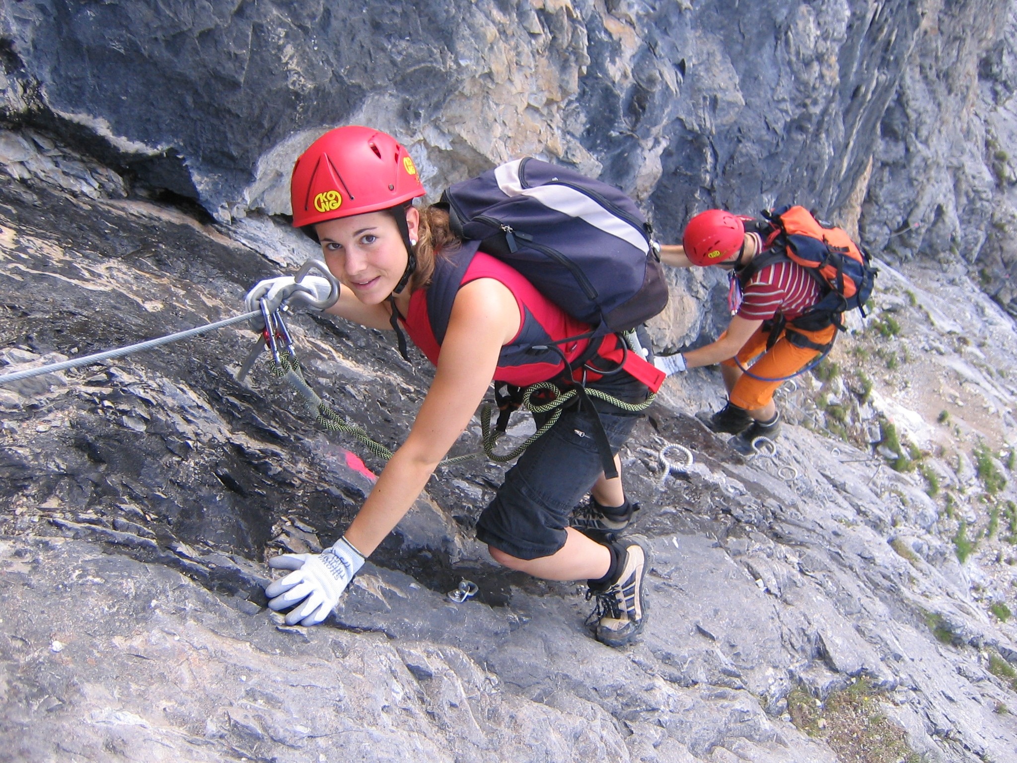
A via ferrata (Italian language, Italian for "iron path", plural ''vie ferrate'' or in English ''via ferratas'') is a protected climbing route found in the Alps and certain other locations. The term "via ferrata" is used in most countries and languages except notably in German-speaking regions, which use ''Klettersteig''—"climbing path" (plural ''Klettersteige''). Infrastructure A via ferrata is a climbing route that employs steel cables, rungs or ladders, fixed to the rock to which the climbers affix #Safety and equipment, a harness with two leashes, which allows the climbers to secure themselves to the metal fixture and limit any fall. The cable and other fixtures, such as iron rungs (stemples), pegs, carved steps, and ladders and bridges, provide both footings and handholds, as well. This allows climbing on otherwise dangerous routes without the risks of unprotected scrambling and climbing or the need for technical climbing equipment. They expand the opportunities for acce ... [...More Info...] [...Related Items...] OR: [Wikipedia] [Google] [Baidu] |


