|
Hinterwaldkopf
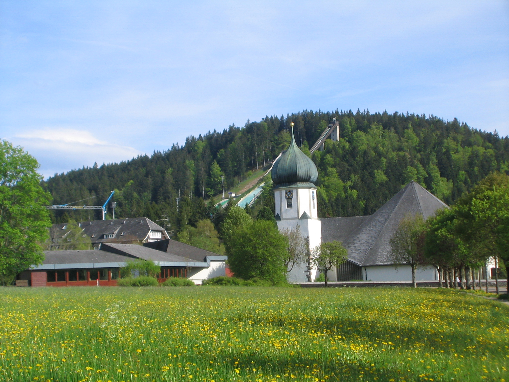
The Hinterwaldkopf is a mountain, , in the Southern Black Forest in Germany. It lies in the southeastern part of the catchment area of the Dreisam east of Freiburg im Breisgau between Kirchzarten and Hinterzarten. To the north it is bounded by the Höllental valley, to the south by the Zastler valley. Nearby settlements include Kirchzarten, Oberried (Breisgau), Falkensteig (part of Buchenbach) and Hinterzarten. The characteristic outline of the Hinterwaldkopf is a symbol of the Dreisam The Dreisam (Celtic: ''*tragisamā'', "the very fast one") is a 29 km long river (48.8 km including its source river Rotbach), and a tributary of the Elz in the German state of Baden-Württemberg. The waters of the Dreisam feed the fam ... valley. Its open summit region offers views over the valley to the Kandel. A trail managed by the Black Forest Club runs over the mountain. References {{Reflist Mountains and hills of Baden-Württemberg Mountains and hills of the ... [...More Info...] [...Related Items...] OR: [Wikipedia] [Google] [Baidu] |
Mountains And Hills Of The Black Forest
The list contains a selection of the mountains and hills in the Black Forest, in order of their height.''Wandern im Schwarzwald'' . Over 1,400 m |
Krummbach (Dreisam)
The Krummbach is a left tributary of the Dreisam in the Southern Black Forest east of Freiburg im Breisgau in the German state of Baden-Württemberg Baden-Württemberg (; ), commonly shortened to BW or BaWü, is a German state () in Southwest Germany, east of the Rhine, which forms the southern part of Germany's western border with France. With more than 11.07 million inhabitants across a .... It is just under 17 kilometres long, In its upper reaches it is better known as the Zastlerbach; in its middle course it is also known as the Osterbach. References External links {{Commons category, Krummbach (Dreisam) Rivers of Baden-Württemberg Rivers of the Black Forest Breisgau-Hochschwarzwald Baden Rivers of Germany ... [...More Info...] [...Related Items...] OR: [Wikipedia] [Google] [Baidu] |
Mountains And Hills Of Baden-Württemberg
A mountain is an elevated portion of the Earth's crust, generally with steep sides that show significant exposed bedrock. Although definitions vary, a mountain may differ from a plateau in having a limited Summit (topography), summit area, and is usually higher than a hill, typically rising at least 300 metres (1,000 feet) above the surrounding land. A few mountains are Monadnock, isolated summits, but most occur in mountain ranges. Mountain formation, Mountains are formed through Tectonic plate, tectonic forces, erosion, or volcanism, which act on time scales of up to tens of millions of years. Once mountain building ceases, mountains are slowly leveled through the action of weathering, through Slump (geology), slumping and other forms of mass wasting, as well as through erosion by rivers and glaciers. High elevations on mountains produce Alpine climate, colder climates than at sea level at similar latitude. These colder climates strongly affect the Montane ecosystems, ecosys ... [...More Info...] [...Related Items...] OR: [Wikipedia] [Google] [Baidu] |
Blick Vom Hinterwaldkopf Ins Dreisamtal
''Blick'' is a Swiss German-language daily newspaper, and online news website covering current affairs, entertainment, sports and lifestyle. History and profile ''Blick'' was established in 1959. The newspaper was the first Swiss tabloid publication. The format of ''Blick'' was broadsheet until 2005 when it was switched to tabloid. The new format induced controversies: protests began and many boycotted the scandalous newspaper. It was nevertheless a huge financial success. However, in 2009 the daily changed its format to broadsheet. Since February 2017, Christian Dorer has been the Editor-in-Chief. Ladina Heimgartner was appointed as CEO in October 2020. ''Blick'' has a center-left political leaning. Its sister paper was from 2008–2018 '' Blick am Abend'', an evening free daily. Both papers are owned by Ringier and are based in Zurich. Circulation In the period of 1995–1996 ''Blick'' had a circulation of 335,143 copies, making it the best-selling paper in the country. ... [...More Info...] [...Related Items...] OR: [Wikipedia] [Google] [Baidu] |
Black Forest Club
The Schwarzwaldverein (Black Forest Club or Black Forest Association) was founded in Freiburg im Breisgau (Germany) in 1864, making it the oldest German hiking and mountaineering club. The Schwarzwaldverein has almost 90,000 members in 241 local chapters. Activities of the club include hiking, environmental protection, the promotion of local culture ('' Heimatpflege''), trail maintenance, and family and youth work projects in the Black Forest. Organisation The Schwarzwaldverein consists of the main association and 241 independent local member chapters. The local chapters are organized into 17 regions, and have a membership of almost 90,000 members. The executive committee consists of three members, and the current president is Eugen Dieterle. In addition to the executive committee, there are nine divisional officers, each of whom is responsible for coordinating specific parts of the club's activities. The main offices are in Freiburg. Trail Maintenance The Schwarzwaldvere ... [...More Info...] [...Related Items...] OR: [Wikipedia] [Google] [Baidu] |
Kandel (mountain)
The Kandel is a mountain, 1,241.4 metres high, in the Black Forest in the south of Baden-Württemberg, Germany. Geography The Kandel is located 25 km northeast of Freiburg in the Breisgau and has a height of 1,241 m (4,072 ft). The Kandel belongs to the Central Black Forest gneiss region. The overall shape of the massif was tectonically formed: the Kandel block rises table-like in a northwesterly direction from the plateau around Sankt Peter. It is surrounded by faults, some of which form clear steps in the terrain; for example the Rhine Plain lies more than 1,000 metres below the Kandel and the summits on the other side of the Elz valley are 500-600 metres lower. The ongoing uplifting of the Kandel block from the Rhine Plain (1-2 mm/year) sometimes manifests itself in earth tremors. The Kandel massif is cut by deep radial valleys into mountain ridges, some rounded and some rocky. The steep mountainsides reach heights of 600 metres in the southwest (Glotter valley), 650 metr ... [...More Info...] [...Related Items...] OR: [Wikipedia] [Google] [Baidu] |
Buchenbach
Buchenbach is a municipality in the south west of the Black Forest in Germany. It is located in the district of Breisgau-Hochschwarzwald in Baden-Württemberg. It is made up of four communities, the main town of Buchenbach and the villages of Falkensteig, Unteribental and Wagensteig. The current municipality was formed by the merger of the former entities of Buchenbach and Falkensteig on 1 December 1971, with Wagensteig being joined to them on 1 August 1973 and Unteribental on 1 January 1975. Geography The municipality is located within the South Black Forest Natural Park, about 12 km as the crow flies east of Freiburg im Breisgau. It stretches from the lower end of the Höllental, below Rotbach to the valley of the Wagensteigbach, and Unteribental borders the St. Märgen plateau. A little to the west of Buchenbach, these two mountain streams merge to form the Dreisam, so Buchenbach is the starting point of the Dreisam valley. Neighbouring municipalities Cloc ... [...More Info...] [...Related Items...] OR: [Wikipedia] [Google] [Baidu] |
Falkensteig
Buchenbach is a municipality in the south west of the Black Forest in Germany. It is located in the district of Breisgau-Hochschwarzwald in Baden-Württemberg. It is made up of four communities, the main town of Buchenbach and the villages of Falkensteig, Unteribental and Wagensteig. The current municipality was formed by the merger of the former entities of Buchenbach and Falkensteig on 1 December 1971, with Wagensteig being joined to them on 1 August 1973 and Unteribental on 1 January 1975. Geography The municipality is located within the South Black Forest Natural Park, about 12 km as the crow flies east of Freiburg im Breisgau. It stretches from the lower end of the Höllental, below Rotbach to the valley of the Wagensteigbach, and Unteribental borders the St. Märgen plateau. A little to the west of Buchenbach, these two mountain streams merge to form the Dreisam, so Buchenbach is the starting point of the Dreisam valley. Neighbouring municipalities Clock ... [...More Info...] [...Related Items...] OR: [Wikipedia] [Google] [Baidu] |
Oberried (Breisgau)
Oberried may refer to: *Oberried am Brienzersee Oberried am Brienzersee is a municipality and village in the Interlaken-Oberhasli administrative district in the canton of Bern in Switzerland. Besides Oberried itself, the municipality includes the settlements of Dörfli and Ebligen. History ..., Switzerland * Oberried, Fribourg, Switzerland * Oberried, Germany See also * Oberrieden {{Geodis ... [...More Info...] [...Related Items...] OR: [Wikipedia] [Google] [Baidu] |
Baden-Württemberg
Baden-Württemberg (; ), commonly shortened to BW or BaWü, is a German state () in Southwest Germany, east of the Rhine, which forms the southern part of Germany's western border with France. With more than 11.07 million inhabitants across a total area of nearly , it is the third-largest German state by both area (behind Bavaria and Lower Saxony) and population (behind North Rhine-Westphalia and Bavaria). As a federated state, Baden-Württemberg is a partly-sovereign parliamentary republic. The largest city in Baden-Württemberg is the state capital of Stuttgart, followed by Mannheim and Karlsruhe. Other major cities are Freiburg im Breisgau, Heidelberg, Heilbronn, Pforzheim, Reutlingen, Tübingen, and Ulm. What is now Baden-Württemberg was formerly the historical territories of Baden, Prussian Hohenzollern, and Württemberg. Baden-Württemberg became a state of West Germany in April 1952 by the merger of Württemberg-Baden, South Baden, and Württemberg-Hohenzollern. The ... [...More Info...] [...Related Items...] OR: [Wikipedia] [Google] [Baidu] |
Germany
Germany,, officially the Federal Republic of Germany, is a country in Central Europe. It is the second most populous country in Europe after Russia, and the most populous member state of the European Union. Germany is situated between the Baltic and North seas to the north, and the Alps to the south; it covers an area of , with a population of almost 84 million within its 16 constituent states. Germany borders Denmark to the north, Poland and the Czech Republic to the east, Austria and Switzerland to the south, and France, Luxembourg, Belgium, and the Netherlands to the west. The nation's capital and most populous city is Berlin and its financial centre is Frankfurt; the largest urban area is the Ruhr. Various Germanic tribes have inhabited the northern parts of modern Germany since classical antiquity. A region named Germania was documented before AD 100. In 962, the Kingdom of Germany formed the bulk of the Holy Roman Empire. During the 16th ce ... [...More Info...] [...Related Items...] OR: [Wikipedia] [Google] [Baidu] |
Hinterzarten
Hinterzarten is a resort village in the Black Forest (German: ''Schwarzwald''), located in the southwest of the state of Baden-Württemberg, Germany. Although Hinterzarten is mostly famous for its ski jumping, it has many other tourist attractions. Geography Location Hinterzarten is located , which is just below that of the Feldberg (), the highest mountain in the Black Forest. The municipality descends to the southeastern end of Lake Titisee (), although its lowest point is the Sternenrank at . Hinterzarten is located within the Southern Black Forest Nature Park, and the Zartenbach stream flows through the municipality. Mountain peaks within the municipality include the Windeckkopf (1,209 m). Climate Hinterzarten's annual precipitation is 1,406 mm, which is thus in amongst the highest in Germany. The driest month is September; the most precipitation falls in December. Neighbouring municipalities Hinterzarten's neighbouring municipalities are Breitnau, Titisee-Ne ... [...More Info...] [...Related Items...] OR: [Wikipedia] [Google] [Baidu] |


