|
Hilmarton
Hilmarton is a village and civil parish in North Wiltshire, in the west of England. The village lies on the A3102 between the towns of Calne and Wootton Bassett, and south of Lyneham. The parish includes the village of Goatacre and the hamlets of Catcomb, Clevancy, Highway and New Zealand. Cowage Brook, a tributary of the River Marden, crosses the parish in a southwesterly direction and forms part of its western boundary. History There is evidence of Roman presence within the parish, including a Romano-British well at Corton, in the northeast. A settlement of 21 households was recorded at ''Helmertone'' in the Domesday Book of 1086. By the 14th century there were a number of scattered hamlets, with Hilmarton and Goatacre the largest. Others assessed for taxation in 1334 were Clevancy, Corton, Witcomb, Littlecott and Beversbrook; by the 20th century these five had few buildings other than farms. The ground-level remains of the medieval settlement at Littlecott are a Schedul ... [...More Info...] [...Related Items...] OR: [Wikipedia] [Google] [Baidu] |
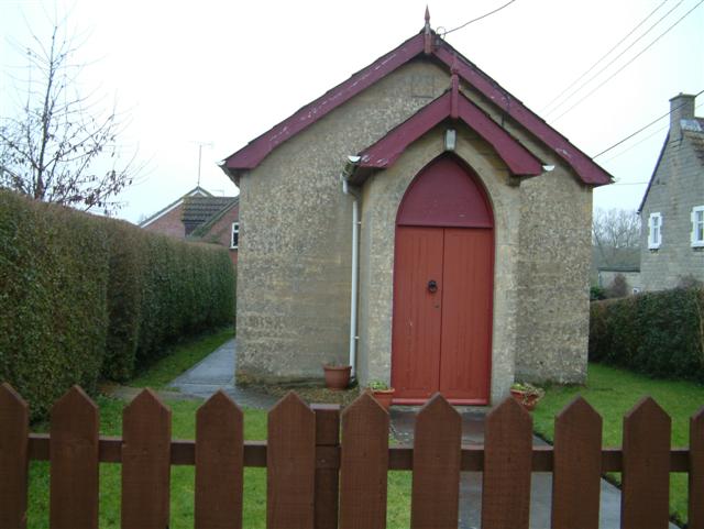
Hilmarton Chapel - Geograph
Hilmarton is a village and civil parish in North Wiltshire, in the west of England. The village lies on the A3102 between the towns of Calne and Wootton Bassett, and south of Lyneham. The parish includes the village of Goatacre and the hamlets of Catcomb, Clevancy, Highway and New Zealand. Cowage Brook, a tributary of the River Marden, crosses the parish in a southwesterly direction and forms part of its western boundary. History There is evidence of Roman presence within the parish, including a Romano-British well at Corton, in the northeast. A settlement of 21 households was recorded at ''Helmertone'' in the Domesday Book of 1086. By the 14th century there were a number of scattered hamlets, with Hilmarton and Goatacre the largest. Others assessed for taxation in 1334 were Clevancy, Corton, Witcomb, Littlecott and Beversbrook; by the 20th century these five had few buildings other than farms. The ground-level remains of the medieval settlement at Littlecott are a Schedule ... [...More Info...] [...Related Items...] OR: [Wikipedia] [Google] [Baidu] |
Goatacre
Goatacre is a village in the English county of Wiltshire, about north of Calne and south of Lyneham on the A3102 road. It is in the parish of Hilmarton and the closest major town is Swindon, some to the northeast. The hamlet of New Zealand is nearby, to the northwest. History The first recorded reference to "Godacre" occurs in 1242. The name occurs in 1348 as Gatacre and in 1408 as Gotagre, and is derived from the Old English word gat-aecre meaning, literally, goat-acre. The land was generally part of the Hilmarton estate, and was acquired by the Poynder family, owners at Hilmarton, in the mid 19th century. The Poynders built or rebuilt several buildings, including the farmhouse (in the centre of the village) and Corton House (to the west). The village has no Church of England presence, the nearest church being St Laurence at Hilmarton, one mile to the south. Quakers were active from the 17th century, and had a burial ground to the east of the village from 1678. A small Pri ... [...More Info...] [...Related Items...] OR: [Wikipedia] [Google] [Baidu] |
Highway, Wiltshire
Highway is a hamlet and former Civil parishes in England, civil parish in Wiltshire, England, today within Hilmarton parish. The hamlet lies about southeast of Hilmarton village and northeast of the town of Calne. History A settlement of 15 households was recorded in the Domesday Book of 1086, and at this time most of the land was held by Malmesbury Abbey. In 1219 the manor (together with Bremhill and Foxham, Wiltshire, Foxham) was transferred to the Bishop of Salisbury, and by this time Highway was probably a chapelry of Bremhill, northwest of Calne. The manor passed through various hands, including (from 1628) John Glanville, Sir John Glanville of Broad Hinton, a member of parliament who served as Speaker of the House of Commons (United Kingdom), Speaker and as King's Serjeant. In 1936 the estate was inherited by Raymond Anthony Addington, 6th Viscount Sidmouth, and continues today as the family seat. Highway was a large village, with a population of 148 recorded at the 1831 ... [...More Info...] [...Related Items...] OR: [Wikipedia] [Google] [Baidu] |
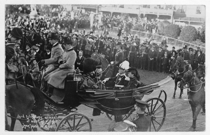
John Dickson-Poynder, 1st Baron Islington
John Poynder Dickson-Poynder, 1st Baron Islington, (31 October 1866 – 6 December 1936), born John Poynder Dickson and known as Sir John Poynder Dickson-Poynder from 1884 to 1910, was a British politician. He was Governor of New Zealand between 1910 and 1912. Early life The son of Rear Admiral John Bourmaster Dickson and Sarah Matilda Dickson (née Poynder), he was born on the Isle of Wight and educated at Twyford School, Harrow and Christ Church, Oxford. In 1884 he succeeded his uncle as sixth baronet, and on succeeding to his maternal uncle's property he assumed by royal licence the additional surname of Poynder in 1888. The Poynder estates in Wiltshire included Hilmarton near Calne, and Hartham near Corsham, where Dickson-Poynder carried out alterations c. 1888. He married Anne Beauclerk Dundas (c.1869-1958) the daughter of James Dundas of Dundas and granddaughter of Baron Napier of Magdala. They had one daughter, Joan, who was later Joan, Lady Altrincham who org ... [...More Info...] [...Related Items...] OR: [Wikipedia] [Google] [Baidu] |
New Zealand, Wiltshire
New Zealand is a hamlet in the civil parish of Hilmarton in Wiltshire, England. Nearby villages are Goatacre, Hilmarton and Lyneham; the nearest town is Calne, approximately to the southwest. Today the hamlet is close to the southern boundary of MoD Lyneham Ministry of Defence Lyneham or MOD Lyneham is a Ministry of Defence site in Wiltshire, England, about northeast of Chippenham and southwest of Swindon. The site houses the Defence School of Electronic and Mechanical Engineering. Also here is Pr ..., which was opened as RAF Lyneham in 1940. References Hamlets in Wiltshire {{Wiltshire-geo-stub ... [...More Info...] [...Related Items...] OR: [Wikipedia] [Google] [Baidu] |
North Wiltshire (UK Parliament Constituency)
North Wiltshire is a constituency represented in the House of Commons of the UK Parliament since 1997 by James Gray, a Conservative. In the period 1832–1983, this was an alternative name for Chippenham or the Northern Division of Wiltshire and as Chippenham dates to the original countrywide Parliament, the Model Parliament, this period is covered in more detail in that article. In 2016 it was announced that the North Wiltshire constituency would be scrapped as part of the planned 2018 Constituency Reforms. Boundaries 1832–1885: The Hundreds of Chippenham, North Damerham, Bradford, Melksham, Potterne and Cannings, Calne, Selkley, Ramsbury, Whorwelsdown, Swanborough, Highworth, Cricklade and Staple, Kingsbridge, and Malmesbury. 1983–1997: The District of North Wiltshire. 1997–2010: The District of North Wiltshire wards of Allington, Ashton Keynes, Audley, Avon, Box, Bremhill, Brinkworth, Colerne, Corsham, Crudwell, Hill Rise, Hilmarton, Kington Langley, Kington St Micha ... [...More Info...] [...Related Items...] OR: [Wikipedia] [Google] [Baidu] |
Hillmorton
Hillmorton is a suburb of Rugby, Warwickshire, England, around south-east of Rugby town centre, forming much of the eastern half of the town. It is also a ward of the Borough of Rugby. Hillmorton was historically a village in its own right, but was incorporated into Rugby in 1932. Hillmorton also encompasses the Paddox housing estate to the west of the old village, which is shown on many maps as 'Hillmorton Paddox', this area however is part of a separate ward called 'Paddox'. History Settlements in the Hillmorton area spread into the prehistoric era. Archaeological digs at near Ashlawn Road in 2017 found remains of human settlement dating back to the Bronze Age (1000 – 500 BC), as well as numerous finds of occupation from the Roman period, including items of pottery and the remains of pottery or tile kilns. Before Rugby spread to the east, Hillmorton was a village. The village was formed by amalgamation of two settlements: ''Hull'' and ''Morton'': The former being the part ... [...More Info...] [...Related Items...] OR: [Wikipedia] [Google] [Baidu] |
Lyneham, Wiltshire
Lyneham is a large village in north Wiltshire, England, within the civil parish of Lyneham and Bradenstoke, and situated southwest of Royal Wootton Bassett, north of Calne and southwest of Swindon. The village is on the A3102 road between Calne and Wootton Bassett. The part of Lyneham village close to the parish church is known as Church End. The civil parish includes the village of Bradenstoke and the hamlets of Preston and The Banks. History In 1086, Domesday Book recorded 42 households at ''Stoche'' in the northwest of the modern parish. Earthworks in this area known as Clack Mount, including a mound 20 metres in diameter, could be from a Norman motte-and-bailey castle, although the early history is uncertain. Bradenstoke Priory was founded nearby in 1142, possibly on the site of an earlier chapel. The hamlet on both sides of the road leading to the priory was called Clack from the 14th century, as shown on Andrews' and Dury's map of 1773; in the 20th century the name Br ... [...More Info...] [...Related Items...] OR: [Wikipedia] [Google] [Baidu] |
Victorian Restoration
The Victorian restoration was the widespread and extensive refurbishment and rebuilding of Church of England churches and cathedrals that took place in England and Wales during the 19th-century reign of Queen Victoria. It was not the same process as is understood today by the term building restoration. Against a background of poorly maintained church buildings, a reaction against the Puritan ethic manifested in the Gothic Revival, and a shortage of churches where they were needed in cities, the Cambridge Camden Society and the Oxford Movement advocated a return to a more medieval attitude to churchgoing. The change was embraced by the Church of England which saw it as a means of reversing the decline in church attendance. The principle was to "restore" a church to how it might have looked during the " Decorated" style of architecture which existed between 1260 and 1360, and many famous architects such as George Gilbert Scott and Ewan Christian enthusiastically accepted commis ... [...More Info...] [...Related Items...] OR: [Wikipedia] [Google] [Baidu] |
Redundant Church
A redundant church, now referred to as a "closed church", is a church building that is no longer used for Christian worship. The term most frequently refers to former Anglican churches in the United Kingdom, but may also be used for disused churches in other countries. Reasons for redundancy include population movements, changing social patterns, merging of parishes, and decline in church attendance (especially in the Global North). Historically, redundant churches were often demolished or left to ruin. Today, many are repurposed as community centres, museums or homes, and are demolished only if no alternative can be found. Anglican buildings Although church buildings fall into disuse around the world, the term "redundancy" was particularly used by the Church of England, which had a Redundant Churches Division. As of 2008, it instead refers to such churches as "closed for regular public worship", and the Redundant Churches Division became the Closed Churches Division. [...More Info...] [...Related Items...] OR: [Wikipedia] [Google] [Baidu] |
William Butterfield
William Butterfield (7 September 1814 – 23 February 1900) was a Gothic Revival architect and associated with the Oxford Movement (or Tractarian Movement). He is noted for his use of polychromy. Biography William Butterfield was born in London in 1814. His parents were strict non-conformists who ran a chemist's shop in the Strand. He was one of nine children and was educated at a local school. At the age of 16, he was apprenticed to Thomas Arber, a builder in Pimlico, who later became bankrupt. He studied architecture under E. L. Blackburne (1833–1836). From 1838 to 1839, he was an assistant to Harvey Eginton, an architect in Worcester, where he became articled. He established his own architectural practice at Lincoln's Inn Fields in 1840. From 1842 Butterfield was involved with the Cambridge Camden Society, later The Ecclesiological Society. He contributed designs to the Society's journal, ''The Ecclesiologist''. His involvement influenced his architectural style. He als ... [...More Info...] [...Related Items...] OR: [Wikipedia] [Google] [Baidu] |
Bremhill
Bremhill is a village and civil parish in Wiltshire, England. The village is about northwest of Calne and east of Chippenham. The name originates from '' 'Bramble hill'.'' Geography Bremhill civil parish is a rural area which stretches northeast some from the eastern boundary of the Chippenham built-up area. It includes the hamlets of Avon, Bremhill Wick, Charlcutt, East Tytherton, Low Bridge, Foxham, Spirthill, Stanley, Tytherton Lucas and West End, and part of the hamlet of Ratford. The River Avon forms part of the western boundary of the parish, where it is joined by the Marden which crosses the parish from the south. The parish has many smaller tributaries of the Avon, including Pudding Brook, which joins the Marden south of Tytherton Lucas; the Cade Burna, which gives its name to Cadenham Manor; and the Cat Brook. Bencroft Hill Meadows, in the south of the parish, is a biological Site of Special Scientific Interest. History Æthelstan gave land at Bremhill ... [...More Info...] [...Related Items...] OR: [Wikipedia] [Google] [Baidu] |


.jpg)


