|
Hill Forts In Scotland
Hillforts in Scotland are earthworks, sometimes with wooden or stone enclosures, built on higher ground, which usually include a significant settlement, built within the modern boundaries of Scotland. They were first studied in the eighteenth century and the first serious field research was undertaken in the nineteenth century. In the twentieth century there were large numbers of archaeological investigations of specific sites, with an emphasis on establishing a chronology of the forts. Forts have been classified by type and their military and ritual functions have been debated. They were introduced into Scotland during the Bronze Age from around 1000 BCE. The largest group are from the Iron Age, with over 1,000 hillforts, mostly below the Clyde-Forth line, most of which were abandoned during the period of Roman occupation of Britain. There are also large numbers of vitrified forts, which have been subjected to fire, many of which may date to this period and are found across Scot ... [...More Info...] [...Related Items...] OR: [Wikipedia] [Google] [Baidu] |
Carbon Dating
Radiocarbon dating (also referred to as carbon dating or carbon-14 dating) is a method for determining the age of an object containing organic material by using the properties of radiocarbon, a radioactive isotope of carbon. The method was developed in the late 1940s at the University of Chicago by Willard Libby. It is based on the fact that radiocarbon () is constantly being created in the Earth's atmosphere by the interaction of cosmic rays with atmospheric nitrogen. The resulting combines with atmospheric oxygen to form radioactive carbon dioxide, which is incorporated into plants by photosynthesis; animals then acquire by eating the plants. When the animal or plant dies, it stops exchanging carbon with its environment, and thereafter the amount of it contains begins to decrease as the undergoes radioactive decay. Measuring the amount of in a sample from a dead plant or animal, such as a piece of wood or a fragment of bone, provides information that can be used to calc ... [...More Info...] [...Related Items...] OR: [Wikipedia] [Google] [Baidu] |
Craig Phadrig
Craig Phadrig (Scottish Gaelic: Creag Phàdraig, meaning Rock of Patrick) is a forested hill on the western edge of Inverness, Scotland. A hill fort on the summit is generally supposed to have been the base of the Pictish king Bridei mac Maelchon (ruled ''circa'' 550–584). The hill rises to above sea level, and overlooks the Beauly Firth to the north and the mouth of the River Ness to the north-east. The hill is currently owned and managed by Forestry and Land Scotland. Craig Phadrig fort The summit of the hill is occupied by a vitrified fort; a stone structure affected by fire to produce a glass-like material. The inner wall of the fort defines an area around , and survives to a height of around . Beyond this is an outer wall and part of a third wall or hornwork to the east. Radiocarbon dates obtained in the 1970s suggest that the inner wall was constructed in the 4th century. Excavations at this time revealed evidence of Pictish occupation, including metal-working implements ... [...More Info...] [...Related Items...] OR: [Wikipedia] [Google] [Baidu] |
Bridei I Of The Picts
Bridei I, also known as Bridei, son of Maelchon, was king of the Picts from 554 to 584. Sources are vague or contradictory regarding him, but it is believed that his court was near Loch Ness and that he may have been a Christian. There were contemporaries claiming the title "king of the Picts". He died in the mid-580s, possibly in battle, and was succeeded by Gartnait son of Domelch. Historical sources Bridei son of Maelchon was king of the Picts until his death around 584–586. Other forms of his name include Brude son of Melcho and, in Irish sources, Bruide son of Maelchú and Bruidhe son of Maelchon. He was first mentioned in the Irish annals from 558 to 560, where the ''Annals of Ulster'' report "the migration before Máelchú's son, king Bruide". An earlier entry, reporting the death of "Bruide son of Máelchú" in the ''Annals of Ulster'' for 505 is presumed to be an error. The Ulster annalist does not say who fled, but the later ''Annals of Tigernach'' refers to "the fl ... [...More Info...] [...Related Items...] OR: [Wikipedia] [Google] [Baidu] |
Alt Clut
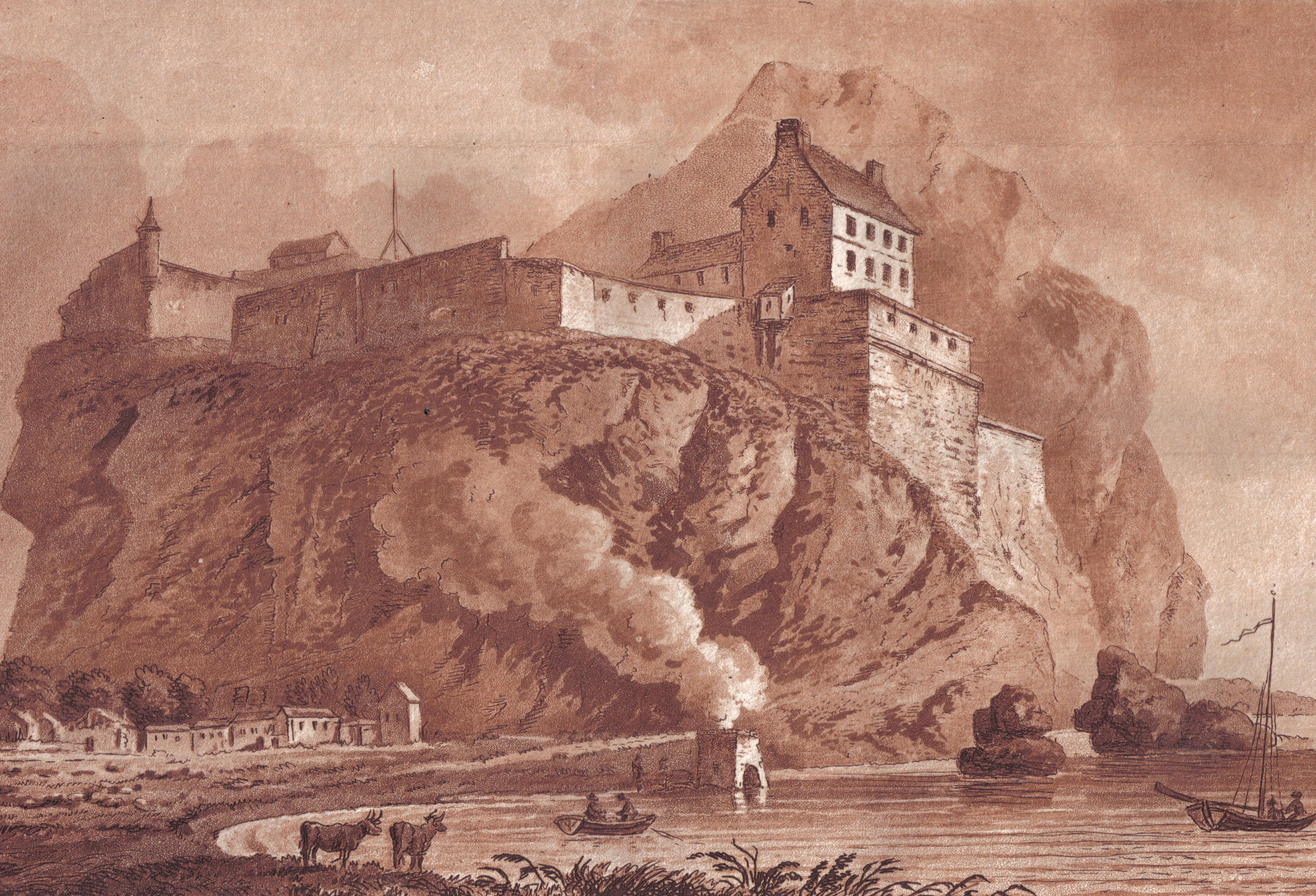
Dumbarton Castle ( gd, Dùn Breatainn, ; ) has the longest recorded history of any stronghold in Scotland. It sits on a volcanic plug of basalt known as Dumbarton Rock which is high and overlooks the Scottish town of Dumbarton. History Dumbarton Rock was formed between 330 and 340 million years ago, during the Early Carboniferous period, a time of widespread volcanic activity in the area where Glasgow is now situated; over time, the softer exterior of the volcano weathered away, leaving behind a volcanic plug of basalt. Iron Age At least as far back as the Iron Age, this has been the site of a strategically important settlement, as evidenced by archaeological finds. The people that came to reside there in the era of Roman Britain were known to have traded with the Romans. However the first written record about a settlement there was in a letter that Saint Patrick wrote to King Ceretic of Alt Clut in the late 5th century. Early Medieval era David Nash Ford has proposed that ... [...More Info...] [...Related Items...] OR: [Wikipedia] [Google] [Baidu] |
Gododdin
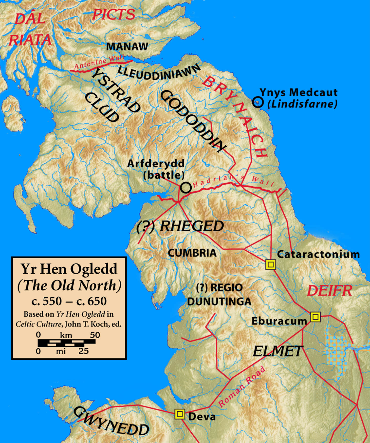
The Gododdin () were a Brittonic people of north-eastern Britannia, the area known as the Hen Ogledd or Old North (modern south-east Scotland and north-east England), in the sub-Roman period. Descendants of the Votadini, they are best known as the subject of the 6th-century Welsh poem ''Y Gododdin'', which memorialises the Battle of Catraeth and is attributed to Aneirin. The name ''Gododdin'' is the Modern Welsh form, but the name appeared in Old Welsh as ''Guotodin'' and derived from the tribal name '' Votadini'' recorded in Classical sources, such as in Greek texts from the Roman period. Kingdom It is not known exactly how far the kingdom of the Gododdin extended, possibly from the Stirling area to the kingdom of '' Bryneich'' (Bernicia), and including what are now the Lothian and Borders regions of eastern Scotland. It was bounded to the west by the Brittonic Kingdom of Strathclyde, and to the north by the Picts. Those living around Clackmannanshire were known as the Ma ... [...More Info...] [...Related Items...] OR: [Wikipedia] [Google] [Baidu] |
Angus, Scotland
Angus ( sco, Angus; gd, Aonghas) is one of the 32 local government council areas of Scotland, a registration county and a lieutenancy area. The council area borders Aberdeenshire, Dundee City and Perth and Kinross. Main industries include agriculture and fishing. Global pharmaceuticals company GSK has a significant presence in Montrose in the north of the county. Angus was historically a province, and later a sheriffdom and county (known officially as Forfarshire from the 18th century until 1928), bordering Kincardineshire to the north-east, Aberdeenshire to the north and Perthshire to the west; southwards it faced Fife across the Firth of Tay; these remain the borders of Angus, minus Dundee which now forms its own small separate council area. Angus remains a registration county and a lieutenancy area. In 1975 some of its administrative functions were transferred to the council district of the Tayside Region, and in 1995 further reform resulted in the establishment of the un ... [...More Info...] [...Related Items...] OR: [Wikipedia] [Google] [Baidu] |
Forfar
Forfar ( sco, Farfar, gd, Baile Fharfair) is the county town of Angus, Scotland and the administrative centre for Angus Council, with a new multi-million pound office complex located on the outskirts of the town. As of 2021, the town has a population of 16,280. The town lies in Strathmore and is situated just off the main A90 road between Perth and Aberdeen, with Dundee (the nearest city) being 13 miles (21 km) away. It is approximately 5 miles (8 km) from Glamis Castle, seat of the Bowes-Lyon family and ancestral home of Her Majesty Queen Elizabeth the Queen Mother, and where the late Princess Margaret, younger sister of Queen Elizabeth II, was born in 1930. Forfar dates back to the temporary Roman occupation of the area, and was subsequently held by the Picts and the Kingdom of Scotland. During the Scottish Wars of Independence, Forfar was occupied by English forces before being recaptured by the Scots and presented to Robert the Bruce. Forfar has been both ... [...More Info...] [...Related Items...] OR: [Wikipedia] [Google] [Baidu] |
Scotland Dumbarton Castle Bordercropped
Scotland (, ) is a country that is part of the United Kingdom. Covering the northern third of the island of Great Britain, mainland Scotland has a border with England to the southeast and is otherwise surrounded by the Atlantic Ocean to the north and west, the North Sea to the northeast and east, and the Irish Sea to the south. It also contains more than 790 islands, principally in the archipelagos of the Hebrides and the Northern Isles. Most of the population, including the capital Edinburgh, is concentrated in the Central Belt—the plain between the Scottish Highlands and the Southern Uplands—in the Scottish Lowlands. Scotland is divided into 32 administrative subdivisions or local authorities, known as council areas. Glasgow City is the largest council area in terms of population, with Highland being the largest in terms of area. Limited self-governing power, covering matters such as education, social services and roads and transportation, is devolved from the Scott ... [...More Info...] [...Related Items...] OR: [Wikipedia] [Google] [Baidu] |
Traprain Law
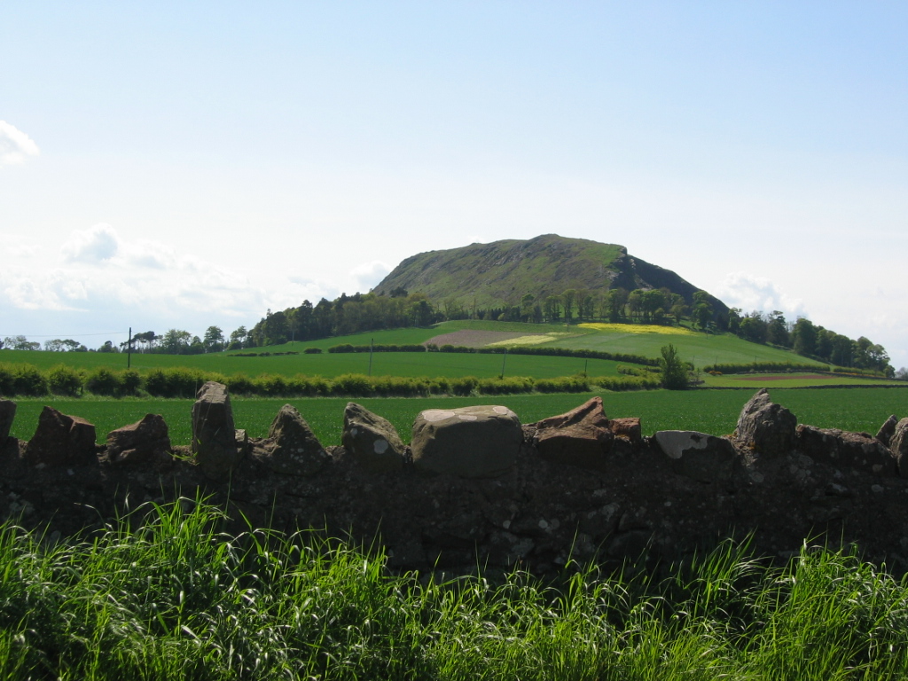
Traprain Law is a hill east of Haddington, East Lothian, Scotland, It is the site of a hill fort or possibly ''oppidum'', which covered at its maximum extent about . It is the site of the Traprain Law Treasure, the largest Roman silver hoard from anywhere outside the Roman Empire which included exquisite silver artefacts. The hill, about above MSL, was already a place of burial by around 1500 BC, and showed evidence of occupation and signs of ramparts after 1000 BC. The ramparts were rebuilt and realigned many times in the following centuries. Excavations have shown it was occupied in the Late Iron Age from about AD 40 until the last quarter of the 2nd century (about the time that the Antonine Wall was manned). In the 1st century AD the Romans recorded the Votadini as a British tribe in the area, and Traprain Law is generally thought to have been one of their major settlements, named ''Curia'' by Ptolemy. They emerged as a kingdom under the Brythonic vers ... [...More Info...] [...Related Items...] OR: [Wikipedia] [Google] [Baidu] |
Scottish Borders
The Scottish Borders ( sco, the Mairches, 'the Marches'; gd, Crìochan na h-Alba) is one of 32 council areas of Scotland. It borders the City of Edinburgh, Dumfries and Galloway, East Lothian, Midlothian, South Lanarkshire, West Lothian and, to the south-west, south and east, the English counties of Cumbria and Northumberland. The administrative centre of the area is Newtown St Boswells. The term Scottish Borders, or normally just "the Borders", is also used to designate the areas of southern Scotland and northern England that bound the Anglo-Scottish border. Geography The Scottish Borders are in the eastern part of the Southern Uplands. The region is hilly and largely rural, with the River Tweed flowing west to east through it. The highest hill in the region is Broad Law in the Manor Hills. In the east of the region, the area that borders the River Tweed is flat and is known as 'The Merse'. The Tweed and its tributaries drain the entire region with the river flowi ... [...More Info...] [...Related Items...] OR: [Wikipedia] [Google] [Baidu] |
Eildon Hill
Eildon Hill lies just south of Melrose, Scotland in the Scottish Borders, overlooking the town. The name is usually pluralised into "the Eildons" or "Eildon Hills", because of its triple peak. The high eminence overlooks Teviotdale to the South.R. Milne & H. Brown, ''The Corbetts and Other Scottish Hills,'' p. 29. Published by the Scottish Mountaineering Trust, 2002. The north hilltop (of three peaks) is surrounded by over of ramparts, enclosing an area of about 16 ha (40 acres) in which at least 300 level platforms have been cut into the rock to provide bases for turf or timber-walled houses, forming one of the largest hill forts known in Scotland. A Roman army signalling station was later constructed on the same site as this hill fort. The mid hilltop is the highest, whilst the south hilltop is the lowest. The hills are owned by the Duke of Buccleuch, Scotland's largest private landowner. As with all land in Scotland the public have a right of responsible access t ... [...More Info...] [...Related Items...] OR: [Wikipedia] [Google] [Baidu] |


