|
Hill 60 (Ypres)
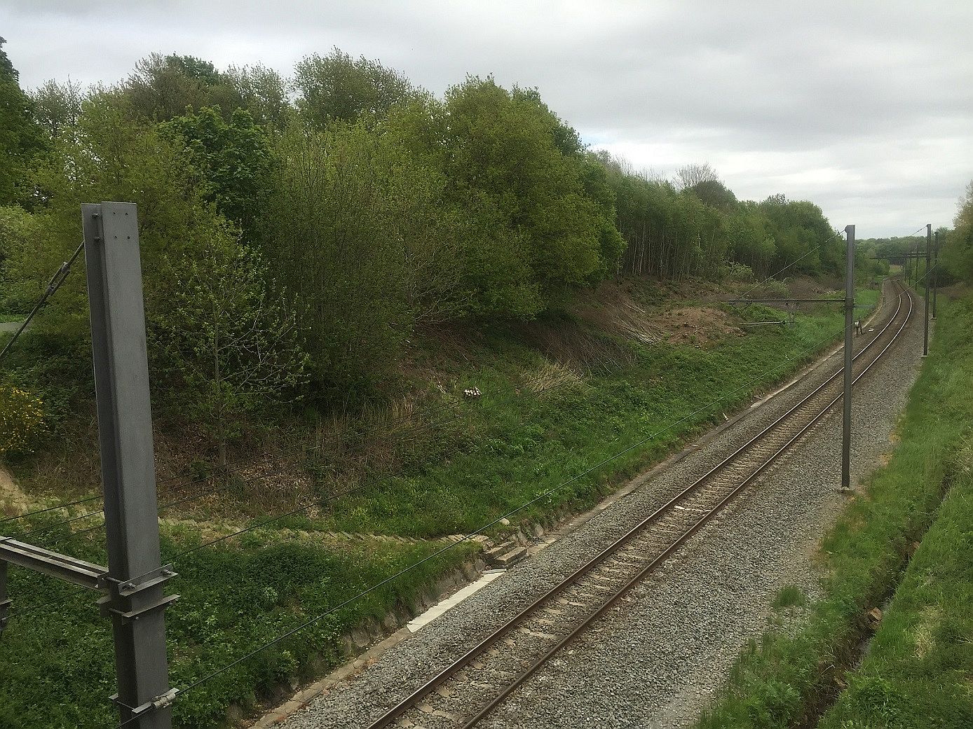
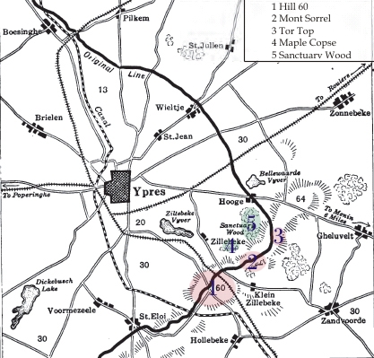
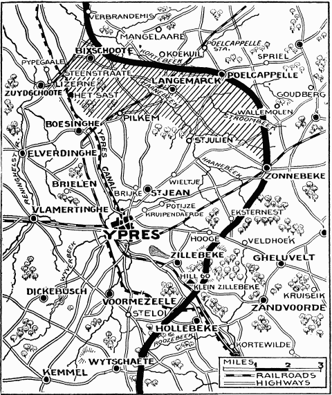
Hill 60 is a World War I battlefield memorial site and park in the Zwarteleen area of Zillebeke south of Ypres, Belgium. It is located about from the centre of Ypres and directly on the railway line to Comines. Before the First World War the hill was known locally as (Lover's Knoll). The site comprises two areas of raised land separated by the railway line; the northern area was known by soldiers as ''Hill 60'' while the southern part was known as ''The Caterpillar''. Background Origin The high ground of Hill 60, south of Zillebeke, was created in the 1850s by spoil dumped from the cutting for the railway line between Ypres and Comines. The line opened in March 1854 and formed part of the La Madeleine–Comines railway from the French Nord-Pas-de-Calais region into Belgian Flanders. The earth excavated during the building of the railway was dumped on either side of the embankment and formed hillocks. On the west side, a long irregular mound atop the ridge was called ''The ... [...More Info...] [...Related Items...] OR: [Wikipedia] [Google] [Baidu] |
Ypres
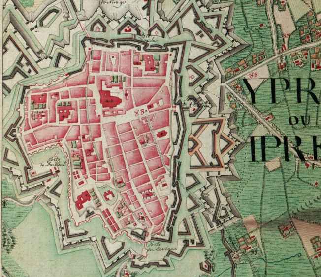
Ypres ( , ; nl, Ieper ; vls, Yper; german: Ypern ) is a Belgian city and municipality in the province of West Flanders. Though the Dutch name is the official one, the city's French name is most commonly used in English. The municipality comprises the city of Ypres/Ieper and the villages of Boezinge, Brielen, Dikkebus, Elverdinge, Hollebeke, Sint-Jan, Vlamertinge, Voormezele, Zillebeke, and Zuidschote. Together, they are home to about 34,900 inhabitants. During the First World War, Ypres (or "Wipers" as it was commonly known by the British troops) was the centre of the Battles of Ypres between German and Allied forces. History Origins before First World War Ypres is an ancient town, known to have been raided by the Romans in the first century BC. It is first mentioned by name in 1066 and is probably named after the river Ieperlee on the banks of which it was founded. During the Middle Ages, Ypres was a prosperous Flemish city with a population of 40,000 in 1200 AD, renow ... [...More Info...] [...Related Items...] OR: [Wikipedia] [Google] [Baidu] |
The Bluff (Ypres)
The Actions of the Bluff were local operations in 1916 carried out in Flanders during the First World War by the German 4th Army and the British Second Army. The Bluff is a mound near St Eloi, south-east of Ypres in Belgium, created from a spoil heap during the digging of the Ypres– Comines Canal before the war. From 14 to 15 February and on 2 March 1916, the Germans and the British fought for control of the Bluff, the Germans capturing the mound and defeating counter-attacks only for the British to recapture it and a stretch of German front line, after pausing to prepare a set-piece attack. The fighting at the Bluff was one of nine sudden attacks for local gains made by the Germans or the British between the appointment of Sir Douglas Haig as commander in chief of the British Expeditionary Force (BEF), and the beginning of the Battle of the Somme. The BEF was at a tactical disadvantage, on low boggy ground, easily observed from German positions. A retirement to more defensi ... [...More Info...] [...Related Items...] OR: [Wikipedia] [Google] [Baidu] |
Tunnelling Companies Of The Royal Engineers
Royal Engineer tunnelling companies were specialist units of the Corps of Royal Engineers within the British Army, formed to dig attacking tunnels under enemy lines during the First World War. The stalemate situation in the early part of the war led to the deployment of tunnel warfare. After the first German Empire attacks on 21 December 1914, through shallow tunnels underneath no man's land and exploding ten mines under the trenches of the Indian Sirhind Brigade, the British began forming suitable units. In February 1915, eight Tunnelling Companies were created and operational in Flanders from March 1915. By mid-1916, the British Army had around 25,000 trained tunnellers, mostly volunteers taken from coal mining communities. Almost twice that number of "attached infantry" worked permanently alongside the trained miners acting as 'beasts of burden'. From the spring of 1917 the whole war became more mobile, with grand offensives at Arras, Messines and Passchendaele. There was n ... [...More Info...] [...Related Items...] OR: [Wikipedia] [Google] [Baidu] |
Sanctuary Wood Cemetery
{{Infobox military memorial , name=Sanctuary Wood Cemetery , body= Commonwealth War Graves Commission , image= , caption= , use_dates=1914–1917 , established=1915 , designer=Sir Edwin Lutyens , coordinates= , nearest_town=5 km east of Ypres, West Flanders, Belgium , total=1,989 buried or commemorated , unknowns=1,353 , by_country=Australia = 88 (55 unidentified) Canada = 142 (unidentified 70) Newfoundland = 3 (2 unidentified) Germany = 1 Great Britain = 1734 (unidentified 1214) New Zealand = 18 (14 unidentified) South Africa = 3 Sanctuary Wood Cemetery is a Commonwealth War Graves Commission (CWGC) cemetery for the dead of the First World War, 5 km east of Ypres, Belgium, near Hooge in the municipality of Zillebeke. Located off the main Ypres-Menin Road on ''Canadalaan'' (Canada Lane). The Canadian Hill 62 Memorial is 100 metres further down the road from the cemetery. Sanctuary Wood itself was named by British troops in November 1914 when it was used to shelter troops. Fi ... [...More Info...] [...Related Items...] OR: [Wikipedia] [Google] [Baidu] |
RE Grave, Railway Wood
RE Grave, Railway Wood is a Commonwealth War Graves Commission (CWGC) memorial and war grave located in the Ypres Salient on the Western Front. It is located on the Bellewaerde Ridge near Zillebeke, about 4 kilometres east of Ypres, and a little north of Hooge. The area of the ''Cambridge Road'' sector, halfway in between Wieltje and Hooge, was the site of intensive underground fighting in the First World War. The Liverpool Scottish Memorial, Railway Wood is located nearby. History The Royal Engineers grave at Railway Wood marks the site where twelve soldiers (eight Royal Engineers of the 177th Tunnelling Company and four attached infantrymen) were killed between November 1915 and August 1917 whilst tunnelling under the hill near Hooge during the defence of Ypres. The men were trapped underground and their bodies not recovered, and after the war, the memorial was erected on the hill. [...More Info...] [...Related Items...] OR: [Wikipedia] [Google] [Baidu] |
Hooge In World War I
In World War I, the area around Hooge on Bellewaerde Ridge, about east of Ypres in Flanders in Belgium, was one of the easternmost sectors of the Ypres Salient and was the site of much fighting between German and Allied forces. Within a radius of Hooge are the sites of Château Wood, Sanctuary Wood, Railway Wood and Menin Road. There are four Commonwealth War Graves Commission (CWGC) war cemeteries in this area and several museums and memorials. Hill 62 and Mount Sorrel (Also Mont Sorrel) are further south, while the sites known to British and Commonwealth soldiers as Stirling Castle and Clapham Junction are further east. Background Hooge For much of the war, Hooge was one of the easternmost sectors of the Ypres Salient, being almost constantly exposed to enemy attacks from three sides. After the First Battle of Ypres in 1914, the front line of the salient ran through the Hooge area and there was almost constant fighting in the region over the next three years, during ... [...More Info...] [...Related Items...] OR: [Wikipedia] [Google] [Baidu] |
16th The Queen's Lancers
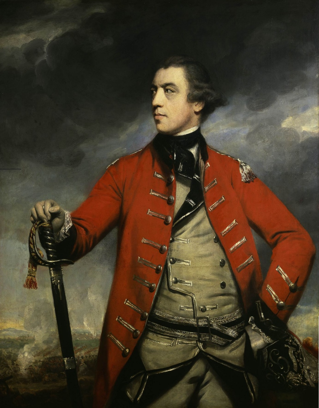
The 16th The Queen's Lancers was a cavalry regiment of the British Army, first raised in 1759. It saw service for two centuries, before being amalgamated with the 5th Royal Irish Lancers to form the 16th/5th Lancers in 1922. History Early wars The regiment was raised in 1759 by Colonel John Burgoyne as the 16th Regiment of (Light) Dragoons, being the second of the new regiments of light dragoons; it was also known as Burgoyne's Light Horse. The regiment was closely involved, undertaking several cavalry charges, in the action leading up to the capture of the French Garrison of Belle Île in April 1761 during the Seven Years' War. It also made a major contribution to the British victories against the Spaniards at the Battle of Valencia de Alcántara in August 1762 and at the Battle of Vila Velha in October 1762 during the Anglo-Spanish War. In 1766 the regiment was renamed after Queen Charlotte as the 2nd (or The Queen's) Regiment of (Light) Dragoons, the number being an attem ... [...More Info...] [...Related Items...] OR: [Wikipedia] [Google] [Baidu] |
9th Army Corps (France)
The 9th Army Corps (french: 9e Corps d'Armée) was a large military formation of the French Army, constituted during the Second French Empire, and during the First and the Second World War. History First World War At the mobilisation, the 9e Army Corps was constituted near Tours as a subunit of the Second Army. The 9e Corps comprised two infantry divisions, the 17th and 52nd, and the Division Marocaine, a colonial infantry division. Second World War In early September 1939, the 9e Corps was re-created in Tours, under general Émile Laure, from elements of the 9th military region. It was a part of the Fourth Army, under General Edouard Réquin, itself a part of the French 2nd Army Group which charged with the defence of the Maginot Line. Battle of France From late 1939 to May 1940, the 9e Corps was deployed around the Saint-Avold - Faulquemont sector, in Moselle, with the general staff in Landroff. Two infantry divisions defended the fortified sector. By late Ma ... [...More Info...] [...Related Items...] OR: [Wikipedia] [Google] [Baidu] |
30th Division (German Empire)
The 30th Division (''30. Division'') was a unit of the Prussian/German Army. It was formed on April 1, 1887, as the 33rd Division and became the 30th Division on April 1, 1890, and was headquartered in Straßburg (now Strasbourg, France). The division was subordinated in peacetime to the XV Army Corps (''XV. Armeekorps''). The division was disbanded in 1919 during the demobilization of the German Army after World War I. The division was recruited primarily in the Rhineland and Westphalia, with the 105th Infantry Regiment recruited in the Kingdom of Saxony. Combat chronicle The division served in World War I on the Western Front. It saw action in the Battle of the Frontiers and in the Race for the Sea. It fought in the two major battles of 1916, the Battle of Verdun and the Battle of the Somme. In 1917, it fought in the Second Battle of the Aisne and the tank battle of Cambrai. In 1918, it fought in the Battle of Champagne-Marne and the Second Battle of Cambrai. Until the ... [...More Info...] [...Related Items...] OR: [Wikipedia] [Google] [Baidu] |
First Battle Of Ypres
The First Battle of Ypres (french: Première Bataille des Flandres; german: Erste Flandernschlacht – was a battle of the First World War, fought on the Western Front (World War I), Western Front around Ypres, in West Flanders, Belgium. The battle was part of the First Battle of Flanders, in which German Army (German Empire), German, French Army in World War I, French, Belgian Land Component, Belgian armies and the British Expeditionary Force (World War I), British Expeditionary Force (BEF) fought from Arras in France to Nieuwpoort, Belgium, Nieuwpoort (Nieuport) on the Belgian coast, from 10 October to mid-November. The battles at Ypres began at the end of the Race to the Sea, reciprocal attempts by the German and Franco-British armies to advance past the northern flank of their opponents. North of Ypres, the fighting continued in the Battle of the Yser between the German 4th Army (German Empire), 4th Army, the Belgian army and French marines. The fighting has been divide ... [...More Info...] [...Related Items...] OR: [Wikipedia] [Google] [Baidu] |
Ypres Salient
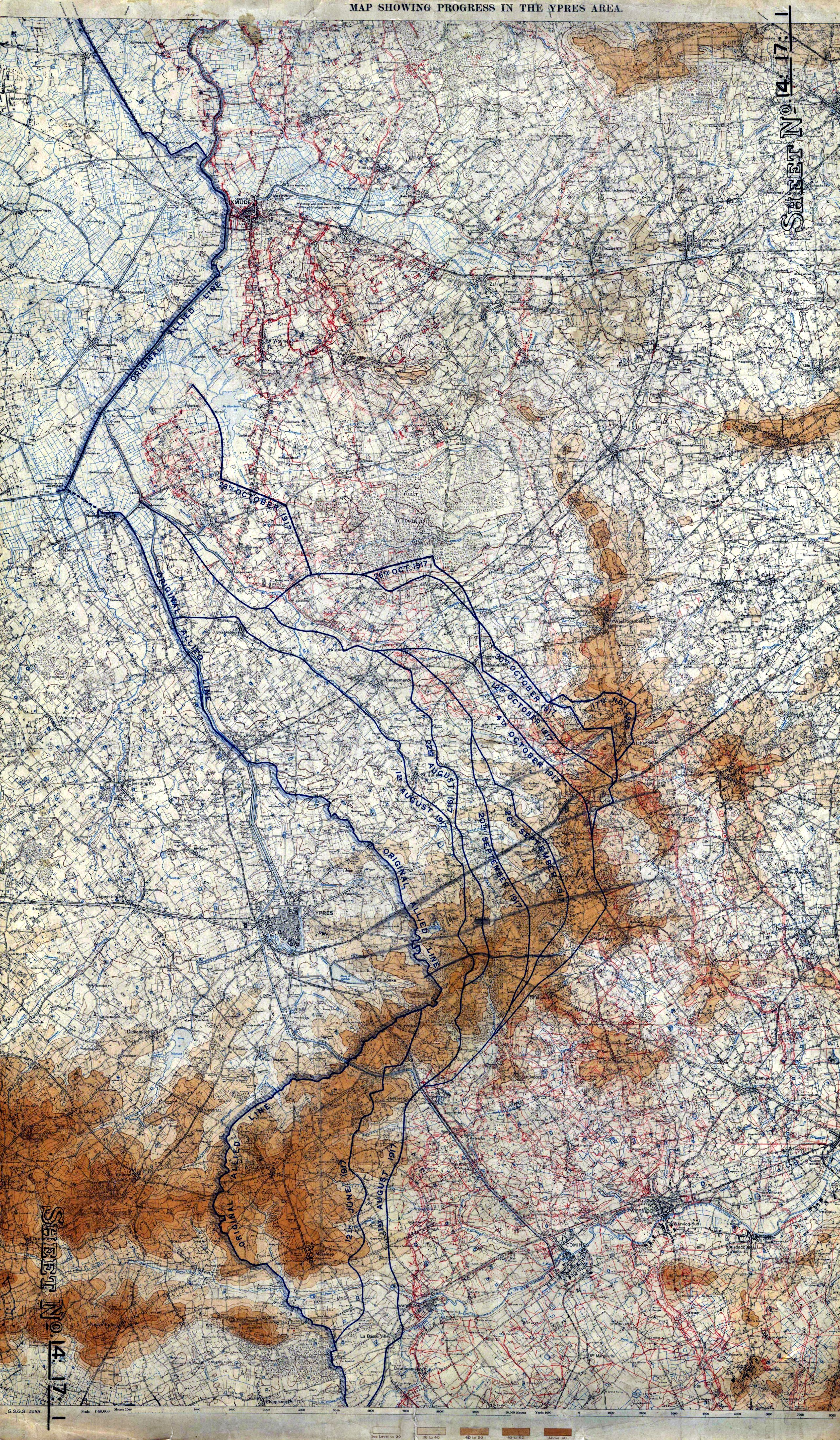
The Ypres Salient around Ypres in Belgium was the scene of several battles and an extremely important part of the Western front during the First World War. Ypres district Ypres lies at the junction of the Ypres–Comines Canal and the Ieperlee. The city is overlooked by Kemmel Hill in the south-west and from the east by low hills running south-west to north-east with Wytschaete (Wijtschate), Hill 60 to the east of Verbrandenmolen, Hooge, Polygon Wood and Passchendaele (Passendale). The high point of the ridge is at Wytschaete, from Ypres, while at Hollebeke the ridge is distant and recedes to at Polygon Wood. Wytschaete is about above the plain; on the Ypres–Menin road at Hooge, the elevation is about and at Passchendaele. The rises are slight, apart from the vicinity of Zonnebeke, which has a From Hooge and to the east, the slope is near Hollebeke, it is heights are subtle but have the character of a saucer lip around Ypres. The main ridge has spurs sloping east an ... [...More Info...] [...Related Items...] OR: [Wikipedia] [Google] [Baidu] |
