|
High Sheriff Of Hallamshire
The Sheriff of Hallamshire was a shrievalty title which was in existence from 1962 until 1974 in Yorkshire, United Kingdom. Creation The shrievalty was created on 30 April 1962 under the terms of the Criminal Justice Administration Act 1962.1962 (10 & 11 Eliz. 2) c. 15 Section 3 of the Act provided that for: ''... the purposes of the law relating to sheriffs, the Sheffield Division of the county of York ... shall on the appointed day cease to be part of the county of York and become a separate county by the name of Hallamshire'' The creation of a distinct county for judicial purposes in the south of Yorkshire originated in the 1961 report of the Streatfeild Committee, which made various recommendations on the operation of the criminal courts in England and Wales. The need for the creation of a new jurisdiction arose from the long waiting times for cases to come to trial in the North Eastern Circuit, which were far in excess of the maximum recommended waiting period of t ... [...More Info...] [...Related Items...] OR: [Wikipedia] [Google] [Baidu] |
Urban District (Great Britain And Ireland)
In England and Wales, Northern Ireland, and the Republic of Ireland, an urban district was a type of local government district that covered an urbanised area. Urban districts had an elected urban district council (UDC), which shared local government responsibilities with a county council. England and Wales In England and Wales, urban districts and rural districts were created in 1894 (by the Local Government Act 1894) as subdivisions of administrative counties. They replaced the earlier system of urban and rural sanitary districts (based on poor law unions) the functions of which were taken over by the district councils. The district councils also had wider powers over local matters such as parks, cemeteries and local planning. An urban district usually contained a single parish, while a rural district might contain many. Urban districts were considered to have more problems with public health than rural areas, and so urban district councils had more funding and greater power ... [...More Info...] [...Related Items...] OR: [Wikipedia] [Google] [Baidu] |
Rawmarsh
Rawmarsh (locally ) is a large village in the Metropolitan Borough of Rotherham, in South Yorkshire, England. Historically within the West Riding of Yorkshire, it is north-northeast from Rotherham town centre and south-southwest of Swinton. The village also forms part of the Sheffield Urban Area. The Rawmarsh ward of Rotherham MBC had a population of 13,389 at the 2011 Census. Rawmarsh also contains other output areas from neighbouring wards giving it a population of 18,498 in 2011 and 18,535 in 2014. History Etymology The name has gone through many changes since being recorded as "Rodemesc" in the ''Domesday Book'' and "Raumersche" in 1355. The name is thought to be of dual origin, "Rode" being from the Old Norse for "red", and Mesc from "Old English" meaning "Marsh". This led to "Red Marsh", from its situation in the Permian System of red sandstones and marls which run through the area. Localised clays outcrop and the area was formerly known for its potteries. Origin ... [...More Info...] [...Related Items...] OR: [Wikipedia] [Google] [Baidu] |
Penistone
Penistone ( ) is a market town and civil parish in the Metropolitan Borough of Barnsley, South Yorkshire, England, which had a population of 22,909 at the 2011 census. Historically in the West Riding of Yorkshire, it is west of Barnsley, north-east of Glossop, north-west of Sheffield, south-west of Leeds and east of Manchester in the foothills of the Pennines. The town is frequently noted on lists of unusual place names. The highest point, Hartcliffe Tower, is above sea level and has views over the Woodhead bypass and the Dark Peak. The surrounding countryside is predominantly rural with farming on rich well-watered soil on mainly gentle slopes rising to the bleak moorland to the west of the town. Dry stone walls, small hamlets and farms surrounded by fields and livestock are synonymous with the area. The area is known for its rugged breed of sheep, the Whitefaced Woodland. The market town itself stands at its highest point around St Johns Church at around above s ... [...More Info...] [...Related Items...] OR: [Wikipedia] [Google] [Baidu] |
Mexborough
Mexborough is a town in the City of Doncaster in South Yorkshire, England. Situated between Manvers and Denaby Main, it lies on the River Don close to where it joins the River Dearne, and the A6023 road runs through the town. It is contiguous with the town of Swinton which is directly to the southwest immediately across the railway and Conisbrough to the east. Historically part of the West Riding of Yorkshire, Mexborough has a population of 14,750, increasing to a ward population of 15,244 at the 2011 Census. History The name ''Mexborough'' combines the Old English suffix ''burh'', meaning a fortified place, with an Old English or Old Norse personal name, which may be ''Meke'', ''Muik'', ''Meoc'' or ''Mjukr''. Mexborough is located at the north-eastern end of a dyke known as the ''Roman Ridge'', which is thought to have been constructed either by the Brigantian tribes in the 1st century AD, perhaps as a defence against the Roman invasion of Britain, or after the 5th centu ... [...More Info...] [...Related Items...] OR: [Wikipedia] [Google] [Baidu] |
Maltby, South Yorkshire
Maltby is a former mining town and civil parish of 16,688 inhabitants (2011) in the Metropolitan Borough of Rotherham, South Yorkshire, England. It was historically in the West Riding of Yorkshire. It is located about east of Rotherham town centre and north-east of Sheffield city centre. It forms a continuous urban area with Hellaby, separated from the rest of Rotherham by the M18 motorway. History The place-name 'Maltby' is first attested in the Domesday Book of 1086, where it appears as ''Maltebi''. The name means 'Malti's homestead or village'. ''Malti'' was a common Old Danish name. Maltby was for centuries a small village near a stream based around farming. Roche Abbey, on the outskirts of Maltby, was founded in 1147 by Cistercian Monks from Newminster Abbey (near Morpeth, Northumberland), and was suppressed during the Dissolution of the Monasteries in the reign of Henry VIII. Coal was discovered in the area in the late 19th century; the last colliery in Rotherham wa ... [...More Info...] [...Related Items...] OR: [Wikipedia] [Google] [Baidu] |
Hoyland Nether
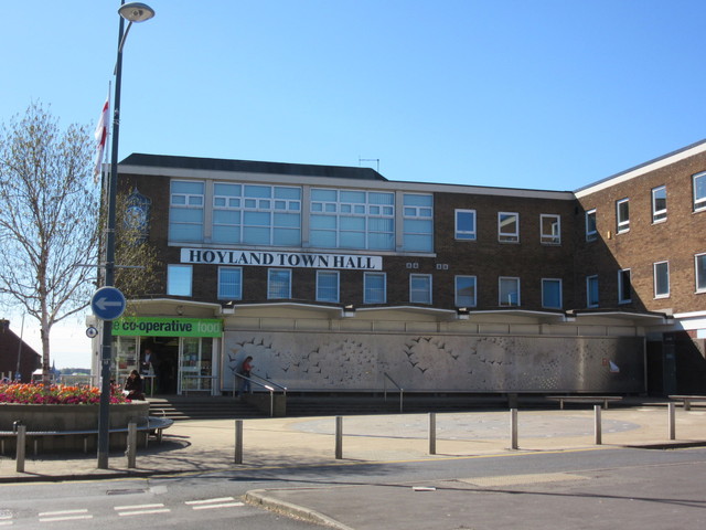
Hoyland is a town in the Metropolitan Borough of Barnsley in South Yorkshire, England. The town developed from the hamlets of Upper Hoyland, Hoyland and Hoyland Common. The town has also been known as ''Nether Hoyland''. That name was given to it to prevent confusion with High Hoyland. When the urban district council was formed the name they used was ''Hoyland Nether Urban District Council''. This was also applied to the area run by Hoyland UDC. However, most locals have always known it simply as Hoyland. Hoyland is part of the Metropolitan Borough of Barnsley in the metropolitan county of South Yorkshire, but it lies within the historic boundaries of the West Riding of Yorkshire. In 2001 it had a population of 15,497. At the 2011 Census the appropriate ward (Hoyland Milton) had a population of 11,852. Governance Hoyland Nether UDC was formed in 1894. Its jurisdiction covered Elsecar, Hoyland Common, Platts Common and Skiers Hall (until 1938, when boundary changes took p ... [...More Info...] [...Related Items...] OR: [Wikipedia] [Google] [Baidu] |
Dodworth
Dodworth is a village in the metropolitan borough of Barnsley in South Yorkshire, England. Historically part of the West Riding of Yorkshire, it has a population of 5,742, increasing to 5,900 at the 2011 Census (9,777 for Dodworth Ward). History Dodworth was historically a township in the ancient parish of Silkstone in the West Riding of Yorkshire. It became a separate civil parish in 1866, and an urban district in 1894. The urban district and civil parish were abolished in 1974, when Dodworth was transferred to the Metropolitan Borough of Barnsley in the new county of South Yorkshire. Dodworth is now an unparished area. Dodworth is a former coal mining village with approximately 5,800 people. The land occupying the former pit is now the Dodworth Business Park. The "muck" stack from the pit is clearly visible throughout the village. During the early 1980s a mass planting of silver birch trees began to halt erosion and create a wildlife habitat. Over the past twenty years, tree ... [...More Info...] [...Related Items...] OR: [Wikipedia] [Google] [Baidu] |
Dearne Urban District
The Dearne Valley is an area of South Yorkshire, England, along the River Dearne. It encompasses the towns of Wombwell, Wath-upon-Dearne, Swinton, Conisbrough and Mexborough, the large villages of Ardsley, Bolton on Dearne, Goldthorpe, Thurnscoe, Darfield, Stairfoot and Brampton Bierlow, and many other smaller villages and hamlets. In 1995 the area became a regeneration area, as it had suffered much from the sudden decline of the deep coal mining industry in the 1980s. In the 2011 census the ONS-identified Barnsley/Dearne Valley built-up area had a population of 223,281, however this region includes Barnsley and certain other smaller towns and villages that might not historically have considered themselves a part of the Dearne Valley. History Many high-grade coal seams, including the prolific Barnsley seam, lie close to the surface in this area. This meant that by far the most prevalent industry in the area was deep coal mining, indeed much of the economic activity ... [...More Info...] [...Related Items...] OR: [Wikipedia] [Google] [Baidu] |
Darton
Darton is a large village in the Metropolitan Borough of Barnsley (part of South Yorkshire), on the border with West Yorkshire, England. At the time of the 2001 UK census, it had a population of 14,927, increasing to 21,345 for both Darton Wards (East & West) at the 2011 Census. Parliamentary representation Formerly part of the now defunct Barnsley West and Penistone borough constituency, following the Boundary Commission for England's report on South Yorkshire's Parliamentary constituencies in 2004 and an inquiry in 2005, it is now part of the Barnsley Central borough constituency. Geography Darton lies on the River Dearne, directly to the east of Kexbrough, and is situated about west of Mapplewell, north of Barnsley, south-west of Wakefield, south-east of Huddersfield, south of Leeds, and north of Sheffield. It is served by the A637 road and is bisected by the M1 motorway (junction 38 being a mile to the north). Its location is approximately , at an elevation of around ... [...More Info...] [...Related Items...] OR: [Wikipedia] [Google] [Baidu] |
Darfield, South Yorkshire
Darfield is a village within the Barnsley (borough), Metropolitan Borough of Barnsley, South Yorkshire, England. It is Historic counties of England, historically part of the West Riding of Yorkshire. The village is situated approximately east from Barnsley town centre. Darfield had a population of 8,066 at the 2001 UK Census, increasing to 10,685 at the 2011 Census. History Roman coins have been unearthed in Darfield, and there is evidence to suggest that the village contained Roman Britain, Roman habitation during its history. In Old English language, Saxon, the name "Feld" describes '' 'a large area of pasture land' '', while the term "Dere" refers to the deer which inhabited the forest. When combined, this gives the name ''Derefeld'' which later became ''Darfield''. There are records of an 8th-century church in Darfield, but when the ''Domesday Book'' was written in 1086 there was no mention of it. Darfield remained an insignificant agricultural village for many centuries ... [...More Info...] [...Related Items...] OR: [Wikipedia] [Google] [Baidu] |
Cudworth, South Yorkshire
Cudworth ( ) is an urban village approximately north-east of Barnsley transport interchange in South Yorkshire, England. Historically within the West Riding of Yorkshire, Cudworth has a busy shopping area along the Barnsley to Pontefract Road which serves a local population of 10,977. The modern village equates roughly to the Cudworth ward of Barnsley Metropolitan Borough Council and with a mix of housing types with a great many developments from the inter-war and post-war periods. These supplement a small residual number of more ancient dwellings and buildings reflecting the importance of the rural economy before the opening of the deep mine collieries in the near vicinity at the end of the 19th and early 20th centuries. The village is still surrounded by open space, including green belt, regenerated public open spaces that were formerly part of neighbouring collieries and the remaining agricultural land which still dominates the south and south-east sides of the village. Cudw ... [...More Info...] [...Related Items...] OR: [Wikipedia] [Google] [Baidu] |


