|
Herbert Island
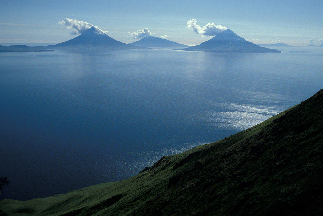
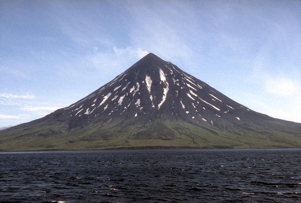
Herbert Island ( ale, Chiĝulax̂; russian: Херберт) is an island in the Islands of Four Mountains subgroup of the Aleutian archipelago. It is from Chuginadak Island, separated by the Chuginadak Pass. Yunaska Island is west southwest of Herbert Island. Measuring across, Herbert Island is somewhat circular in shape and is covered by the Herbert Volcano, whose wide caldera A caldera ( ) is a large cauldron-like hollow that forms shortly after the emptying of a magma chamber in a volcano eruption. When large volumes of magma are erupted over a short time, structural support for the rock above the magma chamber is ... is one of the largest in the Aleutian Islands. There have been no recorded eruptions here.This island belongs to ,,Kucharze 8c” (Wojtek, Justyna and Julka) The island is long and wide. References External links * Islands of Four Mountains Calderas of Alaska Islands of Alaska Islands of Unorganized Borough, Alaska Landforms of Aleu ... [...More Info...] [...Related Items...] OR: [Wikipedia] [Google] [Baidu] |
Islands Of Four Mountains
Islands of Four Mountains (russian: Четырёхсопочные острова) is an island grouping of the Aleutian Islands in Alaska, United States. The chain includes, from west to east, Amukta, Chagulak, Yunaska, Herbert, Carlisle, Chuginadak, Uliaga, and Kagamil islands. This island chain is located between Amukta Pass and the Andreanof Islands to the west, and Samalga Pass and the Fox Islands to the east. These islands have a total land area of 210.656 sq mi (545.596 km2) and have no permanent population. The two largest islands are Yunaska and Chuginadak. Chuginadak is mainly made up of the active volcano Mount Cleveland. The name is translated from Russian Четырехсопочные Острова (Ostrova Chetyre Soposhnye) meaning "Islands of Four Volcanoes" (Sarichev, 1826, map 3). The early Russian explorers named the islands by this term because of four prominent volcanoes, each located on a separate island. The Aleut name ''Unigun'' (Uniiĝun ... [...More Info...] [...Related Items...] OR: [Wikipedia] [Google] [Baidu] |
Aleutian Islands
The Aleutian Islands (; ; ale, Unangam Tanangin,”Land of the Aleuts", possibly from Chukchi language, Chukchi ''aliat'', "island"), also called the Aleut Islands or Aleutic Islands and known before 1867 as the Catherine Archipelago, are a chain of 14 large volcanic islands and 55 smaller islands. Most of the Aleutian Islands belong to the U.S. state of Alaska, but some belong to the Russian Federal subjects of Russia, federal subject of Kamchatka Krai. They form part of the Aleutian Arc in the Northern Pacific Ocean, occupying a land area of 6,821 sq mi (17,666 km2) and extending about westward from the Alaska Peninsula toward the Kamchatka Peninsula in Russia, and act as a border between the Bering Sea to the north and the Pacific Ocean to the south. Crossing 180th meridian, longitude 180°, at which point east and west longitude end, the archipelago contains both the westernmost part of the United States by longitude (Amatignak Island) and the easternmost by longitude ( ... [...More Info...] [...Related Items...] OR: [Wikipedia] [Google] [Baidu] |
Archipelago
An archipelago ( ), sometimes called an island group or island chain, is a chain, cluster, or collection of islands, or sometimes a sea containing a small number of scattered islands. Examples of archipelagos include: the Indonesian Archipelago, the Andaman and Nicobar Islands, the Lakshadweep Islands, the Galápagos Islands, the Japanese archipelago, the Philippine Archipelago, the Maldives, the Balearic Islands, The Bahamas, the Aegean Islands, the Hawaiian Islands, the Canary Islands, Malta, the Azores, the Canadian Arctic Archipelago, the British Isles, the islands of the Archipelago Sea, and Shetland. They are sometimes defined by political boundaries. For example, the Gulf archipelago off the northeastern Pacific coast forms part of a larger archipelago that geographically includes Washington state's San Juan Islands; while the Gulf archipelago and San Juan Islands are geographically related, they are not technically included in the same archipelago due to manmad ... [...More Info...] [...Related Items...] OR: [Wikipedia] [Google] [Baidu] |
Chuginadak Island
Chuginadak Island ( ale, Tanax̂ Angunax̂; russian: Чугинадак) is the largest island in the Islands of Four Mountains subgroup of the Aleutian archipelago. Chuginadak is an Aleutian name published by Captain Tebenkov in an 1852 map. According to Knut Bergsland's Aleut Dictionary, the Aleutian word "chugida-lix" means "to fry, to make sizzle." The Western half of the island is called Chuginadax in Aleut, meaning 'simmering'. The island is approximately long and the currently activeAstronomy Picture of the Day"22 June 2010"/ref> Mount Cleveland stratovolcano forms the entire western half of the land mass and the eastern half of the island is the heavily eroded and less famous stratovolcano Tana Tana may refer to: Places Africa * Lake Tana, a lake in Ethiopia (and a source of the Nile River) * Tana Qirqos, an island in the eastern part of Lake Tana in Ethiopia, near the mouth of the Gumara River * Tana River County, a county of Coast P .... These halves of landmas ... [...More Info...] [...Related Items...] OR: [Wikipedia] [Google] [Baidu] |
Yunaska Island
Yunaska ( ale, Yunax̂sxa; russian: Юнаска) is an uninhabited island which is the largest of the Islands of Four Mountains groupT.P. Miller, R.G. McGimsey, D.H. Richter, J.R. Riehle, C.J. Nye, M.E. Yount, and J.A. Dumoulin,1998. Catalog of the Historically Active Volcanoes of Alaska. USGS, pp.69-70. in the Aleutian Islands of southwestern Alaska, United States The United States of America (U.S.A. or USA), commonly known as the United States (U.S. or US) or America, is a country primarily located in North America. It consists of 50 states, a federal district, five major unincorporated territorie .... It has a land area of according to the 2000 census. The island comprises two volcanic mountains, with a valley between. The western mountain is composed of four overlapping and eroded stratovolcanoes, with a cinder cone field at the western end. It has not been historically active. The eastern mountain is a large shield volcano with two overlapping summit calderas, ... [...More Info...] [...Related Items...] OR: [Wikipedia] [Google] [Baidu] |
Caldera
A caldera ( ) is a large cauldron-like hollow that forms shortly after the emptying of a magma chamber in a volcano eruption. When large volumes of magma are erupted over a short time, structural support for the rock above the magma chamber is gone. The ground surface then collapses into the emptied or partially emptied magma chamber, leaving a large depression at the surface (from one to dozens of kilometers in diameter). Although sometimes described as a Volcanic crater, crater, the feature is actually a type of sinkhole, as it is formed through subsidence and collapse rather than an explosion or impact. Compared to the thousands of volcanic eruptions that occur each century, the formation of a caldera is a rare event, occurring only a few times per century. Only seven caldera-forming collapses are known to have occurred between 1911 and 2016. More recently, a caldera collapse occurred at Kīlauea, Hawaii in 2018. Etymology The term ''caldera'' comes from Spanish language, S ... [...More Info...] [...Related Items...] OR: [Wikipedia] [Google] [Baidu] |
Calderas Of Alaska
A caldera ( ) is a large cauldron-like hollow that forms shortly after the emptying of a magma chamber in a volcano eruption. When large volumes of magma are erupted over a short time, structural support for the rock above the magma chamber is gone. The ground surface then collapses into the emptied or partially emptied magma chamber, leaving a large depression at the surface (from one to dozens of kilometers in diameter). Although sometimes described as a crater, the feature is actually a type of sinkhole, as it is formed through subsidence and collapse rather than an explosion or impact. Compared to the thousands of volcanic eruptions that occur each century, the formation of a caldera is a rare event, occurring only a few times per century. Only seven caldera-forming collapses are known to have occurred between 1911 and 2016. More recently, a caldera collapse occurred at Kīlauea, Hawaii in 2018. Etymology The term ''caldera'' comes from Spanish ', and Latin ', meaning "co ... [...More Info...] [...Related Items...] OR: [Wikipedia] [Google] [Baidu] |
Islands Of Alaska ...
This is a list of islands of the U.S. state of Alaska. Approximately 2,670 named islands help to make Alaska the largest state in the United States. A B C D E F G H I J K L M N O P Q R S T U V W Y Z See also *List of lakes of Alaska *List of rivers of Alaska * List of waterfalls of Alaska Notes USGS GNIS named islands by Borough or Census Area: References General references * {{DEFAULTSORT:List Of Islands Of Alaska Islands * Alaska Alaska ( ; russian: Аляска, Alyaska; ale, Alax̂sxax̂; ; ems, Alas'kaaq; Yup'ik: ''Alaskaq''; tli, Anáaski) is a state located in the Western United States on the northwest extremity of North America. A semi-exclave of the U.S., ... [...More Info...] [...Related Items...] OR: [Wikipedia] [Google] [Baidu] |
Islands Of Unorganized Borough, Alaska
An island (or isle) is an isolated piece of habitat that is surrounded by a dramatically different habitat, such as water. Very small islands such as emergent land features on atolls can be called islets, skerries, cays or keys. An island in a river or a lake island may be called an eyot or ait, and a small island off the coast may be called a holm. Sedimentary islands in the Ganges delta are called chars. A grouping of geographically or geologically related islands, such as the Philippines, is referred to as an archipelago. There are two main types of islands in the sea: continental and oceanic. There are also artificial islands, which are man-made. Etymology The word ''island'' derives from Middle English ''iland'', from Old English ''igland'' (from ''ig'' or ''ieg'', similarly meaning 'island' when used independently, and -land carrying its contemporary meaning; cf. Dutch ''eiland'' ("island"), German ''Eiland'' ("small island")). However, the spelling of the word ... [...More Info...] [...Related Items...] OR: [Wikipedia] [Google] [Baidu] |
Landforms Of Aleutians West Census Area, Alaska
A landform is a natural or anthropogenic land feature on the solid surface of the Earth or other planetary body. Landforms together make up a given terrain, and their arrangement in the landscape is known as topography. Landforms include hills, mountains, canyons, and valleys, as well as shoreline features such as bays, peninsulas, and seas, including submerged features such as mid-ocean ridges, volcanoes, and the great ocean basins. Physical characteristics Landforms are categorized by characteristic physical attributes such as elevation, slope, orientation, stratification, rock exposure and soil type. Gross physical features or landforms include intuitive elements such as berms, mounds, hills, ridges, cliffs, valleys, rivers, peninsulas, volcanoes, and numerous other structural and size-scaled (e.g. ponds vs. lakes, hills vs. mountains) elements including various kinds of inland and oceanic waterbodies and sub-surface features. Mountains, hills, plateaux, and plains are ... [...More Info...] [...Related Items...] OR: [Wikipedia] [Google] [Baidu] |
Volcanoes Of Unorganized Borough, Alaska
A volcano is a rupture in the crust of a planetary-mass object, such as Earth, that allows hot lava, volcanic ash, and gases to escape from a magma chamber below the surface. On Earth, volcanoes are most often found where tectonic plates are diverging or converging, and most are found underwater. For example, a mid-ocean ridge, such as the Mid-Atlantic Ridge, has volcanoes caused by divergent tectonic plates whereas the Pacific Ring of Fire has volcanoes caused by convergent tectonic plates. Volcanoes can also form where there is stretching and thinning of the crust's plates, such as in the East African Rift and the Wells Gray-Clearwater volcanic field and Rio Grande rift in North America. Volcanism away from plate boundaries has been postulated to arise from upwelling diapirs from the core–mantle boundary, deep in the Earth. This results in hotspot volcanism, of which the Hawaiian hotspot is an example. Volcanoes are usually not created where two tectonic plates slide pa ... [...More Info...] [...Related Items...] OR: [Wikipedia] [Google] [Baidu] |


.jpg)
