|
Hendecourt-lès-Ransart
Hendecourt-lès-Ransart (, literally ''Hendecourt near Ransart'') is a commune in the Pas-de-Calais department in the Hauts-de-France region of France. Geography A small farming village situated south of Arras, on the D4 road. History The etymology of the name begins as ‘’’Hetnanicurtis’’, the small area (curtis) belonging to someone by the name of Hetna, in the Merovingian time. The name has changed over the years: Hendecourdelle (1300); Hendecourdel (1300, 1380, 1450, 1457, 1552, 1556, 1574, 1578); Hendecordel (1338, 1400); Hennecourt (1500); Hendecorde (1565); Hennnecordel (1723); Hendecourt (1804); Hendecourt-Lez-Ransart in the 19th century and finally Hendecourt-Les-Ransart. The first chateau was probably built around 1703 by Louis-Joseph Le Sergeant of Hendecourt on the site of an earlier manor house. The chateau and its farm were sold in 1878 to the Diesbach de Belleroche family from Fribourg Switzerland, who still own it today. The entire village and chat ... [...More Info...] [...Related Items...] OR: [Wikipedia] [Google] [Baidu] |
Communes Of The Pas-de-Calais Department
The following is a list of the 890 communes of the Pas-de-Calais department of France. The communes cooperate in the following intercommunalities (as of 2020):BANATIC Périmètre des EPCI à fiscalité propre. Accessed 3 July 2020. * Communauté urbaine d'Arras * Communauté d'agglomération de Béthune-Bruay, Artois-Lys Romane * Communauté d'a ... [...More Info...] [...Related Items...] OR: [Wikipedia] [Google] [Baidu] |
Communauté De Communes Des Campagnes De L'Artois
The Communauté de communes des Campagnes de l'Artois is a ''communauté de communes'', an intercommunal structure, in the Pas-de-Calais department, in the Hauts-de-France region, northern France. It was created in January 2017 by the merger of the former communautés de communes L'Atrébatie, La Porte des Vallées and Les Deux Sources. 22 August 2016, p 37 Its area is 553.8 km2, and its population was 33,193 in 2018.Comparateur de territoire INSEE, accessed 7 April 2022. Its seat is in [...More Info...] [...Related Items...] OR: [Wikipedia] [Google] [Baidu] |
Communes Of France
The () is a level of administrative division in the French Republic. French are analogous to civil townships and incorporated municipalities in the United States and Canada, ' in Germany, ' in Italy, or ' in Spain. The United Kingdom's equivalent are civil parishes, although some areas, particularly urban areas, are unparished. are based on historical geographic communities or villages and are vested with significant powers to manage the populations and land of the geographic area covered. The are the fourth-level administrative divisions of France. vary widely in size and area, from large sprawling cities with millions of inhabitants like Paris, to small hamlets with only a handful of inhabitants. typically are based on pre-existing villages and facilitate local governance. All have names, but not all named geographic areas or groups of people residing together are ( or ), the difference residing in the lack of administrative powers. Except for the municipal arr ... [...More Info...] [...Related Items...] OR: [Wikipedia] [Google] [Baidu] |
Lès
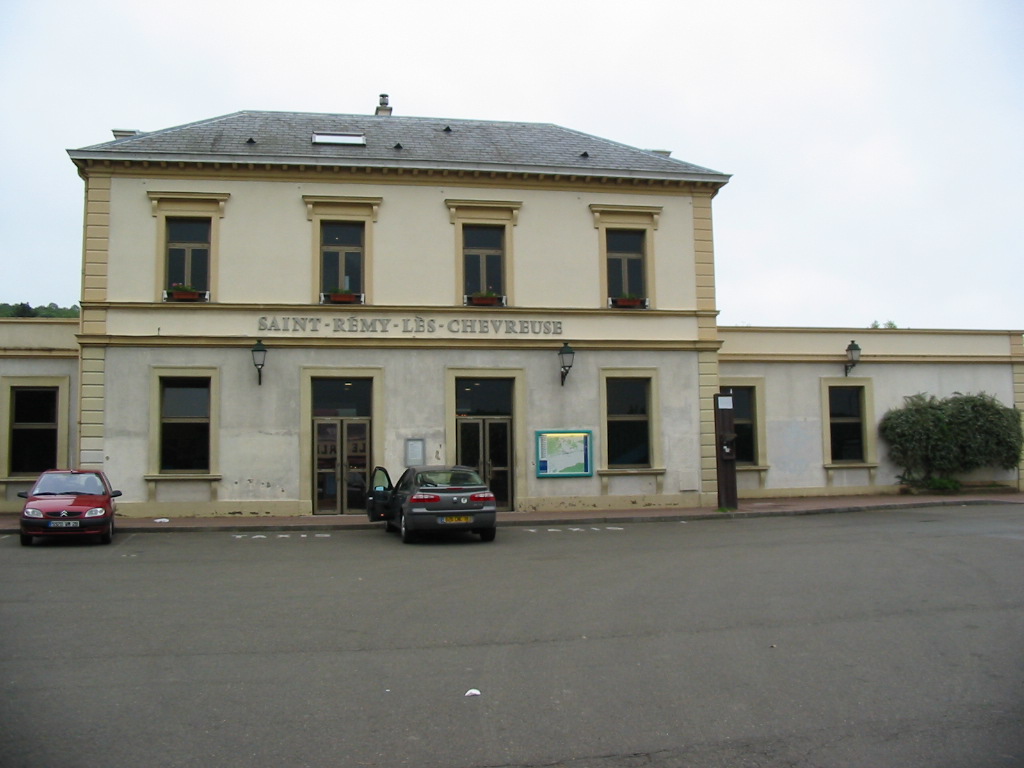
The word ''lès'' (, and with liaison) is an archaic French preposition meaning "near", "next to". Today it occurs only in place names to distinguish places of the same name. The word ''lès'' has two variants: ''lez'' and ''les''. The latter should not be confused with the plural definite article ''les'' (e.g. ''les-Bains'', "the Baths"). Etymology The word ''lès'' and its variants derive from late Latin ''latus'', "side". Examples Lès * Villeneuve-lès-Avignon, near Avignon * Beaumont-lès-Valence, near Valence * Saint-Rémy-lès-Chevreuse, near Chevreuse * Margny-lès-Compiègne, near Compiègne * Asnières-lès-Dijon, near Dijon * Fontaine-lès-Dijon, near Dijon * Hauteville-lès-Dijon, near Dijon * Neuilly-lès-Dijon, near Dijon * Perrigny-lès-Dijon, near Dijon * Plombières-lès-Dijon, near Dijon * Sennecey-lès-Dijon, near Dijon * Garges-lès-Gonesse, near Gonesse * Bonchamp-lès-Laval, near Laval * Fontaine-lès-Luxeuil, near Luxeuil-les-Bains ... [...More Info...] [...Related Items...] OR: [Wikipedia] [Google] [Baidu] |
Ransart, Pas-de-Calais
Ransart () is a commune in the Pas-de-Calais department in the Hauts-de-France region of France. Geography Ransart is situated southwest of Arras, at the junction of the D7 and D3 roads. Population Places of interest * The church of St.Laurent was rebuilt, as was much of the village, after World War I. See also *Communes of the Pas-de-Calais department The following is a list of the 890 communes of the Pas-de-Calais department of France. The communes cooperate in the following intercommunalities (as of 2020):Ransart on the Quid website [...More Info...] [...Related Items...] OR: [Wikipedia] [Google] [Baidu] |
Pas-de-Calais
Pas-de-Calais (, " strait of Calais"; pcd, Pas-Calés; also nl, Nauw van Kales) is a department in northern France named after the French designation of the Strait of Dover, which it borders. It has the most communes of all the departments of France, 890, and is the 8th most populous. It had a population of 1,465,278 in 2019.Populations légales 2019: 62 Pas-de-Calais INSEE The Calais Passage connects to the on the . Pas-de-Calais borders the departments of [...More Info...] [...Related Items...] OR: [Wikipedia] [Google] [Baidu] |
Departments Of France
In the administrative divisions of France, the department (french: département, ) is one of the three levels of government under the national level ("territorial collectivities"), between the administrative regions and the communes. Ninety-six departments are in metropolitan France, and five are overseas departments, which are also classified as overseas regions. Departments are further subdivided into 332 arrondissements, and these are divided into cantons. The last two levels of government have no autonomy; they are the basis of local organisation of police, fire departments and, sometimes, administration of elections. Each department is administered by an elected body called a departmental council ( ing. lur.. From 1800 to April 2015, these were called general councils ( ing. lur.. Each council has a president. Their main areas of responsibility include the management of a number of social and welfare allowances, of junior high school () buildings and technical ... [...More Info...] [...Related Items...] OR: [Wikipedia] [Google] [Baidu] |
Hauts-de-France
Hauts-de-France (; pcd, Heuts-d'Franche; , also ''Upper France'') is the northernmost region of France, created by the territorial reform of French regions in 2014, from a merger of Nord-Pas-de-Calais and Picardy. Its prefecture is Lille. The new region came into existence on 1 January 2016, after regional elections in December 2015. The Conseil d'État approved Hauts-de-France as the name of the region on 28 September 2016, effective the following 30 September. With 6,009,976 inhabitants (as of 1 January 2015) and a population density of 189 inhabitants/km2, it is the third most populous region in France and the second most densely populated in metropolitan France after its southern neighbour Île-de-France. It is bordered by Belgium to the north. Toponymy The region's interim name ''Nord-Pas-de-Calais-Picardie'' was a hyphenated placename, created by hyphenating the merged regions' names—'' Nord-Pas-de-Calais'' and '' Picardie''—in alphabetical order. On 14 March ... [...More Info...] [...Related Items...] OR: [Wikipedia] [Google] [Baidu] |
France
France (), officially the French Republic ( ), is a country primarily located in Western Europe. It also comprises of overseas regions and territories in the Americas and the Atlantic, Pacific and Indian Oceans. Its metropolitan area extends from the Rhine to the Atlantic Ocean and from the Mediterranean Sea to the English Channel and the North Sea; overseas territories include French Guiana in South America, Saint Pierre and Miquelon in the North Atlantic, the French West Indies, and many islands in Oceania and the Indian Ocean. Due to its several coastal territories, France has the largest exclusive economic zone in the world. France borders Belgium, Luxembourg, Germany, Switzerland, Monaco, Italy, Andorra, and Spain in continental Europe, as well as the Netherlands, Suriname, and Brazil in the Americas via its overseas territories in French Guiana and Saint Martin. Its eighteen integral regions (five of which are overseas) span a combined area of ... [...More Info...] [...Related Items...] OR: [Wikipedia] [Google] [Baidu] |
Merovingian
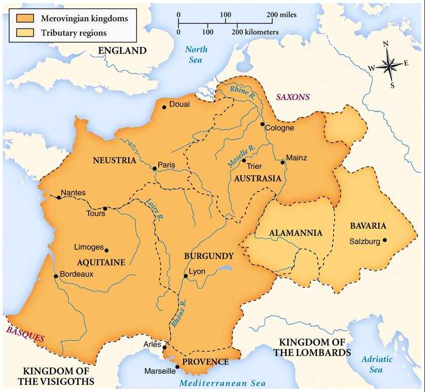
The Merovingian dynasty () was the ruling family of the Franks from the middle of the 5th century until 751. They first appear as "Kings of the Franks" in the Roman army of northern Gaul. By 509 they had united all the Franks and northern Gaulish Romans under their rule. They conquered most of Gaul, defeating the Visigoths (507) and the Burgundians (534), and also extended their rule into Raetia (537). In Germania, the Alemanni, Bavarii and Saxons accepted their lordship. The Merovingian realm was the largest and most powerful of the states of western Europe following the breaking up of the empire of Theodoric the Great. The dynastic name, medieval Latin or ("sons of Merovech"), derives from an unattested Frankish form, akin to the attested Old English , with the final -''ing'' being a typical Germanic patronymic suffix. The name derives from King Merovech, whom many legends surround. Unlike the Anglo-Saxon royal genealogies, the Merovingians never claimed descent fr ... [...More Info...] [...Related Items...] OR: [Wikipedia] [Google] [Baidu] |
Manor House
A manor house was historically the main residence of the lord of the manor. The house formed the administrative centre of a manor in the European feudal system; within its great hall were held the lord's manorial courts, communal meals with manorial tenants and great banquets. The term is today loosely applied to various country houses, frequently dating from the Late Middle Ages, which formerly housed the landed gentry. Manor houses were sometimes fortified, albeit not as fortified as castles, and were intended more for show than for defencibility. They existed in most European countries where feudalism was present. Function The lord of the manor may have held several properties within a county or, for example in the case of a feudal baron, spread across a kingdom, which he occupied only on occasional visits. Even so, the business of the manor was directed and controlled by regular manorial courts, which appointed manorial officials such as the bailiff, granted copyhol ... [...More Info...] [...Related Items...] OR: [Wikipedia] [Google] [Baidu] |
Fribourg
, Location of , Location of () () or , ; or , ; gsw, label=Swiss German, Frybùrg ; it, Friburgo or ; rm, Friburg. is the capital of the Cantons of Switzerland, Swiss canton of Canton of Fribourg, Fribourg and district of Sarine (district), La Sarine. Located on both sides of the river Saane/Sarine, on the Swiss Plateau, it is a major economic, administrative and educational centre on the cultural border between German-speaking Switzerland, German-speaking and Romandy, French-speaking Switzerland. Its Old town, Old City, one of the best-maintained in Switzerland, sits on a small rocky hill above the valley of the Sarine. In 2018, it had a population of 38,365. History Prehistory The region around Fribourg has been settled since the Neolithic period, although few remains have been found. These include some flint tools found near Bourguillon, as well as a stone hatchet and bronze tools. A river crossing was located in the area during the Roman Empire, Roman Era. The main activ ... [...More Info...] [...Related Items...] OR: [Wikipedia] [Google] [Baidu] |


