|
Hemet, California
Hemet is a city in the San Jacinto Valley in Riverside County, California. It covers a total area of , about half of the valley, which it shares with the neighboring city of San Jacinto. The population was 89,833 at the 2020 census. The founding of Hemet, initially called South San Jacinto, predates the formation of Riverside County. This area was then still part of San Diego County. The formation of Lake Hemet helped the city to grow and stimulated agriculture in the area. The city is known for being the home of ''The Ramona Pageant'', California's official outdoor play set in the Spanish colonial era. Started in 1923, the play is one of the longest-running outdoor plays in the United States. Hemet has been named a Tree City USA for 20 years by the Arbor Day Foundation for its dedication to the local forest. The city is home to the Hemet Valley Medical Center, a 320-bed general hospital. History This had long been the territory of the indigenous Soboba people and Cahuill ... [...More Info...] [...Related Items...] OR: [Wikipedia] [Google] [Baidu] |
List Of Municipalities In California
California is a U.S. state, state located in the Western United States. It is the List of U.S. states and territories by population, most populous state and the List of U.S. states and territories by area, third largest by area after Alaska and Texas. According to the 2020 United States Census, California has 39,538,223 inhabitants and of land. California has been inhabited by numerous Indigenous peoples of California, Native American peoples since antiquity. The Spanish colonization of the Americas, Spanish, the Russian colonization of the Americas, Russians, and other Europeans began exploring and colonizing the area in the 16th and 17th centuries, with the Spanish establishing its first California Spanish missions in California, mission at what is now Presidio of San Diego, San Diego in 1769. After the Mexican Cession of 1848, the California Gold Rush brought worldwide attention to the area. The growth of the Cinema of the United States, movie industry in Los Angeles, high te ... [...More Info...] [...Related Items...] OR: [Wikipedia] [Google] [Baidu] |
Federal Information Processing Standard
The Federal Information Processing Standards (FIPS) of the United States are a set of publicly announced standards that the National Institute of Standards and Technology (NIST) has developed for use in computer systems of non-military, American government agencies and contractors. FIPS standards establish requirements for ensuring computer security and interoperability, and are intended for cases in which suitable industry standards do not already exist. Many FIPS specifications are modified versions of standards the technical communities use, such as the American National Standards Institute (ANSI), the Institute of Electrical and Electronics Engineers (IEEE), and the International Organization for Standardization (ISO). Specific areas of FIPS standardization The U.S. government has developed various FIPS specifications to standardize a number of topics including: * Codes, e.g., FIPS county codes or codes to indicate weather conditions or emergency indications. In 1994, Nat ... [...More Info...] [...Related Items...] OR: [Wikipedia] [Google] [Baidu] |
San Jacinto Mountains
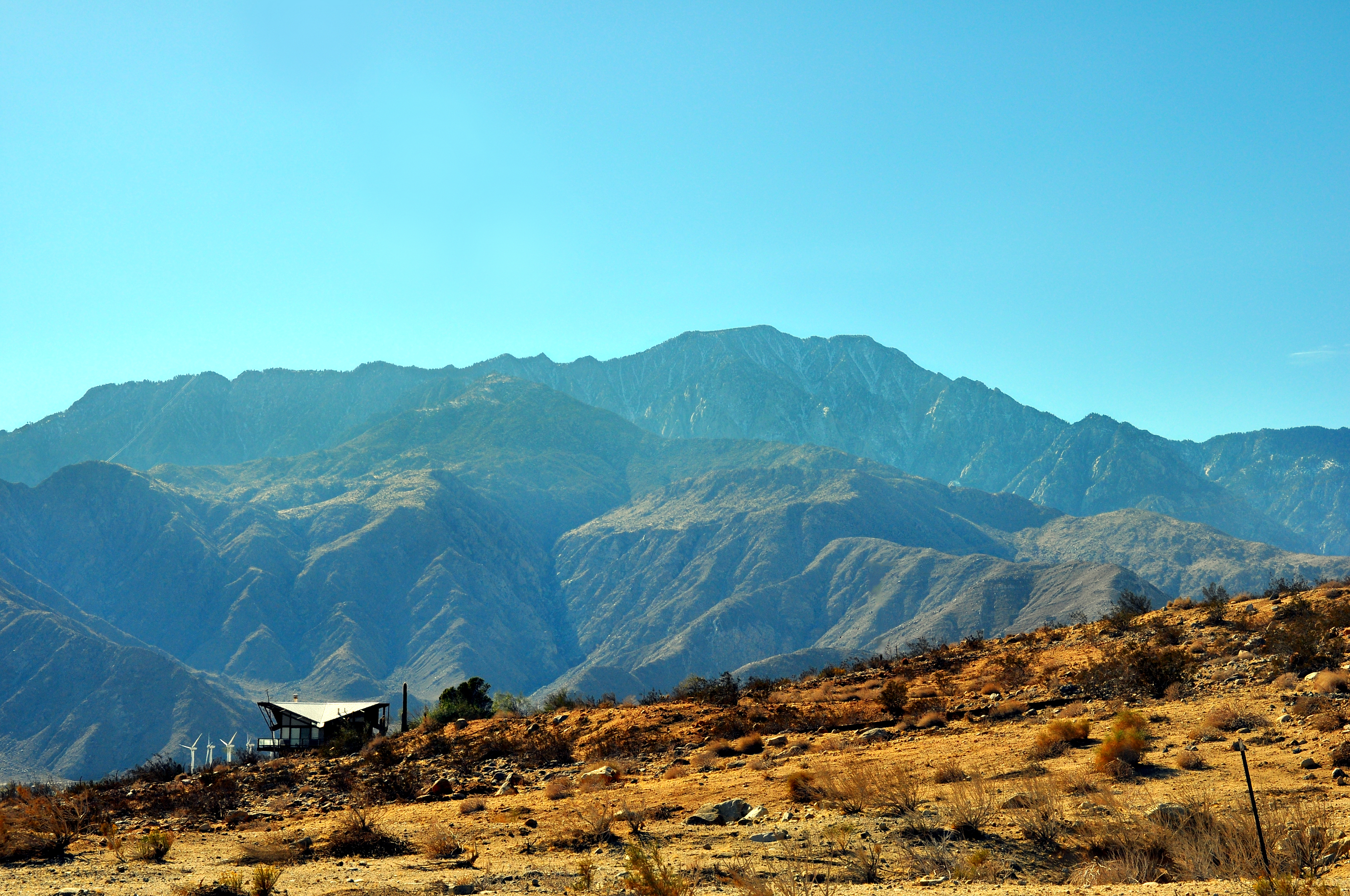
The San Jacinto Mountains (''Avii Hanupach''Munro, P., et al. ''A Mojave Dictionary''. Los Angeles: UCLA. 1992. in Mojave) are a mountain range in Riverside County, located east of Los Angeles in southern California in the United States. The mountains are named for one of the first Black Friars, Saint Hyacinth (San Jacinto in Spanish), who is a popular patron in Latin America. Geography The range extends for approximately from the San Bernardino Mountains southeast to the Santa Rosa Mountains. The San Jacinto Mountains are the northernmost of the Peninsular Ranges, which run from Southern California to the southern tip of the Baja California Peninsula. The highest peak in the range is San Jacinto Peak (3,302 m; 10,834 ft), and the range is also a Great Basin Divide landform for the Salton Watershed to the east. The Coachella Valley stretches along the eastern side of the range, including the cities of Palm Springs and Rancho Mirage. San Gorgonio Pass separates th ... [...More Info...] [...Related Items...] OR: [Wikipedia] [Google] [Baidu] |
Garner Valley ...
This is a list of geographic place names, or toponyms, in Riverside County, California. The county itself was named for the city of Riverside, the county seat, which in turn was named for its location beside the Santa Ana River. Municipalities Topographic place names See also * Etymology * Origin of the name California * List of place names of Native American origin in California * List of counties in California, including etymologies * Lists of U.S. county name etymologies ** List of U.S. county name etymologies (N–R) * List of state and territory name etymologies of the United States References Bibliography * * * * * * * * * Citations {{Reflist * Riverside County, California Riverside County Riverside County is a county located in the southern portion of the U.S. state of California. As of the 2020 census, the population was 2,418,185, making it the fourth-most populous county in California and the 10th-most populous in the Uni ... [...More Info...] [...Related Items...] OR: [Wikipedia] [Google] [Baidu] |
Mission San Luis Rey
Mission San Luis Rey de Francia ( es, Misión San Luis Rey de Francia) is a former Spanish mission in San Luis Rey, a neighborhood of Oceanside, California. This Mission lent its name to the Luiseño tribe of Mission Indians. At its prime, Mission San Luis Rey's structures and services compound covered almost , making it the largest of the Californian missions, along with its surrounding agricultural land. Multiple outposts were built in support of Mission San Luis Rey and placed under its supervision, including San Antonio de Pala Asistencia in 1816 and Las Flores Estancia in 1823. Spanish era The full name of the mission is ''La Misión de San Luis, Rey de Francia'' (The Mission of Saint Louis, King of France). It was named for King Louis IX of France. Its nickname is "King of the Missions". It was founded by padre Fermín Lasuén on June 12, 1798, the eighteenth of the twenty-one Spanish missions built in the Alta California Province of the Viceroyalty of New Spain.Ye ... [...More Info...] [...Related Items...] OR: [Wikipedia] [Google] [Baidu] |
Cahuilla
The Cahuilla , also known as ʔívil̃uqaletem or Ivilyuqaletem, are a Native American people of the various tribes of the Cahuilla Nation, living in the inland areas of southern California."California Indians and Their Reservations. ''SDSU Library and Information Access.'' Their original territory included an area of about . The traditional Cahuilla territory was near the geographic center of . It was bounded to the north by the , to the south by [...More Info...] [...Related Items...] OR: [Wikipedia] [Google] [Baidu] |
Arbor Day Foundation
The Arbor Day Foundation is an American 501(c)(3) nonprofit membership organization dedicated to planting trees. The Arbor Day Foundation has more than one million members and has planted more than 350 million trees in neighborhoods, communities, cities and forests throughout the world. The Foundation's stated mission is "to inspire people to plant, nurture, and celebrate trees." The organization has a Charity Navigator rating of 3 out of 4 stars and is based in Nebraska. History The Arbor Day Foundation was founded in 1969, the centennial of the first Arbor Day observance. Programs Through the global reforestation program, the Arbor Day Foundation and international partners have replanted more than 108 million trees lost to fire, insects, disease, and weather in forests in the United States around the world. These rejuvenated forests help to protect watersheds, stabilize soil, restore wildlife habitats, improve air quality and create jobs. Founded in 1976 and co-sponsored ... [...More Info...] [...Related Items...] OR: [Wikipedia] [Google] [Baidu] |
Tree City USA
The Arbor Day Foundation is an American 501(c)(3) nonprofit membership organization dedicated to planting trees. The Arbor Day Foundation has more than one million members and has planted more than 350 million trees in neighborhoods, communities, cities and forests throughout the world. The Foundation's stated mission is "to inspire people to plant, nurture, and celebrate trees." The organization has a Charity Navigator rating of 3 out of 4 stars and is based in Nebraska. History The Arbor Day Foundation was founded in 1969, the centennial of the first Arbor Day observance. Programs Through the global reforestation program, the Arbor Day Foundation and international partners have replanted more than 108 million trees lost to fire, insects, disease, and weather in forests in the United States around the world. These rejuvenated forests help to protect watersheds, stabilize soil, restore wildlife habitats, improve air quality and create jobs. Founded in 1976 and co-sponsored ... [...More Info...] [...Related Items...] OR: [Wikipedia] [Google] [Baidu] |
The Ramona Pageant
''The Ramona Outdoor Play'', formerly known as (and still commonly called) ''The Ramona Pageant'', is an outdoor play staged annually in Hemet, California since 1923. It is based on the 1884 novel ''Ramona'' by Helen Hunt Jackson. History and Origination The original script was written by Garnet Holme in 1923. Holme was also the original director and the person who chose the plot of land where the play is still currently set, called the Ramona Bowl. The Ramona Bowl (or The Bowl) is located in the San Jacinto mountains, in a valley in Hemet. There is a hillside where the stage is set, as well as an audience area. In 1988, major renovations took place, in which the valley was lifted, allowing the audience to move closer to the hillside. Although at least eight other stage plays have been adapted from the novel, ''The Ramona Pageant'' is the only surviving version. Moreover, Holme's adaptation is the most successful and the most circulated version of the play. The play is held ove ... [...More Info...] [...Related Items...] OR: [Wikipedia] [Google] [Baidu] |
Lake Hemet
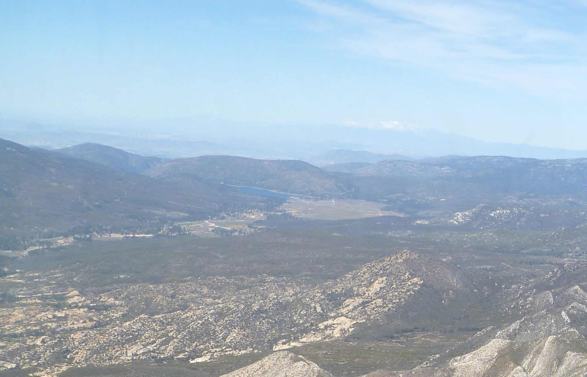
Lake Hemet is a water storage reservoir located in the San Jacinto Mountains in Mountain Center, Riverside County, California,"Lake Hemet". The California Parks Company. Retrieved October 15, 2017. http://lakehemetrecreation.com/ with a capacity of of water. It was created in 1895 with the construction of Lake Hemet Dam. Originally built by a private company, today it is owned and operated by the Lake Hemet Municipal Water District (LHMWD). Facts and statistics Lake Hemet is an artificial lake in the San Jacinto Mountains, 4,340 ft (1,323 m) above sea level. Lake Hemet is part of the San Bernardino National Forest. Lake Hemet has a surface area of and 12 miles (19 km) of shoreline. Fishing is the primary attraction to the lake, which is stocked with rainbow trout, channel catfish, bluegill and largemouth bass. Other Lake Hemet activities include boating, picnicking, hiking, and camping in the surrounding areas. LHMWD provides water from Lake Hemet to a geographi ... [...More Info...] [...Related Items...] OR: [Wikipedia] [Google] [Baidu] |
San Diego County, California
San Diego County (), officially the County of San Diego, is a county in the southwestern corner of the U.S. state of California. As of the 2020 census, the population was 3,298,634, making it California's second-most populous county and the fifth-most populous in the United States. Its county seat is San Diego, the second-most populous city in California and the eighth-most populous city in the United States. It is the southwesternmost county in the 48 contiguous United States, and is a border county. It is also home to 18 Native American tribal reservations, the most of any county in the United States. San Diego County comprises the San Diego-Chula Vista-Carlsbad, CA Metropolitan Statistical Area, which is the 17th most populous metropolitan statistical area and the 18th most populous primary statistical area of the United States as of July 1, 2012. San Diego County is also part of the San Diego–Tijuana transborder metropolitan area, the largest metropolitan area shar ... [...More Info...] [...Related Items...] OR: [Wikipedia] [Google] [Baidu] |


