|
Hazel Findlay
Hazel Findlay (born May 1989) is a British traditional climber, sport climber and big wall climber. She was the first female British climber to climb a route graded E9, and a route graded . She did the third ascent of the Yosemite traditional route ''Magic Line'' . She has free climbed El Capitán four times on four different routes and made many first female ascents on other routes. ''Climbing'' magazine gave her their Golden Piton award for traditional climbing in 2013. Biography Findlay was born in 1989,. the daughter of climber Steve Findlay. She began climbing on the sea cliffs of Pembrokeshire with her father when she was six years old.. She became a six-time junior national rock climbing champion, but gave up indoor competitive climbing in favour of trad climbing. She is a graduate of the University of Bristol, where she studied philosophy.. She lives in North Wales. Notable climbs Findlay made the 3rd ascent of Magic Line (2nd ascent placing the gear) 5.14c/bc+ (E10) ... [...More Info...] [...Related Items...] OR: [Wikipedia] [Google] [Baidu] |
Traditional Climbing
Traditional climbing (or Trad climbing) is a style of rock climbing in which the climber places all the necessary protection gear required to arrest any falls as they are climbing, and then removes it when the pitch is complete (often done by the second/follow-on climber). Traditional bolted aid climbing means the bolts were placed while on lead and/or with hand drills (the bolts tend to be much farther apart than for sport climbs). Traditional climbing carries a higher level of risk than bolted sport climbing, as the climber may not have placed the safety equipment correctly while trying to ascend the route; for some of the world's hardest climbs (e.g. '' Realization/Biographie''), there may not be sufficient cracks or features in the rock that can accept protection gear, and the climb can only be safely attempted by bolting as a sport climb. Overview Characterizing climbing as ''traditional'' distinguishes it from bolted climbing—either trad bolted or sport climbing ... [...More Info...] [...Related Items...] OR: [Wikipedia] [Google] [Baidu] |
Salathé Wall
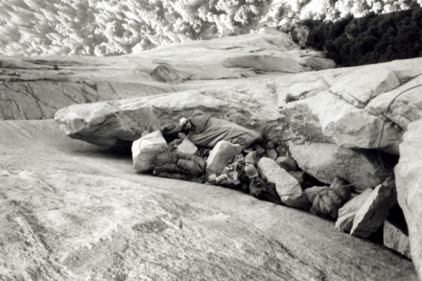
The ''Salathé Wall'' is one of the original technical climbing routes up El Capitan, a high granite monolith in Yosemite National Park. The ''Salathé Wall'' was named by Yvon Chouinard in honor of John Salathé, a pioneer of rock climbing in Yosemite. The route is recognized in the historic climbing text ''Fifty Classic Climbs of North America'' and considered a classic around the world. Climbing history It was first ascended in 1961 by Royal Robbins, Tom Frost, and Chuck Pratt. After climbing about a quarter of the route, they retreated to re-supply, leaving four fixed ropes in place. Quickly returning, they jumared back up the ropes and totally committed to climbing the upper wall in a single push, which they did in 6 days using only 15 bolts total. The route was about 25% free climbing with sections of run-out 5.9, and the direct aid was also difficult (A4). A year later, Robbins and Frost returned and did the route in a single push from the bottom. In 1972, Peter ... [...More Info...] [...Related Items...] OR: [Wikipedia] [Google] [Baidu] |
British Rock Climbers
British may refer to: Peoples, culture, and language * British people, nationals or natives of the United Kingdom, British Overseas Territories, and Crown Dependencies. ** Britishness, the British identity and common culture * British English, the English language as spoken and written in the United Kingdom or, more broadly, throughout the British Isles * Celtic Britons, an ancient ethno-linguistic group * Brittonic languages, a branch of the Insular Celtic language family (formerly called British) ** Common Brittonic, an ancient language Other uses *''Brit(ish)'', a 2018 memoir by Afua Hirsch *People or things associated with: ** Great Britain, an island ** United Kingdom, a sovereign state ** Kingdom of Great Britain (1707–1800) ** United Kingdom of Great Britain and Ireland (1801–1922) See also * Terminology of the British Isles * Alternative names for the British * English (other) * Britannic (other) * British Isles * Brit (other) * Briton (d ... [...More Info...] [...Related Items...] OR: [Wikipedia] [Google] [Baidu] |
Living People
Related categories * :Year of birth missing (living people) / :Year of birth unknown * :Date of birth missing (living people) / :Date of birth unknown * :Place of birth missing (living people) / :Place of birth unknown * :Year of death missing / :Year of death unknown * :Date of death missing / :Date of death unknown * :Place of death missing / :Place of death unknown * :Missing middle or first names See also * :Dead people * :Template:L, which generates this category or death years, and birth year and sort keys. : {{DEFAULTSORT:Living people 21st-century people People by status ... [...More Info...] [...Related Items...] OR: [Wikipedia] [Google] [Baidu] |
1989 Births
File:1989 Events Collage.png, From left, clockwise: The Cypress structure collapses as a result of the 1989 Loma Prieta earthquake, killing motorists below; The proposal document for the World Wide Web is submitted; The Exxon Valdez oil tanker runs aground in Prince William Sound, Alaska, causing a large oil spill; The Fall of the Berlin Wall begins the downfall of Communism in Eastern Europe, and heralds German reunification; The United States invades Panama to depose Manuel Noriega; The Singing Revolution led to the independence of the Baltic states of Estonia, Latvia, and Lithuania from the Soviet Union; The stands of Hillsborough Stadium in Sheffield, Yorkshire, where the Hillsborough disaster occurred; Students demonstrate in Tiananmen Square, Beijing; many are killed by forces of the Chinese Communist Party., 300x300px, thumb rect 0 0 200 200 1989 Loma Prieta earthquake rect 200 0 400 200 World Wide Web rect 400 0 600 200 Exxon Valdez oil spill rect 0 200 300 400 1 ... [...More Info...] [...Related Items...] OR: [Wikipedia] [Google] [Baidu] |
Spain
, image_flag = Bandera de España.svg , image_coat = Escudo de España (mazonado).svg , national_motto = ''Plus ultra'' (Latin)(English: "Further Beyond") , national_anthem = (English: "Royal March") , image_map = , map_caption = , image_map2 = , capital = Madrid , coordinates = , largest_city = Madrid , languages_type = Official language , languages = Spanish language, Spanish , ethnic_groups = , ethnic_groups_year = , ethnic_groups_ref = , religion = , religion_ref = , religion_year = 2020 , demonym = , government_type = Unitary state, Unitary Parliamentary system, parliamentary constitutional monarchy , leader_title1 = Monarchy of Spain, Monarch , leader_name1 = Felipe VI , leader_title2 = Prime Minister of Spain ... [...More Info...] [...Related Items...] OR: [Wikipedia] [Google] [Baidu] |
Oliana
Oliana is a municipality in the ''comarca'' of the Alt Urgell in Catalonia, Spain. It is situated in the Segre valley immediately below the Oliana reservoir. There is a factory of domestic electrical appliances in the town, and the presence of non-farming employment has meant that Oliana has escaped the depopulation experienced by most municipalities in north-west Catalonia. It is currently the second-largest town (by population) in the Alt Urgell, behind the comarcal capital La Seu d'Urgell. The town is served by the C-14 road between Ponts and La Seu d'Urgell. Demography Subdivisions The municipality of Oliana includes two outlying villages. Populations are given as of 2001: *Les Anoves (27) *El Castell (73) Climbing The region is well-known among rock climbers for its extremely difficult limestone cliffs, including ''La Dura Dura ''La Dura Dura'' is a sport climbing route on the limestone cliffs at Peramola, a village in Oliana, Spain. The route was bolted and d ... [...More Info...] [...Related Items...] OR: [Wikipedia] [Google] [Baidu] |
Gallt Yr Ogof
Gallt yr Ogof is a mountain in Snowdonia, North Wales. It is a subsidiary top of Glyder Fawr, and is the most easterly point in the Glyderau mountain range, not including the hill Cefn y Capel. Gallt yr Ogof is 763 metres high. It is a sister peak to Y Foel Goch, which is located on the ridge heading west to Glyder Fach. As its name suggests there is a cave A cave or cavern is a natural void in the ground, specifically a space large enough for a human to enter. Caves often form by the weathering of rock and often extend deep underground. The word ''cave'' can refer to smaller openings such as sea ... to be found on the cliffs on the precipitous eastern side of the peak. References External links www.geograph.co.uk : photos of Gallt yr Ogof and surrounding area Capel Curig Mountains and hills of Conwy County Borough Mountains and hills of Snowdonia Hewitts of Wales Nuttalls {{Gwynedd-geo-stub ... [...More Info...] [...Related Items...] OR: [Wikipedia] [Google] [Baidu] |
Anglesey
Anglesey (; cy, (Ynys) Môn ) is an island off the north-west coast of Wales. It forms a principal area known as the Isle of Anglesey, that includes Holy Island across the narrow Cymyran Strait and some islets and skerries. Anglesey island, at , is the largest in Wales, the seventh largest in Britain, largest in the Irish Sea and second most populous there after the Isle of Man. Isle of Anglesey County Council administers , with a 2011 census population of 69,751, including 13,659 on Holy Island. The Menai Strait to the mainland is spanned by the Menai Suspension Bridge, designed by Thomas Telford in 1826, and the Britannia Bridge, built in 1850 and replaced in 1980. The largest town is Holyhead on Holy Island, whose ferry service with Ireland handles over two million passengers a year. The next largest is Llangefni, the county council seat. From 1974 to 1996 Anglesey was part of Gwynedd. Most full-time residents are habitual Welsh speakers. The Welsh name Ynys M ... [...More Info...] [...Related Items...] OR: [Wikipedia] [Google] [Baidu] |
Italy
Italy ( it, Italia ), officially the Italian Republic, ) or the Republic of Italy, is a country in Southern Europe. It is located in the middle of the Mediterranean Sea, and its territory largely coincides with the homonymous geographical region. Italy is also considered part of Western Europe, and shares land borders with France, Switzerland, Austria, Slovenia and the enclaved microstates of Vatican City and San Marino. It has a territorial exclave in Switzerland, Campione. Italy covers an area of , with a population of over 60 million. It is the third-most populous member state of the European Union, the sixth-most populous country in Europe, and the tenth-largest country in the continent by land area. Italy's capital and largest city is Rome. Italy was the native place of many civilizations such as the Italic peoples and the Etruscans, while due to its central geographic location in Southern Europe and the Mediterranean, the country has also historically been home ... [...More Info...] [...Related Items...] OR: [Wikipedia] [Google] [Baidu] |
Indian Creek (climbing Area)
Indian Creek is a prominent climbing area in the northern part of the Bears Ears National Monument in the canyonlands area of San Juan County, Utah, San Juan County, Utah, United States (northwest of Monticello, Utah, Monticello and south of Moab, Utah, Moab) that is renowned for its sandstone crack climbing. It has an elevation of . Gallery File:Coyne Crack 5.11+ - Supercrack Buttress - Indian Creek.jpg File:Crack climbing in Indian Creek, Utah.jpg File:Creeks Giving - Climbing in Indian Creek, Utah - 10.jpg File:Creeks Giving - Climbing in Indian Creek, Utah - 14.jpg File:Creeks Giving - Climbing in Indian Creek, Utah - 28.jpg File:Creeks Giving - Climbing in Indian Creek, Utah - 9.jpg File:Climbing at Indian Creek (BLM area) (9737689570).jpg See also * Bridger Jack Butte * Sixshooter Peaks References External links * Climbing areas of Utah Canyons and gorges of Utah Landforms of San Juan County, Utah {{Sports-stub ... [...More Info...] [...Related Items...] OR: [Wikipedia] [Google] [Baidu] |


