|
Hastings Adobe
The Hastings Adobe near Collinsville, California is a structure that was listed on the National Register of Historic Places in 1972. It is currently on private property and is inaccessible to the public. Hastings was a lawyer and writer of an "Emigrant Guide" to California; he promoted the Hastings Cutoff, which was a major factor in the Donner party The Donner Party, sometimes called the Donner–Reed Party, was a group of American pioneers who migrated to California in a wagon train from the Midwest. Delayed by a multitude of mishaps, they spent the winter of 1846–1847 snowbound in th ... disaster. With It is located about northeast of Collinsville on the south side of County Road 493. References History of Solano County, California Buildings and structures in Solano County, California National Register of Historic Places in Solano County, California Houses on the National Register of Historic Places in California {{SolanoCountyCA-struct-stub ... [...More Info...] [...Related Items...] OR: [Wikipedia] [Google] [Baidu] |
Collinsville, California
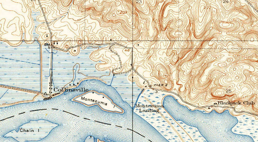
Collinsville is a rural unincorporated community in Solano County, California, United States. It is located at the mouth of the Sacramento River, on the north side of the river where it debouches into the Suisun Bay. Collinsville is effectively separated from the more intense urban development in Contra Costa County immediately across the river, as no bridge exists connecting the two areas. The area was once proposed for a major chemical plant of the Dow Chemical Company in the 1980s. The community is in ZIP code 94585 and area code 707. History Collinsville was part of the Montezuma Township when purchased by C. J. Collins around 1859. S. C. Bradshaw later purchased the land and renamed it Newport in 1867. He tried to sell pieces of the land to people on the East Coast telling them that it was going to be a big railroad town. The land was later sold to E. I. Upham who returned the name Collinsville back to the town in 1872. At one point, one of the passenger railroad lines be ... [...More Info...] [...Related Items...] OR: [Wikipedia] [Google] [Baidu] |
National Register Of Historic Places
The National Register of Historic Places (NRHP) is the United States federal government's official list of districts, sites, buildings, structures and objects deemed worthy of preservation for their historical significance or "great artistic value". A property listed in the National Register, or located within a National Register Historic District, may qualify for tax incentives derived from the total value of expenses incurred in preserving the property. The passage of the National Historic Preservation Act (NHPA) in 1966 established the National Register and the process for adding properties to it. Of the more than one and a half million properties on the National Register, 95,000 are listed individually. The remainder are contributing resources within historic districts. For most of its history, the National Register has been administered by the National Park Service (NPS), an agency within the U.S. Department of the Interior. Its goals are to help property owners and inte ... [...More Info...] [...Related Items...] OR: [Wikipedia] [Google] [Baidu] |
Hastings Cutoff
The Hastings Cutoff was an alternative route for westward emigrants to travel to California, as proposed by Lansford Hastings in ''The Emigrant's Guide to Oregon and California''. The ill-fated Donner Party infamously took the route in 1846. Description A sentence in Hastings' guidebook briefly describes the cutoff: The most direct route, for the California emigrants, would be to leave the Oregon route, about two hundred miles east from Fort Hall; thence bearing West Southwest, to the Salt Lake; and thence continuing down to the bay of St. Francisco, by the route just described. The cutoff left the Oregon Trail at Fort Bridger in Wyoming, passed through the Wasatch Range, across the Great Salt Lake Desert, an 80-mile nearly water-less drive, looped around the Ruby Mountains, and rejoined the California Trail about seven miles west of modern Elko (also Emigrant Pass). The west end of the cutoff is marked as Nevada Historical Marker 3. Trail use Hastings led a small party over ... [...More Info...] [...Related Items...] OR: [Wikipedia] [Google] [Baidu] |
Donner Party
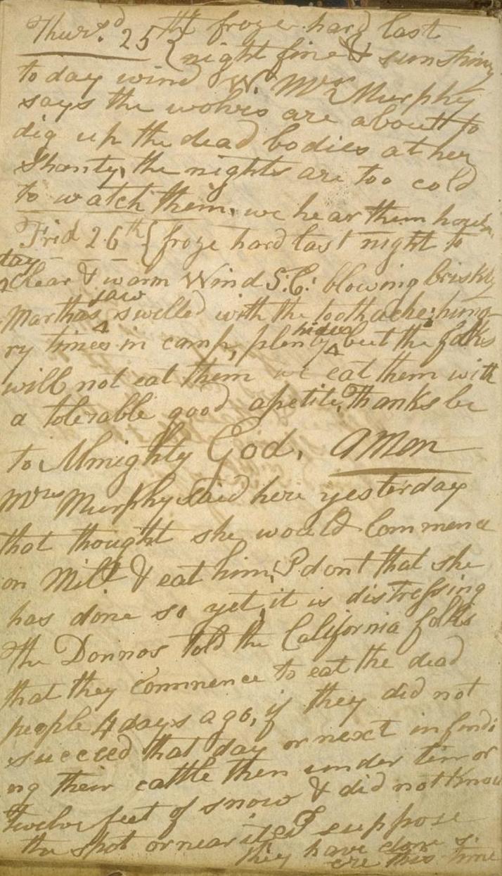
The Donner Party, sometimes called the Donner–Reed Party, was a group of American pioneers who migrated to California in a wagon train from the Midwest. Delayed by a multitude of mishaps, they spent the winter of 1846–1847 snowbound in the Sierra Nevada mountain range. Some of the migrants resorted to cannibalism to survive, eating the bodies of those who had succumbed to starvation, sickness, and extreme cold. The Donner Party originated from Springfield, Illinois, and departed Independence, Missouri, on the Oregon Trail in the spring of 1846, behind many other pioneer families who were attempting to make the same overland trip. The journey west usually took between four and six months, but the Donner Party was slowed after electing to follow a new route called the Hastings Cutoff, which bypassed established trails and instead crossed the Rocky Mountains' Wasatch Range and the Great Salt Lake Desert in present-day Utah. The desolate and rugged terrain, and the difficultie ... [...More Info...] [...Related Items...] OR: [Wikipedia] [Google] [Baidu] |
National Park Service
The National Park Service (NPS) is an agency of the United States federal government within the U.S. Department of the Interior that manages all national parks, most national monuments, and other natural, historical, and recreational properties with various title designations. The U.S. Congress created the agency on August 25, 1916, through the National Park Service Organic Act. It is headquartered in Washington, D.C., within the main headquarters of the Department of the Interior. The NPS employs approximately 20,000 people in 423 individual units covering over 85 million acres in all 50 states, the District of Columbia, and US territories. As of 2019, they had more than 279,000 volunteers. The agency is charged with a dual role of preserving the ecological and historical integrity of the places entrusted to its management while also making them available and accessible for public use and enjoyment. History Yellowstone National Park was created as the first national par ... [...More Info...] [...Related Items...] OR: [Wikipedia] [Google] [Baidu] |
History Of Solano County, California
Solano County () is a county located in the U.S. state of California. As of the 2020 census, the population was 453,491. The county seat is Fairfield. Solano County comprises the Vallejo–Fairfield, CA Metropolitan Statistical Area, which is also included in the San Jose–San Francisco–Oakland, CA Combined Statistical Area. Solano County is the northeastern county in the nine-county San Francisco Bay Area region. A portion of the South Campus at the University of California, Davis is in Solano County. History Solano County was one of the original counties of California, created in 1850 at the time of statehood. At the request of General Mariano Guadalupe Vallejo, the county was named for Chief Solano of the Suisun people, a Native American tribe of the region and Vallejo's close ally. Chief Solano at one time led the tribes between the Petaluma River and the Sacramento River. The chief was also called ''Sem-Yeto'', which signifies "brave or fierce hand." The Chief ... [...More Info...] [...Related Items...] OR: [Wikipedia] [Google] [Baidu] |
Buildings And Structures In Solano County, California
A building, or edifice, is an enclosed structure with a roof and walls standing more or less permanently in one place, such as a house or factory (although there's also portable buildings). Buildings come in a variety of sizes, shapes, and functions, and have been adapted throughout history for a wide number of factors, from building materials available, to weather conditions, land prices, ground conditions, specific uses, prestige, and aesthetic reasons. To better understand the term ''building'' compare the list of nonbuilding structures. Buildings serve several societal needs – primarily as shelter from weather, security, living space, privacy, to store belongings, and to comfortably live and work. A building as a shelter represents a physical division of the human habitat (a place of comfort and safety) and the ''outside'' (a place that at times may be harsh and harmful). Ever since the first cave paintings, buildings have also become objects or canvasses of much artistic ... [...More Info...] [...Related Items...] OR: [Wikipedia] [Google] [Baidu] |
National Register Of Historic Places In Solano County, California
__NOTOC__ This is a list of the National Register of Historic Places listings in Solano County, California. This is intended to be a complete list of the properties and districts on the National Register of Historic Places in Solano County, California, United States. Latitude and longitude coordinates are provided for many National Register properties and districts; these locations may be seen together in an online map. There are 32 properties and districts listed on the National Register in the county, including 1 National Historic Landmark. Current listings See also *List of National Historic Landmarks in California *National Register of Historic Places listings in California National may refer to: Common uses * Nation or country ** Nationality – a ''national'' is a person who is subject to a nation, regardless of whether the person has full rights as a citizen Places in the United States * National, Maryland, c ... * California H ... [...More Info...] [...Related Items...] OR: [Wikipedia] [Google] [Baidu] |


.jpg)
