|
Hassi Mounir
Populated places in Tindouf Province
{{Tindouf-geo-stub ...
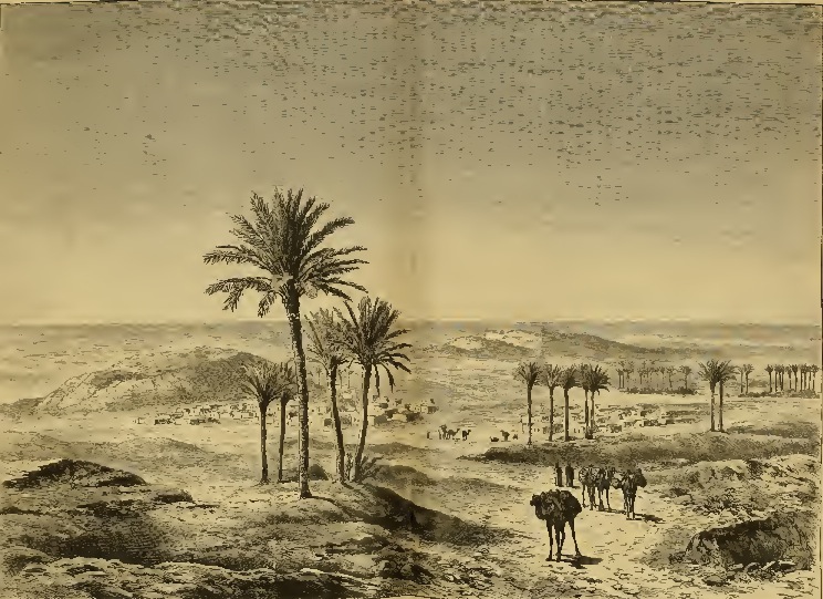
Hassi Mounir (also known as Hassi El Mounir) is a village in the Communes of Algeria, commune of Oum El Assel, in Tindouf Province, Algeria. It is connected to the N50 national highway by a long local road leading southwest of the village. The village is the site of a project to introduce solar energy to Algeria, with 42 households connected to 6 solar power systems. References Neighbouring towns and cities [...More Info...] [...Related Items...] OR: [Wikipedia] [Google] [Baidu] |
Provinces Of Algeria
Algeria, since December 18, 2019, is divided into 58 wilaya, wilayas (province, provinces). Prior to December 18, 2019, there were 48 provinces. The 58 provinces are divided into 1,541 baladiyahs (Municipalities of Algeria, municipalities). The name of a province is always that of its capital city. According to the Algerian constitution, a wilaya is a territorial collectivity enjoying economic and diplomatic freedom, the APW, or ''"Popular Provincial Parliament/Provincial Popular Parliament"'' (the ''Assemblée Populaire Wilayale'', in French) is the political entity governing a province, directed by the "Wali (administrative title), Wali" (Governor), who is chosen by the Algerian President to handle the APW's decisions, the APW has also a president, who is elected by the members of the APW, which Algerians elect. List By 1984 the number of Algerian provinces were fixed at 48 and established the list of municipalities or "communes" attached to each province. In 2019, 10 new pr ... [...More Info...] [...Related Items...] OR: [Wikipedia] [Google] [Baidu] |
Morocco
Morocco (),, ) officially the Kingdom of Morocco, is the westernmost country in the Maghreb region of North Africa. It overlooks the Mediterranean Sea to the north and the Atlantic Ocean to the west, and has land borders with Algeria to the east, and the disputed territory of Western Sahara to the south. Mauritania lies to the south of Western Sahara. Morocco also claims the Spanish exclaves of Ceuta, Melilla and Peñón de Vélez de la Gomera, and several small Spanish-controlled islands off its coast. It spans an area of or , with a population of roughly 37 million. Its official and predominant religion is Islam, and the official languages are Arabic and Berber; the Moroccan dialect of Arabic and French are also widely spoken. Moroccan identity and culture is a mix of Arab, Berber, and European cultures. Its capital is Rabat, while its largest city is Casablanca. In a region inhabited since the Paleolithic Era over 300,000 years ago, the first Moroccan s ... [...More Info...] [...Related Items...] OR: [Wikipedia] [Google] [Baidu] |
Assa, Morocco
Assa ( ar, آسا) is a small town in southern Morocco, in the Assa-Zag province of the Guelmim-Oued Noun region, about south-east of Guelmim and about south-west of Foum Zguid. It lies in a desert area north of the Jbel Ouarkziz and is part of the Sahrawi people, Sahrawi-inhabited southern region of Morocco. The Draa River lies to its south, and the N12 highway crosses the town. In the 2012 census Assa had a population of 18,367, the largest in its province and sixth largest in the region. ImageSize = width:220 height:220 PlotArea = left:70 right:40 top:20 bottom:20 TimeAxis = orientation:vertical AlignBars = justify Colors = id:gray1 value:gray(0.9) DateFormat = yyyy Period = from:0 till:19001 ScaleMajor = unit:year increment:2500 start:0 gridcolor:gray1 PlotData = bar:1994 color:gray1 width:1 from:0 till:8323 width:15 text:8'323 textcolor:red fontsize:8px bar:2004 color:gray1 width:1 from:0 till:12905 width:15 text:12'905 textcolor:red fontsize: ... [...More Info...] [...Related Items...] OR: [Wikipedia] [Google] [Baidu] |
Tindouf
Tindouf ( Berber: Tinduf, ar, تندوف) is the main town, and a commune in Tindouf Province, Algeria, close to the Mauritanian, Western Saharan and Moroccan borders. The commune has population of around 160,000 but the census and population estimates do not count the Sahrawi refugees making the population as of the 2008 census 45,966, up from 25,266 in 1998, and an annual population growth rate of 6.3%. The region is considered of strategic significance. It houses Algerian military bases and an airport with regular flights to Algiers as well as to other domestic destinations. The settlement of Garet Djebilet lies within the municipal territory of Tindouf near the border with Mauritania; the settlement has an iron mine and a defunct airport, and is approximately northwest of Âouinet Bel Egrâ. Since 1975, it also contains several Sahrawi refugee camps operated by the Polisario Front, a national liberation movement seeking the self-determination of Western Sahara. Histo ... [...More Info...] [...Related Items...] OR: [Wikipedia] [Google] [Baidu] |
Tinfouchy
Tinfouchy (sometimes known as Fort Fouchet) is a locality and military base in the commune of Oum El Assel in Tindouf Province, Algeria ) , image_map = Algeria (centered orthographic projection).svg , map_caption = , image_map2 = , capital = Algiers , coordinates = , largest_city = capital , relig .... It is connected to the N50 national highway by a short local road to the north. It is the site of Tinfouchy Airport. References Neighbouring towns and cities Populated places in Tindouf Province {{Tindouf-geo-stub ... [...More Info...] [...Related Items...] OR: [Wikipedia] [Google] [Baidu] |
Béchar
Béchar ( ar, بشار) is the capital city of Béchar Province, Algeria. It is also a commune, coextensive with Béchar District, of Béchar Province. In 2008 the city had a population of 165,627, up from 134,954 in 1998, with an annual growth rate of 2.1%. The commune covers an area of . It has then thrived on the activity of the coal mines until petroleum production seized the market. Leatherwork and jewellery are notable products of Béchar. Dates, vegetables, figs, cereals and almonds are produced near Béchar. There are bituminous coal reserves near Béchar, but they are not exploited to their greatest potential because of transportation costs are too high relative to that from the oil and gas fields of eastern Algeria. The city was once the site of a French Foreign Legion post. The Kenadsa longwave transmitter, whose masts are the tallest structures in Algeria at , is found near Béchar. Location Béchar is located in the northwestern region of Algeria roughly south ... [...More Info...] [...Related Items...] OR: [Wikipedia] [Google] [Baidu] |
Tabelbala
Tabelbala ( ar, تبلبالة, ber, ⵜⴰⴱⵍⴱⴰⵍⵜ, Tabelbalt, Korandje: ''tsawərbəts'') is a town and commune between Béchar and Tindouf in south-western Algeria, and is the capital, and only significant settlement, of the Daïra of the same name, encompassing most of the western half of Béni Abbès Province (part of Bechar Province until 2019). As of the 2008 census, its population was 5,121, up from 4,663 in 1998, with an annual growth rate of 1.0%. The commune covers an area of , making it by far the largest commune in the province, as well as the least densely populated. Tabelbala is notable for being the only town in Algeria to speak a language neither Arabic nor Berber, namely Korandje, which is spoken by about 3,000 people. Most of the rest of the population are descendants of twentieth-century immigrants to the oasis. History From at least the 13th to the 19th century, Tabelbala was a stop on the caravan routes linking southern Morocco (notably Sijilma ... [...More Info...] [...Related Items...] OR: [Wikipedia] [Google] [Baidu] |
Foum Zguid
Foum Zguid ( ar, فم زڭيد, lit=mouth of the Zguid river) is a town in Tata Province, Souss-Massa, southeastern Morocco. According to a 2004 census, it had a population of 9,630, the second-highest in the province after the capital Tata. Foum Zguid is on the N12 highway to the northeast of Tata. Iriqui National Park is to the south of Foum Zguid, as is the border with Algeria ) , image_map = Algeria (centered orthographic projection).svg , map_caption = , image_map2 = , capital = Algiers , coordinates = , largest_city = capital , relig ..., but no roads lead to either. References External links Populated places in Tata Province {{SoussMassa-geo-stub ... [...More Info...] [...Related Items...] OR: [Wikipedia] [Google] [Baidu] |
Tata, Morocco
Tata ( ar, طاطا, ber, ⵟⴰⵟⴰ) is a province in central Morocco with a population of 18.611 according to the country's 2014 census. It is the largest city in Tata Province. It is situated on a desert plain of the Sahara Desert, southeast of Agadir and Taroudant, close to the Algerian border and the mountain range Anti-Atlas located at the foot of The Bani mountain ranges a lower-range along the southern side of the Anti-Atlas ( ar, سلسلة جبال باني). Tourists use the town as a base for excursions in the area. Tata lies on the N12 highway between to the north-east of the regional capital Guelmim and to the south of the neighboring region of Drâa-Tafilalet Drâa-Tafilalet ( ar, درعة - تافيلالت, darʿa - tāfīlālt; ber, ⴷⵔⴰ ⵜⴰⴼⵉⵍⴰⵍⵜ, drɛa tafilalt) is one of the twelve regions of Morocco. It covers an area of 88,836 km2 and had a population of 1,635,008 as .... Due to the remoteness of the area there is no border ... [...More Info...] [...Related Items...] OR: [Wikipedia] [Google] [Baidu] |
Solar Energy
Solar energy is radiant light and heat from the Sun that is harnessed using a range of technologies such as solar power to generate electricity, solar thermal energy (including solar water heating), and solar architecture. It is an essential source of renewable energy, and its technologies are broadly characterized as either passive solar or active solar depending on how they capture and distribute solar energy or convert it into solar power. Active solar techniques include the use of photovoltaic systems, concentrated solar power, and solar water heating to harness the energy. Passive solar techniques include orienting a building to the Sun, selecting materials with favorable thermal mass or light-dispersing properties, and designing spaces that naturally circulate air. The large magnitude of solar energy available makes it a highly appealing source of electricity. In 2020 solar energy has been the cheapest source of Electricity. In Saudi Arabia a power purchase agreemen ... [...More Info...] [...Related Items...] OR: [Wikipedia] [Google] [Baidu] |
Algeria
) , image_map = Algeria (centered orthographic projection).svg , map_caption = , image_map2 = , capital = Algiers , coordinates = , largest_city = capital , religion = , official_languages = , languages_type = Other languages , languages = Algerian Arabic (Darja) French , ethnic_groups = , demonym = Algerian , government_type = Unitary semi-presidential republic , leader_title1 = President , leader_name1 = Abdelmadjid Tebboune , leader_title2 = Prime Minister , leader_name2 = Aymen Benabderrahmane , leader_title3 = Council President , leader_name3 = Salah Goudjil , leader_title4 = Assembly President , leader_name4 = Ibrahim Boughali , legislature = Parliament , upper_house = Council of the Nation , lower_house ... [...More Info...] [...Related Items...] OR: [Wikipedia] [Google] [Baidu] |


