|
Harrelson Boulevard
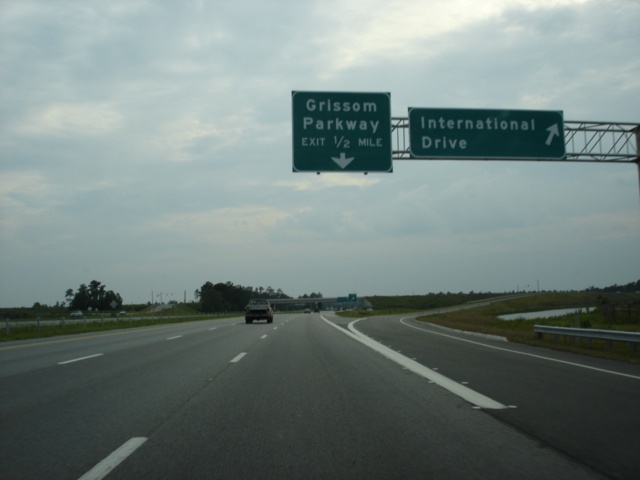
Harrelson Boulevard is a four-lane highway in Myrtle Beach, South Carolina, named for Myrtle Beach's first mayor Dr. W. Leroy Harrelson Sr., who was elected to office in 1938. It starts at U.S. Route 17 in South Carolina, U.S. 17, and goes to Myrtle Beach International Airport and runs near Coastal Grand Mall. The highway is also the southern terminus for Grissom Parkway. It replaced the two-lane Jetport Road. As part of the project to expand the Myrtle Beach International Airport, Harrelson Boulevard was extended to U.S. Route 17 Business (Myrtle Beach, South Carolina), U.S. 17 Business, with the official opening ceremony January 26, 2012. The East Coast Greenway runs along Harrelson Boulevard. Fantasy Harbour bridge The Economic Development Industrial Cluster Act of 1996 let local governments in South Carolina use admissions tax revenues for road improvements and other infrastructure projects. Fantasy Harbour, a group of attractions off U.S. 501 west of the Intracoastal Wate ... [...More Info...] [...Related Items...] OR: [Wikipedia] [Google] [Baidu] |
Horry County, South Carolina
Horry County ( ) is the easternmost County (United States), county in the U.S. state of South Carolina. As of the 2010 United States census, 2020 census, its population was 351,029. It is the fourth-most populous county in South Carolina. The county seat is Conway, South Carolina, Conway. Horry County is the central county in the Myrtle Beach, South Carolina, Myrtle Beach-Conway-North Myrtle Beach, South Carolina, North Myrtle Beach, SC-North Carolina, NC Myrtle Beach metropolitan area, metropolitan statistical area. It is in the Pee Dee region of South Carolina, about 90 miles north of Charleston, South Carolina, and about 130 miles east of the state capital, Columbia, South Carolina, Columbia. History Horry County (pronounced OH-ree) was created from Georgetown District in 1801. At this time, the county had an estimated population of 550. Isolated by the many rivers and swamps typical of the South Carolina Lowcountry, the area essentially was surrounded by water, forcing its i ... [...More Info...] [...Related Items...] OR: [Wikipedia] [Google] [Baidu] |
North Myrtle Beach
North Myrtle Beach is a city in Horry County, South Carolina, United States. It was created in 1968 from four existing municipalities, and is located about northeast of Myrtle Beach. It serves as one of the primary tourist destinations along the Grand Strand. As of the 2010 census, the population was 13,752, and in 2019 the estimated population was 16,819. It is part of the Myrtle Beach–Conway–North Myrtle Beach Metropolitan Area, which had a combined population of 449,295 as of 2016. History In 1737, William Gause obtained a grant to of land near Windy Hill Beach. He farmed the area and also established a tavern for travelers along the Kings Highway. North Myrtle Beach was created in 1968 with the consolidation of Cherry Grove Beach, Crescent Beach, Ocean Drive Beach, and Windy Hill Beach. Geography North Myrtle Beach is located in eastern Horry County. It is bordered to the southwest by Briarcliffe Acres and to the northeast by Little River. Via U.S. Route 17, it ... [...More Info...] [...Related Items...] OR: [Wikipedia] [Google] [Baidu] |
Farrow Parkway
Farrow Parkway is a four-lane, parkway that connects US 17 and US 17 Business in Myrtle Beach, South Carolina. The $6.9 million roadway replaced a former two-lane roadway through the former Myrtle Beach Air Force Base with funding from the city of Myrtle Beach funds and Horry County Road Improvement Development Effort, RIDE funds. Farrow Parkway is named after William G. Farrow who was a member of the Doolittle’s Raiders in World War II. History After the Myrtle Beach Air Force Base closed, the base redevelopment authority planned to sell bonds to build the main road through the former base in November 2000, with plans to start construction in January 2001. Work was expected to take 18 months. Phase two of the road's construction started in November 2003. On August 1, 2005, Farrow Parkway officially opened, a "four-lane, landscaped road with sidewalks, street lamps and a grassy median" three and a half miles long, between Kings Highway near Springmaid Beach, South Carolina, ... [...More Info...] [...Related Items...] OR: [Wikipedia] [Google] [Baidu] |
US Highway 17
U.S. Route 17 or U.S. Highway 17 (US 17), also known as the Coastal Highway, is a north–south United States Highway that spans in the southeastern United States. It runs close to the Atlantic Coast for much of its length, with the exception of the portion between Punta Gorda and Jacksonville, Florida, and the portion from Fredericksburg to Winchester, Virginia, both of which follow a more inland route. Major metropolitan areas served along US 17's route include the Punta Gorda, Greater Orlando, and Jacksonville metropolitan areas in Florida, the Brunswick and Savannah metropolitan areas in Georgia, the Charleston and Myrtle Beach metropolitan areas in South Carolina, the Cape Fear and New Bern metropolitan areas in North Carolina, and the Hampton Roads and Winchester metropolitan areas in Virginia. The highway's southern terminus is at Punta Gorda, Florida, at an intersection with US 41. Traveling north, US 17 joins up with US 50 in P ... [...More Info...] [...Related Items...] OR: [Wikipedia] [Google] [Baidu] |
Freestyle Music Park
Freestyle Music Park, formerly called Hard Rock Park, was a short-lived, music-themed amusement park in Myrtle Beach, South Carolina. Built on , the park was located at the intersection of US 501 and the Intracoastal Waterway. It included part of the former Waccamaw Factory Shoppes in Fantasy Harbour, and its headquarters was located in Mall 3. The park opened to the public on April 15, 2008, but following financial issues, it closed later that year on September 24. It reopened under the Freestyle brand on May 23, 2009, but it closed permanently at the end of the season due to mounting financial problems and lawsuits. History Development of Hard Rock Park Plans for a Hard Rock-themed amusement park were released in 2003, but at the time funding and licensing agreements had yet to be finalized. AVX Corporation CEO Dick Rosen and other investors including Ziel Feldman and Safe Harbor Capital Partners managing partner Amnon Bar-Tur created two companies. Myrtle Property Owners I, ... [...More Info...] [...Related Items...] OR: [Wikipedia] [Google] [Baidu] |
Medieval Times
In the history of Europe, the Middle Ages or medieval period lasted approximately from the late 5th to the late 15th centuries, similar to the post-classical period of global history. It began with the fall of the Western Roman Empire and transitioned into the Renaissance and the Age of Discovery. The Middle Ages is the middle period of the three traditional divisions of Western history: classical antiquity, the medieval period, and the modern period. The medieval period is itself subdivided into the Early, High, and Late Middle Ages. Population decline, counterurbanisation, the collapse of centralized authority, invasions, and mass migrations of tribes, which had begun in late antiquity, continued into the Early Middle Ages. The large-scale movements of the Migration Period, including various Germanic peoples, formed new kingdoms in what remained of the Western Roman Empire. In the 7th century, North Africa and the Middle East—most recently part of the Eastern Roman ... [...More Info...] [...Related Items...] OR: [Wikipedia] [Google] [Baidu] |
Traffic
Traffic comprises pedestrians, vehicles, ridden or herded animals, trains, and other conveyances that use public ways (roads) for travel and transportation. Traffic laws govern and regulate traffic, while rules of the road include traffic laws and informal rules that may have developed over time to facilitate the orderly and timely flow of traffic. Organized traffic generally has well-established priorities, lanes, right-of-way, and traffic control at intersections. Traffic is formally organized in many jurisdictions, with marked lanes, junctions, intersections, interchanges, traffic signals, or signs. Traffic is often classified by type: heavy motor vehicle (e.g., car, truck), other vehicle (e.g., moped, bicycle), and pedestrian. Different classes may share speed limits and easement, or may be segregated. Some jurisdictions may have very detailed and complex rules of the road while others rely more on drivers' common sense and willingness to cooperate. Organization ... [...More Info...] [...Related Items...] OR: [Wikipedia] [Google] [Baidu] |
Bypass (road)
A bypass is a road or highway that avoids or "bypasses" a built-up area, town, or village, to let through traffic flow without interference from local traffic, to reduce congestion in the built-up area, and to improve road safety. A bypass specifically designated for trucks may be called a truck route. If there are no strong land use controls, buildings are often built in town along a bypass, converting it into an ordinary town road, and the bypass may eventually become as congested as the local streets it was intended to avoid. Petrol station A filling station, also known as a gas station () or petrol station (), is a facility that sells fuel and engine lubricants for motor vehicles. The most common fuels sold in the 2010s were gasoline (or petrol) and diesel fuel. Gaso ...s, shopping centres and some other businesses are often built there for ease of access, while homes are often avoided for noise and pollution reasons. Bypass routes are often controversial, ... [...More Info...] [...Related Items...] OR: [Wikipedia] [Google] [Baidu] |
Robert Edge Parkway
Robert Edge Parkway is a connection highway in North Myrtle Beach, South Carolina. It begins at U.S. Route 17 (US 17) and Main Street, crosses the Intracoastal Waterway, has an interchange with South Carolina Highway 31 (SC 31) or the Carolina Bays Parkway, and terminates at an intersection with SC 90. The project consisted of upgrading Firetower Road, adding a new interchange for SC 31, expanding Main Street in North Myrtle Beach to accommodate the increase in traffic, and a over the Intracoastal Waterway which includes a for walkers and bicycles. Formerly known as the Main Street Connector, the road has been named for Robert Edge Sr., the first mayor of North Myrtle Beach starting in 1968. For twelve years before that, Edge was the mayor of Crescent Beach, one of the four towns which, through Edge's efforts, became North Myrtle Beach. The road opened September 3, 2009. The road is maintained by the South Carolina Department of Transportation (SCDOT) and offic ... [...More Info...] [...Related Items...] OR: [Wikipedia] [Google] [Baidu] |
Bridge
A bridge is a structure built to span a physical obstacle (such as a body of water, valley, road, or rail) without blocking the way underneath. It is constructed for the purpose of providing passage over the obstacle, which is usually something that is otherwise difficult or impossible to cross. There are many different designs of bridges, each serving a particular purpose and applicable to different situations. Designs of bridges vary depending on factors such as the function of the bridge, the nature of the terrain where the bridge is constructed and anchored, and the material used to make it, and the funds available to build it. The earliest bridges were likely made with fallen trees and stepping stones. The Neolithic people built boardwalk bridges across marshland. The Arkadiko Bridge (dating from the 13th century BC, in the Peloponnese) is one of the oldest arch bridges still in existence and use. Etymology The '' Oxford English Dictionary'' traces the origin of ... [...More Info...] [...Related Items...] OR: [Wikipedia] [Google] [Baidu] |
South Carolina Highway 31
South Carolina Highway 31 (SC 31), also known as the Carolina Bays Parkway, is a six-lane, limited-access highway that parallels (in most cases) the Intracoastal Waterway around Myrtle Beach. The first phase opened on December 17, 2002, completing a link between U.S. Route 501 (US 501) and SC 9. The second phase opened in March 2005, running from US 501 southwest to S.C. Highway 544. The third phase opened on November 7, 2019, extending to SC 707. While usually referred to only as the Carolina Bays Parkway, the highway is also dedicated the John B. Singleton Parkway in memory of John B. Singleton, a former Myrtle Beach City Council member and police commissioner. Route description The route first starts at the interchange with S.C. 707 with a trumpet interchange where it then heads northwest before curving northeast. The route then makes an interchange at S.C. 544 near Socastee where it continues on for about four miles before reaching the interchange ... [...More Info...] [...Related Items...] OR: [Wikipedia] [Google] [Baidu] |
Myrtle Beach, South Carolina
Myrtle Beach is a resort city on the east coast of the United States in Horry County, South Carolina. It is located in the center of a long and continuous stretch of beach known as "The Grand Strand" in the northeastern part of the state. Its year-round population was 35,682 as of the 2020 census. Myrtle Beach is one of the major centers of tourism in South Carolina and the United States. The city's warm subtropical climate, miles of beaches, 86 golf courses, and 1,800 restaurants attract over 20 million visitors each year, making Myrtle Beach one of the most visited destinations in the country. Located along the historic King's Highway (modern U.S. Route 17), the region was once home to the Waccamaw people. During the colonial period, the Whither family settled in the area, and a prominent local waterway, Wither's Swash, is named in their honor. Originally called alternately "New Town" or "Withers", the area was targeted for development as a resort community by Fran ... [...More Info...] [...Related Items...] OR: [Wikipedia] [Google] [Baidu] |


