|
Hanson (MBTA Station)
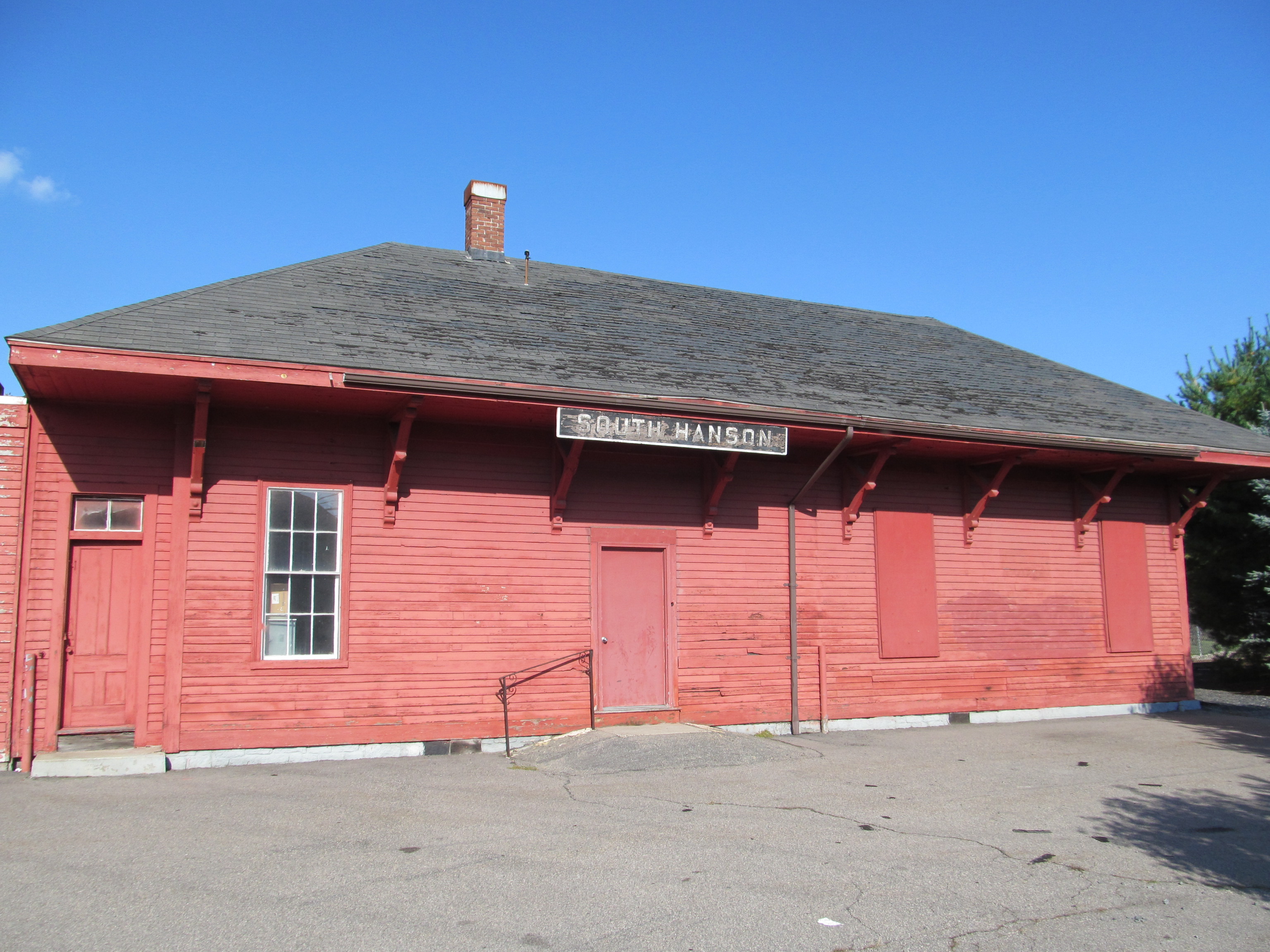
Hanson station is an MBTA Commuter Rail station in Hanson, Massachusetts. It serves the Plymouth/Kingston Line, It is located off Main Street (Massachusetts Route 27) in the South Hanson village. It has one full-length high-level platform serving the line's single track and is fully accessible. History The Old Colony Railroad opened through South Hanson in November 1845, with Hanson station located at Main Street. The station burned two weeks later, and an exact replica was constructed. The station was renamed South Hanson on June 24, 1878. The New Haven Railroad ended its remaining Old Colony Division service, including commuter service to South Hanson, on June 30, 1959. The former station building remains intact, though unused. On September 29, 1997, the MBTA restored commuter rail service on the two Old Colony Lines The Old Colony Lines are a pair of branches of the MBTA Commuter Rail system, connecting downtown Boston, Massachusetts with the South Shore and cranberry-far ... [...More Info...] [...Related Items...] OR: [Wikipedia] [Google] [Baidu] |
Massachusetts Route 27
Route 27 is a south–north state highway in eastern Massachusetts. Its southern terminus is at Route 106 in Kingston and its northern terminus is at Route 4 in Chelmsford. Along the way it intersects several major highways including Route 24 in Brockton, U.S. Route 1 (US 1) in Walpole, Route 9 in Natick, US 20 in Wayland, and Route 2 in Acton. Route description Route 27 runs in a sweeping arc from Kingston to Chelmsford. For most of its route, it acts as an intermediate route between Interstate 95 and Interstate 495. Route 27 begins in Kingston at Route 106, approximately 1-1/4 miles west of Route 3. It heads northwest towards Brockton, passing through Pembroke, Hanson, East Bridgewater and Whitman. In Brockton the road shares a triple concurrency with Route 28 and Route 123 Eastbound (Route 123 Westbound only intersects with the route). From the center of town, Route 27 heads northwest, past the Westgate Mall, over Route 24 at Exits 33A-B (formerl ... [...More Info...] [...Related Items...] OR: [Wikipedia] [Google] [Baidu] |
Hanson, Massachusetts
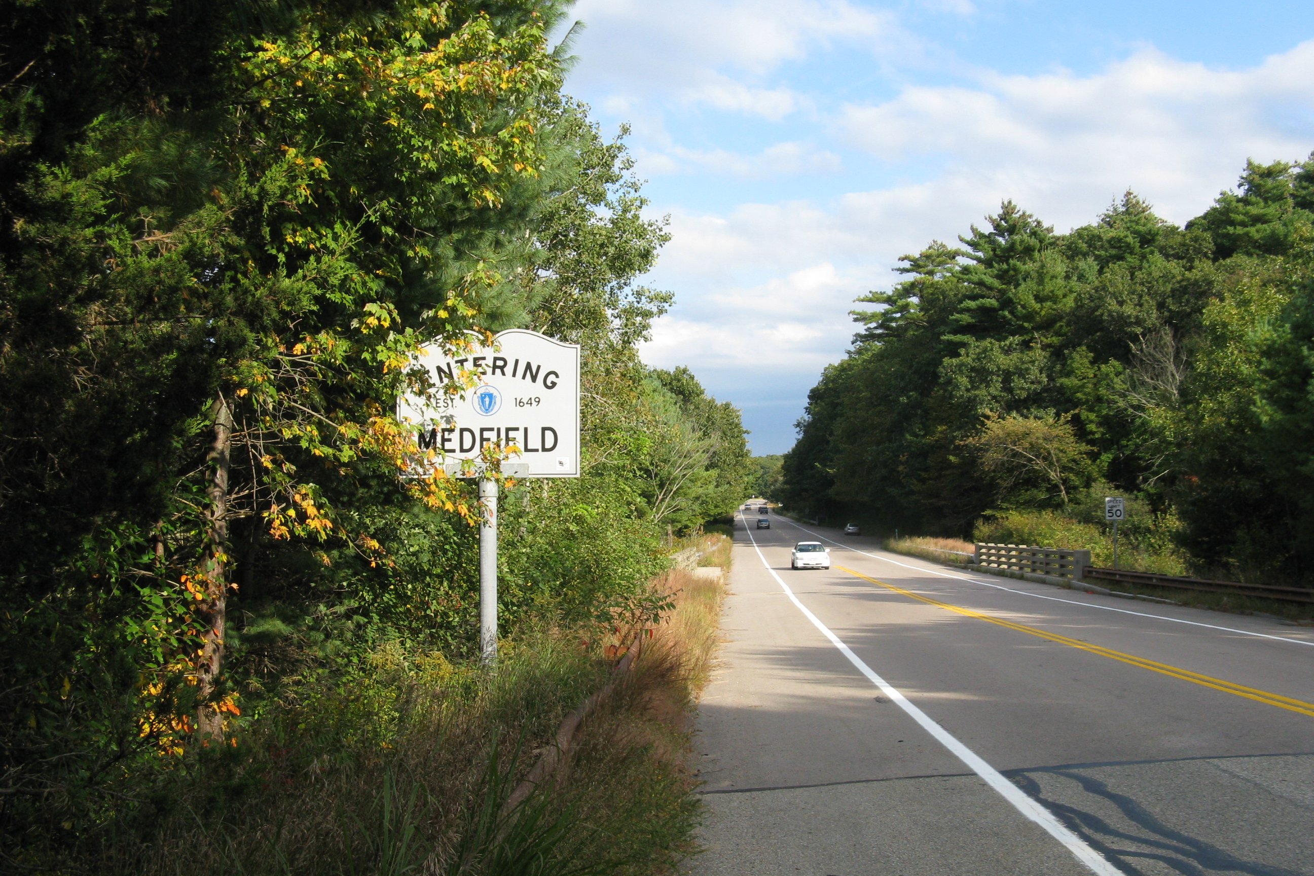
Hanson is a town in Plymouth County, Massachusetts, United States. Part of Greater Boston, Hanson is located 20 miles (32 km) south of Boston and is one of the inland towns of the South Shore. The population was 10,639 at the 2020 census. History Hanson was first settled in 1632 as the western parish of Pembroke. The town was officially incorporated in 1820, and was named for Maryland publisher of the ''Federal Republican'' newspaper and U.S. Senator Alexander Contee Hanson. Hanson was a champion of free speech and freedom of the press, and he was severely beaten and his newspaper offices were attacked and destroyed by an angry mob after he published an article that was critical of the administration shortly after the outbreak of the War of 1812. The town's early industry revolved around farming, as well as bog iron and quarrying. Mills also popped up along the rivers during the nineteenth century. Today the town is mostly residential, with some farming and cranberry farm ... [...More Info...] [...Related Items...] OR: [Wikipedia] [Google] [Baidu] |
Side Platform
A side platform (also known as a marginal platform or a single-face platform) is a platform positioned to the side of one or more railway tracks or guideways at a railway station, tram stop, or transitway. A station having dual side platforms, one for each direction of travel, is the basic design used for double-track railway lines (as opposed to, for instance, the island platform where a single platform lies between the tracks). Side platforms may result in a wider overall footprint for the station compared with an island platform where a single width of platform can be shared by riders using either track. In some stations, the two side platforms are connected by a footbridge running above and over the tracks. While a pair of side platforms is often provided on a dual-track line, a single side platform is usually sufficient for a single-track line. Layout Where the station is close to a level crossing (grade crossing) the platforms may either be on the same side of the cross ... [...More Info...] [...Related Items...] OR: [Wikipedia] [Google] [Baidu] |
MBTA Commuter Rail
The MBTA Commuter Rail system serves as the commuter rail arm of the Massachusetts Bay Transportation Authority's transportation coverage of Greater Boston in the United States. Trains run over of track to 141 different stations, with 58 stations on the north side and 83 stations on the south. It is operated under contract by Keolis, which took over operations on July 1, 2014, from the Massachusetts Bay Commuter Railroad Company (MBCR). In , the system had a ridership of , or about per weekday as of , making it the sixth-busiest commuter rail system in the U.S., behind the three New York-area systems, the Chicago-area system, and the Philadelphia-area system. The line's characteristic purple-trimmed coaches operate as far south as North Kingstown, Rhode Island, and as far north as Newburyport and as far west as Fitchburg, both in Massachusetts. Trains originate at two major terminals in Boston—South Station and North Station—with both transportation hubs offering conn ... [...More Info...] [...Related Items...] OR: [Wikipedia] [Google] [Baidu] |
MBTA Accessibility
The Massachusetts Bay Transportation Authority (MBTA) system is mostly but not fully accessible. Like most American mass transit systems, much of the MBTA subway and commuter rail were built before wheelchair access became a requirement under the Americans with Disabilities Act of 1990. The MBTA has renovated most stations to be compliant with the ADA, and all stations built since 1990 are accessible. The MBTA also has a paratransit program, The Ride, which provides accessible vehicles to transport passengers who cannot use the fixed-route system. Much of the MBTA subway system is accessible: all Orange and Red Line stations, and all but one Blue Line station, are accessible. Most of the underground portion of the Green Line is accessible, though only some surface stops are; all but one stop on the Ashmont–Mattapan High-Speed Line are accessible. About three-quarters of the MBTA Commuter Rail system is accessible, including the North Station and South Station terminals. All ... [...More Info...] [...Related Items...] OR: [Wikipedia] [Google] [Baidu] |
South Hanson Station, South Hanson MA
South is one of the cardinal directions or compass points. The direction is the opposite of north and is perpendicular to both east and west. Etymology The word ''south'' comes from Old English ''sūþ'', from earlier Proto-Germanic ''*sunþaz'' ("south"), possibly related to the same Proto-Indo-European root that the word ''sun'' derived from. Some languages describe south in the same way, from the fact that it is the direction of the sun at noon (in the Northern Hemisphere), like Latin meridies 'noon, south' (from medius 'middle' + dies 'day', cf English meridional), while others describe south as the right-hand side of the rising sun, like Biblical Hebrew תֵּימָן teiman 'south' from יָמִין yamin 'right', Aramaic תַּימנַא taymna from יָמִין yamin 'right' and Syriac ܬܰܝܡܢܳܐ taymna from ܝܰܡܝܺܢܳܐ yamina (hence the name of Yemen, the land to the south/right of the Levant). Navigation By convention, the ''bottom or down-facing side'' of a ... [...More Info...] [...Related Items...] OR: [Wikipedia] [Google] [Baidu] |
Old Colony Railroad
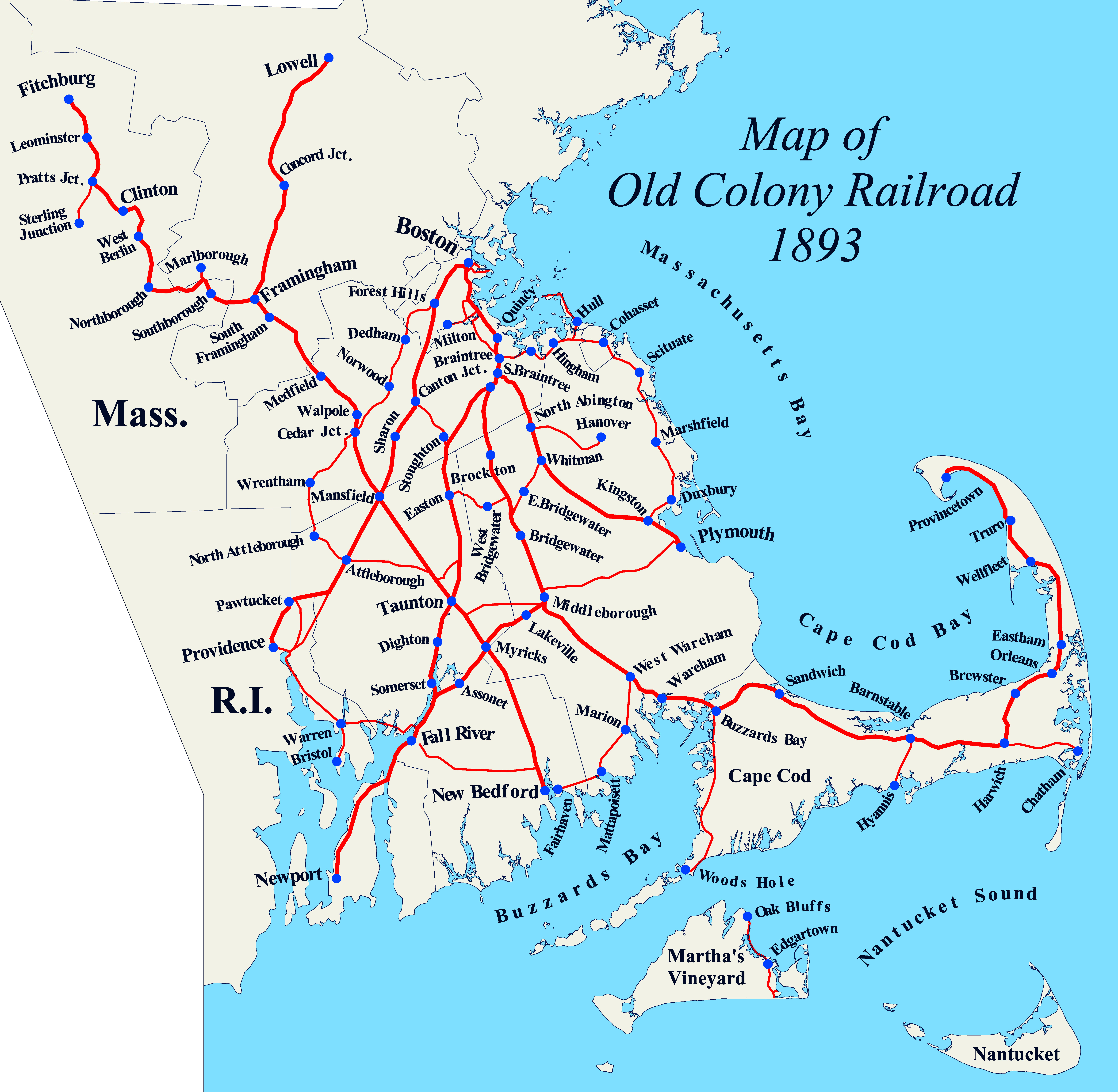
The Old Colony Railroad (OC) was a major railroad system, mainly covering southeastern Massachusetts and parts of Rhode Island, which operated from 1845 to 1893. Old Colony trains ran from Boston to points such as Plymouth, Fall River, New Bedford, Newport, Providence, Fitchburg, Lowell and Cape Cod. For many years the Old Colony Railroad Company also operated steamboat and ferry lines, including those of the Fall River Line with express train service from Boston to its wharf in Fall River where passengers boarded luxury liners to New York City. The company also briefly operated a railroad line on Martha's Vineyard, as well as the freight-only Union Freight Railroad in Boston. The OC was named after the "Old Colony", the nickname for the Plymouth Colony. From 1845 to 1893, the OC network grew extensively largely through a series of mergers and acquisitions with other established railroads, until it was itself acquired by the New York, New Haven and Hartford Railroa ... [...More Info...] [...Related Items...] OR: [Wikipedia] [Google] [Baidu] |
New Haven Railroad
The New York, New Haven and Hartford Railroad , commonly known as The Consolidated, or simply as the New Haven, was a railroad that operated in the New England region of the United States from 1872 to December 31, 1968. Founded by the merger of the New York and New Haven Railroad, New York and New Haven and Hartford and New Haven Railroad, Hartford and New Haven railroads, the company had near-total dominance of railroad traffic in Southern New England for the first half of the 20th century. Beginning in the 1890s and accelerating in 1903, New York banker J. P. Morgan sought to monopolize New England transportation by arranging the NH's acquisition of 50 companies, including other railroads and steamship lines, and building a network of electrified trolley lines that provided interurban transportation for all of southern New England. By 1912, the New Haven operated more than of track, with 120,000 employees, and practically monopolized traffic in a wide swath from Boston to New ... [...More Info...] [...Related Items...] OR: [Wikipedia] [Google] [Baidu] |
MBTA
The Massachusetts Bay Transportation Authority (abbreviated MBTA and known colloquially as "the T") is the public agency responsible for operating most public transportation services in Greater Boston, Massachusetts. The MBTA transit network includes the MBTA subway with three metro lines (the Blue, Orange, and Red lines), two light rail lines (the Green and Ashmont–Mattapan lines), and a five-line bus rapid transit system (the Silver Line); MBTA bus local and express service; the twelve-line MBTA Commuter Rail system, and several ferry routes. In , the system had a ridership of , or about per weekday as of , of which the rapid transit lines averaged and the light rail lines , making it the fourth-busiest rapid transit system and the third-busiest light rail system in the United States. As of , average weekday ridership of the commuter rail system was , making it the sixth-busiest commuter rail system in the U.S. The MBTA is the successor of several previous public a ... [...More Info...] [...Related Items...] OR: [Wikipedia] [Google] [Baidu] |
Old Colony Lines (MBTA)
The Old Colony Lines are a pair of branches of the MBTA Commuter Rail system, connecting downtown Boston, Massachusetts with the South Shore and cranberry-farming country to the south and southeast. The two branches operate concurrently for via the Old Colony Mainline from South Station to Braintree station. The Middleborough/Lakeville Line then winds south through Holbrook, Brockton, Bridgewater, Middleborough, and Lakeville via the Middleborough Main Line and Cape Main Line. The Kingston/Plymouth Line heads southeast to serve Weymouth, Abington, Whitman, Hanson, Halifax, Kingston, and Plymouth by way of the Plymouth branch. History The Old Colony under the New Haven Historically, train service extended beyond the current terminus of the three branches. Greenbush service continued on a now-abandoned right-of-way to Kingston, where it joined the Plymouth line. The Plymouth line extended into downtown Plymouth, and a branch connected to Middleborough through Carver. ... [...More Info...] [...Related Items...] OR: [Wikipedia] [Google] [Baidu] |
MBTA Commuter Rail Stations In Plymouth County, Massachusetts
The Massachusetts Bay Transportation Authority (abbreviated MBTA and known colloquially as "the T") is the public agency responsible for operating most public transportation services in Greater Boston, Massachusetts. The MBTA transit network includes the MBTA subway with three metro lines (the Blue, Orange, and Red lines), two light rail lines (the Green and Ashmont–Mattapan lines), and a five-line bus rapid transit system (the Silver Line); MBTA bus local and express service; the twelve-line MBTA Commuter Rail system, and several ferry routes. In , the system had a ridership of , or about per weekday as of , of which the rapid transit lines averaged and the light rail lines , making it the fourth-busiest rapid transit system and the third-busiest light rail system in the United States. As of , average weekday ridership of the commuter rail system was , making it the sixth-busiest commuter rail system in the U.S. The MBTA is the successor of several previous public ... [...More Info...] [...Related Items...] OR: [Wikipedia] [Google] [Baidu] |


