|
Hans Müller Von Bulgenbach
Hans Müller, also known as Hans Müller von Bulgenbach, (c.1490 – 12 August 1525 in Laufenburg, Switzerland, Habsburg-Laufenburg), was a peasant leader during the German Peasants' War. After a career in the French military, he played a pivotal role in the initial peasant uprising at Stuhlingen, and organised peasant bands throughout southwestern Germany. He was captured after the peasants' loss at Klettgau in July 1525, imprisoned at the Hohentweil fortress, and executed in August of that year. Participation in the German Peasants' War The exact date of his birth is not known, but is probably between 1485 and 1495. The location of his birth is usually given as the village of Bulgenbach, which today is in the vicinity of Grafenhausen, near the Black Forest lake of Schluchsee. Müller entered the imperial military service and fought in France. After he returned to his homeland, in the territory of the Stühlingen count, he was caught up in peasant uprisings in 1524. In June, he ... [...More Info...] [...Related Items...] OR: [Wikipedia] [Google] [Baidu] |
Brigach
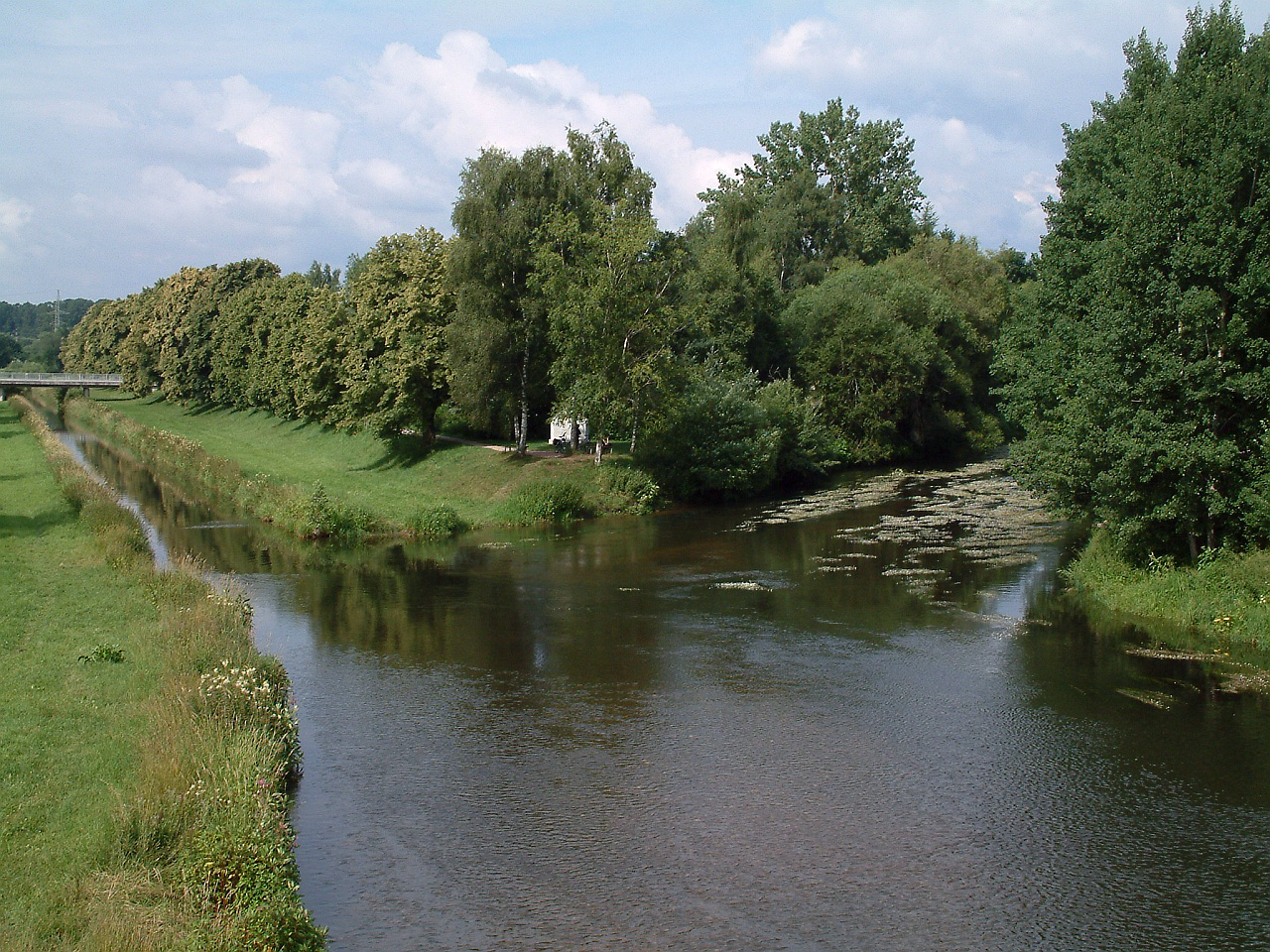
The Brigach is the shorter of two streams that jointly form the river Danube in Baden-Württemberg, Germany. The Brigach has its source at above sea level within St. Georgen in the Black Forest. The Brigach crosses the city Villingen-Schwenningen. from the source, the Brigach joins the Breg in Donaueschingen to form the Danube River. Name The name Brigach is of Celtic origin and means ''"light coloured, pure water"''. A relief found here points to the goddess, Abnoba.Wolfdieter Gramlich: Steinernes Zeugnis vergangener Zeit.' In: ''Südkurier'', 12 July 2012 Geography Sources One source of the Brigach is impounded in the cellar of a farmhouse in the upper valley near the village of Brigach and may be visited by the public. On the official state water map the Brigach begins, however, at a height of about somewhat below a small pond near this farm in the borough of Sankt Georgen im Schwarzwald. Course The Brigach flows initially along a gently descending course and ... [...More Info...] [...Related Items...] OR: [Wikipedia] [Google] [Baidu] |
Hohentwiel
Hohentwiel is an extinct volcano in the Hegau region of Baden-Württemberg in southern Germany The mountain is west of the city of Singen and 20 miles (30 km) from Lake Constance. Hohentwiel began forming, along with the chain of volcanoes in the Hegau region, about 7–8 million years ago, when a layer of volcanic ash and stone was laid down. The magma consists of phonolite. In the following millions of years, the core was opened 260 metres beneath the surface by the glaciers from the ice age. This formed the core that is now exposed, after the ensuing millions of years of erosion. Hohentwiel Castle, whose ruins are on top of Hohentwiel, was built in 914 using stone taken from the mountain by Burchard II, Duke of Swabia. Originally, the Monastery of St. Georg was within the fortress, but in 1005 it was moved to Stein am Rhein (now in Switzerland), and the Swabian dukes lost control of Hohentwiel. In the later Middle Ages the noble families von Singen-Twiel ... [...More Info...] [...Related Items...] OR: [Wikipedia] [Google] [Baidu] |
Radolfzell
Radolfzell am Bodensee is a town in Germany at the western end of Lake Constance approximately 18 km northwest of Konstanz. It is the third largest town, after Constance and Singen, in the district of Konstanz, in Baden-Württemberg. Radolfzell is a well-known health care town (Mettnau) and an important railway junction of the High Rhine Railway and the Hegau-Ablach Valley Railway (leading to the Stahringen–Friedrichshafen railway). In 1990 Radolfzell was named the Federal Environment Capital City of Germany. History This town developed out of a monastery founded in 826 AD as a "cell" under Bishop Radolf of Verona. The town belonged to the Abbey of Reichenau, then to the house of Habsburg for a long time, and for 40 years was a Free Imperial City. In the centre is the gothic Cathedral of our Dear Lady, dating from the 15th century and decorated in the baroque style in the 18th. One particularly beautiful feature is the Rosary altar by the Zürn brothers and the Master ... [...More Info...] [...Related Items...] OR: [Wikipedia] [Google] [Baidu] |
Freiburg Im Breisgau
Freiburg im Breisgau (; abbreviated as Freiburg i. Br. or Freiburg i. B.; Low Alemannic German, Low Alemannic: ''Friburg im Brisgau''), commonly referred to as Freiburg, is an independent city in Baden-Württemberg, Germany. With a population of about 230,000 (as of 31 December 2018), Freiburg is the List of cities in Baden-Württemberg by population, fourth-largest city in Baden-Württemberg after Stuttgart, Mannheim, and Karlsruhe. The population of the Freiburg metropolitan area was 656,753 in 2018. In the Southern Germany, south-west of the country, it straddles the Dreisam river, at the foot of the Schlossberg (Freiburg), Schlossberg. Historically, the city has acted as the hub of the Breisgau region on the western edge of the Black Forest in the Upper Rhine Plain. A famous old German university town, and Roman Catholic Archdiocese of Freiburg, archiepiscopal seat, Freiburg was incorporated in the early twelfth century and developed into a major commercial, intellectual, an ... [...More Info...] [...Related Items...] OR: [Wikipedia] [Google] [Baidu] |
Baltringer Haufen
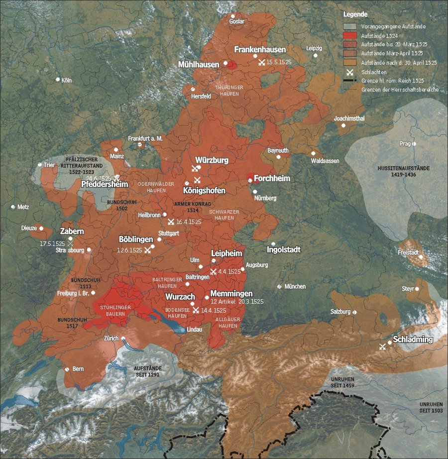
The Baltringer Haufen (also spelled ''Baltringer Haufe'', German for Baltringen Band, Baltringen Troop or Baltringen Mob) was prominent among several armed groups of peasants and craftsmen during the German Peasants' War of 1524–1525. The name derived from the small Upper Swabian village of Baltringen, which lies approximately south of Ulm in the district of Biberach, Germany. In the early modern period the term ''Haufe(n)'' (literally: heap) denoted a lightly organised military formation particularly with regard to Landsknecht regiments. Formation of the ''Baltringer Haufen'' According to the account of a nun from nearby Heggbach Abbey, local peasants assembled and conferred in an inn at Baltringen for the first time on Christmas Eve 1524. From then on regular meetings took place, the number of attendants reaching 80 at the beginning of February 1525. Whereas in other regions the peasants met and discussed at markets, in Baltringen this occurred during the ''Fastnach ... [...More Info...] [...Related Items...] OR: [Wikipedia] [Google] [Baidu] |
Baltringen
Baltringen is a once autonomous village in Baden-Württemberg in the region of Upper Swabia, situated approximately 17 km north of Biberach. Administratively, Baltringen is part of the municipality of Mietingen. Baltringen lies on the river Dürnach. History The area in which the village of Baltringen is now situated, was settled by Alemans in the 3rd century CE, being part of the Agri Decumates. It is located on an important road, connecting Ulm with Lake Constance. This road was partly restored in the early 7th century and new settlements were founded in order to safeguard travelling. The road lead from Meersburg via Ravensburg to Birkendorf, continuing via Baltringen in the direction of Laupheim and then on towards Ulm. This road would have crossed the river Dürnach on the southern entrance of the village by using the existing sandstone bridge. The first appearance of Baltringen in written sources dates from 1274, when two brothers, Ulrich and Berthold of Baltring ... [...More Info...] [...Related Items...] OR: [Wikipedia] [Google] [Baidu] |
Allgäu
The Allgäu (Standard German: , also Allgovia) is a region in Swabia in southern Germany. It covers the south of Bavarian Swabia, southeastern Baden-Württemberg, and parts of Austria. The region stretches from the pre-alpine lands up to the Alps. The main rivers flowing through the Allgäu are the Lech and Iller. Allgäu is not an administrative unit. The alpine regions of the Allgäu rise over 2,000 metres in elevation and are popular for winter skiing. The Allgovian area is notable for its beautiful landscapes and is popular for vacations and therapeutic stays.Its scenic countryside can be seen in Asmus, C. and Bufe, S. "Dampflokomotiven im Allgau" (1977, Hermann Merker). It is well known in Germany for its farm produce, especially dairy products including ''Hirtenkäse'' ("herdsman's cheese") and Bergkäse ("mountain cheese"). Besides tourism and dairy products, another important economic sector is the building of industrial equipment and machines. Fendt tractors, develop ... [...More Info...] [...Related Items...] OR: [Wikipedia] [Google] [Baidu] |
Bodensee
Lake Constance (german: Bodensee, ) refers to three bodies of water on the Rhine at the northern foot of the Alps: Upper Lake Constance (''Obersee''), Lower Lake Constance (''Untersee''), and a connecting stretch of the Rhine, called the Lake Rhine (''Seerhein''). These waterbodies lie within the Lake Constance Basin () in the Alpine Foreland through which the Rhine flows. The lake is situated where Germany, Switzerland, and Austria meet. Its shorelines lie in the German states of Baden-Württemberg and Bavaria, the Swiss cantons of St. Gallen, Thurgau, and Schaffhausen, and the Austrian state of Vorarlberg. The actual location of the border is disputed. The Alpine Rhine forms in its original course the Austro-Swiss border and flows into the lake from the south. The High Rhine flows westbound out of the lake and forms (with the exception of the Canton of Schaffhausen) the German-Swiss border as far as to the city of Basel. The most populous towns on the Upper Lake are Con ... [...More Info...] [...Related Items...] OR: [Wikipedia] [Google] [Baidu] |
Schloss Gutenberg
Schloss Gutenberg is a castle in Styria, Austria. Schloss Gutenberg is situated at a height of 567 meters. Schloss Gutenberg stands on a prominent rock by the Raabklamm in Gutenberg an der Raabklamm parish. The castle is a foundation of Luitold III of Waldstein, who moved into the castle in 1185. The castle has belonged to the Stubenberg family since 1288. The oldest section from the 12th century was supplemented by a 2-story bailey that is protected by two moats. The outer moat is bridged today, the inner was filled in. The castle was remodeled and expanded, mixing the medieval style with Renaissance elements. An irregular four-story building complex with an almost pentagonal footprint and similarly pentagonal courtyard. The rustic gate faces south. Schlosskapelle St. Pankras The southwest corner with the Chapel of Saint Pancras constitutes the oldest section of the castle. The chapel, originally constructed over three stories like a tower, with galleries in both upper storie ... [...More Info...] [...Related Items...] OR: [Wikipedia] [Google] [Baidu] |
Donaueschingen
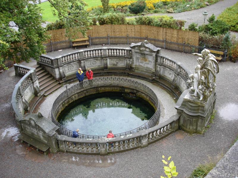
Donaueschingen (; Low Alemannic: ''Eschinge'') is a German town in the Black Forest in the southwest of the federal state of Baden-Württemberg in the Schwarzwald-Baar '' Kreis''. It stands near the confluence of the two sources of the river Danube (in german: Donau). Donaueschingen stands in a basin within low mountainous terrain. It is located about south of Villingen-Schwenningen, west of Tuttlingen, and about north of the Swiss town of Schaffhausen. In 2015 the population was 21,750, making it the second largest town in the district (''Kreis'') of Schwarzwald-Baar. It is a regional rail hub. Geography Donaueschingen lies in the Baar basin in the southern Black Forest at the confluence of the Brigach and Breg rivers—the two source tributaries of the Danube—from which the town gets its name. This is today considered the true source of the Danube. An enclosed karst spring on the castle grounds, the source of the "Donaubach", is known as the source of the Danube ... [...More Info...] [...Related Items...] OR: [Wikipedia] [Google] [Baidu] |


_4029.jpg)


