|
Hanoverdale, Pennsylvania
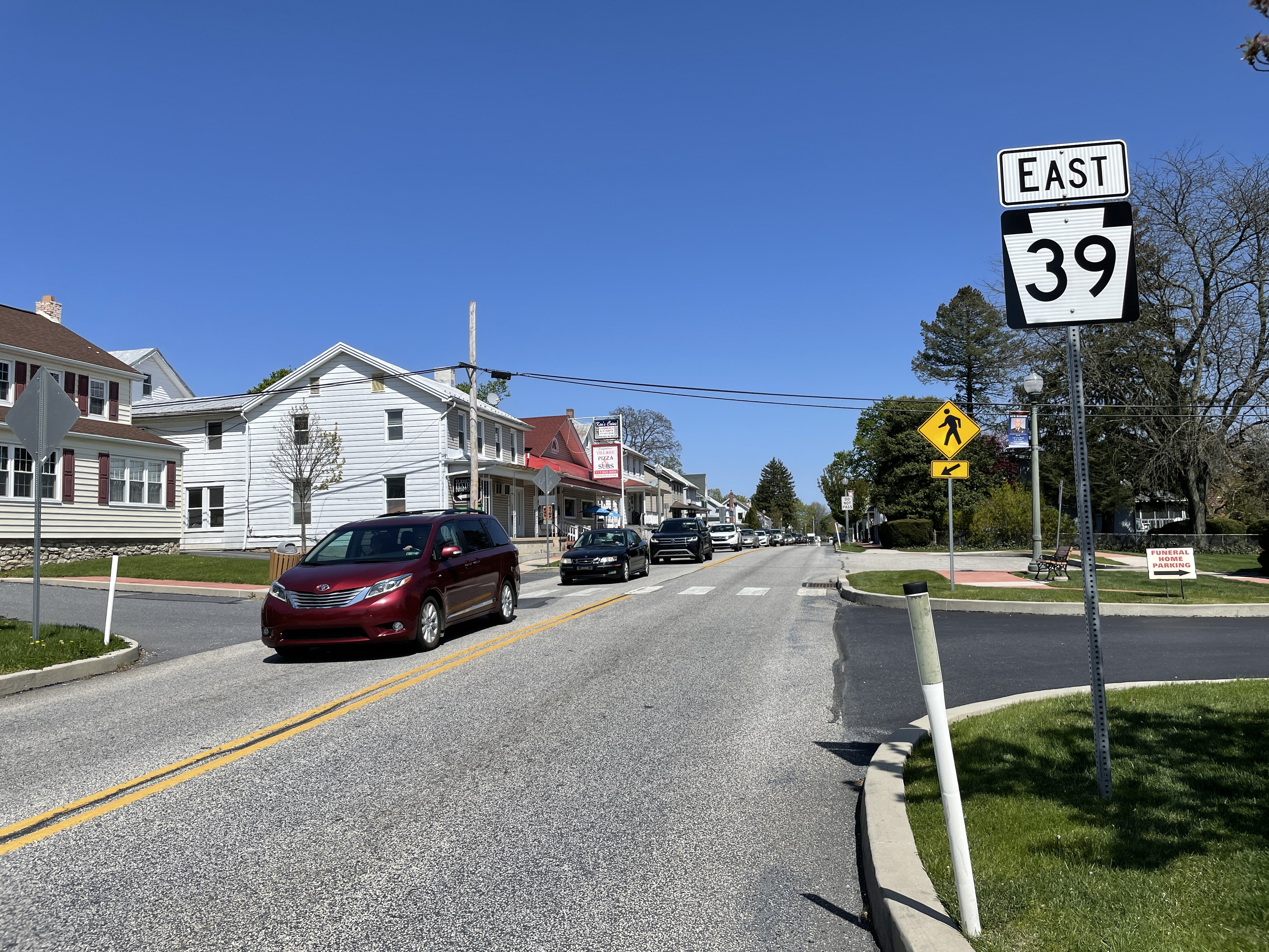
Hanoverdale is an unincorporated community in West Hanover Township, Dauphin County, Pennsylvania, United States, and is part of the Harrisburg-Carlisle Carlisle ( , ; from xcb, Caer Luel) is a city that lies within the Northern England, Northern English county of Cumbria, south of the Anglo-Scottish border, Scottish border at the confluence of the rivers River Eden, Cumbria, Eden, River C ... Metropolitan Statistical Area. Hanoverdale is located southeast of Skyline View at the intersection of Hershey Road and Devonshire Heights Road. References External links Hanoverdale Profile Harrisburg–Carlisle metropolitan statistical area Unincorporated communities in Dauphin County, Pennsylvania Unincorporated communities in Pennsylvania {{DauphinCountyPA-geo-stub ... [...More Info...] [...Related Items...] OR: [Wikipedia] [Google] [Baidu] |
Unincorporated Area
An unincorporated area is a region that is not governed by a local municipal corporation. Widespread unincorporated communities and areas are a distinguishing feature of the United States and Canada. Most other countries of the world either have no unincorporated areas at all or these are very rare: typically remote, outlying, sparsely populated or List of uninhabited regions, uninhabited areas. By country Argentina In Argentina, the provinces of Chubut Province, Chubut, Córdoba Province (Argentina), Córdoba, Entre Ríos Province, Entre Ríos, Formosa Province, Formosa, Neuquén Province, Neuquén, Río Negro Province, Río Negro, San Luis Province, San Luis, Santa Cruz Province, Argentina, Santa Cruz, Santiago del Estero Province, Santiago del Estero, Tierra del Fuego Province, Argentina, Tierra del Fuego, and Tucumán Province, Tucumán have areas that are outside any municipality or commune. Australia Unlike many other countries, Australia has only local government in Aus ... [...More Info...] [...Related Items...] OR: [Wikipedia] [Google] [Baidu] |
West Hanover Township, Pennsylvania
West Hanover Township is a township in Dauphin County, Pennsylvania, United States. The population was 10,693 at the 2020 census, an increase over the figure of 9,343 tabulated in 2010. History Hanover Township of Dauphin County was divided into East Hanover, West Hanover, and South Hanover townships. Geography According to the United States Census Bureau, the township has a total area of , all land. The unincorporated community and census-designated place of Skyline View is in the southern part of the township. Ritzie Village is north of the intersection of PA 443 and Mountain Road in the northern part of the township. Also contained in the township are the villages of Piketown and Manadahill. Demographics The earliest US census figures reveal a total population of 1,862 residents in the year 1800. As of the census of 2000, there were 6,505 people, 2,502 households, and 1,944 families residing in the township. The population density was . There were 2,584 housing unit ... [...More Info...] [...Related Items...] OR: [Wikipedia] [Google] [Baidu] |
Dauphin County, Pennsylvania
Dauphin County (; Pennsylvania Dutch: Daffin Kaundi) is a county in the Commonwealth of Pennsylvania. As of the 2020 census, the population was 286,401. The county seat and the largest city is Harrisburg, Pennsylvania's state capital and ninth largest city. The county was created ("erected") on March 4, 1785, from part of Lancaster County and was named after Louis Joseph, Dauphin of France, the first son of King Louis XVI. Dauphin County is included in the Harrisburg–Carlisle Metropolitan Statistical Area. Located within the county is Three Mile Island Nuclear Generating Station, site of the 1979 nuclear core meltdown. The nuclear power plant closed in 2019. Geography According to the U.S. Census Bureau, the county has a total area of , of which is land and (5.9%) is water. The county is bound to its western border by the Susquehanna River (with the exception of a small peninsula next to Duncannon). The area code is 717 with an overlay of 223. Adjacent counties * N ... [...More Info...] [...Related Items...] OR: [Wikipedia] [Google] [Baidu] |
Harrisburg
Harrisburg is the capital city of the Pennsylvania, Commonwealth of Pennsylvania, United States, and the county seat of Dauphin County, Pennsylvania, Dauphin County. With a population of 50,135 as of the 2021 census, Harrisburg is the List of cities and boroughs in Pennsylvania by population, 9th largest city and 15th largest municipality in Pennsylvania. Harrisburg is situated on the east bank of the Susquehanna River. It is the larger principal city of the Harrisburg–Carlisle metropolitan statistical area, also known as the Susquehanna Valley, which had a population of 591,712 as of 2020, making it the Pennsylvania metropolitan areas, fourth most populous metropolitan area in Pennsylvania after the Delaware Valley, Philadelphia, Greater Pittsburgh, Pittsburgh, and Lehigh Valley metropolitan areas. Harrisburg played a role in American history during the American frontier, Westward Migration, the American Civil War, and the Industrial Revolution. During part of the 19th cen ... [...More Info...] [...Related Items...] OR: [Wikipedia] [Google] [Baidu] |
Carlisle, Pennsylvania
Carlisle is a Borough (Pennsylvania), borough in and the county seat of Cumberland County, Pennsylvania, United States. Carlisle is located within the Cumberland Valley, a highly productive agricultural region. As of the 2020 United States census, 2020 census, the borough population was 20,118; including suburbs in the neighboring townships, 37,695 live in the Carlisle urban cluster. Carlisle is the smaller principal city of the Harrisburg–Carlisle metropolitan statistical area, which includes all of Cumberland, Dauphin County, Pennsylvania, Dauphin, and Perry County, Pennsylvania, Perry counties in South Central Pennsylvania. In 2010, ''Forbes'' rated Carlisle and Harrisburg the second-best place to raise a family. The United States Army War College, U.S. Army War College, located at Carlisle Barracks, prepares high-level military personnel and civilians for strategic leadership responsibilities. Carlisle Barracks ranks among the oldest U.S. Army installations and the most senio ... [...More Info...] [...Related Items...] OR: [Wikipedia] [Google] [Baidu] |
Harrisburg Metropolitan Area
Harrisburg is the capital city of the Commonwealth of Pennsylvania, United States, and the county seat of Dauphin County. With a population of 50,135 as of the 2021 census, Harrisburg is the 9th largest city and 15th largest municipality in Pennsylvania. Harrisburg is situated on the east bank of the Susquehanna River. It is the larger principal city of the Harrisburg–Carlisle metropolitan statistical area, also known as the Susquehanna Valley, which had a population of 591,712 as of 2020, making it the fourth most populous metropolitan area in Pennsylvania after the Philadelphia, Pittsburgh, and Lehigh Valley metropolitan areas. Harrisburg played a role in American history during the Westward Migration, the American Civil War, and the Industrial Revolution. During part of the 19th century, the building of the Pennsylvania Canal and later the Pennsylvania Railroad allowed Harrisburg to develop into one of the most industrialized cities in the Northeastern Unite ... [...More Info...] [...Related Items...] OR: [Wikipedia] [Google] [Baidu] |
Skyline View, Pennsylvania
Skyline View is an unincorporated community and census-designated place (CDP) in West Hanover Township, Dauphin County, Pennsylvania, United States. The population was 4,003 at the 2010 census, up from 2,307 at the 2000 census. It is part of the Harrisburg–Carlisle Metropolitan Statistical Area. Geography Skyline View is located in southern West Hanover Township at (40.336439, -76.722848). Its northern border follows Interstate 81, and its eastern border follows Pennsylvania Route 39. U.S. Route 22 (Allentown Boulevard) runs through the center of the community, leading east to Allentown and west to downtown Harrisburg. PA 39 leads south to Hershey. According to the United States Census Bureau, the Skyline View CDP has a total area of , all land. Demographics As of the census of 2000, there were 2,307 people, 865 households, and 703 families residing in the CDP. The population density was . There were 890 housing units at an average density of . The racial makeup of ... [...More Info...] [...Related Items...] OR: [Wikipedia] [Google] [Baidu] |
Pennsylvania State Route 39
Pennsylvania Route 39 (PA 39) is a state highway located in Dauphin County, Pennsylvania, United States. PA 39 runs from North Front Street near Harrisburg east to U.S. Route 322 (US 322) and US 422 near Hummelstown and Hershey. The route passes through the northern and eastern suburbs of Harrisburg and passes by Hersheypark, Giant Center, as well as the primary production factory for The Hershey Company. Between Harrisburg and Manada Hill, it is known as Linglestown Road, from Manada Hill to Hershey as Hershey Road and from Hershey to near Hummelstown and Hershey as Hersheypark Drive. Prior to the establishment of PA 39 in 1937, PA 39, had previously been designated as a route in northeastern Pennsylvania during the 1920s. That designation was deleted when it was renumbered US 11. As a result, PA 39 is one of a few routes which has a set of child routes which are no where near the primary route. The Linglestown–Manada ... [...More Info...] [...Related Items...] OR: [Wikipedia] [Google] [Baidu] |
Harrisburg–Carlisle Metropolitan Statistical Area
The Harrisburg–Carlisle metropolitan statistical area, officially the Harrisburg–Carlisle, PA Metropolitan Statistical Area, and also referred to as the Susquehanna Valley, is defined by the Office of Management and Budget as an area consisting of three counties in South Central Pennsylvania, anchored by the cities of Harrisburg and Carlisle. As of the 2020 census, the metropolitan statistical area (MSA) had a population of 591,712, making it the fourth-most-populous metropolitan area in Pennsylvania, after the Delaware Valley, Greater Pittsburgh, and the Lehigh Valley. Since 2012, it has been defined as part of the Harrisburg–York–Lebanon combined statistical area, which also includes York, Lebanon and Adams counties. Components The Harrisburg–Carlisle Metropolitan Area consists of three counties, located entirely within the Commonwealth of Pennsylvania. The following three counties are designated as being part of the greater Harrisburg–Carlisle area: * Cum ... [...More Info...] [...Related Items...] OR: [Wikipedia] [Google] [Baidu] |
Unincorporated Communities In Dauphin County, Pennsylvania
Unincorporated may refer to: * Unincorporated area, land not governed by a local municipality * Unincorporated entity, a type of organization * Unincorporated territories of the United States, territories under U.S. jurisdiction, to which Congress has determined that only select parts of the U.S. Constitution apply * Unincorporated association Unincorporated associations are one vehicle for people to cooperate towards a common goal. The range of possible unincorporated associations is nearly limitless, but typical examples are: :* An amateur football team who agree to hire a pitch onc ..., also known as voluntary association, groups organized to accomplish a purpose * ''Unincorporated'' (album), a 2001 album by Earl Harvin Trio {{disambig ... [...More Info...] [...Related Items...] OR: [Wikipedia] [Google] [Baidu] |


.jpg)

