|
Hanger Lane Gyratory
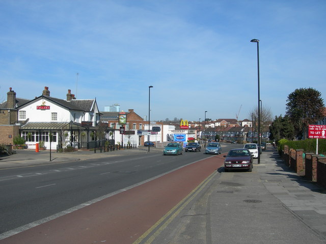
The Hanger Lane gyratory is a multi-lane rectangular gyratory – having the Hanger Lane underpass, under its southern limb, for the Western Avenue ( A40). It enables intersection with the North Circular (A406) and the inceptive Ealing Road towards Wembley. It is in the north of the borough of Ealing in west London. Scope and interior It covers about . At rush hour it carries nearly 10,000 vehicles per hour. An above-ground section of the London Underground Central line passes under the structure which takes the form of a rounded-corner rectangular roundabout. The south-east corner of its interior hosts Hanger Lane tube station accessed by paths beneath; the rest hosts small utility buildings and a nature reserve which has many mature, deciduous trees – a Site of Importance for Nature Conservation. History In the 1960s, a long tunnel was built to take the A40 road underneath the Hanger Lane junction. The junction became a gyratory in the early 1980s when the ... [...More Info...] [...Related Items...] OR: [Wikipedia] [Google] [Baidu] |
Hanger Lane Gyratory On The North Circular - Geograph
Hanger or hangers may refer to: Hardware * Clothes hanger, a device in the shape of human shoulders or legs used to hang clothes on * Casing hanger, part of a wellhead assembly in oil drilling * Derailleur hanger, a slot in a bicycle frame where the derailleur bolt attaches * Tie (engineering), a type of structural member * Hanger, part of a skateboard * Hanger, a sword similar to a cutlass, used by woodsmen and soldiers in 17th to 18th centuries * A hanger, a vertical cable or rod connecting the roadway of a suspension bridge to the bridge's main cable or arch People * George Wallace William Hanger (1866–1935), American * George Hanger, 4th Baron Coleraine (1750–1824), English author and soldier in the American Revolution * Art Hanger (born 1943), Canadian politician * Harry Hanger (1886–1918), English footballer * James Edward Hanger (born 1843), U.S. Civil War veteran and founder of: :* Hanger, Inc. * Mostyn Hanger (1908–1980), judge, chief justice of Queensland, A ... [...More Info...] [...Related Items...] OR: [Wikipedia] [Google] [Baidu] |
Hanger Lane Tube Station
Hanger Lane is a London Underground station in Hanger Hill, Ealing, on the border between West and Northwest London. It is located on the West Ruislip branch of the Central line (London Underground), Central line, between Perivale tube station, Perivale and North Acton tube station, North Acton stations, and is in Travelcard Zone 3. It is within walking distance of Park Royal tube station, Park Royal station on the Piccadilly line. The two lines cross a little east of Hanger Lane station. History The Great Western Railway (GWR) opened Twyford Abbey Halt railway station, Twyford Abbey Halt just east of the site on 1 May 1904 as part of the GWR and Great Central Railway Joint Railway project (the New North Main Line) towards High Wycombe. It was closed on 1 May 1911, replaced by Brentham for North Ealing and Greystoke Park railway station, Brentham station to the west of the present location. That station was closed between 1915 and 1920 due to World War I economies. Brentham a ... [...More Info...] [...Related Items...] OR: [Wikipedia] [Google] [Baidu] |
Road Junctions In London
A road is a linear way for the conveyance of traffic that mostly has an improved surface for use by vehicles (motorized and non-motorized) and pedestrians. Unlike streets, the main function of roads is transportation. There are many types of roads, including parkways, avenues, controlled-access highways (freeways, motorways, and expressways), tollways, interstates, highways, thoroughfares, and local roads. The primary features of roads include lanes, sidewalks (pavement), roadways (carriageways), medians, shoulders, verges, bike paths (cycle paths), and shared-use paths. Definitions Historically many roads were simply recognizable routes without any formal construction or some maintenance. The Organization for Economic Co-operation and Development (OECD) defines a road as "a line of communication (travelled way) using a stabilized base other than rails or air strips open to public traffic, primarily for the use of road motor vehicles running on their own wheels", wh ... [...More Info...] [...Related Items...] OR: [Wikipedia] [Google] [Baidu] |
H2G2
The h2g2 website is a British-based collaborative online encyclopedia project. It describes itself as "an unconventional guide to life, the universe, and everything", in the spirit of the fictional publication ''The Hitchhiker's Guide to the Galaxy'' from the science fiction comedy series of the same name by Douglas Adams. It was founded by Adams in 1999 and was run by the BBC between 2001 and 2011. The intent is to create an Earth-focused guide that allows members to share information about their geographic area and the local sites, activities and businesses, to help people decide where they want to go and what they may find when they get there. It has grown to contain subjects from restaurants and recipes, to quantum theory and history. Explicit advertising of businesses was forbidden when the site was run by the BBC, but customer reviews were permitted. – ''No Spitting. The lawyers wanted to know what rules we needed, and we said 'The usual ones, plus "No spitting" pl ... [...More Info...] [...Related Items...] OR: [Wikipedia] [Google] [Baidu] |
High Speed 2
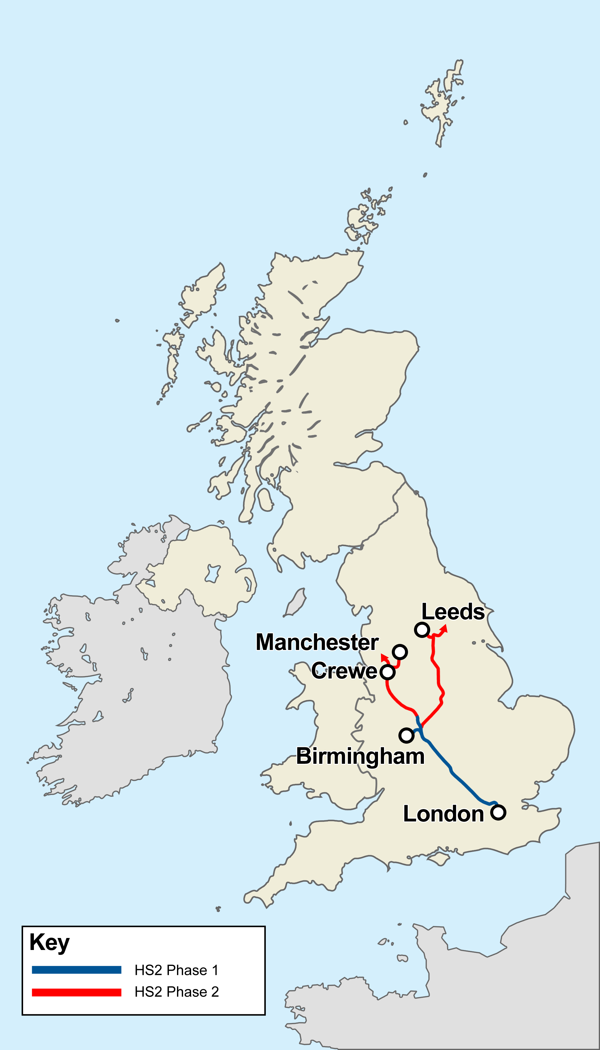
High Speed 2 (HS2) is a planned high-speed railway line in England, the first phase of which is under construction in stages and due for completion between 2029 and 2033, depending on approval for later stages. The new line will run from its most southerly terminus, London, to its most northerly point, Manchester, with branches to Birmingham and the East Midlands. HS2 will be Britain's second purpose-built High-speed rail in the United Kingdom, high-speed line, the first being High Speed 1, which connects London to the Channel Tunnel. At its southern end, the line will terminate at London's London Euston railway station, Euston station while other termini will be Birmingham Curzon Street railway station, Birmingham Curzon Street station and Manchester Piccadilly station. In addition to these stations, the dedicated track will serve Old Oak Common railway station, Old Oak Common in west London, Birmingham Interchange, East Midlands Parkway railway station, East Midlands Parkway ... [...More Info...] [...Related Items...] OR: [Wikipedia] [Google] [Baidu] |
Gyratory System
A roundabout is a type of circular intersection (road), intersection or junction in which road traffic is permitted to flow in one direction around a central island, and priority is typically given to traffic already in the junction.''The New Shorter Oxford English Dictionary,'' Volume 2, Clarendon Press, Oxford (1993), page 2632 Engineers use the term modern roundabout to refer to junctions installed after 1960 that incorporate various design rules to increase safety. Both modern and non-modern roundabouts, however, may bear street names or be identified colloquially by local names such as rotary or traffic circle. Compared to stop signs, traffic signals, and earlier forms of roundabouts, modern roundabouts reduce the likelihood and severity of collisions greatly by reducing traffic speeds and minimizing Side collision#Broadside or T-bone collision, T-bone and head-on collisions. Variations on the basic concept include integration with tram or train lines, two-way flow, hi ... [...More Info...] [...Related Items...] OR: [Wikipedia] [Google] [Baidu] |
A40 Road In London
The A40 is a major trunk road connecting London to Fishguard, Wales. The A40 in London passes through seven London Boroughs: the City of London, Camden, Westminster, Kensington & Chelsea, Hammersmith & Fulham, Ealing and Hillingdon, to meet the M40 motorway junction 1 at Denham, Buckinghamshire. The road has been re-routed several times in the last 100 yearspart of the route of the London section of the A40 was laid out in the 1920s and 1930s when Western Avenue was builtnow most of it is grade-separated, dual carriageway (divided highway). In the 1960s Westway was constructed, easing traffic access to and from the centre of the city. The A40 links the City of London and the West End to the M40 motorway and M25 motorway. The route is called The London to Fishguard Trunk Road (A40) in legal documents and acts. City of LondonCity of Westminster The A40 officially starts where St. Martin's Le Grand meets Cheapside. Here it shares a terminus with the A1, the main north Lo ... [...More Info...] [...Related Items...] OR: [Wikipedia] [Google] [Baidu] |
Map Of Middlesex Sheet 016, Ordnance Survey, 1868-1883
A map is a symbolic depiction emphasizing relationships between elements of some space, such as objects, regions, or themes. Many maps are static, fixed to paper or some other durable medium, while others are dynamic or interactive. Although most commonly used to depict geography, maps may represent any space, real or fictional, without regard to context or scale, such as in brain mapping, DNA mapping, or computer network topology mapping. The space being mapped may be two dimensional, such as the surface of the earth, three dimensional, such as the interior of the earth, or even more abstract spaces of any dimension, such as arise in modeling phenomena having many independent variables. Although the earliest maps known are of the heavens, geographic maps of territory have a very long tradition and exist from ancient times. The word "map" comes from the , wherein ''mappa'' meant 'napkin' or 'cloth' and ''mundi'' 'the world'. Thus, "map" became a shortened term referring to ... [...More Info...] [...Related Items...] OR: [Wikipedia] [Google] [Baidu] |
Site Of Importance For Nature Conservation
Site of Nature Conservation Interest (SNCI), Site of Importance for Nature Conservation (SINC) and regionally important geological site (RIGS) are designations used by local authorities in the United Kingdom for sites of substantive local nature conservation and geological value. The Department for Environment, Food and Rural Affairs has recommended the generic term 'local site', which is divided into 'local wildlife site' and 'local geological site'. There are approximately 35,000 local sites, and according to the former Minister for Biodiversity, Jim Knight, they make a vital contribution to delivering the United Kingdom Biodiversity Action Plan, UK and Local Biodiversity Action Plans and the Geodiversity Action Plan, as well as maintaining local natural character and distinctiveness. Sites of Special Scientific Interest (SSSIs) and local nature reserves (LNRs) have statutory protection, but they are only intended to cover a representative selection of sites, and Local sites are ... [...More Info...] [...Related Items...] OR: [Wikipedia] [Google] [Baidu] |
Central Line (London Underground)
The Central line is a London Underground line that runs through central London, from , Essex, in the north-east to and in west London. Printed in red on the Tube map, the line serves 49 stations over . It is one of only two lines on the Underground network to cross the Greater London boundary, the other being the Metropolitan line. One of London's deep-level railways, Central line trains are smaller than those on British main lines. The line was opened as the Central London Railway in 1900, crossing central London on an east–west axis along the central shopping street of Oxford Street to the financial centre of the City of London. It was later extended to the western suburb of Ealing. In the 1930s, plans were created to expand the route into the new suburbs, taking over steam-hauled outer-suburban routes to the borders of London and beyond to the east. These projects were mostly realised after Second World War, when construction stopped and the unused tunnels were used as air ... [...More Info...] [...Related Items...] OR: [Wikipedia] [Google] [Baidu] |
Hanger Lane
Hanger Lane is a major road in Ealing, London, England. The majority of the road forms the westernmost part of the A406 North Circular Road, running north from the A4020 Uxbridge Road at Ealing Common to the A40 Western Avenue at the Hanger Lane gyratory. This complex and busy junction incorporates Hanger Lane Underground station on the Central line of the London Underground. North of the gyratory, Hanger Lane continues along the A4005 to Vicar's Bridge and the border with Alperton in the London Borough of Brent. The road takes its name from Hanger Hill,Ordnance Survey Map, First Series, Sheet 7, 1856, 1:63360 which is also the name of the surrounding area. The name comes from the Old English Old English (, ), or Anglo-Saxon, is the earliest recorded form of the English language, spoken in England and southern and eastern Scotland in the early Middle Ages. It was brought to Great Britain by Anglo-Saxon settlement of Britain, Anglo ... word ''hangra'', meaning a wooded s ... [...More Info...] [...Related Items...] OR: [Wikipedia] [Google] [Baidu] |
London Underground
The London Underground (also known simply as the Underground or by its nickname the Tube) is a rapid transit system serving Greater London and some parts of the adjacent ceremonial counties of England, counties of Buckinghamshire, Essex and Hertfordshire in England. The Underground has its origins in the Metropolitan Railway, the world's first underground passenger railway. Opened on 10 January 1863, it is now part of the Circle line (London Underground), Circle, District line, District, Hammersmith & City line, Hammersmith & City and Metropolitan lines. The first line to operate underground electric locomotive, electric traction trains, the City & South London Railway in 1890, is now part of the Northern line. The network has expanded to 11 lines, and in 2020/21 was used for 296 million passenger journeys, making it List of metro systems, one of the world's busiest metro systems. The 11 lines collectively handle up to 5 million passenger journeys a day and serve 272 ... [...More Info...] [...Related Items...] OR: [Wikipedia] [Google] [Baidu] |


