|
Hampton, Herne Bay
Hampton is the coastal west end of Herne Bay, Kent, England. Formerly the site of the village of Hampton-on-Sea, the settlement is underwater due to massive coastal erosion, but it was on the west side of the northern end of Hampton Pier Avenue, between the 1959 sea defences and the remains of the sea wall which are exposed at low water in Hampton bay. When Hampton-on-Sea existed and until 1934, the Hampton-on-Sea site was under the jurisdiction of Blean Rural District Council, the boundary with Herne Bay Council running north–south along the line of the present-day Hampton Pier Avenue.Easdown 2008 p.23-41 In 1934, the area was transferred to Herne Bay Urban District Council,Easdown 2008 p.43 and in 1974 to Canterbury City Council Canterbury (, ) is a cathedral city and UNESCO World Heritage Site, situated in the heart of the City of Canterbury local government district of Kent, England. It lies on the River Stour. The Archbishop of Canterbury is the primate of th ... ... [...More Info...] [...Related Items...] OR: [Wikipedia] [Google] [Baidu] |
Herne Bay
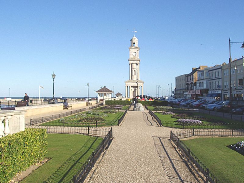
Herne Bay is a seaside town on the north coast of Kent in South East England. It is north of Canterbury and east of Whitstable. It neighbours the ancient villages of Herne and Reculver and is part of the City of Canterbury local government district, although it remains a separate town with countryside between it and Canterbury. Herne Bay's seafront is home to the world's first freestanding purpose-built Clock Tower, built in 1837. From the late Victorian period until 1978, the town had the second-longest pier in the United Kingdom.Herne Bay Pier at www.theheritagetrail.co.uk (accessed 7 July 2008) The town began as a small shipping community, receiving goods and passengers from London en route to Canterbury and |
Hampton-on-Sea
Hampton-on-Sea is a drowned and abandoned village in what is now the Hampton area of Herne Bay, Kent. It grew from a tiny fishing hamlet in 1864 at the hands of an oyster fishery company, was developed from 1879 by land agents, abandoned in 1916 and finally drowned due to coastal erosion by 1921. All that now remains is the stub of the original pier, the Hampton Inn, and the rocky arc of Hampton-on-Sea's ruined coastal defence visible at low tide. The site is notable for sharing its history with the eccentric Edmund Reid. Reid was previously the Metropolitan Police head of CID who handled the Jack the Ripper case. In retirement he chose to champion the plight of the beleaguered residents of the settlement. Location Today Hampton, Herne Bay is the coastal west end of Herne Bay, Kent. The site of Hampton-on-Sea is now underwater due to coastal erosion, but it was on the west side of the northern end of Hampton Pier Avenue, between the 1959 sea defences and the remains of the se ... [...More Info...] [...Related Items...] OR: [Wikipedia] [Google] [Baidu] |
Coastal Erosion
Coastal erosion is the loss or displacement of land, or the long-term removal of sediment and rocks along the coastline due to the action of waves, currents, tides, wind-driven water, waterborne ice, or other impacts of storms. The landward retreat of the shoreline can be measured and described over a temporal scale of tides, seasons, and other short-term cyclic processes. Coastal erosion may be caused by hydraulic action, abrasion, impact and corrosion by wind and water, and other forces, natural or unnatural. On non-rocky coasts, coastal erosion results in rock formations in areas where the coastline contains rock layers or fracture zones with varying resistance to erosion. Softer areas become eroded much faster than harder ones, which typically result in landforms such as tunnels, bridges, columns, and pillars. Over time the coast generally evens out. The softer areas fill up with sediment eroded from hard areas, and rock formations are eroded away. Also erosion commonly ... [...More Info...] [...Related Items...] OR: [Wikipedia] [Google] [Baidu] |
City Of Canterbury
The City of Canterbury () is a local government district with city status in Kent, England. As well as Canterbury itself, the district extends north to the coastal towns of Whistable and Herne Bay. History The district was formed on 1 April 1974 by the merger of the existing city of Canterbury with the Whitstable and Herne Bay Urban Districts, and Bridge- Blean Rural District. The latter district entirely surrounded the city; the urban districts occupied the coastal area to the north. Politics Elections for to all seats on the city council are held every four years. After being under no overall control for a number of years, the Conservative party gained a majority in 2005 following a by election and defection from the Liberal Democrats. Following the 2019 United Kingdom local elections the political composition of Canterbury council is as follows (2017 results follows by-elections): Meeting place After the Church of the Holy Cross, which was commissioned by Archbis ... [...More Info...] [...Related Items...] OR: [Wikipedia] [Google] [Baidu] |


