|
Halton Moor
Halton Moor is a district of east Leeds, West Yorkshire, England, about three miles east of Leeds city centre close to the A63. It is situated between Killingbeck to the north, Temple Newsam to the south, Osmondthorpe to the west and Halton and Colton to the east. The area falls into the Temple Newsam ward of Leeds City Council and Leeds East parliamentary constituency. The area is mainly a council housing estate with approximately 1000 homes, made up of semi-detached houses, with some detached and terraced houses and some high rise blocks of flats. Halton Moor lies within the LS15 & LS9 postcode, with Wyke Beck forming its western boundary. In 2018, the Halton Moor Public House was demolished and will be replaced by a housing development. Many housing developments are currently being constructed in and around the estate. History Before the 20th century, Halton Moor was open land between Osmondthorpe and the older village of Halton which was constructed in the late 19th c ... [...More Info...] [...Related Items...] OR: [Wikipedia] [Google] [Baidu] |
City Of Leeds
The City of Leeds is a city and metropolitan borough in West Yorkshire, England. The metropolitan borough includes the administrative centre of Leeds and the towns of Farsley, Garforth, Guiseley, Horsforth, Morley, Otley, Pudsey, Rothwell, Wetherby and Yeadon. It has a population of (), making it technically the second largest city in England by population behind Birmingham, since London is not a single local government entity. It is governed by Leeds City Council. The current city boundaries were set on 1 April 1974 by the provisions of the Local Government Act 1972, as part a reform of local government in England. The city is a merger of eleven former local government districts; the unitary City and County Borough of Leeds combined with the municipal boroughs of Morley and Pudsey, the urban districts of Aireborough, Garforth, Horsforth, Otley and Rothwell, and parts of the rural districts of Tadcaster, Wharfedale and Wetherby from the West Riding of Yorkshire. ... [...More Info...] [...Related Items...] OR: [Wikipedia] [Google] [Baidu] |
Wyke Beck
Wyke Beck is a stream that runs from Roundhay Park to the River Aire in east Leeds, West Yorkshire, England. Described as an ''Urban Beck'', the stream flows through housing estates and then an industrial landscape in its lower reaches. Wyke Beck has been prone to flooding so often, that remediation of its course and flood storage schemes have been initiated by Leeds City Council. The Wyke Beck is a green corridor through east Leeds and flows through, or near, five local nature reserves. Industrial development in its lower reaches has had an impact on the beck and future developments may also mean a reduction in sites for wildlife. A proposal to site a railway depot in the Temple Green/Knostrop area, has been identified as potentially damaging to a colony of white-clawed crayfish. Description The stream starts as an outflow of Waterloo Lake in Roundhay Park, Leeds. The lake, which covers and is deep, was previously a quarry which was adapted into a feature of the park by unem ... [...More Info...] [...Related Items...] OR: [Wikipedia] [Google] [Baidu] |
Joyride (crime)
Joyriding refers to driving or riding in a stolen vehicle, most commonly a car, with no particular goal other than the pleasure or thrill of doing so or to impress other people. The term "Joy Riding" was coined by a New York judge in 1908. Joyriders often act opportunistically and choose easy targets (key-on-ignition while shopping, neighbor's car...). Like other car thieves, they can also gain access to locked cars with a flathead screwdriver and a slide hammer, although modern cars have systems to prevent a screwdriver from opening locks. Locks in cars manufactured before the early to mid-1990s were very weak and could be opened easily. The vehicle is started by either hot-wiring or breaking the ignition lock. Ignition systems were much less sophisticated before the early to mid-1990s and easier to bypass. The vehicle is often driven through rural areas or less busy residential areas to avoid police notice, and dumped when it is exhausted of fuel or damaged. Many cases of joy ... [...More Info...] [...Related Items...] OR: [Wikipedia] [Google] [Baidu] |
Chicanes
A chicane () is a serpentine curve in a road, added by design rather than dictated by geography. Chicanes add extra turns and are used both in motor racing and on roads and streets to slow traffic for safety. For example, one form of chicane is a short, shallow S-shaped turn that requires the driver to turn slightly left and then slightly right to continue on the road, requiring the driver to reduce speed. The word ''chicane'' is derived from the French verb ''chicaner'', which means "to create difficulties" or "to dispute pointlessly", "quibble", which is also the root of the English noun ''chicanery''. Motor racing On modern racing circuits, chicanes are usually located after long straights, making them a prime location for overtaking. They can be placed tactically by circuit designers to prevent vehicles from reaching speeds deemed to be unsafe. A prime example of this is the three chicanes at the Autodromo Nazionale Monza, introduced in the early 1970s; the Chase at Mount ... [...More Info...] [...Related Items...] OR: [Wikipedia] [Google] [Baidu] |
Speed Bump
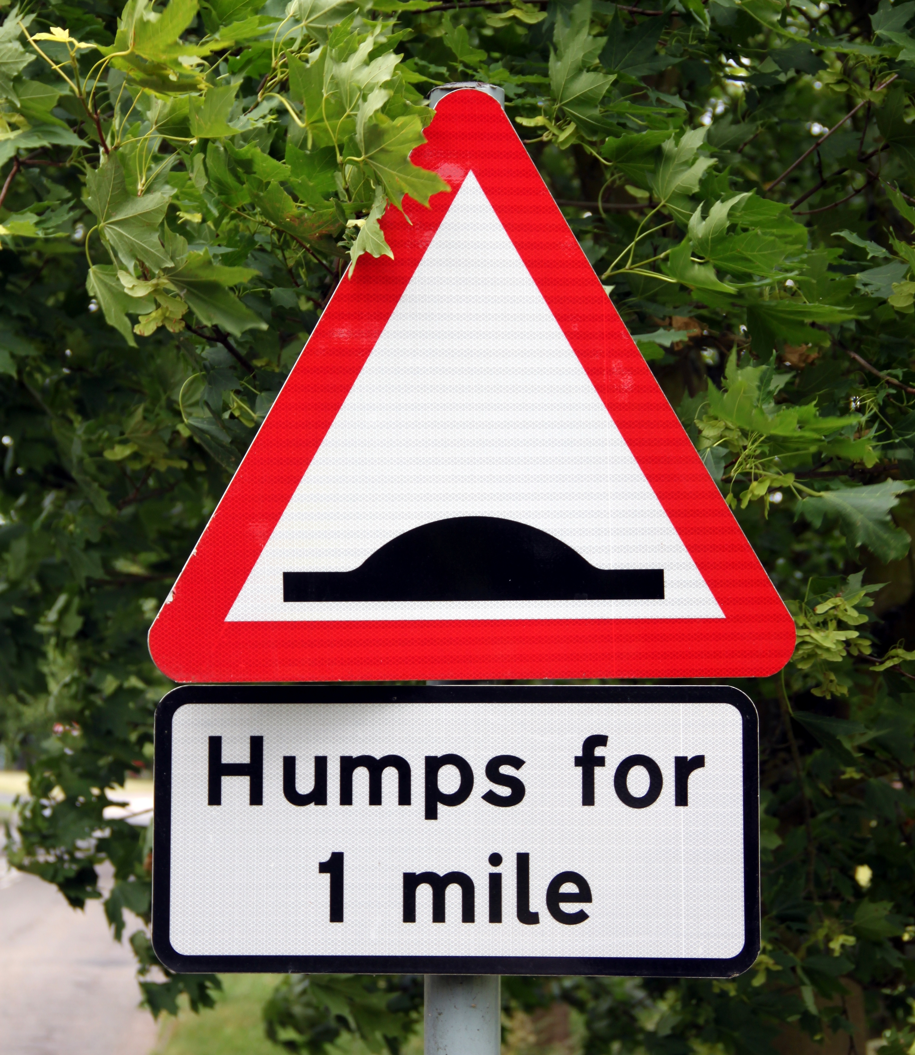
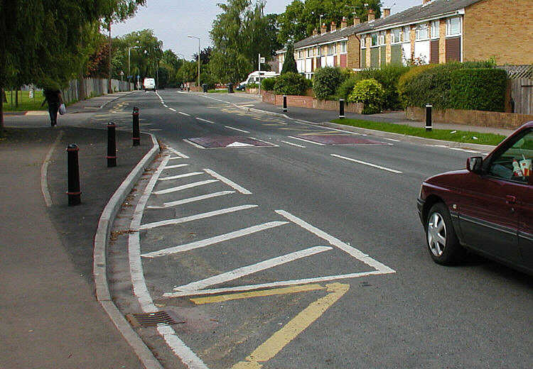
Speed bumps (also called traffic thresholds, speed breakers or sleeping policemen) are the common name for a class of traffic calming devices that use vertical deflection to slow motor-vehicle traffic in order to improve safety conditions. Variations include the speed hump, speed cushion, and speed table. The use of vertical deflection devices is widespread around the world, and they are most commonly used to enforce a low speed limit, under or lower. Although speed bumps are effective in keeping vehicle speeds down, their use is sometimes controversial—as they can increase traffic noise, may damage vehicles if traversed at too great a speed, and slow emergency vehicles. Poorly-designed speed bumps that stand too tall or with too-sharp an angle can be disruptive for drivers, and may be difficult to navigate for vehicles with low ground clearance, even at very low speeds. Many sports cars have this problem with such speed bumps. Speed bumps can also pose serious hazards to mot ... [...More Info...] [...Related Items...] OR: [Wikipedia] [Google] [Baidu] |
Speed Cushion
Speed bumps (also called traffic thresholds, speed breakers or sleeping policemen) are the common name for a class of traffic calming devices that use vertical deflection to slow motor-vehicle traffic in order to improve safety conditions. Variations include the speed hump, speed cushion, and speed table. The use of vertical deflection devices is widespread around the world, and they are most commonly used to enforce a low speed limit, under or lower. Although speed bumps are effective in keeping vehicle speeds down, their use is sometimes controversial—as they can increase traffic noise, may damage vehicles if traversed at too great a speed, and slow emergency vehicles. Poorly-designed speed bumps that stand too tall or with too-sharp an angle can be disruptive for drivers, and may be difficult to navigate for vehicles with low ground clearance, even at very low speeds. Many sports cars have this problem with such speed bumps. Speed bumps can also pose serious hazards to mot ... [...More Info...] [...Related Items...] OR: [Wikipedia] [Google] [Baidu] |
Traffic Calming
Traffic calming uses physical design and other measures to improve safety for motorists, pedestrians and bicycle-friendly, cyclists. It has become a tool to combat speeding and other unsafe behaviours of drivers in the neighbourhoods. It aims to encourage safer, more responsible driving and potentially reduce traffic flow. Urban planners and Traffic engineering (transportation), traffic engineers have many strategies for traffic calming, including narrowed roads and speed humps. Such measures are common in Australia and Europe (especially Northern Europe), but less so in North America. Traffic calming is a calque (literal translation) of the German word ''Verkehrsberuhigung'' – the term's first published use in English was in 1985 by Carmen Hass-Klau. History In its early development in the UK in the 1930s, traffic calming was based on the idea that residential areas should be protected from through-traffic. Subsequently, it became valued for its ability to improve pedest ... [...More Info...] [...Related Items...] OR: [Wikipedia] [Google] [Baidu] |
Rothwell, West Yorkshire
Rothwell is a town in the south-east of the City of Leeds metropolitan borough in West Yorkshire, England. It is situated between Leeds and Wakefield. It is in the Rothwell (ward), Rothwell ward of Leeds City Council and Elmet and Rothwell (UK Parliament constituency), Elmet and Rothwell UK Parliament constituencies, parliamentary constituency. Rothwell is part of the West Yorkshire Urban Area. Rothwell had a population of 21,010 in the 2001 census, and the Rothwell ward has an estimated population of 32,365. At the 2011 census the ward had a population of 20,354. The town is close to the A1 road (Great Britain), A1/M1 motorway, M1 link road and the Stourton park and ride. The nearest railway station is Woodlesford railway station, Woodlesford. History Rothwell was mentioned in the Domesday Book as ''"Rodewelle"''. One of the royal lodge's documented owners was John of Gaunt, 1st Duke of Lancaster, who is supposed to have killed the last wild boar in England while hunting ... [...More Info...] [...Related Items...] OR: [Wikipedia] [Google] [Baidu] |
Roundhay Park
Roundhay Park in Leeds, West Yorkshire, England, is one of the biggest city parks in Europe.Only Richmond Park (London), Phoenix Park (Dublin) and Silesian Culture and Recreation Park ( Chorzów, Poland) are larger. It covers more than of parkland, lakes, woodland and gardens which are owned by Leeds City Council. The park is one of the most popular attractions in Leeds; nearly a million people visit each year. It is situated on the north-east edge of the city, bordered by the suburb of Roundhay to the west, Oakwood to the south and the A6120 outer ring road to the north. History In the 11th century William the Conqueror granted the lands on which the park stands to Ilbert de Lacy for his support in the Harrying of the North in the winter 1069–70. De Lacy, who founded Pontefract Castle, was a knight from Normandy. During the 13th century, the area was used as a hunting park for the de Lacys, who were the Lords of Bowland on the Yorkshire-Lancaster border. Ownership of Rou ... [...More Info...] [...Related Items...] OR: [Wikipedia] [Google] [Baidu] |
River Aire
The River Aire is a major river in Yorkshire, England, in length. The ''Handbook for Leeds and Airedale'' (1890) notes that the distance from Malham to Howden is direct, but the river's meanderings extend that to . Between Malham Tarn and Airmyn, the river drops . Part of the river below Leeds is canalised, and is known as the Aire and Calder Navigation. Course The Aire starts at Malham Tarn and becomes a subterranean stream at 'Water Sinks' about one mile (1.6 km) before the top of Malham Cove, it then flows underground to Aire Head, just below Malham, in North Yorkshire, and then flows through Gargrave and Skipton. After Cononley, the river enters West Yorkshire where it passes through the former industrial areas of Keighley, Bingley, Saltaire and Shipley. It then passes through Leeds and on to Swillington and Woodlesford. At Castleford is the confluence of the Aire and Calder; just downstream of the confluence was the ford where the ancient British road, used by t ... [...More Info...] [...Related Items...] OR: [Wikipedia] [Google] [Baidu] |
East End Park, Leeds
East End Park is an inner city area of east Leeds, West Yorkshire, England. It is situated between Burmantofts to the north west, Harehills to the north east (although not a direct neighbour), Halton Moor to the east, Richmond Hill to the west and Cross Green to the south west. It blends into the Halton Moor/Osmondthorpe area and is 1 mile to the east of Leeds city centre in the LS9 Leeds postcode area. General description The area is situated in the vicinity of the A64 York Road, east Leeds' main thoroughfare, and is also home to a large park dating back from Victorian times which was purchased by Leeds City Council in the late 19th century, when it was waste land. Housing in the area is made up of nineteenth-century through terraced housing, some back-to-back terraced housing. Semi-detached and detached houses are also found in the area. Many of the back-to-back terraced houses in the area were due to be demolished as part of the £1.3 billion ''EASEL'' regeneration ... [...More Info...] [...Related Items...] OR: [Wikipedia] [Google] [Baidu] |
Garden Suburb
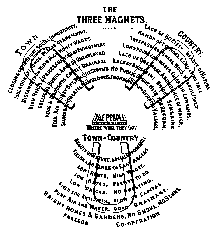
The garden city movement was a 20th century urban planning movement promoting satellite communities surrounding the central city and separated with greenbelts. These Garden Cities would contain proportionate areas of residences, industry, and agriculture. Ebenezer Howard first posited the idea in 1898 as a way to capture the primary benefits of the countryside and the city while avoiding the disadvantages presented by both. In the early 20th century, Letchworth, Brentham Garden Suburb and Welwyn Garden City were built in or near London according to Howard's concept and many other garden cities inspired by his model have since been built all over the world. History Conception Inspired by the utopian novel ''Looking Backward'' and Henry George's work ''Progress and Poverty'', Howard published the book '': a Peaceful Path to Real Reform'' in 1898 (which was reissued in 1902 as ''Garden Cities of To-morrow''). His idealised garden city would house 32,000 people on a site of , pl ... [...More Info...] [...Related Items...] OR: [Wikipedia] [Google] [Baidu] |


.jpg)


