|
Hallasan
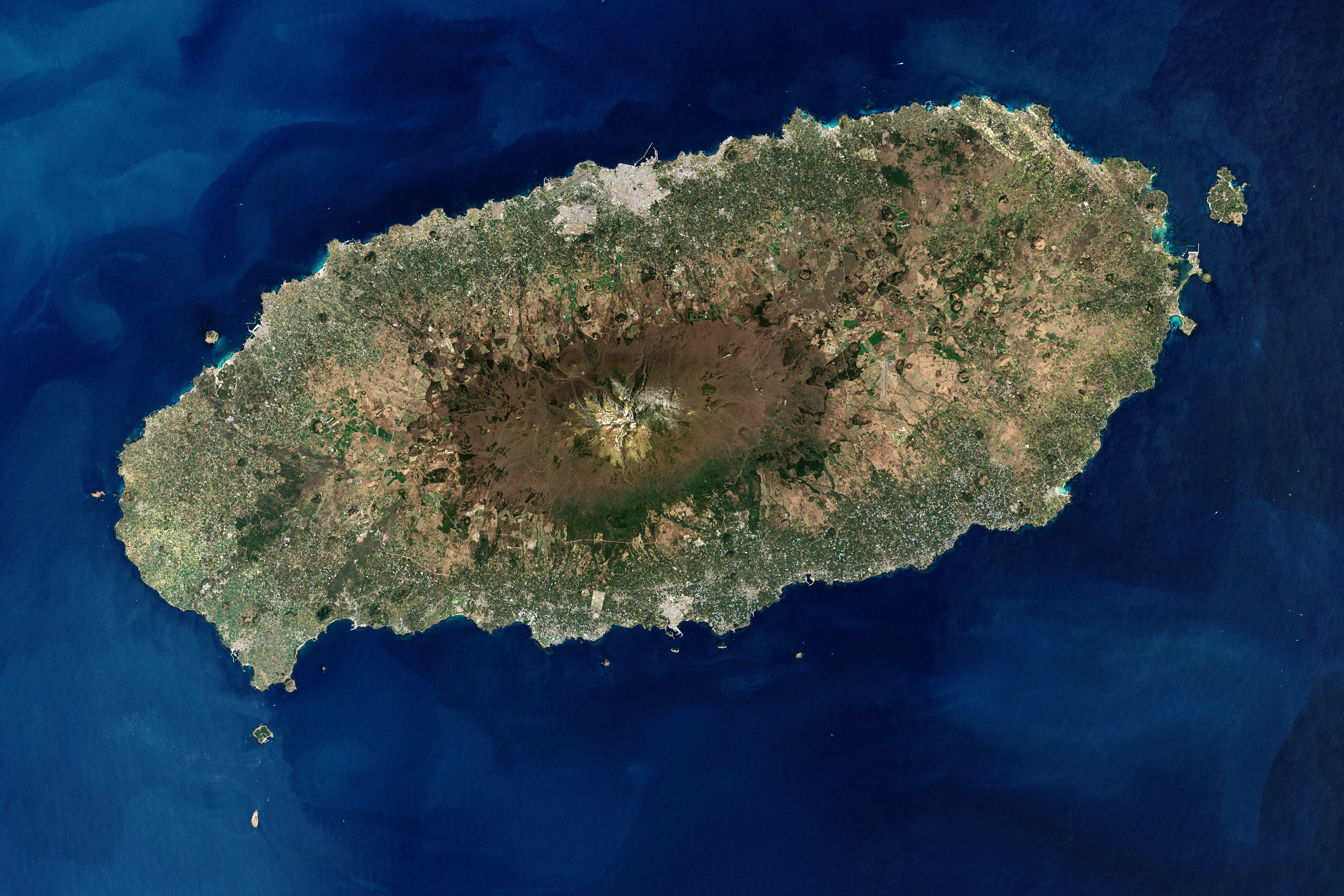
Hallasan is a shield volcano on Jeju Island in South Korea; it is the highest point of South Korea and the second-highest mountain in Korea overall, after Paektu Mountain. The area around the mountain is a designated national park, the Hallasan National Park (, ). Hallasan is commonly considered to be one of the three main mountains of South Korea, along with Jirisan and Seoraksan. Names Hallasan is the highest mountain in South Korea and is worshipped by people as they believe that gods and spirits live on the mountain. Alternate English names for the mountain include Hanla Mountain or Mount Halla and older English sources refer to the peak as Mount Auckland. Hallasan is written in Hangul as if it were ''Hanrasan'' (); however, it is still pronounced as ''Hallasan''. In the past, Hallasan has been known by numerous other names in Korean including ''Buak'' (/), ''Wonsan'' (/), ''Jinsan'' (/), ''Seonsan'' (/), ''Dumuak'' (/), ''Burasan'' (/), ''Yeongjusan'' (/), and ''Hyeolm ... [...More Info...] [...Related Items...] OR: [Wikipedia] [Google] [Baidu] |
Hallasan National Park
Hallasan National Park ( ko, 한라산국립공원, 漢拏山國立公園) is located in the province of Jeju-do, South Korea. It was designated as the 9th national park in 1970. It features the highest mountain in South Korea, the shield volcano Hallasan on Jeju Island. It was designated a UNESCO Biosphere Reserve in 2002, and a World Heritage Site in 2007. Hallasan National Park is managed by Jeju Special Self-Governing Province. It is the only out of 22 national parks that is not managed by the Korea National Park Service. Trails Hallasan has 7 trails: Eorimok Trail (6.8 km), Yeongsil Trail (5.8 km), Seongpanak Trail (9.6 km), Seokgulam Trail (1.5 km), Gwaneumsa Trail (8.7 km), Donnaeko Trail (7 km), and Eoseungsaengak Trail (1.3 km). The longest trail is Seongpanak Trail which takes about 4.5 hours. * Eorimok Trail() (6.8 km): Eorimok Trail Starts from Hallasan National Park’s Visitors center (altitude 970 m) and finishes at the ... [...More Info...] [...Related Items...] OR: [Wikipedia] [Google] [Baidu] |
Natural Monuments Of South Korea
The natural monuments of South Korea constitute a natural heritage system designated by the South Korean government according to the Natural Heritage Protection Law (문화재보호법) that considers significant natural resources, such as animals and plants. As of August 2022, a total of 702 (132+570) animal, plants, landforms, geological formations, and nature reserves had been designated by the Cultural Heritage Administration of South Korea as natural monuments and scenic sites, with 132 being scenic sites, and 570 of them natural monuments. Only 472 of these continue to maintain their natural monument designation, and only 129 maintained their scenic site designation.From pdf file 천연기념물과 통계 ��연기념물,명승2200831기준).pdf, available from link History During the period of Japanese occupation, the Japanese authorities legislated the "Rules to conserve artefacts and historic sites (고적및유물보존규칙)" in July 1916, and a law called The Act o ... [...More Info...] [...Related Items...] OR: [Wikipedia] [Google] [Baidu] |
Jeju Dialect
Jeju (Jeju: , ; ko, 제주어, or , ), often called Jejueo or Jejuan in English-language scholarship, is a Koreanic language traditionally spoken on Jeju Island, South Korea. While often classified as a divergent Jeju dialect ( ko, 제주방언, links=no, ) of the Korean language, the variety is referred to as a language in local government and increasingly in both South Korean and foreign academia. Jeju is not mutually intelligible with the mainland dialects of South Korea. The consonants of Jeju are similar to those of Seoul Korean, but Jeju has a larger and more conservative vowel inventory. Jeju is a head-final, agglutinative, suffixing language like Korean. Nouns are followed by particles that may function as case markers. Verbs inflect for tense, aspect, mood, evidentiality, relative social status, formality, and other grammatical information. Korean and Jeju differ significantly in their verbal paradigms. For instance, the continuative aspect marker of Jeju and the ... [...More Info...] [...Related Items...] OR: [Wikipedia] [Google] [Baidu] |
South Korea
South Korea, officially the Republic of Korea (ROK), is a country in East Asia, constituting the southern part of the Korea, Korean Peninsula and sharing a Korean Demilitarized Zone, land border with North Korea. Its western border is formed by the Yellow Sea, while its eastern border is defined by the Sea of Japan. South Korea claims to be the sole legitimate government of the entire peninsula and List of islands of South Korea, adjacent islands. It has a Demographics of South Korea, population of 51.75 million, of which roughly half live in the Seoul Capital Area, the List of metropolitan areas by population, fourth most populous metropolitan area in the world. Other major cities include Incheon, Busan, and Daegu. The Korean Peninsula was inhabited as early as the Lower Paleolithic period. Its Gojoseon, first kingdom was noted in Chinese records in the early 7th century BCE. Following the unification of the Three Kingdoms of Korea into Unified Silla, Silla and Balhae in the ... [...More Info...] [...Related Items...] OR: [Wikipedia] [Google] [Baidu] |
Parasitic Cone
A parasitic cone (also adventive cone or satellite cone) is the cone-shaped accumulation of volcanic material not part of the central vent of a volcano. It forms from eruptions from fractures on the flank of the volcano. These fractures occur because the flank of the volcano is unstable. Eventually, the fractures reach the magma chamber and generate eruptions called flank eruptions, which, in turn, produce a parasitic cone. A parasitic cone can also be formed from a dike or sill cutting up to the surface from the central magma chamber in an area different from the central vent. A peculiar example of multiple parasitic cones is Jeju Island in South Korea. Jeju features 368 " oreums" (; "mount"), which lie in a roughly lateral line on either side of the island's central dormant shield volcano Hallasan. See also *Flank crater A volcanic crater is an approximately circular depression in the ground caused by volcanic activity. It is typically a bowl-shaped feature containing ... [...More Info...] [...Related Items...] OR: [Wikipedia] [Google] [Baidu] |
Seoraksan
Seoraksan is the highest mountain in the Taebaek mountain range in the Gangwon Province (South Korea), Gangwon Province in eastern South Korea. It is located in a national park near the city of Sokcho. After the Hallasan volcano on Jeju-do, Jeju Island and Jirisan in the south, Seoraksan is the third highest mountain in South Korea. The ''Daechongbong Peak'' (대청봉) of Seoraksan reaches 1,708 meters (5,603 feet). The mountain is sometimes considered the backbone of South Korea. Geography Seoraksan is divided into Naeseorak (Inner Seorak), Oaeseorak (Outer Seorak), and Namseorak (South Seorak). Naeseorak (Inner Seorak) The area belonging to Inje-gun in the northwest and Daecheongbong Peak is called Naeseolak, Naeseorak features various valley views including Baekdam Valley, Gaya-dong Valley, Gugokdam Valley, Gugokdam Valley, 12 Seonnyeondang, Daeseung Falls and Yongajangseong Fortress. In addition to Cheonbul-dong Valley, it is easy to access Ulsan Rock, Gwongeumseong F ... [...More Info...] [...Related Items...] OR: [Wikipedia] [Google] [Baidu] |
Jirisan
Jirisan is a mountain located in the southern region of South Korea. It is the second-tallest mountain in South Korea after Jeju Island's Hallasan, and the tallest mountain in mainland South Korea. The 1915m-high mountain is located in Jirisan National Park. The park spans three provinces (North, South Jeolla and South Gyeongsang) and is the largest in South Korea. The largest proportion of the national park is in the province of South Gyeongsang. The highest peak of the mountain, Cheonwangbong is also located in this province. Another well-known peak is Samshin-bong (Three Spirits Peak). Jirisan is at the southern end of the Sobaek and Baekdudaegan mountain ranges, the "spine" of the Korean Peninsula incorporating the Sobaek mountain range and most of the Taebaek mountain range. There are seven major Buddhist temples on Jirisan. Hwaeomsa is the largest and best-known temple among these. It contains several national treasures, mostly stone artworks from about 600–900 ... [...More Info...] [...Related Items...] OR: [Wikipedia] [Google] [Baidu] |
List Of Countries By Highest Point
The following sortable table lists land surface elevation extremes by country or dependent territory. Topographic elevation is the vertical distance above the reference geoid, a mathematical model of the Earth's sea level as an equipotential gravitational surface. Table }) is a salt lake on the border between Turkmenistan and Uzbekistan which dries into salt ponds and can eventually leave a salt flat with an elevation as low as in Turkmenistan. At present, the water level of the main lake in Turkmenistan is about , with a higher lake in Uzbekistan at . , - , , Blue Hills on Providenciales , North Atlantic Ocean , - , , Unnamed location on Niulakita , South Pacific Ocean , - , , Mount Stanley ( Margherita Peak) , Albert Nile , - , , Hoverla , Kuyalnik Estuary , - , , Jabal Al Jais , Persian Gulf Gulf of Oman , - , , Ben Nevis , Holme Fen , - , , Denali , Badwater Basin , - , , Unnamed hill on Sand Island ( Johnston Atoll) , Pacific Ocean , - , ... [...More Info...] [...Related Items...] OR: [Wikipedia] [Google] [Baidu] |
Sand
Sand is a granular material composed of finely divided mineral particles. Sand has various compositions but is defined by its grain size. Sand grains are smaller than gravel and coarser than silt. Sand can also refer to a textural class of soil or soil type; i.e., a soil containing more than 85 percent sand-sized particles by mass. The composition of sand varies, depending on the local rock sources and conditions, but the most common constituent of sand in inland continental settings and non-tropical coastal settings is silica (silicon dioxide, or SiO2), usually in the form of quartz. Calcium carbonate is the second most common type of sand, for example, aragonite, which has mostly been created, over the past 500million years, by various forms of life, like coral and shellfish. For example, it is the primary form of sand apparent in areas where reefs have dominated the ecosystem for millions of years like the Caribbean. Somewhat more rarely, sand may be composed of calciu ... [...More Info...] [...Related Items...] OR: [Wikipedia] [Google] [Baidu] |
Lapilli
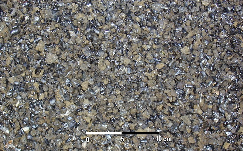
Lapilli is a size classification of tephra, which is material that falls out of the air during a volcanic eruption or during some meteorite impacts. ''Lapilli'' (singular: ''lapillus'') is Latin for "little stones". By definition lapilli range from in diameter. A pyroclastic particle greater than 64 mm in diameter is known as a volcanic bomb when molten, or a volcanic block when solid. Pyroclastic material with particles less than 2 mm in diameter is referred to as volcanic ash. Formation Lapilli are spheroid-, teardrop-, dumbbell- or button-shaped droplets of molten or semi-molten lava ejected from a volcanic eruption that fall to earth while still at least partially molten. These granules are not accretionary, but instead the direct result of liquid rock cooling as it travels through the air. Lapilli tuffs are a very common form of volcanic rock typical of rhyolite, andesite and dacite pyroclastic eruptions, where thick layers of lapilli can be deposited during a ... [...More Info...] [...Related Items...] OR: [Wikipedia] [Google] [Baidu] |
Drainage
Drainage is the natural or artificial removal of a surface's water and sub-surface water from an area with excess of water. The internal drainage of most agricultural soils is good enough to prevent severe waterlogging (anaerobic conditions that harm root growth), but many soils need artificial drainage to improve production or to manage water supplies. History Early history The Indus Valley civilization had sewerage and drainage systems. All houses in the major cities of Harappa and Mohenjo-daro had access to water and drainage facilities. Waste water was directed to covered gravity sewers, which lined the major streets. 18th and 19th century The invention of hollow-pipe drainage is credited to Sir Hugh Dalrymple, who died in 1753. Current practices Geotextiles New storm water drainage systems incorporate geotextile filters that retain and prevent fine grains of soil from passing into and clogging the drain. Geotextiles are synthetic textile fabrics specially ... [...More Info...] [...Related Items...] OR: [Wikipedia] [Google] [Baidu] |
Continental Shelf
A continental shelf is a portion of a continent that is submerged under an area of relatively shallow water, known as a shelf sea. Much of these shelves were exposed by drops in sea level during glacial periods. The shelf surrounding an island is known as an ''insular shelf''. The continental margin, between the continental shelf and the abyssal plain, comprises a steep continental slope, surrounded by the flatter continental rise, in which sediment from the continent above cascades down the slope and accumulates as a pile of sediment at the base of the slope. Extending as far as 500 km (310 mi) from the slope, it consists of thick sediments deposited by turbidity currents from the shelf and slope. The continental rise's gradient is intermediate between the gradients of the slope and the shelf. Under the United Nations Convention on the Law of the Sea, the name continental shelf was given a legal definition as the stretch of the seabed adjacent to the shores of a par ... [...More Info...] [...Related Items...] OR: [Wikipedia] [Google] [Baidu] |


