|
Hainaut Province
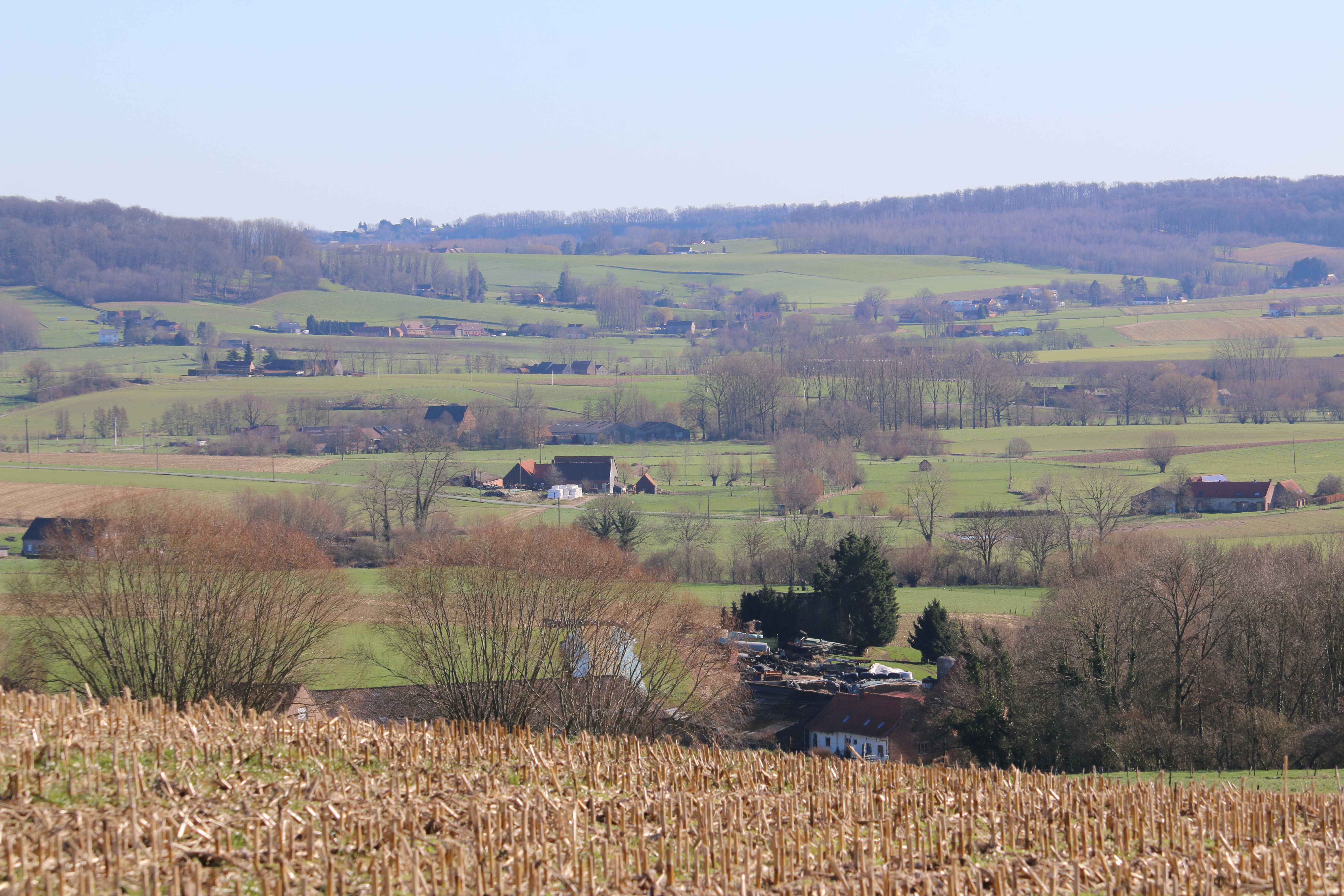
Hainaut (, also , , ; nl, Henegouwen ; wa, Hinnot; pcd, Hénau), historically also known as Heynowes in English, is a province of Wallonia and Belgium. To its south lies the French department of Nord, while within Belgium it borders (clockwise from the North) on the Flemish provinces of West Flanders, East Flanders, Flemish Brabant and the Walloon provinces of Walloon Brabant and Namur. Its capital is Mons (Dutch ''Bergen'') and the most populous city is Charleroi, the province's urban, economic and cultural hub, the financial capital of Hainaut and the fifth largest city in the country by population. Hainaut has an area of and as of January 2019 a population of 1,344,241. Another remarkable city is Tournai (Dutch ''Doornik'') on the Scheldt river, one of the oldest cities of Belgium and the first capital of the Frankish Empire. Hainaut province exists of a wavy landscape, except for the very southern part, the so-called ''Boot of Hainaut'', which is quite hilly and bel ... [...More Info...] [...Related Items...] OR: [Wikipedia] [Google] [Baidu] |
Provinces Of Belgium
The Kingdom of Belgium is divided into three regions. Two of these regions, Flanders and Wallonia, are each subdivided into five provinces. The third region, Brussels, does not belong to any province and nor is it subdivided into provinces. Instead, it has amalgamated both regional and provincial functions into a single "Capital Region" administration. Most of the provinces take their name from earlier duchies and counties of similar location, while their territory is mostly based on the departments installed during French annexation. At the time of the creation of Belgium in 1830, only nine provinces existed, including the province of Brabant, which held the City of Brussels. In 1995, Brabant was split into three areas: Flemish Brabant, which became a part of the region of Flanders; Walloon Brabant, which became part of the region of Wallonia; and the Brussels-Capital Region, which became a third region. These divisions reflected political tensions between the French-speaki ... [...More Info...] [...Related Items...] OR: [Wikipedia] [Google] [Baidu] |
Flemish Brabant
Flemish Brabant ( nl, Vlaams-Brabant ; french: Brabant flamand ) is a province of Flanders, one of the three regions of Belgium. It borders on (clockwise from the North) the Belgian provinces of Antwerp, Limburg, Liège, Walloon Brabant, Hainaut and East Flanders. Flemish Brabant also surrounds the Brussels-Capital Region. Its capital is Leuven. It has an area of which is divided into two administrative districts (''arrondissementen'' in Dutch) containing 65 municipalities. As of January 2019, Flemish Brabant has a population of 1,146,175. Flemish Brabant was created in 1995 by the splitting of the former province of Brabant into three parts: two new provinces, Flemish Brabant and Walloon Brabant; and the Brussels-Capital Region, which no longer belongs to any province. The split was made to accommodate the eventual division of Belgium in three regions (Flanders, Wallonia and the Brussels-Capital Region). The province is made up of two arrondissements. The Halle-Vilvoorde Arr ... [...More Info...] [...Related Items...] OR: [Wikipedia] [Google] [Baidu] |
Flemish Ardennes
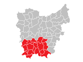
The Flemish Ardennes (Dutch: ''Vlaamse Ardennen'') is an informal name given to a hilly region in the south of the province of East Flanders, Belgium. Highest summit is the Hotondberg (145 m). Main characteristics of the region are rural hilly landscapes with hilltop bluebell woodlands (Muziekbos, Brakelbos, Kluisbos), windmills and watermills. The area is distinct and not adjacent to the larger Ardennes, which is further to the south east of the country in Wallonia, France, Germany and Luxembourg. Among the largest towns in the area are Oudenaarde, Ronse, Zottegem and Geraardsbergen. Cycling is particularly popular in the Flemish Ardennes. Many major bike races are held here, including a large part of the Tour of Flanders. Most of its toughest climbs (Koppenberg, Taaienberg, Molenberg, Paterberg, Oude Kwaremont, Muur van Geraardsbergen, Eikenberg) and most of its cobblestone-street sections (Paddestraat) are situated in the Flemish Ardennes. Photos Vlaamse Ardennen 03.jpg, ... [...More Info...] [...Related Items...] OR: [Wikipedia] [Google] [Baidu] |
Borinage
The Borinage () is an area in the Walloon province of Hainaut in Belgium. The name derives from the coal mines of the region, ''bores'' meaning mineshafts. In French the inhabitants of the Borinage are called Borains. The provincial capital Mons is located in the east of the Borinage, but there was a great sociological difference between the inhabitants of Mons and the Borains of all the villages around Mons. Rise and fall of coal "From the 18th century to 1850, the economy of thirty municipalities in the Borinage was founded on coal mining. Between 1822 and 1829, production more than doubled in that region i.e. from 602,000 to 1,260,000 tons. That was more than the total production of France and Germany at the time. The Borinage exported its coal mostly to France and Flanders." In 1878, several fossils of iguanodons were found: this find was unique because complete skeletons were present. When this area was occupied by the Germans in World War I, a few attempts were made ... [...More Info...] [...Related Items...] OR: [Wikipedia] [Google] [Baidu] |
Eau D'Heure Lakes
The Eau d'Heure lakes (french: lacs de l'Eau d'Heure) is a complex of five artificial lakes in Wallonia, forming the largest lake area in Belgium. The dams were built during the 1970s. The lakes are not far from the village of Cerfontaine, south of the city of Charleroi, and the border with France. They are within the municipalities of Cerfontaine (province of Namur) and Froidchapelle (province of Hainaut). The primary river feeding the lakes is the Eau d'Heure. There are five dams and one hydro-electric power station. The largest lake, the ''Lac de la Plate Taille'', is itself the largest single lake in the country, at , while together the lakes have a surface area of . It is a popular tourist attraction, with water sports, including fishing, kayaking, diving and windsurfing Windsurfing is a wind propelled water sport that is a combination of sailing and surfing. It is also referred to as "sailboarding" and "boardsailing", and emerged in the late 1960s from the aerospace ... [...More Info...] [...Related Items...] OR: [Wikipedia] [Google] [Baidu] |
L'Escaillère
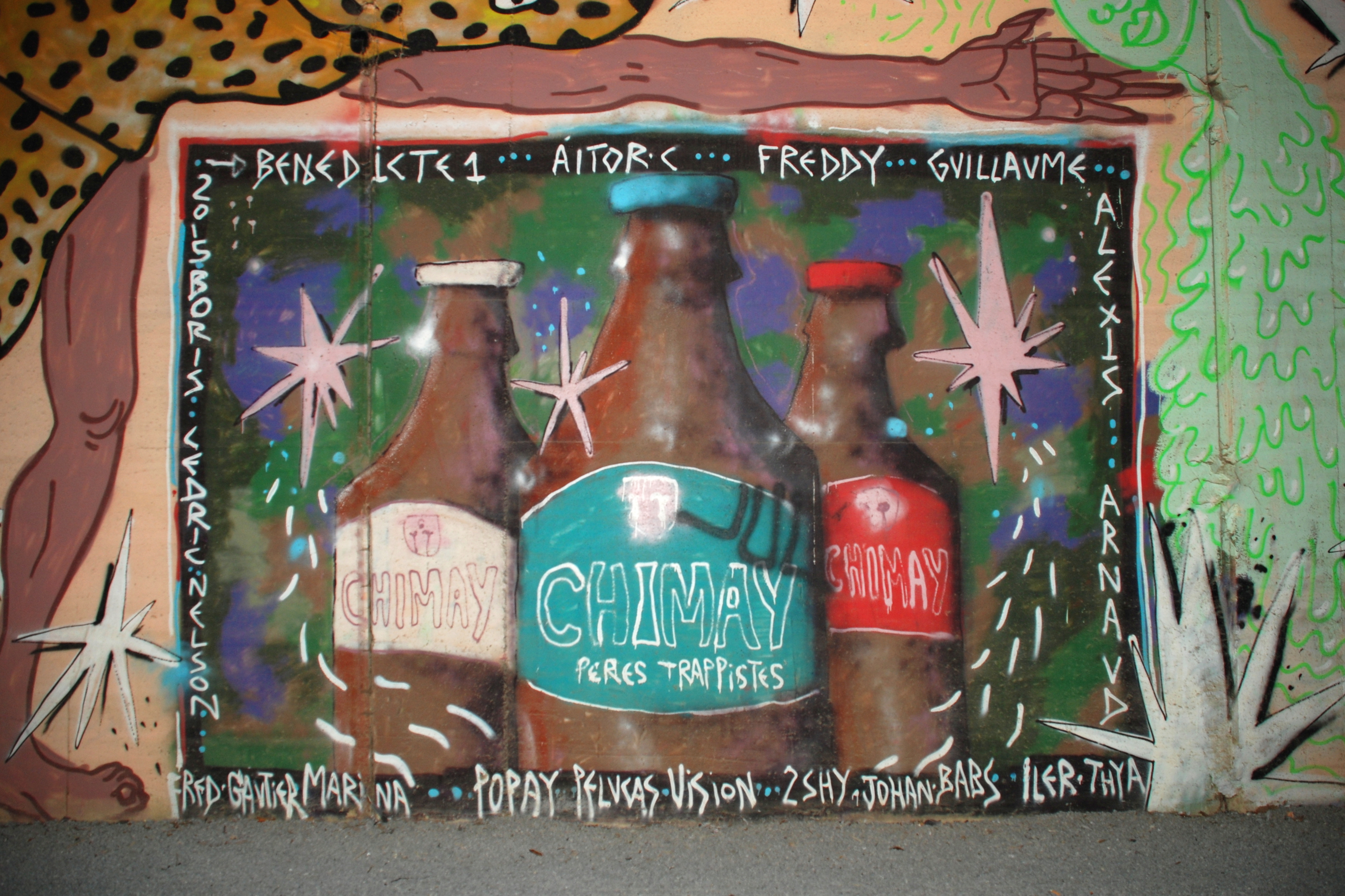
Chimay (, wa, Chimai) is a city and municipality of Wallonia located in the province of Hainaut, Belgium. In 2006, Chimay had a population of 9,774. The area is 197.10 km2 which gives a population density of 50 inhabitants per km2. It is the source of the Oise River. In the administrative district of Thuin, the municipality was created with a merger of 14 communes in 1977. The Trappist monastery of Scourmont Abbey in the town is famous for the Chimay Brewery. Toponymy The etymology of the name is ultimately, via Vulgar Latin, from the Proto-Celtic word ''koimos'' meaning "pretty, pleasant". Subdivisions The Walloon names of the place names are in brackets and italics. * Baileux (''Balieu'') * Bailièvre (''Bailleve'') * Bourlers (''Bourlé'') *Chimay (''Chimai'') * Forges (''Foidjes'') *L'Escaillère (''L'Ecayire'') * Lompret (''Lompré'') * Rièzes (''Rieze'') * Robechies (''Robchiye'') * Saint-Remy (''Sint-Rmey'') * Salles (''Sale'') * Vaulx (''Vå'') * Villers-la-Tour ( ... [...More Info...] [...Related Items...] OR: [Wikipedia] [Google] [Baidu] |
Condroz
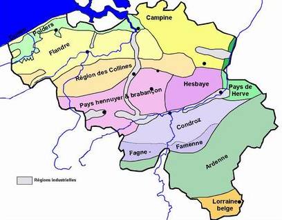
The Condroz () is a natural region in Wallonia (the French-speaking part of Belgium), located to the north-west of the Ardennes. Its unofficial capital is Ciney. The region preserves the name of the Condrusi, a Germanic tribe which inhabited the area in the Roman era. Compared to other parts of Belgium, the Condroz is a sparsely populated, agricultural area. It consists of low hills of an average altitude of about 200 to 300 meters (670–970 feet). It is mainly situated in the provinces of Liège and Namur and also in smaller parts of the Belgian provinces of Hainaut and Luxembourg. It is bordered in the north by the Meuse river, in the east by the Ardennes, in the south by the Famenne region. Historically, the Condroz did not stretch west of the Meuse, but today there is a western section, south of Namur and the Sambre river stretching to the Thiérache and southern Hainaut. History Very little is known of the Roman era Condrusi, after whom the region was originally ... [...More Info...] [...Related Items...] OR: [Wikipedia] [Google] [Baidu] |
Fagne (natural Region)
The Fagne or la Fagne (french: fen) is a natural region in southern Belgium and northern France, sometimes grouped with Famenne as Fagne-Famenne. It should not be confused with the High Fens (french: Hautes Fagnes), which are further east and straddle the border of Belgium and Germany. Etymology The word ''Fagne'' comes from the Walloon language, and means 'swampy ground'. This term comes from the Old Low Franconian *''fanja'' 'mud', in turn coming from the Gothic ''fani'' 'mud'. The English term 'fen' is a cognate. The Haute Fagnes in eastern Belgium share the same etymology. Geography The Fagne is mostly in the provinces of Namur and Hainaut in Wallonia in southern Belgium. It extends west into the French Arrondissement of Avesnes-sur-Helpe in the Nord department, in the Nord-Pas de Calais region. It is bounded on the east by the river Meuse, east of which lies Famenne, similar to the Fagne both geographically and naturally. [...More Info...] [...Related Items...] OR: [Wikipedia] [Google] [Baidu] |
Ardennes
The Ardennes (french: Ardenne ; nl, Ardennen ; german: Ardennen; wa, Årdene ; lb, Ardennen ), also known as the Ardennes Forest or Forest of Ardennes, is a region of extensive forests, rough terrain, rolling hills and ridges primarily in Belgium and Luxembourg, extending into Germany and France. Geologically, the range is a western extension of the Eifel; both were raised during the Givetian age of the Devonian (382.7 to 387.7 million years ago), as were several other named ranges of the same greater range. The Ardennes proper stretches well into Germany and France (lending its name to the Ardennes department and the former Champagne-Ardenne region) and geologically into the Eifel (the eastern extension of the Ardennes Forest into Bitburg-Prüm, Germany); most of it is in the southeast of Wallonia, the southern and more rural part of Belgium (away from the coastal plain but encompassing more than half of the country's total area). The eastern part of the Ardennes forms the ... [...More Info...] [...Related Items...] OR: [Wikipedia] [Google] [Baidu] |
Frankish Empire
Francia, also called the Kingdom of the Franks ( la, Regnum Francorum), Frankish Kingdom, Frankland or Frankish Empire ( la, Imperium Francorum), was the largest post-Roman barbarian kingdom in Western Europe. It was ruled by the Franks during late antiquity and the Early Middle Ages. After the Treaty of Verdun in 843, West Francia became the predecessor of France, and East Francia became that of Germany. Francia was among the last surviving Germanic kingdoms from the Migration Period era before its partition in 843. The core Frankish territories inside the former Western Roman Empire were close to the Rhine and Meuse rivers in the north. After a period where small kingdoms interacted with the remaining Gallo-Roman institutions to their south, a single kingdom uniting them was founded by Clovis I who was crowned List of Frankish kings, King of the Franks in 496. His dynasty, the Merovingian dynasty, was eventually replaced by the Carolingian dynasty. Under the nearly continu ... [...More Info...] [...Related Items...] OR: [Wikipedia] [Google] [Baidu] |
Scheldt
The Scheldt (french: Escaut ; nl, Schelde ) is a river that flows through northern France, western Belgium, and the southwestern part of Netherlands, the Netherlands, with its mouth at the North Sea. Its name is derived from an adjective corresponding to Old English ' ("shallow"), English language, Modern English ''shoal'', Low German ''schol'', West Frisian language, West Frisian ''skol'', and Swedish language, Swedish (obsolete) ''skäll'' ("thin"). Course The headwaters of the Scheldt are in Gouy, Aisne, Gouy, in the Aisne department of northern France. It flows north through Cambrai and Valenciennes, and enters Belgium near Tournai. Ghent developed at the confluence of the Lys (river), Lys, one of its main tributaries, and the Scheldt, which then turns east. Near Antwerp, the largest city on its banks, the Scheldt flows west into the Netherlands toward the North Sea. Originally there were two branches from that point: the Oosterschelde (Eastern Scheldt); and the Westersc ... [...More Info...] [...Related Items...] OR: [Wikipedia] [Google] [Baidu] |
Tournai
Tournai or Tournay ( ; ; nl, Doornik ; pcd, Tornai; wa, Tornè ; la, Tornacum) is a city and municipality of Wallonia located in the province of Hainaut, Belgium. It lies southwest of Brussels on the river Scheldt. Tournai is part of Eurometropolis Lille–Kortrijk–Tournai, which had 2,155,161 residents in 2008. Tournai is one of the oldest cities in Belgium and has played an important role in the country's cultural history. It was the first capital of the Frankish Empire, with Clovis I being born here. Geography Tournai is located in the Picardy Wallonia and Romance Flanders region of Belgium, at the southern limit of the Flemish plain, in the basin of the River Scheldt (''Escaut'' in French, ''Schelde'' in Dutch). Administratively, the town is part of the Province of Hainaut, itself part of Wallonia. It is also a municipality that is part of the French-speaking Community of Belgium. Tournai has its own arrondissements, both administrative and judicial. Its area of ma ... [...More Info...] [...Related Items...] OR: [Wikipedia] [Google] [Baidu] |

.png)


