|
History Of Zambia
The history of Zambia experienced many stages from colonization to independence from Britain on October 24, 1964. Northern Rhodesia became a British sphere of influence in the present-day region of Zambia in 1888, and was officially proclaimed a British protectorate in 1924. After many years of suggested mergers, Southern Rhodesia, Northern Rhodesia, and Nyasaland were merged into the British Federation of Rhodesia and Nyasaland. By 1960, British Prime Minister, Harold Macmillan, declared that the age of colonial rule in Africa was ending. Finally, in December 1963, the federation was dissolved, and the Republic of Zambia was formed out of Northern Rhodesia on October 24, 1964. History Prehistoric era Archaeological excavation work on the Zambezi Valley and Kalambo Falls show a succession of human cultures. In particular, ancient camping site tools near the Kalambo Falls have been radiocarbon dated to more than 36,000 years ago. The fossil skull remains of Broken Hill Man, da ... [...More Info...] [...Related Items...] OR: [Wikipedia] [Google] [Baidu] |
Colonization
Colonization, or colonisation, constitutes large-scale population movements wherein migrants maintain strong links with their, or their ancestors', former country – by such links, gain advantage over other inhabitants of the territory. When colonization takes place under the protection of Colonialism, colonial structures, it may be termed settler colonialism. This often involves the settlers dispossessing Indigenous peoples, indigenous inhabitants, or instituting legal and other structures which disadvantage them. Colonization can be defined as a process of establishing foreign control over target territory, territories or people, peoples for the purpose of colonialism, cultivation, often by establishing Colony, colonies and possibly by settling them. In colonies established by Western European countries in the Americas, Australia, and New Zealand, settlers (supplemented by Central European, Eastern European, Asian, and African people) eventually formed a large majority of ... [...More Info...] [...Related Items...] OR: [Wikipedia] [Google] [Baidu] |
Kafwe Twa
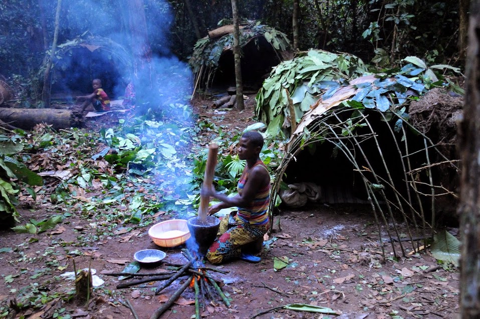
The Twa of the Kafue Flats wetlands of Zambia are one of several fishing and hunter-gatherer castes living in a patron-client relationship with farming Bantu peoples across central and southern Africa. In Southern Province, where swampy terrain means that large-scale crops cannot be planted near the main rivers, only the Twa fish.This may once have been true of the entire country, but due to the commercial market for fish, immigrant fishermen now work the north and east of Zambia. They exchange their catch for agricultural produce from their Bantu/village patrons, the Tonga and perhaps the Ila, who build villages at the ecotone on the margins of the floodplain, which they call ''Butwa'' "Twa country". The Kafue Twa have a dark-hut method of fishing unique in Africa. The sides of the river are covered with a thick mat of vegetation. The Twa raise a small reed platform about 3 square at the margin of the vegetation, with a tube in the center down to the water. They cove ... [...More Info...] [...Related Items...] OR: [Wikipedia] [Google] [Baidu] |
West Africa
West Africa or Western Africa is the westernmost region of Africa. The United Nations defines Western Africa as the 16 countries of Benin, Burkina Faso, Cape Verde, The Gambia, Ghana, Guinea, Guinea-Bissau, Ivory Coast, Liberia, Mali, Mauritania, Niger, Nigeria, Senegal, Sierra Leone, and Togo, as well as Saint Helena, Ascension and Tristan da Cunha ( United Kingdom Overseas Territory).Paul R. Masson, Catherine Anne Pattillo, "Monetary union in West Africa (ECOWAS): is it desirable and how could it be achieved?" (Introduction). International Monetary Fund, 2001. The population of West Africa is estimated at about million people as of , and at 381,981,000 as of 2017, of which 189,672,000 are female and 192,309,000 male. The region is demographically and economically one of the fastest growing on the African continent. Early history in West Africa included a number of prominent regional powers that dominated different parts of both the coastal and internal trade networks, suc ... [...More Info...] [...Related Items...] OR: [Wikipedia] [Google] [Baidu] |
African Great Lakes
The African Great Lakes ( sw, Maziwa Makuu; rw, Ibiyaga bigari) are a series of lakes constituting the part of the Rift Valley lakes in and around the East African Rift. They include Lake Victoria, the second-largest fresh water lake in the world by area, Lake Tanganyika, the world's second-largest freshwater lake by volume and depth, and Lake Malawi, the world's eighth-largest fresh water lake by area. Collectively, they contain 31,000 km3 (7400 cu mi) of water, which is more than either Lake Baikal or the North American Great Lakes. This total constitutes about 25% of the planet's unfrozen surface fresh water. The large rift lakes of Africa are the ancient home of great biodiversity, and 10% of the world's fish species live in this region. Riparian countries in the African Great Lakes region include: Burundi, the Democratic Republic of the Congo, Ethiopia, Kenya, Malawi, Mozambique, Rwanda, Zambia, Tanzania, and Uganda. Lakes and drainage basins The following are ... [...More Info...] [...Related Items...] OR: [Wikipedia] [Google] [Baidu] |
Central Africa
Central Africa is a subregion of the African continent comprising various countries according to different definitions. Angola, Burundi, the Central African Republic, Chad, the Democratic Republic of the Congo, the Republic of the Congo, Equatorial Guinea, Gabon, Rwanda, and São Tomé and Príncipe are members of the Economic Community of Central African States (ECCAS). Six of those states (the Central African Republic, Chad, the Republic of the Congo, Equatorial Guinea, and Gabon) are also members of the Economic and Monetary Community of Central Africa (CEMAC) and share a common currency, the Central African CFA franc. The African Development Bank defines Central Africa as the Central African Republic, Chad, the Democratic Republic of the Congo, the Republic of the Congo, Equatorial Guinea, and Gabon. Middle Africa is an analogous term used by the United Nations in its geoscheme for Africa. It includes the same countries as the African Development Bank's definition, ... [...More Info...] [...Related Items...] OR: [Wikipedia] [Google] [Baidu] |
Southern Africa
Southern Africa is the southernmost subregion of the African continent, south of the Congo and Tanzania. The physical location is the large part of Africa to the south of the extensive Congo River basin. Southern Africa is home to a number of river systems; the Zambezi River being the most prominent. The Zambezi flows from the northwest corner of Zambia and western Angola to the Indian Ocean on the coast of Mozambique. Along the way, the Zambezi River flows over the mighty Victoria Falls on the border between Zambia and Zimbabwe. Victoria Falls is one of the largest waterfalls in the world and a major tourist attraction for the region. Southern Africa includes both subtropical and temperate climates, with the Tropic of Capricorn running through the middle of the region, dividing it into its subtropical and temperate halves. Countries commonly included in Southern Africa include Angola, Botswana, the Comoros, Eswatini, Lesotho, Madagascar, Malawi, Mauritius, Mozambique, Namib ... [...More Info...] [...Related Items...] OR: [Wikipedia] [Google] [Baidu] |
East Africa
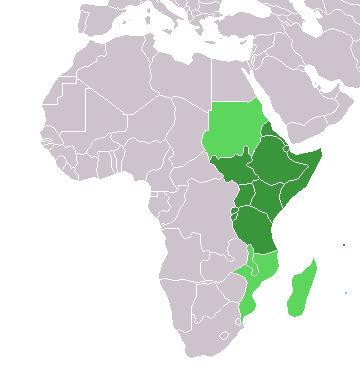
East Africa, Eastern Africa, or East of Africa, is the eastern subregion of the African continent. In the United Nations Statistics Division scheme of geographic regions, 10-11-(16*) territories make up Eastern Africa: Due to the historical Omani Empire and colonial territories of the British East Africa Protectorate and German East Africa, the term ''East Africa'' is often (especially in the English language) used to specifically refer to the area now comprising the three countries of Kenya, Tanzania, and Uganda. However, this has never been the convention in many other languages, where the term generally had a wider, strictly geographic context and therefore typically included Djibouti, Eritrea, Ethiopia, and Somalia.Somaliland is not included in the United Nations geoscheme, as it is internationally recognized as a part of Somalia. *Tanzania, Kenya, Uganda, Rwanda, Burundi, Democratic Republic of Congo and South Sudan are members of the East African Community. The firs ... [...More Info...] [...Related Items...] OR: [Wikipedia] [Google] [Baidu] |
Ethnolinguistic Group
An ethnolinguistic group (or ethno-linguistic group) is a group that is unified by both a common ethnicity and language. Most ethnic groups share a first language. However, "ethnolinguistic" is often used to emphasise that language is a major basis for the ethnic group, especially in regard to its neighbours. A central concept in the linguistic study of ethnolinguistic groups is ethnolinguistic vitality, the ability of the group's language and ethnicity to sustain themselves. An ethnolinguistic group that lacks such vitality is unlikely to survive as a distinct entity. Factors that influence the ethnolinguistic vitality are demographics, institutional control and status (including language planning factors). See also *First language * Ethnolinguistics *Ethnoreligious group *Nation state *Race (human classification) *Regionalism (politics) Regionalism is a political ideology that seeks to increase the political power, influence, and/or self-determination of the people of one ... [...More Info...] [...Related Items...] OR: [Wikipedia] [Google] [Baidu] |
Hunter-gatherer
A traditional hunter-gatherer or forager is a human living an ancestrally derived lifestyle in which most or all food is obtained by foraging, that is, by gathering food from local sources, especially edible wild plants but also insects, fungi, honey, or anything safe to eat, and/or by hunting game (pursuing and/or trapping and killing wild animals, including catching fish), roughly as most animal omnivores do. Hunter-gatherer societies stand in contrast to the more sedentary agricultural societies, which rely mainly on cultivating crops and raising domesticated animals for food production, although the boundaries between the two ways of living are not completely distinct. Hunting and gathering was humanity's original and most enduring successful competitive adaptation in the natural world, occupying at least 90 percent of human history. Following the invention of agriculture, hunter-gatherers who did not change were displaced or conquered by farming or pastoralist groups in ... [...More Info...] [...Related Items...] OR: [Wikipedia] [Google] [Baidu] |
Mumbwa Caves
The Mumbwa Caves are an archeological site in Zambia. The site has yielded artifacts that date from the Mesolithic, Neolithic and the Iron Age. The caves are a source of stratified, in situ deposits with faunal and human remains. Mumbwa, with its interior structures, demonstrates the complexity of the behavioral abilities of the people from the Mesolithic. Selection of raw materials along with features such as hearths suggests a population which was modern in its behaviors used to inhabit the Mumbwa Caves. Study and excavation of the Mumbwa Caves is helping to fill in the gaps in the late Pleistocene prehistory of south central Africa. Excavations Macrae 1926; Clark 1942; Savage 1983. In 1931, Dart and Del Grande excavated the caves and discovered intact basal deposits which were used to date the site. In 1993, Lawrence Barham gathered a team represented by the Zambian National Heritage Conservation Commission, the Livingstone Museum and the Universities of Bristol and Oxfo ... [...More Info...] [...Related Items...] OR: [Wikipedia] [Google] [Baidu] |
Mwela Rock Paintings
The Mwela Rock Paintings are a national monument of Zambia, about east of Kasama. The rock paintings (about 700 in all) are in caves and overhangs spread over a very wide area of bush, north of the Kasama Isoka road at 10°10' S 31°13' E, where a signpost denotes the ‘Mwela Rocks National Monument’ with an entry kiosk and guides to escort visitors. The site encompasses eastwards rock outcrops of Mwankole, Sumina, Mulundu, Fwambo, Changa Mwibwe and westwards 10 km from the town Lwimbo rock outcrops. The paintings are associated with the Later Stone Age. Archaeologists rate the Kasama rock art as one of the largest and most significant collections of ancient art in Southern Africa, though their quality is outdone in Zimbabwe and Namibia. The works are attributed to Stone Age hunter-gatherers (sometimes known as Batwa or Twa) and are up to 2000 years old. Many are abstract designs, but some of the finest pictographs show human figures and animals, often capturing a remark ... [...More Info...] [...Related Items...] OR: [Wikipedia] [Google] [Baidu] |


