|
History Of Hunslet
Ever since its early days Hunslet has been the 'Workshop of Leeds'. Although from the Industrial Revolution onwards there have been other areas in Leeds to have a large industrial base, such as Holbeck, Armley, Kirkstall and Harehills, none so much as Hunslet. Like neighbouring Holbeck, Hunslet benefited from its close proximity with the River Aire, Leeds city centre, coal mining communities to the south, extensive railways and some of Leeds' best infrastructure. From the 1960s onwards the motorways would also drive industry and commerce in Hunslet. Hunslet grew from an unremarkable area at the beginning of the Industrial Revolution to a major industrial area only a few years later. The growing industries in Hunslet were not the textile industries, for which Leeds was becoming best known, but generally heavier industries such as steel and iron foundries, engine works and railway works. 1906 By 1906, Hunslet was home to Leeds’ second largest gas works, the city's main rail g ... [...More Info...] [...Related Items...] OR: [Wikipedia] [Google] [Baidu] |
Hunslet Feast
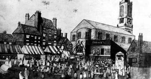
Hunslet () is an inner-city area in south Leeds, West Yorkshire, England. It is southeast of the city centre and has an industrial past. It is situated in the Hunslet and Riverside ward of Leeds City Council and Leeds Central parliamentary constituency. The population of the previous City and Hunslet council ward at the 2011 census was 33,705. Many engineering companies were based in Hunslet, including John Fowler & Co. manufacturers of traction engines and steam rollers, the Hunslet Engine Company builders of locomotives (including those used during the construction of the Channel Tunnel), Kitson & Co., Manning Wardle and Hudswell Clarke. Many railway locomotives were built in the Jack Lane area of Hunslet. The area has a mixture of modern and 19th century industrial buildings, terraced housing and 20th century housing. It is an area that has grown up significantly around the River Aire in the early years of the 21st century, especially with the construction of modern r ... [...More Info...] [...Related Items...] OR: [Wikipedia] [Google] [Baidu] |
Hunslet Grange Flats
The Hunslet Grange Flats (colliqually known as the Leek Street Flats) was a complex of deck-accessed flats in Hunslet, Leeds. Planning and construction Slum clearances in the 1960s led to clearing of much of Hunslet with many terraced housing, mostly back-to-backs. Deck accessed flats were becoming a common solution in cities around this time. Leeds had one development of medium rise large scale flats, which were built in Quarry Hill in the 1930s, however they were more conventional in their enclosed design. Construction of the complex of 350 flats and maisonettes began in 1968 The complex was commissioned by Leeds City Council and built by Shepherd Construction. The building was built of pre-fabricated concrete panels and constructed using temporary cranes built on site which ran on rails across the footprints of where the buildings were to be built. Design The complex was built in the style of so-called 'streets in the sky' with overhead walkways connecting blocks. Th ... [...More Info...] [...Related Items...] OR: [Wikipedia] [Google] [Baidu] |
History Of Seacroft
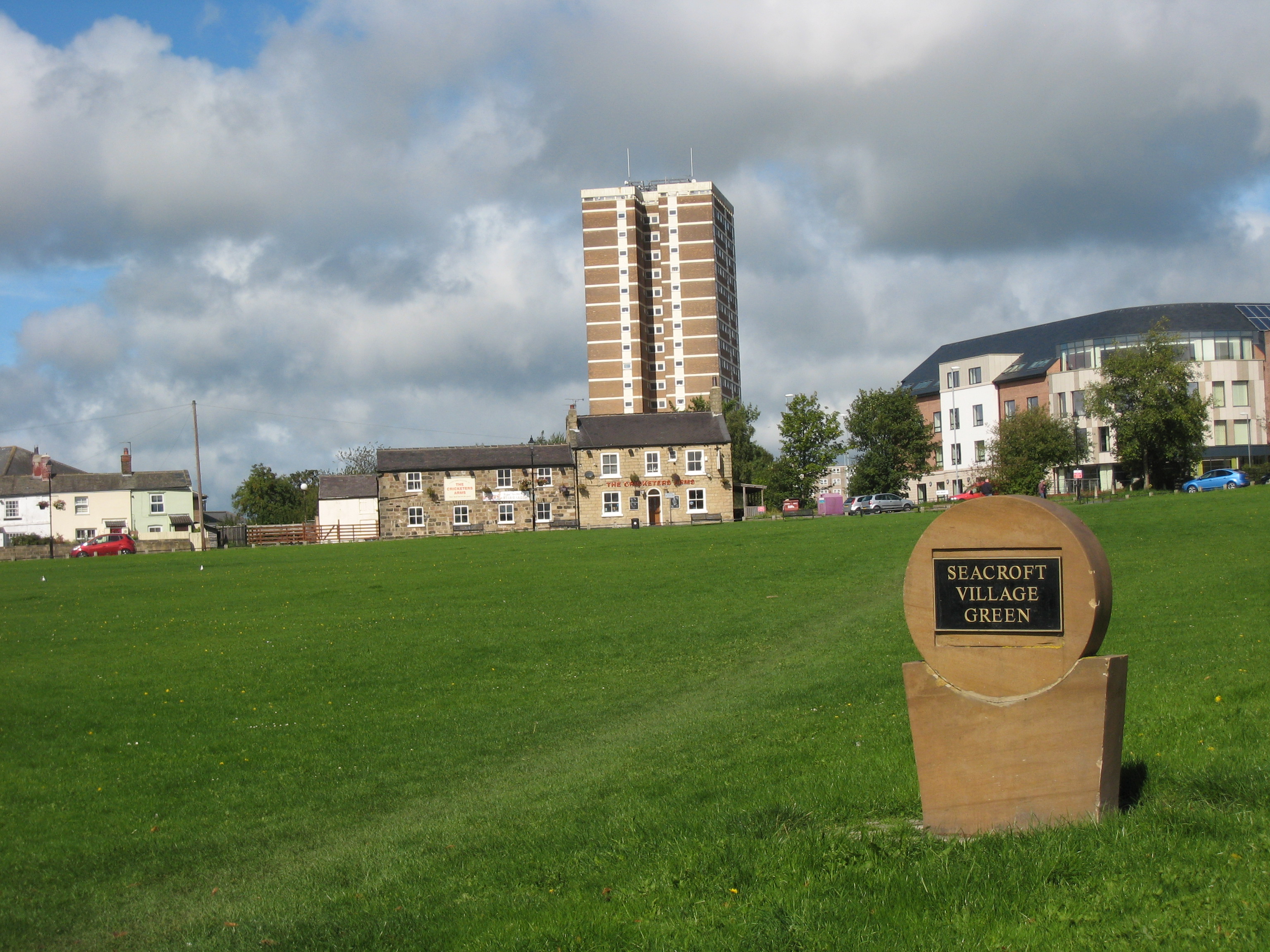
Seacroft (once a village, now a suburb of Leeds, England) pre-dates the Domesday book, with evidence of a settlement in the area from the Neolithic Age. Seacroft remained largely unchanged for centuries as a small Yorkshire village, until in the 1950s the area was developed into Leeds' largest council estate. In the 1960s and 1970s the building of Whinmoor and Swarcliffe enclosed Seacroft within other suburbs. Seacroft Village Seacroft has a history dating back beyond the publication of the Domesday Book (1086). However, there is evidence of inhabitation prior to that, during construction of the estate in the 1950s, a stone axe dating from the Neolithic age (3500)-(2100)BC was found on Kentmere Avenue, while two silver Roman coins were found on Seacroft Green in the 1850s. The Venerable Bede records the battle of Winwaed between King Oswy's forces and the, unsuccessful, invading Mercians under King Penda. Bede gives this as taking place near Seacroft on 15 November 655. T ... [...More Info...] [...Related Items...] OR: [Wikipedia] [Google] [Baidu] |
History Of Leeds
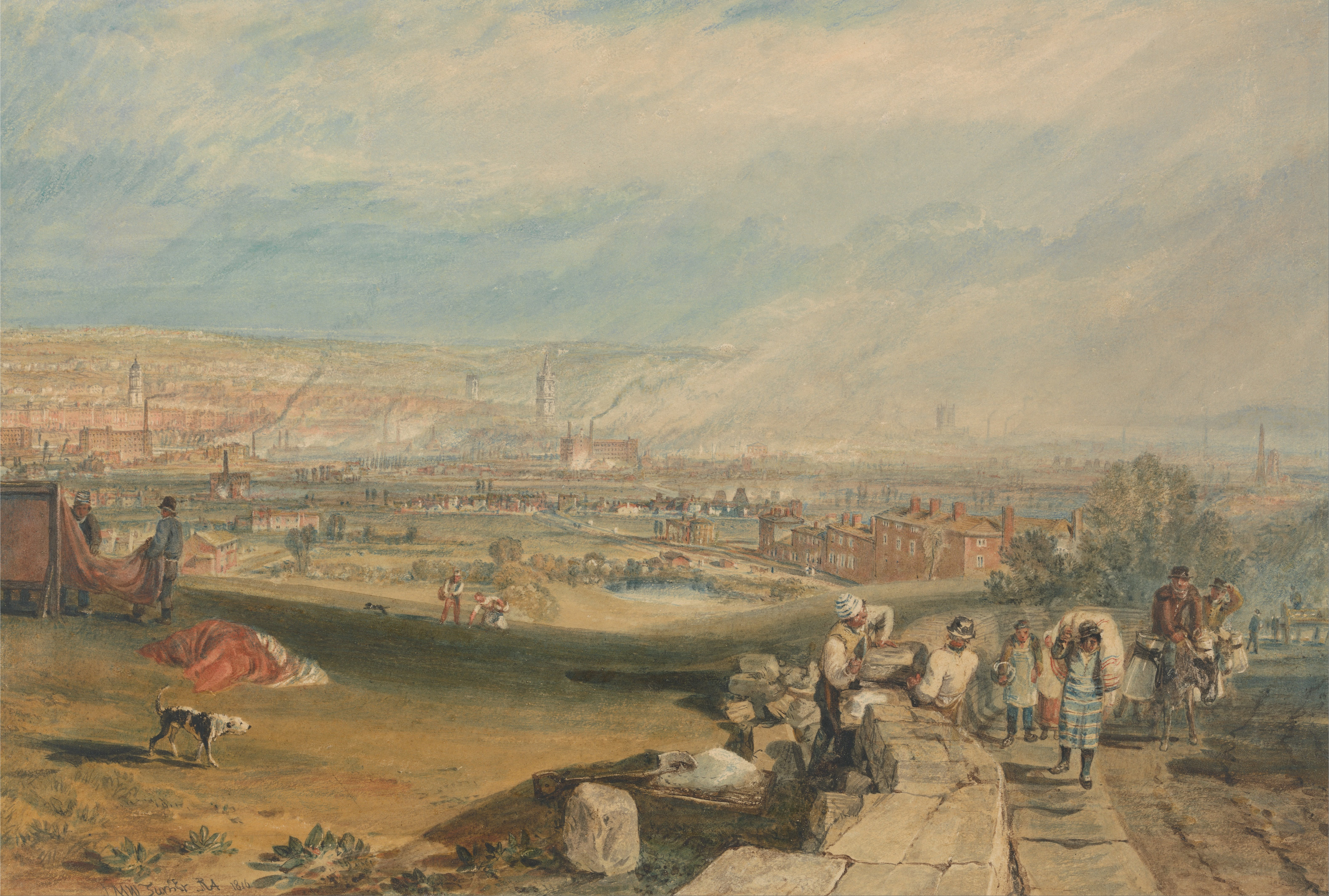
Loidis, from which Leeds derives its name, was anciently a forested area of the Celtic kingdom of Elmet. The settlement certainly existed at the time of the Norman conquest of England and in 1086 was a thriving manor under the overlordship of Ilbert de Lacy. It gained its first charter from Maurice de Gant in 1207 yet only grew slowly throughout the medieval and Tudor periods. The town had become part of the Duchy of Lancaster and reverted to the crown in the medieval period, so was a Royalist stronghold at the start of the English Civil War. In the seventeenth and eighteenth centuries Leeds prospered and expanded as a centre of the woollen industry and it continued to expand rapidly in the Industrial Revolution. Following a period of post industrial decline in the mid twentieth century Leeds' prosperity revived with the development of tertiary industrial sectors. Name The name "Leeds" is first attested in the form "Loidis": around 731 Bede mentioned it in book II, chapter 14 ... [...More Info...] [...Related Items...] OR: [Wikipedia] [Google] [Baidu] |
Leeds New Lane Railway Station
Leeds New Lane was a proposed new railway station to accommodate High Speed Two rail services in West Yorkshire, England. It was planned to be constructed on a viaduct on New Lane south of Leeds city centre, the River Aire and Leeds railway station, Leeds City station to which it would be connected by an elevated walkway. The site is occupied by ''Central Park'', a small low-rise office park built in the 1990s and other small office buildings. Whilst originally the preferred station option, a November 2015 review of the phase two route instead proposed that the Leeds HS2 platforms should join onto the side of the existing Leeds railway station, Leeds station. Unlike New Lane, this would have provided a common concourse for easy interchange between high speed and classic rail services. Background In 2009, the Brown Ministry, Labour Government created ''High Speed Two Ltd'' to examine the prospect of further high-speed rail in the United Kingdom. Later in 2010, the Cameron– ... [...More Info...] [...Related Items...] OR: [Wikipedia] [Google] [Baidu] |
High Speed 2
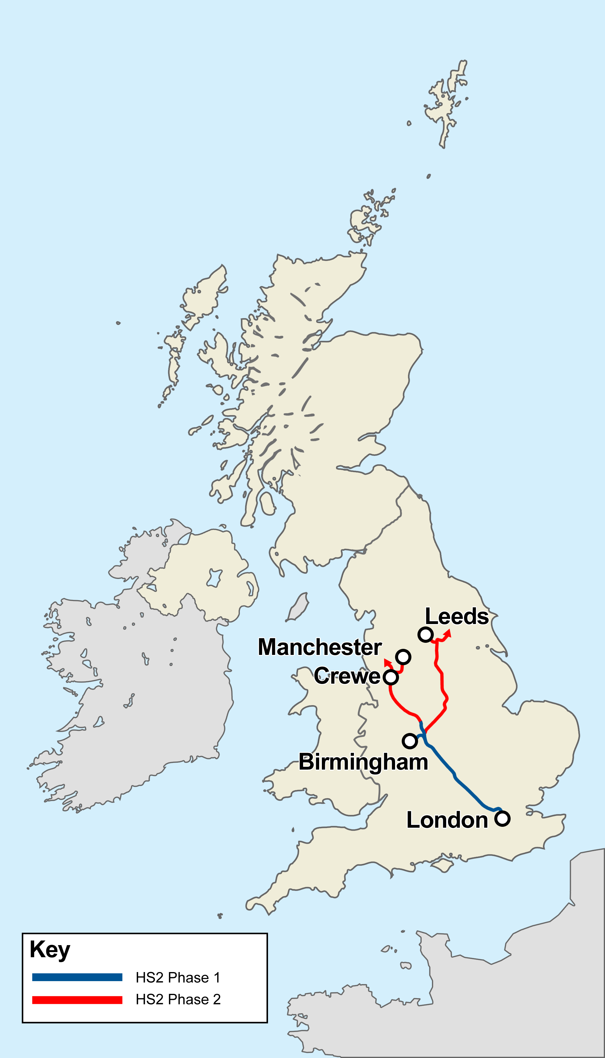
High Speed 2 (HS2) is a planned high-speed railway line in England, the first phase of which is under construction in stages and due for completion between 2029 and 2033, depending on approval for later stages. The new line will run from its most southerly terminus, London, to its most northerly point, Manchester, with branches to Birmingham and the East Midlands. HS2 will be Britain's second purpose-built High-speed rail in the United Kingdom, high-speed line, the first being High Speed 1, which connects London to the Channel Tunnel. At its southern end, the line will terminate at London's London Euston railway station, Euston station while other termini will be Birmingham Curzon Street railway station, Birmingham Curzon Street station and Manchester Piccadilly station. In addition to these stations, the dedicated track will serve Old Oak Common railway station, Old Oak Common in west London, Birmingham Interchange, East Midlands Parkway railway station, East Midlands Parkway ... [...More Info...] [...Related Items...] OR: [Wikipedia] [Google] [Baidu] |
Clarence Dock (Leeds)
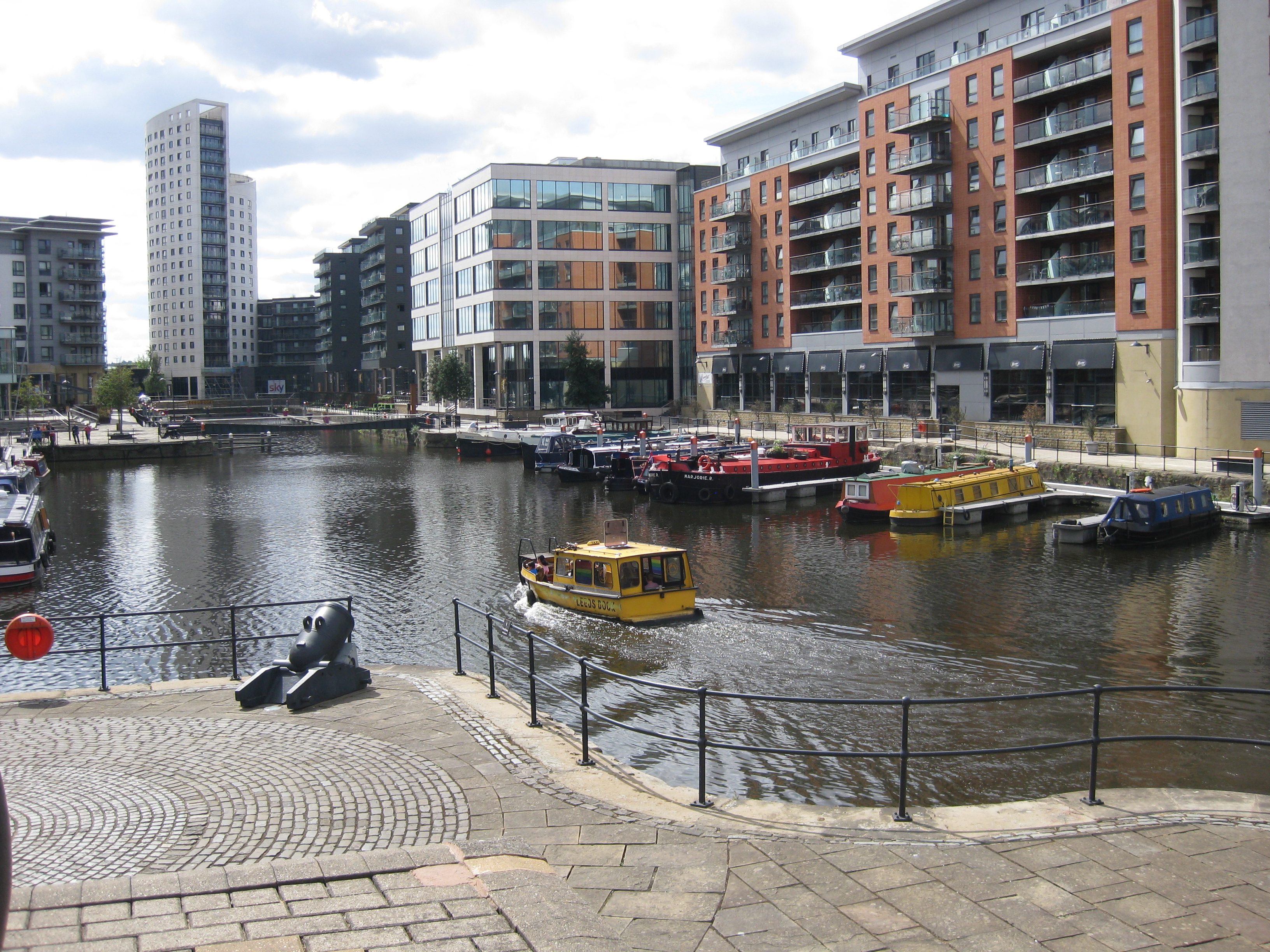
Leeds Dock (formerly New Dock and previously Clarence Dock) is a mixed development with retail, office and leisure presence by the River Aire in central Leeds, West Yorkshire, England. It has a large residential population in waterside apartments. History The dock was constructed for boats using the Leeds and Liverpool Canal and the Aire and Calder Navigation to tranship goods and commodities from Leeds city centre in 1843. It was primarily used to bring coal from collieries around Rothwell and Wakefield to supply heavy industries in Hunslet and business and commerce in Leeds city centre. The western side of the dock once had a large crane on tracks along the side of the dock to load and unload goods from canal barges. In the 1990s the surrounding area was made up of Victorian industrial buildings most of which were derelict. Throughout the second half of the 20th century the area suffered steady industrial decline. The mills and many heavy engineering works began to c ... [...More Info...] [...Related Items...] OR: [Wikipedia] [Google] [Baidu] |
Council Housing
Public housing in the United Kingdom, also known as council estates, council housing, or social housing, provided the majority of rented accommodation until 2011 when the number of households in private rental housing surpassed the number in social housing. Houses and flats built for public or social housing use are built by or for Municipality, local authorities and known as council houses, though since the 1980s the role of non-profit housing associations became more important and subsequently the term "social housing" became more widely used, as technically council housing only refers to housing owned by a local authority, though the terms are largely used interchangeably. Before 1865, housing for the poor was provided solely by the private sector. Council houses were built on council estates, known as schemes in Scotland, where other amenities, like schools and shops, were often also provided. From the 1950s, blocks of Apartment, flats and three-or-four-storey blocks of Apart ... [...More Info...] [...Related Items...] OR: [Wikipedia] [Google] [Baidu] |
M621 Motorway
The M621 is a short loop of motorway in West Yorkshire, England that takes traffic into central Leeds between the M1 and M62 motorways. History The first section of the M621 to open, known at the time as the 'South West Urban Motorway', extended from the M62 to Junction 3 in central Leeds where it used to terminate at a roundabout which was also the terminus of the M1 motorway. This section opened in stages, first from the M62 to Junction 1 in 1971, and then next from Junction 1 to Junction 3 in 1973. When the M1 was diverted away from Leeds when the 'M1 – A1 Lofthouse to Bramham' extension opened in 1999 adjustments were made to Junction 3 and the Leeds section of the M1 was re-designated as M621, given Junction 3 to Junction 7). Junctions {, class="plainrowheaders wikitable" , - !scope=col, County !scope=col, Location !scope=col, mi !scope=col, km !scope=col, Junction !scope=col, Destinations !scope=col, Notes , - , rowspan="10", West Yorkshire , Morley , 0 , 0 , — ... [...More Info...] [...Related Items...] OR: [Wikipedia] [Google] [Baidu] |
Aberford
Aberford is a village and civil parish on the eastern outskirts of the City of Leeds metropolitan borough in West Yorkshire, England. It had a population of 1,059 at the 2001 census, increasing to 1,180 at the 2011 Census. It is situated east, north east of Leeds city centre in the LS25 Leeds postcode area. Etymology The name 'Aberford' comes from the Old English woman's name ''Ēadburg'' and ''ford'', which, then as now, meant 'ford'. The name meant 'Eadburg's ford'. This suggests the settlement's once-strategic importance. The name was recorded as ''Ædburford'' in 1176 and ''Ædburgford'' in 1177, ''Ebberford'' in the 13th century and ''Aberford'' from 1208. History Aberford was where the ancient Great North Road crossed over the Cock River (now reduced in volume as the Cock Beck). Aberford was the midway point between London and Edinburgh, being around distant from each city until the construction of the A1(M) motorway bypass starting at Hook Moor. On the north side ... [...More Info...] [...Related Items...] OR: [Wikipedia] [Google] [Baidu] |
A1(M) Motorway
A1(M) is the designation given to a series of four separate controlled-access highway, motorway sections in England. Each section is an upgrade to a section of the A1 road (Great Britain), A1, a major north–south road which connects Greater London, London, the capital of England, with Edinburgh, the capital of Scotland. The first section, the Doncaster Bypass, opened in 1961 and is one of the oldest sections of motorway in Britain. Construction of a new section of A1(M) between Leeming, North Yorkshire, Leeming and Barton, North Yorkshire, Barton was completed on 29 March 2018, a year later than the anticipated opening in 2017 due to extensive archaeological excavations. Its completion linked the Barton to Washington, Tyne and Wear, Washington section with the Darrington, West Yorkshire, Darrington to Leeming Bar section, forming the longest A1(M) section overall and reducing the number of sections from five to four. In 2015 a proposal was made by three local government or ... [...More Info...] [...Related Items...] OR: [Wikipedia] [Google] [Baidu] |
_002.jpg)
