|
Herrenberg Station
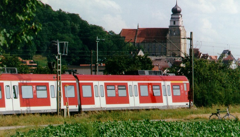
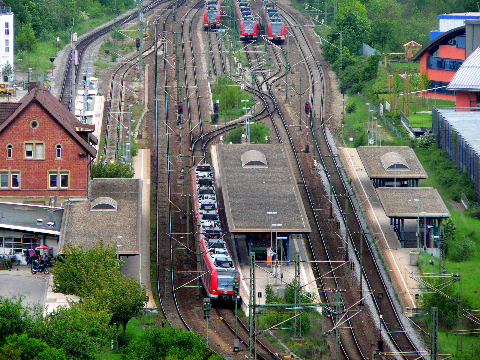
Herrenberg station is located on the Gäu Railway (german: Gäubahn) and is at the start of the Ammer Valley Railway (''Ammertalbahn''). Because it is a stop for Regional-Express services and it is a terminus for both Stuttgart S-Bahn line S 1 and Regionalbahn services from Tübingen and Bondorf, it is an important transport node. It is located about 200 metres west of the old centre of Herrenberg in the German state of Baden-Württemberg. History In the mid 19th century the citizens of Oberamt Herrenberg (one of the former districts of Baden-Württemberg, that were replaced in 1934 by Landkreise) were mostly engaged in agriculture. The most profitable seems to have been the cultivation of sugar beet and hops. In the 1860s, Herrenberg sought a connection to the rail network so that and the district could have access to night soil from the latrines of Stuttgart as cheap fertilizer in order to grow produce for supply to the Böblingen sugar beet factory and the breweries. Th ... [...More Info...] [...Related Items...] OR: [Wikipedia] [Google] [Baidu] |
Herrenberg
Herrenberg (Swabian German, Swabian: ''Härrabärg'' or ''Haerebärg'') is a town in the middle of Baden-Württemberg, about 30 km south of Stuttgart and 20 km from Tübingen. After Sindelfingen, Böblingen, and Leonberg, it is the fourth largest town in the district of Böblingen (district), Böblingen. Location Herrenberg is situated on the western edge of the Schönbuch forest and is a central town within the Gäu region. The Stiftskirche, which houses the Glockenmuseum (bell museum), is a tourist attraction in the main square. The following towns and municipalities border Herrenberg. They are listed in clockwise direction beginning in the north: Deckenpfronn, Gärtringen, Nufringen, Hildrizhausen and Altdorf, Böblingen, Altdorf (all Böblingen district), Ammerbuch (Tübingen district), Gäufelden and Jettingen (both Böblingen district) as well as Wildberg, Baden-Württemberg, Wildberg (Calw district). History The once small community Herrenberg was formed out of ... [...More Info...] [...Related Items...] OR: [Wikipedia] [Google] [Baidu] |
Filder
The Filder (plural) – also Filder Plain (german: Filderebene) – is a natural region (major unit no. 106) of the Swabian Keuper-Lias Land within the South German Scarplands. They form a gently rolling, fertile plateau in the German state of Baden-Württemberg, which extends over the western half of the county of Esslingen and the southern part of the borough of the state capital of Stuttgart. Geologically it was formed by the transformation of a fault zone from the Lias period. Hills Among the hills of the Filder are the: * Bernhartshöhe (), near Vaihingen by the 4-way motorway intersection, the highest point in the borough of Stuttgart * Bopser (), here is the Stuttgart TV Tower and the Waldau Sports Centre (''Sportzentrum Waldau'') (including the Gazi-Stadion auf der Waldau, home ground of Stuttgarter Kickers football team) * Frauenkopf Frauenkopf is a mountain of Baden-Württemberg, Germany Germany,, officially the Federal Republic of Germany, is a co ... [...More Info...] [...Related Items...] OR: [Wikipedia] [Google] [Baidu] |
Deutsche Bundesbahn
The Deutsche Bundesbahn or DB (German Federal Railway) was formed as the state railway of the newly established Federal Republic of Germany (FRG) on 7 September 1949 as a successor of the Deutsche Reichsbahn-Gesellschaft (DRG). The DB remained the state railway of West Germany until after German reunification, when it was merged with the former East German Deutsche Reichsbahn (DR) to form Deutsche Bahn, which came into existence on 1 January 1994. Background After World War II, each of the military governments of the Allied Occupation Zones in Germany were ''de facto'' in charge of the German railways in their respective territories. On 10 October 1946, the railways in the British and American occupation zones formed the ''Deutsche Reichsbahn im Vereinigten Wirtschaftsgebiet'' (German Imperial Railway in the united economic area), while on 25 June 1947, the provinces under French occupation formed the Südwestdeutsche Eisenbahn. With the formation of the FRG these succe ... [...More Info...] [...Related Items...] OR: [Wikipedia] [Google] [Baidu] |
Pfäffinger
Ammerbuch is a municipality in the district of Tübingen, in Baden-Württemberg, Germany. It is situated 7 km northwest of Tübingen. Geographical location The municipality Ammerbuch is 345–551 meters above sea level in part on the edge of the Schönbuch nature park, and partly in the valley of Ammer in the northern Gäu. Geology Ammerbuch is located in the Gäu, which is dominated by keuper, gypsum and sandstone layers. Since 1750, limestone was mined in Reusten, the last quarry was closed in 1970. In Breitenholz, Entringen, Poltringen and Altingen gypsum was mined, but now only the gypsum quarry in Altingen is in operation. In the northern Schönbuch, but also in Breitenholz sandstone was broken since 1383. Neighboring communities The following cities and towns bordering the municipality Ammerbuch, they are in a clockwise direction starting called the north and part of the district of Tübingen¹ or the Böblingen²: Herrenberg², Altdorf², Tübingen¹, Rottenburg am ... [...More Info...] [...Related Items...] OR: [Wikipedia] [Google] [Baidu] |
Nagold Valley Railway
The Nagold Valley Railway (German: ''Nagoldtalbahn'') is a railway line in the northern part of the Black Forest in Germany which links Pforzheim with Horb am Neckar and, for most of its route, follows the valley of the River Nagold. Trains on the non-electrified, single-tracked main line are operated by ''DB Regionalverkehr Alb-Bodensee''. Since 2005, the line has been designated and operated as a ''Kulturbahn'' ("cultural line"), together with the Upper Neckar Railway from Horb to Tübingen. Topography The Nagold Valley Railway runs along the northeastern edge of the Black Forest. Leaving Pforzheim, it does not initially follow the River Nagold, but instead runs together with the Enz Valley Railway along the Enz, before diverging after 3 km in Brötzingen and running through a tunnel to the Nagold Valley. It follows the river to the town of Nagold, passing through several tunnels which shorten its route appreciably, so that the line between Calw and Nagold is several ... [...More Info...] [...Related Items...] OR: [Wikipedia] [Google] [Baidu] |
Wildberg, Baden-Württemberg
Wildberg is a town in the district of Calw (district), Calw in Baden-Württemberg, Germany. History Wildberg was founded by County of Hohenberg around 1281 at the foot of a castle built around 1200 by the County Palatine of Tübingen. Over the course of the 14th century, Wildberg became a possession of the Electoral Palatinate, who sold it and the towns of Schönbronn, Sulz am Eck, and Gültlingen to the County of Württemberg in 1440. The latter town would not be fully controlled by Württemberg until 1445, when it purchased the properties of other local nobles. These towns would exist in their own district until 1807, when the government of the Kingdom of Württemberg assigned them to , which was dissolved in 1938 and replaced by Landkreis Calw. After World War II, Effringen, Gültlingen and Sulz am Eck established new residential areas but it was not until the 1970s that Wildberg also began growing. In 1971, Schönbronn merged into Wildberg and was followed four years later by ... [...More Info...] [...Related Items...] OR: [Wikipedia] [Google] [Baidu] |
Althengstett
Althengstett is a municipality in the district of Calw in Baden-Württemberg in Germany. History Althengstett was first mentioned in a document from around 1120 regarding a donation to Hirsau Abbey as "Hingesteten". The village was purchased in 1301 by Herrenalb Abbey and, some time from 1338 to 1341, the County of Württemberg was named protector of the town. It was assigned to the at Merklingen. Geography The municipality (''Gemeinde'') of Simmozheim is located in the district of Calw, in Baden-Württemberg, one of the 16 States of the Federal Republic of Germany. Althengstett lies in a transitional landscape between the Northern Black Forest to the west and the to the east. At the southwestern edge of the municipal area is the source of the Tälesbach, a tributary of the Nagold. Elevation above sea level in the municipal area ranges from a high of Normalnull (NN) to a low of NN. A portion of the Federally protected nature reserve is located in Althengstett's municipal ... [...More Info...] [...Related Items...] OR: [Wikipedia] [Google] [Baidu] |
Calw
Calw (; previously pronounced and sometimes spelled ''Kalb'' accordingly) is a town in the middle of Baden-Württemberg in the south of Germany, capital and largest town of the district Calw. It is located in the Northern Black Forest and is approximately south of Pforzheim and west of Stuttgart. It has the status of a ''große Kreisstadt.'' Geography Location Calw is located in the valley of the Nagold in the Northern Black Forest at an altitude between above sea level. The historic centre lies west of the river. The newer parts of town have developed on the surrounding slopes. The following streams also exist within the town: the Tälesbach, Ziegelbach, Wurstbrunnenbach, Schießbach, Schlittenbach und Schweinbach. In the northern part of the town, on the western slope of the Nagold valley is the cave known as the Bruderhöhle. Neighbouring Communities The following towns and communities ('' Gemeinden'') border on the town of Calw (clockwise, from the north): Bad Liebe ... [...More Info...] [...Related Items...] OR: [Wikipedia] [Google] [Baidu] |
Schönbuch
Schönbuch is an almost completely wooded area south west of Stuttgart and part of the Southern German Escarpment Landscape (German: ''südwestdeutsches Schichtstufenland''). In 1972 the centre zone of Schönbuch became the first nature park in Baden-Württemberg. A geological trail is located in Schönbuch nature park at KirnbergJohannes Baier''Der Geologische Lehrpfad am Kirnberg (Keuper; SW-Deutschland)''. - Jber. Mitt. oberrhein. geol. Ver, N. F. 93, 9-26, 2011. and was created in 1977 on the 500th anniversary of the Eberhard Karls University of Tübingen. Several panels explain the sediments of the Keuper highland (shale, marl and sandstone) and the development of the Kirnbach valley. Today the 156 km² large reserve is referred to as Schönbuch whereas the original, more comprehensive area is usually called Schönbuch-Region. Schönbuch nature park is an important recreational area of the Stuttgart Region, also because it is only intersected by relatively few roads. ... [...More Info...] [...Related Items...] OR: [Wikipedia] [Google] [Baidu] |
Upper Neckar Railway
Upper may refer to: * Shoe upper or ''vamp'', the part of a shoe on the top of the foot * Stimulant, drugs which induce temporary improvements in either mental or physical function or both * ''Upper'', the original film title for the 2013 found footage film ''The Upper Footage ''The Upper Footage'' (also known as ''Upper'') is a 2013 found footage film written and directed by Justin Cole. First released on January 31, 2013 to a limited run of midnight theatrical screenings at Landmark’s Sunshine Cinema in New York Cit ...'' See also {{Disambiguation ... [...More Info...] [...Related Items...] OR: [Wikipedia] [Google] [Baidu] |
Affstätt
Herrenberg ( Swabian: ''Härrabärg'' or ''Haerebärg'') is a town in the middle of Baden-Württemberg, about 30 km south of Stuttgart and 20 km from Tübingen. After Sindelfingen, Böblingen, and Leonberg, it is the fourth largest town in the district of Böblingen. Location Herrenberg is situated on the western edge of the Schönbuch forest and is a central town within the Gäu region. The Stiftskirche, which houses the Glockenmuseum (bell museum), is a tourist attraction in the main square. The following towns and municipalities border Herrenberg. They are listed in clockwise direction beginning in the north: Deckenpfronn, Gärtringen, Nufringen, Hildrizhausen and Altdorf (all Böblingen district), Ammerbuch ( Tübingen district), Gäufelden and Jettingen (both Böblingen district) as well as Wildberg ( Calw district). History The once small community Herrenberg was formed out of the hamlets "Mühlhausen" and "Raistingen", who were combinated in the 13th cen ... [...More Info...] [...Related Items...] OR: [Wikipedia] [Google] [Baidu] |


