|
Heliotrope (instrument)
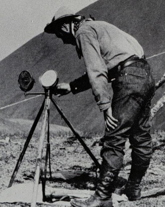
The heliotrope is an instrument that uses a mirror to reflect sunlight over great distances to mark the positions of participants in a land survey. The heliotrope was invented in 1821 by the German mathematician Carl Friedrich Gauss. The word "heliotrope" is taken from the Greek: ''helios'' (), meaning "sun", and '' tropos'' (), meaning "turn". Heliotropes were used in surveys from Gauss's survey in Germany in 1821 through the late 1980s, when GPS measurements replaced the use of the heliotrope in long distance surveys. Colonel Sir George Everest introduced the use of heliotropes into the Great Trigonometric Survey in India around 1831, and the US Coast and Geographic Survey used heliotropes to survey the United States. ThIndian specification for heliotropeswas updated in 1981, and the American military specification for heliotropes (MIL-H-20194E) was retired on 8 December 1995. Surveyors used the heliotrope as a specialized form of survey target; it was employed during large ... [...More Info...] [...Related Items...] OR: [Wikipedia] [Google] [Baidu] |
Heliotrope2-2
Heliotrope most often refers to: * Heliotrope (color), a pink-purple color, named for the color of the flowering plants * ''Heliotropium'', a genus of flowering plants Heliotrope may also refer to: Natural science * Heliotrope (mineral), a variety of jasper or chalcedony * Heliotropism, plants' diurnal motion in response to the sun's movement Art, media and entertainment * ''Heliotrope'', a story collection by Justina Robson * Heliotropes (band), a Brooklyn-based band * "Heliotrope" (song), by At the Drive-In * "Heliotrope", a song by Robyn Hitchcock on the album '' Moss Elixir'' * Heliotrope Studios, a video game developer * ''Heliotrope'' (film), a lost 1920 American silent drama film * Miss Heliotrope, the governess in Elizabeth Goudge's children's book, ''The Little White Horse'' Other uses * Heliotrope, a distinctive rash associated with dermatomyositis, including juvenile dermatomyositis * Heliotrope (instrument), in surveying, a long distance survey target based on m ... [...More Info...] [...Related Items...] OR: [Wikipedia] [Google] [Baidu] |
George Everest
Colonel Sir George Everest CB FRS FRAS FRGS (; 4 July 1790 – 1 December 1866) was a British surveyor and geographer who served as Surveyor General of India from 1830 to 1843. After receiving a military education in Marlow, Everest joined the East India Company and arrived in India at the age of 16. He was eventually made an assistant to William Lambton on the Great Trigonometric Survey, and replaced Lambton as superintendent of the survey in 1823. Everest was largely responsible for surveying the meridian arc from the southernmost point of India north to Nepal, a distance of about , a task that took from 1806 to 1841 to complete. He was made Surveyor General of India in 1830, retiring in 1843 and returning to England. In 1865, the Royal Geographical Society renamed Peak XV – at the time only recently identified as the world's highest peak – to Mount Everest in his honour. Andrew Scott Waugh, his protégé and successor as surveyor general, had been responsible for put ... [...More Info...] [...Related Items...] OR: [Wikipedia] [Google] [Baidu] |
Heliograph
A heliograph () is a semaphore system that signals by flashes of sunlight (generally using Morse code) reflected by a mirror. The flashes are produced by momentarily pivoting the mirror, or by interrupting the beam with a shutter. The heliograph was a simple but effective instrument for instantaneous optical communication over long distances during the late 19th and early 20th century. Its main uses were military, survey and forest protection work. Heliographs were standard issue in the British and Australian armies until the 1960s, and were used by the Pakistani army as late as 1975. Description There were many heliograph types. Most heliographs were variants of the British Army Mance Mark V version (Fig.1). It used a mirror with a small unsilvered spot in the centre. The sender aligned the heliograph to the target by looking at the reflected target in the mirror and moving their head until the target was hidden by the unsilvered spot. Keeping their head still, they then adj ... [...More Info...] [...Related Items...] OR: [Wikipedia] [Google] [Baidu] |
India
India, officially the Republic of India (Hindi: ), is a country in South Asia. It is the seventh-largest country by area, the second-most populous country, and the most populous democracy in the world. Bounded by the Indian Ocean on the south, the Arabian Sea on the southwest, and the Bay of Bengal on the southeast, it shares land borders with Pakistan to the west; China, Nepal, and Bhutan to the north; and Bangladesh and Myanmar to the east. In the Indian Ocean, India is in the vicinity of Sri Lanka and the Maldives; its Andaman and Nicobar Islands share a maritime border with Thailand, Myanmar, and Indonesia. Modern humans arrived on the Indian subcontinent from Africa no later than 55,000 years ago., "Y-Chromosome and Mt-DNA data support the colonization of South Asia by modern humans originating in Africa. ... Coalescence dates for most non-European populations average to between 73–55 ka.", "Modern human beings—''Homo sapiens''—originated in Africa. Then, int ... [...More Info...] [...Related Items...] OR: [Wikipedia] [Google] [Baidu] |
Heliograph
A heliograph () is a semaphore system that signals by flashes of sunlight (generally using Morse code) reflected by a mirror. The flashes are produced by momentarily pivoting the mirror, or by interrupting the beam with a shutter. The heliograph was a simple but effective instrument for instantaneous optical communication over long distances during the late 19th and early 20th century. Its main uses were military, survey and forest protection work. Heliographs were standard issue in the British and Australian armies until the 1960s, and were used by the Pakistani army as late as 1975. Description There were many heliograph types. Most heliographs were variants of the British Army Mance Mark V version (Fig.1). It used a mirror with a small unsilvered spot in the centre. The sender aligned the heliograph to the target by looking at the reflected target in the mirror and moving their head until the target was hidden by the unsilvered spot. Keeping their head still, they then adj ... [...More Info...] [...Related Items...] OR: [Wikipedia] [Google] [Baidu] |
Aberration In Optical Systems
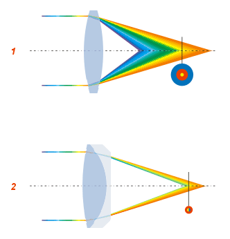
In optics, aberration is a property of optical systems, such as lenses, that causes light to be spread out over some region of space rather than focused to a point. Aberrations cause the image formed by a lens to be blurred or distorted, with the nature of the distortion depending on the type of aberration. Aberration can be defined as a departure of the performance of an optical system from the predictions of paraxial optics. In an imaging system, it occurs when light from one point of an object does not converge into (or does not diverge from) a single point after transmission through the system. Aberrations occur because the simple paraxial theory is not a completely accurate model of the effect of an optical system on light, rather than due to flaws in the optical elements. An image-forming optical system with aberration will produce an image which is not sharp. Makers of optical instruments need to correct optical systems to compensate for aberration. Aberration can be anal ... [...More Info...] [...Related Items...] OR: [Wikipedia] [Google] [Baidu] |
NOAA
The National Oceanic and Atmospheric Administration (abbreviated as NOAA ) is an United States scientific and regulatory agency within the United States Department of Commerce that forecasts weather, monitors oceanic and atmospheric conditions, charts the seas, conducts deep sea exploration, and manages fishing and protection of marine mammals and endangered species in the U.S. exclusive economic zone. Purpose and function NOAA's specific roles include: * ''Supplying Environmental Information Products''. NOAA supplies to its customers and partners information pertaining to the state of the oceans and the atmosphere, such as weather warnings and forecasts via the National Weather Service. NOAA's information services extend as well to climate, ecosystems, and commerce. * ''Providing Environmental Stewardship Services''. NOAA is a steward of U.S. coastal and marine environments. In coordination with federal, state, local, tribal and international authorities, NOAA manages the ... [...More Info...] [...Related Items...] OR: [Wikipedia] [Google] [Baidu] |
Mount Shasta
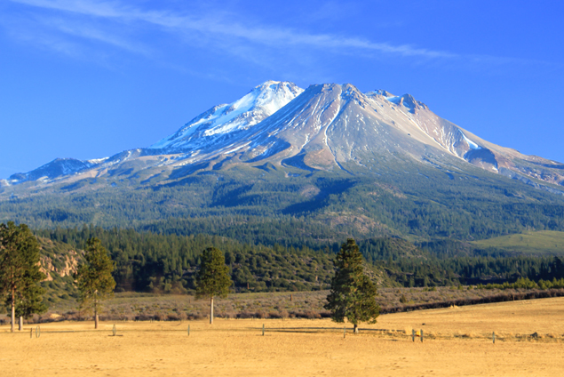
Mount Shasta ( Shasta: ''Waka-nunee-Tuki-wuki''; Karuk: ''Úytaahkoo'') is a potentially active volcano at the southern end of the Cascade Range in Siskiyou County, California. At an elevation of , it is the second-highest peak in the Cascades and the fifth-highest in the state. Mount Shasta has an estimated volume of , which makes it the most voluminous stratovolcano in the Cascade Volcanic Arc. The mountain and surrounding area are part of the Shasta–Trinity National Forest. Description Mount Shasta is connected to its satellite cone of Shastina, and together they dominate the landscape. Shasta rises abruptly to tower nearly above its surroundings. On a clear winter day, the mountain can be seen from the floor of the Central Valley to the south. The mountain has attracted the attention of poets, authors, and presidents. The mountain consists of four overlapping dormant volcanic cones that have built a complex shape, including the main summit and the prominent and visi ... [...More Info...] [...Related Items...] OR: [Wikipedia] [Google] [Baidu] |
Mount Saint Helena
Mount Saint Helena (Wappo: Kanamota, "Human Mountain") is a peak in the Mayacamas Mountains with flanks in Napa, Sonoma, and Lake counties of California. Composed of uplifted 2.4-million-year-old volcanic rocks from the Clear Lake Volcanic Field, it is one of the few mountains in the San Francisco Bay Area to receive any snowfall during the winter. The mountain has five peaks, arranged in a rough "M" shape. Its highest point, North Peak, is in Sonoma County. The second-tallest, immediately east of the main summit, is the highest point in Napa County. The headwaters of the Napa River arise on the southeast slope of Mount Saint Helena. History Mount Saint Helena has had an explosive history of pyroclastic flows that resulted in California's Petrified Forest. Mount Saint Helena, originally named Kanamota ("Human Mountain") by the Wappo, and later Mount Mayacamas by Spanish colonists, was renamed by a Russian survey party who ascended the peak in 1841. They left a copper plate ... [...More Info...] [...Related Items...] OR: [Wikipedia] [Google] [Baidu] |
Triangulation
In trigonometry and geometry, triangulation is the process of determining the location of a point by forming triangles to the point from known points. Applications In surveying Specifically in surveying, triangulation involves only angle measurements at known points, rather than measuring distances to the point directly as in trilateration; the use of both angles and distance measurements is referred to as triangulateration. In computer vision Computer stereo vision and optical 3D measuring systems use this principle to determine the spatial dimensions and the geometry of an item. Basically, the configuration consists of two sensors observing the item. One of the sensors is typically a digital camera device, and the other one can also be a camera or a light projector. The projection centers of the sensors and the considered point on the object's surface define a (spatial) triangle. Within this triangle, the distance between the sensors is the base ''b'' and must be known. ... [...More Info...] [...Related Items...] OR: [Wikipedia] [Google] [Baidu] |
Surveyor (surveying)
Surveying or land surveying is the technique, profession, art, and science of determining the terrestrial two-dimensional or three-dimensional positions of points and the distances and angles between them. A land surveying professional is called a land surveyor. These points are usually on the surface of the Earth, and they are often used to establish maps and boundaries for ownership, locations, such as the designed positions of structural components for construction or the surface location of subsurface features, or other purposes required by government or civil law, such as property sales. Surveyors work with elements of geodesy, geometry, trigonometry, regression analysis, physics, engineering, metrology, programming languages, and the law. They use equipment, such as total stations, robotic total stations, theodolites, GNSS receivers, retroreflectors, 3D scanners, LiDAR sensors, radios, inclinometer, handheld tablets, optical and digital levels, subsurface locators, d ... [...More Info...] [...Related Items...] OR: [Wikipedia] [Google] [Baidu] |
Great Trigonometric Survey
The Great Trigonometrical Survey was a project that aimed to survey the entire Indian subcontinent with scientific precision. It was begun in 1802 by the British infantry officer William Lambton, under the auspices of the East India Company.Gill, B. (2001); "THE BIG MAN. Surveying Sir George Everest", in: ''Professional Surveyor Magazine'', Vol. 21 Nr 2. Retrieveonline 8 March 2016. Under the leadership of his successor, George Everest, the project was made the responsibility of the Survey of India. Everest was succeeded by Andrew Scott Waugh, and after 1861, the project was led by James Walker, who oversaw its completion in 1871. Among the many accomplishments of the Survey were the demarcation of the British territories in India and the measurement of the height of the Himalayan giants: Everest, K2, and Kanchenjunga. The Survey had an enormous scientific impact as well, being responsible for one of the first accurate measurements of a section of an arc of longitude, and f ... [...More Info...] [...Related Items...] OR: [Wikipedia] [Google] [Baidu] |


_crop.jpg)
