|
Hatton, Aberdeenshire
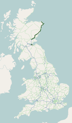
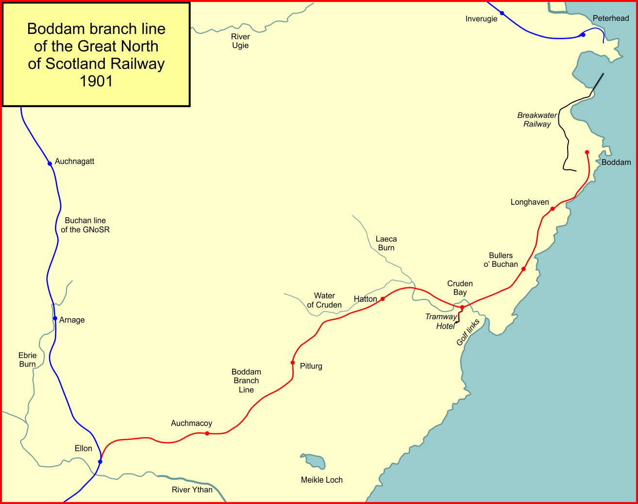
Hatton (occasionally Hatton of Cruden) is a village in Aberdeenshire, Scotland that lies on the A90 road, approximately equidistant from both Ellon and Peterhead. It has a biscuit factory that was once called Simmers - it was Hatton's only claim to fame, as it supplied biscuits to such upmarket shops as Marks and Spencers. However, it was purchased by McVities and then acquired by Murdoch Allan and Sons. It also has a shop, a village hall, a primary school and small park. History There is considerable evidence of early human habitation in the vicinity, most notably by the existence of the ancient Catto Long Barrow and numerous tumuli A tumulus (plural tumuli) is a mound of earth and stones raised over a grave or graves. Tumuli are also known as barrows, burial mounds or ''kurgans'', and may be found throughout much of the world. A cairn, which is a mound of stones built ... nearby. Transport Hatton railway station, on the Boddam Branch, served the village from 18 ... [...More Info...] [...Related Items...] OR: [Wikipedia] [Google] [Baidu] |
Aberdeenshire
Aberdeenshire ( sco, Aiberdeenshire; gd, Siorrachd Obar Dheathain) is one of the 32 Subdivisions of Scotland#council areas of Scotland, council areas of Scotland. It takes its name from the County of Aberdeen which has substantially different boundaries. The Aberdeenshire Council area includes all of the area of the Counties of Scotland, historic counties of Aberdeenshire and Kincardineshire (except the area making up the City of Aberdeen), as well as part of Banffshire. The county boundaries are officially used for a few purposes, namely land registration and Lieutenancy areas of Scotland, lieutenancy. Aberdeenshire Council is headquartered at Woodhill House, in Aberdeen, making it the only Scottish council whose headquarters are located outside its jurisdiction. Aberdeen itself forms a different council area (Aberdeen City). Aberdeenshire borders onto Angus, Scotland, Angus and Perth and Kinross to the south, Highland (council area), Highland and Moray to the west and Aber ... [...More Info...] [...Related Items...] OR: [Wikipedia] [Google] [Baidu] |
Gazetteer For Scotland
The ''Gazetteer for Scotland'' is a gazetteer covering the geography, history and people of Scotland. It was conceived in 1995 by Bruce Gittings of the University of Edinburgh and David Munro of the Royal Scottish Geographical Society, and contains 25,870 entries as of July 2019. It claims to be "the largest dedicated Scottish resource created for the web". The Gazetteer for Scotland provides a carefully researched and editorially validated resource widely used by students, researchers, tourists and family historians with interests in Scotland. Following on from a strong Scottish tradition of geographical publishing, the ''Gazetteer for Scotland'' is the first comprehensive gazetteer to be produced for the country since Francis Groome's ''Ordnance Gazetteer of Scotland'' (1882-6) (the text of which is incorporated into relevant entries). The aim is not to produce a travel guide, of which there are many, but to write a substantive and thoroughly edited description of the count ... [...More Info...] [...Related Items...] OR: [Wikipedia] [Google] [Baidu] |
A90 Road
The A90 road is a major north to south road in eastern Scotland, running from Edinburgh to Fraserburgh, through Dundee and Aberdeen. Along with the A9 and the A82 it is one of the three major north–south trunk roads connecting the Central Belt to the North. Background The creation and development of the A90 road has to be understood in terms of the development of the economy of the North-East of Scotland which had resulted in an increase in traffic along the route between Perth and Aberdeen. In recognition of this, in 1979, the British government announced that it was giving priority to the upgrading of the route to dual carriageway standard. It had already been decided that the trunk route between Dundee and Stonehaven which, previously, had followed the same route as the railway line between the two towns, would now follow an inland route through Forfar and Laurencekirk. The new route would incorporate the A85 from Perth to Dundee the A929 between Dundee and Forfar, the ... [...More Info...] [...Related Items...] OR: [Wikipedia] [Google] [Baidu] |
Ellon, Aberdeenshire
Ellon ( gd, Eilean) is a town in Aberdeenshire, Scotland, approximately north of Aberdeen, lying on the River Ythan, which has one of the few undeveloped river Ythan Estuary, estuaries on the eastern coast of Scotland. It is in the ancient region of Formartine. Its name is believed to derive from the Gaelic term ''Eilean'', an island, on account of the presence of an island in the River Ythan, which offered a convenient fording point. In 1707 it was made a burgh of barony for the Earl of Buchan. Places of interest Places of interest within the town include Ellon Castle Gardens, recently brought back to life by volunteers and open to the public (see website for latest opening times). They include a walled garden of historical importance, yew trees dating back 500 years and the ruins of old Ellon Castle, and the surrounding walls known as the ''Deer Dyke''. Ellon also has ''Auld Brig'', a category A listed bridge across the Ythan, built in 1793 and still in use as a pedestria ... [...More Info...] [...Related Items...] OR: [Wikipedia] [Google] [Baidu] |
Peterhead
Peterhead (; gd, Ceann Phàdraig, sco, Peterheid ) is a town in Aberdeenshire, Scotland. It is Aberdeenshire's biggest settlement (the city of Aberdeen itself not being a part of the district), with a population of 18,537 at the 2011 Census. It is the biggest fishing port in the United Kingdom for total landings by UK vessels, according to a 2019 survey."Brexit trade deal: What does it mean for fishing?" - BBC News, December 2020 Peterhead sits at the easternmost point in mainland Scotland. It is often referred to as ''The Blue Toun'' (locally spelled "The Bloo Toon") and its natives are known as ''Bloo Touners''. They are also referred to as ''blue mogganers'' (locally spelled "bloomogganners"), supposedly from the blue |
Catto Long Barrow
Cairn Catto is a Neolithic long cairn near the village of Longside, Aberdeenshire, Scotland. Historic Environment Scotland established the site as a scheduled monument in 1973. Description Cairn Catto is located southeast of Longside, in Aberdeenshire, Scotland. The site is four miles north-west of Cruden Bay, to the west of the minor road between the A952 and the A950. The existing monument measures . It consists of several mounds of pink-granite stones of great length. The southwest end of the cairn has been robbed. Several holes have been discovered on the southeastern edge of the cairn. The Arbuthnot Museum in Peterhead houses two stone axes that were found at Cairn Catto in 1885. Historic Environment Scotland established the site as a scheduled monument in 1973. See also * Longman Hill * Morris Wells * Skelmuir Hill Skelmuir Hill is a landform in Aberdeenshire, Scotland. This is the location of a trig point or official government survey marker. Skelmuir Hill is the sit ... [...More Info...] [...Related Items...] OR: [Wikipedia] [Google] [Baidu] |
Tumuli
A tumulus (plural tumuli) is a mound of earth and stones raised over a grave or graves. Tumuli are also known as barrows, burial mounds or ''kurgans'', and may be found throughout much of the world. A cairn, which is a mound of stones built for various purposes, may also originally have been a tumulus. Tumuli are often categorised according to their external apparent shape. In this respect, a long barrow is a long tumulus, usually constructed on top of several burials, such as passage graves. A round barrow is a round tumulus, also commonly constructed on top of burials. The internal structure and architecture of both long and round barrows has a broad range; the categorization only refers to the external apparent shape. The method of may involve a dolmen, a cist, a mortuary enclosure, a mortuary house, or a chamber tomb. Examples of barrows include Duggleby Howe and Maeshowe. Etymology The word ''tumulus'' is Latin for 'mound' or 'small hill', which is derived from the ... [...More Info...] [...Related Items...] OR: [Wikipedia] [Google] [Baidu] |
Hatton Railway Station (Aberdeenshire)
Hatton railway station was a railway station in Hatton, Aberdeenshire Hatton (occasionally Hatton of Cruden) is a village in Aberdeenshire, Scotland that lies on the A90 road, approximately equidistant from both Ellon and Peterhead. It has a biscuit factory that was once called Simmers - it was Hatton's only cl ....British Railways Atlas.1947. p.38 It was situated to the south-east of the village and closed in 1932. Like the other stations on the branch, it was designed by Mr Smith, the GNSR architect in 1897. References Disused railway stations in Aberdeenshire Former Great North of Scotland Railway stations Railway stations in Great Britain opened in 1897 Railway stations in Great Britain closed in 1932 1897 establishments in Scotland 1932 disestablishments in Scotland Buildings and structures in Buchan {{Aberdeenshire-railstation-stub ... [...More Info...] [...Related Items...] OR: [Wikipedia] [Google] [Baidu] |
Boddam Branch
The Boddam Branch Line was a 15-mile branch railway line constructed by the Great North of Scotland Railway (GNoSR) from Ellon railway station to Boddam in Aberdeenshire. It opened in 1897. As well as serving the small fishing port of Boddam and nearby stone quarries, it connected to the Cruden Bay Hotel, a luxurious resort hotel established and operated by the GNoSR. As a United Kingdom railway-owned resort hotel, the hotel was an unusual development. The remote location of the hotel and the short season, led to poor financial performance of the hotel; the other hoped-for traffics of the branch line were also disappointing. The passenger service on the branch line was discontinued in 1932 and the hotel itself was requisitioned by the military at the outset of World War II; it never re-opened to the public. The goods service on the branch closed at the end of 1948. Origins A branch line and a hotel The GNoSR had a main line from Aberdeen to Keith, and had encouraged local pri ... [...More Info...] [...Related Items...] OR: [Wikipedia] [Google] [Baidu] |
Area Control Center
In air traffic control, an area control center (ACC), also known as a center or en-route center, is a facility responsible for controlling aircraft flying in the airspace of a given flight information region (FIR) at high altitudes between airport approaches and departures. In the US, such a center is referred to as an air route traffic control center (ARTCC). A center typically accepts traffic from — and ultimately passes traffic to — the control of a Terminal control area, terminal control center or another center. Most centers are operated by the national governments of the countries in which they are located. The general operations of centers worldwide, and the boundaries of the airspace each center controls, are governed by the International Civil Aviation Organization (ICAO). In some cases, the function of an area control center and a terminal control center are combined in a single facility. For example, NATS Holdings, NATS combines the London Terminal Control Ce ... [...More Info...] [...Related Items...] OR: [Wikipedia] [Google] [Baidu] |
Villages In Aberdeenshire
A village is a clustered human settlement or Residential community, community, larger than a hamlet (place), hamlet but smaller than a town (although the word is often used to describe both hamlets and smaller towns), with a population typically ranging from a few hundred to a few thousand. Though villages are often located in rural areas, the term urban village is also applied to certain urban neighborhoods. Villages are normally permanent, with fixed dwellings; however, transient villages can occur. Further, the dwellings of a village are fairly close to one another, not scattered broadly over the landscape, as a dispersed settlement. In the past, villages were a usual form of community for societies that practice subsistence agriculture, and also for some non-agricultural societies. In Great Britain, a hamlet earned the right to be called a village when it built a Church (building), church. [...More Info...] [...Related Items...] OR: [Wikipedia] [Google] [Baidu] |


