|
HMNZS Endeavour (A184)
USS ''Namakagon'' (AOG-53) was a built for the United States Navy during World War II. In some sources, the ship's name is also spelled ''Namakogon''. After her decommissioning from the U.S. Navy in 1957, the former ''Namakagon'' served as Antarctic supply vessel HMNZS ''Endeavour'' (A184) for the Royal New Zealand Navy (1962–1971), and as ROCS ''Lung Chuan'' for the Republic of China Navy. ''Lung Chuan'' ended active service when she was decommissioned from the Republic of China Navy in 2005. Service history United States Navy career ''Namakagon'' was laid down on 1 August 1944 by Cargill, Inc., Savage, Minnesota and was launched on 4 November 1944; sponsored by Mrs. Alfred J. Scobba. The ship was commissioned on 18 June 1945. The gasoline tanker ''Namakagon'' completed her U.S. Gulf Coast shakedown and, having filled her tanks at Baytown, Texas, departed for the Pacific Ocean, 19 July 1945. She arrived at Pearl Harbor as hostilities in the Pacific ceased and on 20 August ... [...More Info...] [...Related Items...] OR: [Wikipedia] [Google] [Baidu] |
Namakagon River
The Namekagon River (pronounced ''NAM-uh-KAH-gun'') is a tributary of the St. Croix River (Wisconsin–Minnesota), St. Croix River. It is longU.S. Geological Survey. National Hydrography Dataset high-resolution flowline dataThe National Map accessed October 5, 2012 and is located in northwestern Wisconsin in the United States. Its course is protected as part of the St. Croix National Scenic Riverway. According to the Geographic Names Information System, the river's name has also been spelled Namakagon, Namekagan, and Namekagun; the United States Board on Geographic Names issued a decision setting "Namekagon" as the river's spelling in 1933. Its name is derived from the Ojibwe language ''Namekaagong-ziibi'', meaning "river at the place abundant with sturgeons." Course The Namekagon River issues from Lake Namakagon in southeastern Bayfield County, Wisconsin, Bayfield County and flows southwestwardly through Sawyer County, Wisconsin, Sawyer and Washburn County, Wisconsin, Washburn ... [...More Info...] [...Related Items...] OR: [Wikipedia] [Google] [Baidu] |
Shakedown Cruise
Shakedown cruise is a nautical term in which the performance of a ship is tested. Generally, shakedown cruises are performed before a ship enters service or after major changes such as a crew change, repair or overhaul. The shakedown cruise simulates working conditions for the vessel, for various reasons. For most new ships, the major reasons are to familiarise a crew with a new vessel and to ensure all of the ship's systems are functional. Overview If the ship is the first of its class, it will likely also be performing its sea trials, a test of its performance. In this context, 'shakedown cruise' and 'sea trials' may be used interchangeably, though each has a slightly different meaning. In such a case, it is likely that the ship's systems will be pushed to redline, or maximum capacity, to demonstrate the class's speed and other important traits. Until bested by another ship of the same class, this shakedown performance will be the standard of the class's capabilities, a ... [...More Info...] [...Related Items...] OR: [Wikipedia] [Google] [Baidu] |
Kyūshū
is the third-largest island of Japan's five main islands and the most southerly of the four largest islands ( i.e. excluding Okinawa). In the past, it has been known as , and . The historical regional name referred to Kyushu and its surrounding islands. Kyushu has a land area of and a population of 14,311,224 in 2018. In the 8th-century Taihō Code reforms, Dazaifu was established as a special administrative term for the region. Geography The island is mountainous, and Japan's most active volcano, Mount Aso at , is on Kyushu. There are many other signs of tectonic activity, including numerous areas of hot springs. The most famous of these are in Beppu, on the east shore, and around Mt. Aso in central Kyushu. The island is separated from Honshu by the Kanmon Straits. Being the nearest island to the Asian continent, historically it is the gateway to Japan. The total area is which makes it the 37th largest island in the world. It's slightly larger than Taiwan island . ... [...More Info...] [...Related Items...] OR: [Wikipedia] [Google] [Baidu] |
Peleliu
Peleliu (or Beliliou) is an island in the island nation of Palau. Peleliu, along with two small islands to its northeast, forms one of the sixteen states of Palau. The island is notable as the location of the Battle of Peleliu in World War II. History Beliliou was traditionally divided into five villages. Teliu is located on the southwest coast bordered on the north by Ngerkeiukl on the west coast, Ngesias in the central portion of the island, and Ngerdelolk on the east coast. Ngerchol occupies the northern part of the island on the west side of Bloody Nose Ridge. Most of the surface remains of the traditional villages have been obliterated. However, the locations of the villages and the locations of features within the villages, including odesongel, are known and preserved in the oral tradition. These traditional features are important symbols giving identity to families, clans and regions. The lagoon and adjacent rock islands are important resource areas, and probably were int ... [...More Info...] [...Related Items...] OR: [Wikipedia] [Google] [Baidu] |
Okinawa
is a prefecture of Japan. Okinawa Prefecture is the southernmost and westernmost prefecture of Japan, has a population of 1,457,162 (as of 2 February 2020) and a geographic area of 2,281 km2 (880 sq mi). Naha is the capital and largest city of Okinawa Prefecture, with other major cities including Okinawa, Uruma, and Urasoe. Okinawa Prefecture encompasses two thirds of the Ryukyu Islands, including the Okinawa, Daitō and Sakishima groups, extending southwest from the Satsunan Islands of Kagoshima Prefecture to Taiwan ( Hualien and Yilan Counties). Okinawa Prefecture's largest island, Okinawa Island, is the home to a majority of Okinawa's population. Okinawa Prefecture's indigenous ethnic group are the Ryukyuan people, who also live in the Amami Islands of Kagoshima Prefecture. Okinawa Prefecture was ruled by the Ryukyu Kingdom from 1429 and unofficially annexed by Japan after the Invasion of Ryukyu in 1609. Okinawa Prefecture was officially founded in 1879 by the Empi ... [...More Info...] [...Related Items...] OR: [Wikipedia] [Google] [Baidu] |
Saipan
Saipan ( ch, Sa’ipan, cal, Seipél, formerly in es, Saipán, and in ja, 彩帆島, Saipan-tō) is the largest island of the Northern Mariana Islands, a Commonwealth (U.S. insular area), commonwealth of the United States in the western Pacific Ocean. According to 2020 estimates by the United States Census Bureau, the population of Saipan was 43,385, a decline of 10% from its 2010 count of 48,220. The legislative and executive branches of Commonwealth government are located in the village of Capitol Hill, Saipan, Capitol Hill on the island while the judicial branch is headquartered in the village of Susupe. Since the entire island is organized as a single municipality, most publications designate Saipan as the Commonwealth's capital. As of 2015, Saipan's mayor is David M. Apatang and the governor of the Northern Mariana Islands is Ralph Torres. History Prehistory Traces of human settlements on Saipan have been found by archaeologists ranging over 4,000 years, includ ... [...More Info...] [...Related Items...] OR: [Wikipedia] [Google] [Baidu] |
Guam
Guam (; ch, Guåhan ) is an organized, unincorporated territory of the United States in the Micronesia subregion of the western Pacific Ocean. It is the westernmost point and territory of the United States (reckoned from the geographic center of the U.S.); its capital Hagåtña (144°45'00"E) lies further west than Melbourne, Australia (144°57'47"E). In Oceania, Guam is the largest and southernmost of the Mariana Islands and the largest island in Micronesia. Guam's capital is Hagåtña, and the most populous village is Dededo. People born on Guam are American citizens but have no vote in the United States presidential elections while residing on Guam and Guam delegates to the United States House of Representatives have no vote on the floor. Indigenous Guamanians are the Chamoru, historically known as the Chamorro, who are related to the Austronesian peoples of Indonesia, the Philippines, Malaysia, Taiwan, Micronesia, and Polynesia. As of 2022, Guam's population is 168, ... [...More Info...] [...Related Items...] OR: [Wikipedia] [Google] [Baidu] |
Chuuk Lagoon
Chuuk Lagoon, previously Truk Atoll, is an atoll in the central Pacific. It lies about northeast of New Guinea, and is part of Chuuk State within the Federated States of Micronesia (FSM). A protective reef, around, encloses a natural harbour , with an area of . It has a land area of , with a population of 36,158 people and a maximal elevation of . Weno city on Moen Island functions as the atoll's capital and also as the state capital and is the largest city in the FSM with its 13,700 people. Chuuk Lagoon was the Empire of Japan's main naval base in the Pacific War, South Pacific theatre during World War II. It was the site of a major U.S. attack during Operation Hailstone in February 1944, and Operation Inmate, a small assault conducted by British and Canadian forces during June 1945. Name Chuuk means ''mountain'' in the Chuukese language. The lagoon was known mainly as Truk (a mispronunciation of Ruk), until 1990. Other names included Hogoleu, Torres, Ugulat, and Lugu ... [...More Info...] [...Related Items...] OR: [Wikipedia] [Google] [Baidu] |
Marcus Island
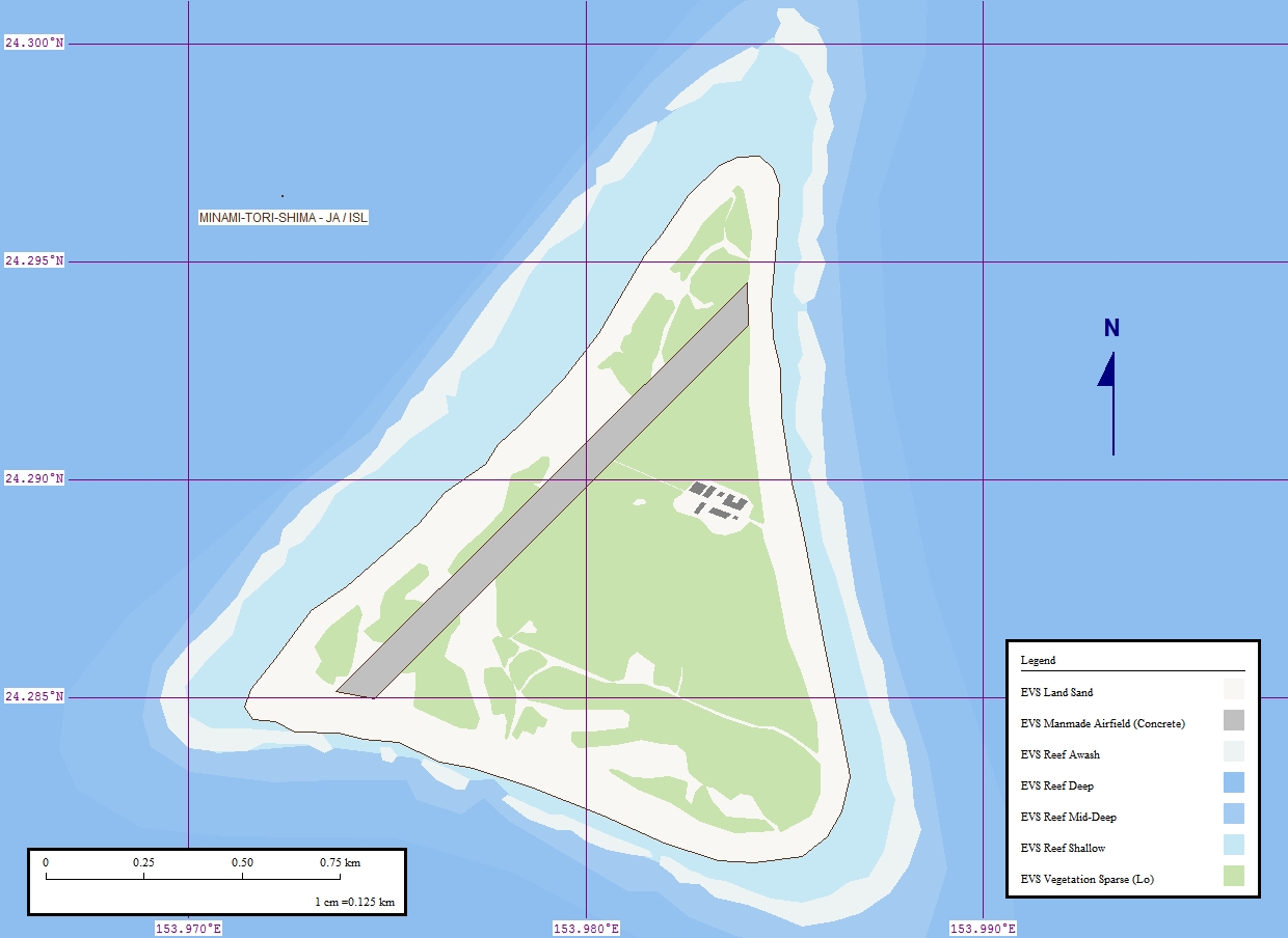
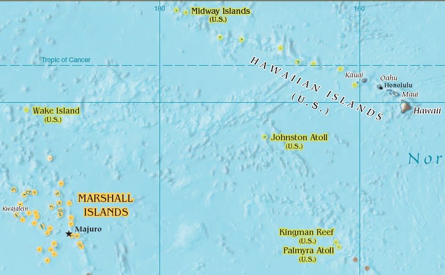
, also known as Marcus Island, is an isolated Japanese coral atoll in the northwestern Pacific Ocean, located some southeast of Tokyo and east of the closest Japanese island, South Iwo Jima of the Ogasawara Islands, and nearly on a straight line between mainland Tokyo and Wake Island, further to the east-southeast. The closest island to Minamitorishima is East Island in the Mariana Islands, which is to the west-southwest. It is the easternmost territory belonging to Japan, and the only Japanese territory on the Pacific Plate, past the Japan Trench. Although small () it is of strategic importance, as it enables Japan to claim a exclusive economic zone in the surrounding waters. It is also the easternmost territory of Tokyo, being administratively part of Ogasawara village. There is no civilian population, except personnel of the Japan Meteorological Agency, JSDF, and Japan Coast Guard serving temporary tours of duty on the island. Access The island is off-limits to civili ... [...More Info...] [...Related Items...] OR: [Wikipedia] [Google] [Baidu] |
Canton Island
Canton Island (also known as Kanton or Abariringa), previously known as Mary Island, Mary Balcout's Island or Swallow Island, is the largest, northernmost, and , the sole inhabited island of the Phoenix Islands, in the Republic of Kiribati. It is an atoll located in the South Pacific Ocean roughly halfway between Hawaii and Fiji. The island is a narrow ribbon of land around a lagoon; an area of . Canton's closest neighbour is the uninhabited Enderbury Island, west-southwest. The capital of Kiribati, South Tarawa, lies to the west. , the population was 20, down from 61 in 2000. The island's sole village is called Tebaronga. Kiribati declared the Phoenix Islands Protected Area in 2006, with the park being expanded in 2008. The marine reserve contains eight coral atolls, including Canton. Because it is inhabited, management of Canton Island is described in the Canton Resource Use Sustainability Plan (KRUSP), which covers a radius around the atoll. Over 50% of the island and lago ... [...More Info...] [...Related Items...] OR: [Wikipedia] [Google] [Baidu] |
Johnston Island
Johnston Atoll is an unincorporated territory of the United States, currently administered by the United States Fish and Wildlife Service (USFWS). Johnston Atoll is a National Wildlife Refuge and part of the Pacific Remote Islands Marine National Monument. It is closed to public entry, and limited access for management needs is only granted by Letter of Authorization from the United States Air Force and a Special Use Permit from the U.S. Fish and Wildlife Service. For nearly 70 years, the isolated atoll was under the control of the U.S. military. During that time, it was variously used as a naval refueling depot, an airbase, a testing site for nuclear and biological weapons, a secret missile base, and a site for the storage and disposal of chemical weapons and Agent Orange. Those activities left the area environmentally contaminated, and monitoring continues. The island is home to thriving communities of nesting seabirds and has significant marine biodiversity. USFWS teams c ... [...More Info...] [...Related Items...] OR: [Wikipedia] [Google] [Baidu] |
Midway Island
Midway Atoll (colloquial: Midway Islands; haw, Kauihelani, translation=the backbone of heaven; haw, Pihemanu, translation=the loud din of birds, label=none) is a atoll in the North Pacific Ocean. Midway Atoll is an insular area of the United States and is an unorganized and unincorporated territory. The largest island is Sand Island, which has housing and an airstrip. Immediately to the east of Sand Island across the narrow Brooks Channel is Eastern Island, which is uninhabited and no longer has any facilities. Forming a rough, incomplete circle around the two main islands and creating Midway Lagoon is Spit Island, a narrow reef. Roughly equidistant between North America and Asia, Midway is the only island in the Hawaiian Archipelago that is not part of the state of Hawaii. Unlike the other Hawaiian islands, Midway observes Samoa Time ( UTC−11:00, i.e., eleven hours behind Coordinated Universal Time), which is one hour behind the time in the Hawaii–Aleutian Time Zone ... [...More Info...] [...Related Items...] OR: [Wikipedia] [Google] [Baidu] |

_during_shakedown_cruise_1959.jpg)


