|
Güzelbahçe
Güzelbahçe is a coastal district of İzmir Province in Turkey. Until 2009 Local Government Elections, Greater İzmir Municipality had 9 district (second-tier) municipalities and Güzelbahçe was one of the smallest district municipality in terms of land area and population. With March 2009 Local Elections, İzmir Greater (Metropolitan) Municipality now have 21 district municipalities, since new municipalities had established due to high population of some major second-tier municipalities like Karşıyaka and Konak. Now, İzmir Greater (Metropolitan) Municipality has several smaller municipalities in terms of land area coverage, however, Güzelbahçe still remains as the smallest municipality within the metropolitan area in terms of population. March 2009 Local Elections of Turkey has also resulted of mergers of villages and town municipalities with their respective second-tier / district municipalities in all greater municipalities. Therefore, parallel to this regulation and cha ... [...More Info...] [...Related Items...] OR: [Wikipedia] [Google] [Baidu] |
Gulf Of İzmir
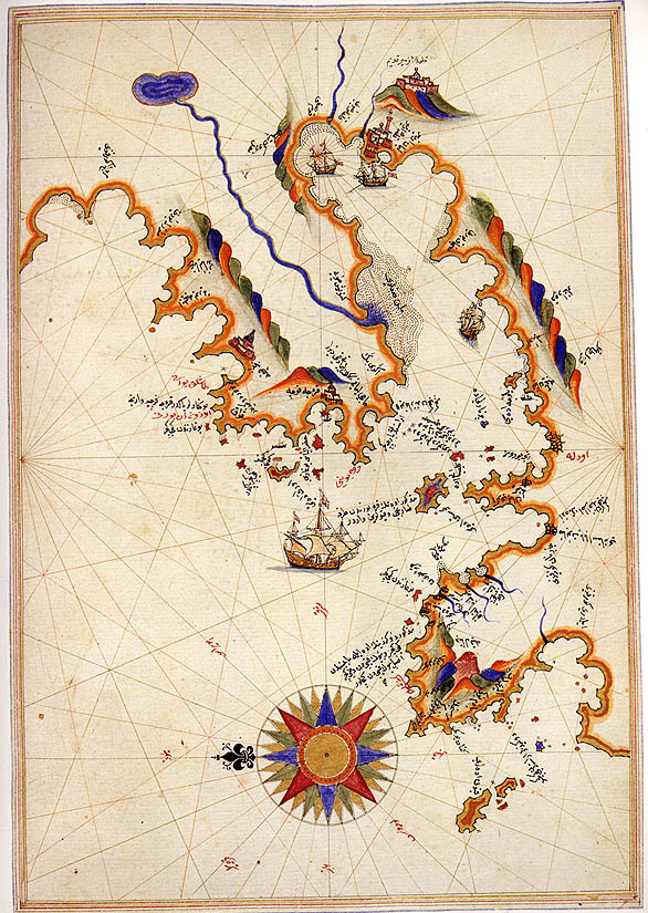
The Gulf of İzmir ( tr, İzmir Körfezi), formerly known as the Gulf of Smyrna, is a gulf on the Aegean Sea, with its inlet between the Karaburun Peninsula and the mainland area of Foça. It is in length by in breadth, with an excellent anchorage. The city of İzmir, an important port city of Turkey, surrounds the end of the gulf. Geography The northern limit of the Gulf of İzmir is defined as a 13 nmi line running from Cape Kanlıkaya () of the Karaburun Peninsula, to Cape Aslan () of Foça. The surface area of the gulf is , while its shore length is . Uzunada located in the Gulf of İzmir is Turkey's fourth largest island. Other islands of the gulf include Hekim Island, Foça Islands ( Orak Island, Fener Ada, Incir Ada, Metalik Ada), Çiçek Islands ( Yassıca Island, Pırnarlı Island, İncirli Island, Akça), Karantina Island, Yılan Island, and Büyük Ada. Seventeen rivers empty into the gulf, most notably the Gediz and the Meles. Gediz Delta, which is a Ramsa ... [...More Info...] [...Related Items...] OR: [Wikipedia] [Google] [Baidu] |
Kilizman
Klazomenai ( grc, Κλαζομεναί) or Clazomenae was an ancient Greek city on the coast of Ionia and a member of the Ionian League. It was one of the first cities to issue silver coinage. Its ruins are now located in the modern town Urla near Izmir in Izmir Province, Turkey. Location Klazomenai is located in modern Urla (Vourla (Βουρλά) in Greek) on the western coast of Anatolia, on the southern coast of the Gulf of İzmir, at about 20 miles west of İzmir. The city was originally located on the mainland at Limantepe, but probably during the early fifth-century BC Ionian Revolt from the Persians, it was moved to the Karantina Island just off the coast. Soon after that, the city of Chyton was founded on the mainland the late fifth-century BC. Both cities had conflictual relations but Alexander the Great eventually connected Karantina island to the mainland with a causeway, the remains of which are still visible. Mythology A silver coin minted in Klazomenai sh ... [...More Info...] [...Related Items...] OR: [Wikipedia] [Google] [Baidu] |
Seferihisar
Seferihisar is a coastal district and the center town of the same district in İzmir Province, in Turkey. Seferihisar district area borders on other İzmir districts of Urla to the west and Menderes ( Cumaovası) to the east, and touches İzmir's westernmost metropolitan district of Güzelbahçe in the north. Seferihisar town center is situated slightly inland at an altitude of 28 m and the urban area extends towards the sea as composed of eight quarters, with some distance among some, and one of which, the neighborhood called Sığacık stands somewhat separately from the rest at a distance of 5 km, and has its own port and made a name as a tourism resort by its own right. The wide area of the district center partly accounts for the high number of the population and an urbanization rate of only 51%, and the general impression observed is rather rural in some of its sections. Both the center town and the district as a whole preserves an overall outlook of a pleasant resort are ... [...More Info...] [...Related Items...] OR: [Wikipedia] [Google] [Baidu] |
İzmir Province
İzmir Province ( tr, İzmir ili) is a province and metropolitan municipality of Turkey in western Anatolia, situated along the Aegean coast. Its capital is the city of İzmir, which is in itself composed of the province's central 11 districts out of 30 in total. To the west, it is surrounded by the Aegean Sea, and it encloses the Gulf of Izmir. Its area is , with a population of 4,279,677 in 2017. The population was 3,370,866 in 2000. Neighboring provinces are Balıkesir to the north, Manisa to the east, and Aydın to the south. The traffic code of the province is 35. Major rivers of the province include the Küçük Menderes river, Koca Çay (with Güzelhisar dam), and Bakırçay. An earthquake on 30 October 2020 killed 117 people in the area. Districts * Aliağa * Balçova * Bayındır * Bayraklı * Bergama * Beydağ * Bornova * Buca * Çeşme * Çiğli * Dikili * Foça * Gaziemir * Güzelbahçe * Karabağlar * Karaburun * Karşıyaka * Kemalpaşa * Kınık ... [...More Info...] [...Related Items...] OR: [Wikipedia] [Google] [Baidu] |
Klazomenai
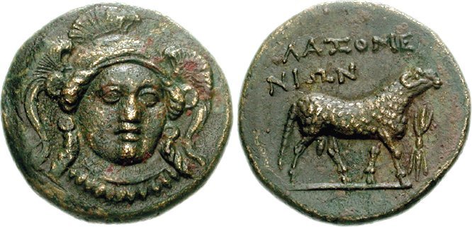
Klazomenai ( grc, Κλαζομεναί) or Clazomenae was an ancient Greek city on the coast of Ionia and a member of the Ionian League. It was one of the first cities to issue silver coinage. Its ruins are now located in the modern town Urla near Izmir in Izmir Province, Turkey. Location Klazomenai is located in modern Urla (Vourla (Βουρλά) in Greek) on the western coast of Anatolia, on the southern coast of the Gulf of İzmir, at about 20 miles west of İzmir. The city was originally located on the mainland at Limantepe, but probably during the early fifth-century BC Ionian Revolt from the Persians, it was moved to the Karantina Island just off the coast. Soon after that, the city of Chyton was founded on the mainland the late fifth-century BC. Both cities had conflictual relations but Alexander the Great eventually connected Karantina island to the mainland with a causeway, the remains of which are still visible. Mythology A silver coin minted in Klazomenai sh ... [...More Info...] [...Related Items...] OR: [Wikipedia] [Google] [Baidu] |
İzmir
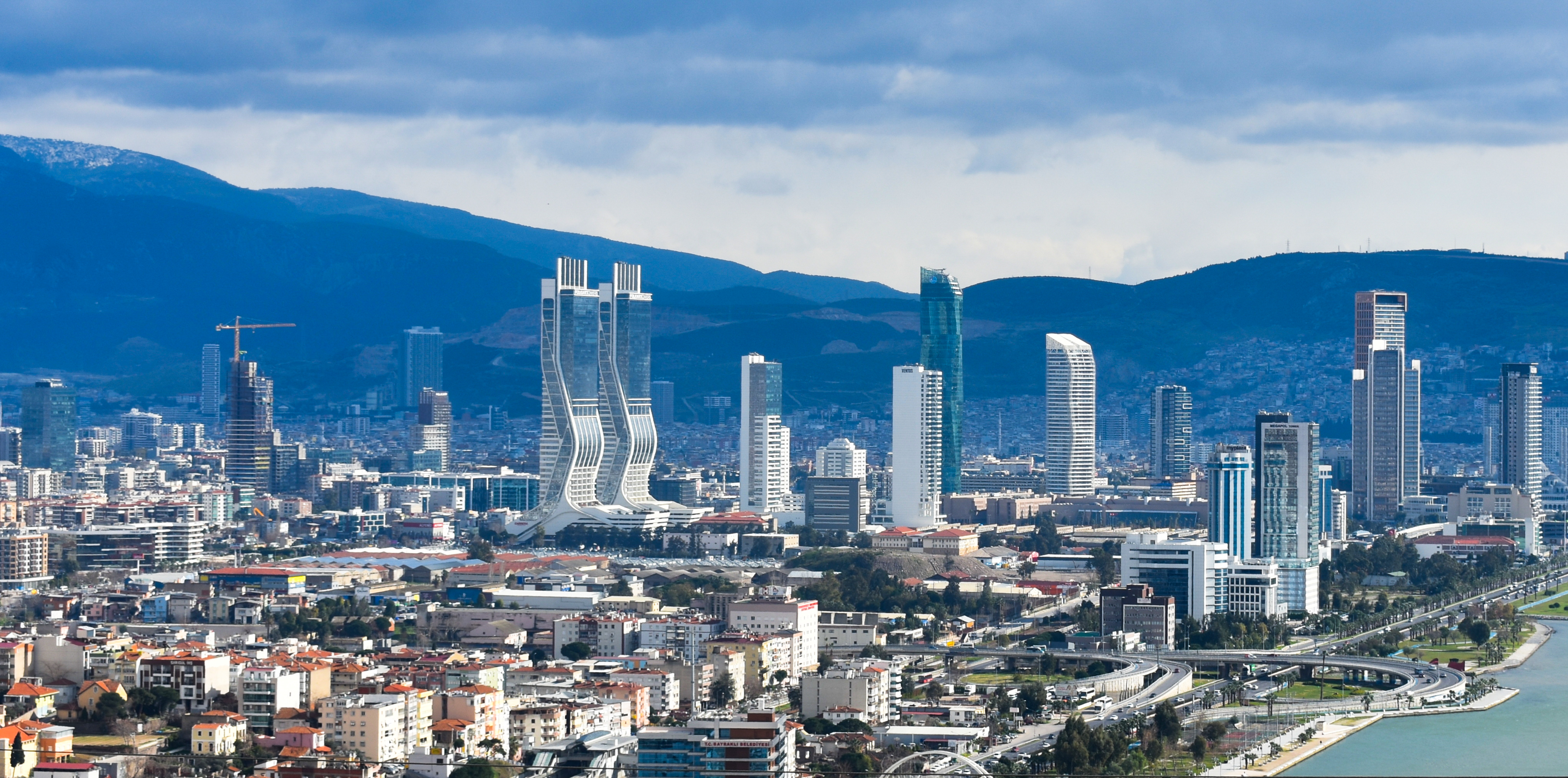
İzmir ( , ; ), also spelled Izmir, is a metropolitan city in the western extremity of Anatolia, capital of the province of the same name. It is the third most populous city in Turkey, after Istanbul and Ankara and the second largest urban agglomeration on the Aegean Sea after Athens. As of the last estimation, on 31 December 2019, the city of İzmir had a population of 2,965,900, while İzmir Province had a total population of 4,367,251. Its built-up (or metro) area was home to 3,209,179 inhabitants extending on 9 out of 11 urban districts (all but Urla and Guzelbahce not yet agglomerated) plus Menemen and Menderes largely conurbated. It extends along the outlying waters of the Gulf of İzmir and inland to the north across the Gediz River Delta; to the east along an alluvial plain created by several small streams; and to slightly more rugged terrain in the south. İzmir has more than 3,000 years of recorded urban history, and up to 8,500 years of history as a human settlemen ... [...More Info...] [...Related Items...] OR: [Wikipedia] [Google] [Baidu] |
Narlıdere
Narlıdere is a district of İzmir Province in Turkey. It is one of the nine districts in the Greater Metropolitan Area of İzmir, one of the smallest in terms both of population and area, and is fully (100.0%) urbanized. The district center has no depending township with own municipalities or villages. Narlıdere district area follows the southern coastline of the inner Gulf of İzmir. Narlıdere center is at a distance of to the west from the traditional center of İzmir ( Konak). Narlıdere district area neighbors the district areas of Balçova to the east, Menderes ( Cumaovası) to the south and Güzelbahçe to the west, this last also being westernmost among İzmir's metropolitan districts. Narlıdere district's overall levels of education are among the highest in Turkey, the literacy rate reaching 93 per cent, while the calculations for average yearly income per inhabitant situate Narlıdere rather below the national average, at 2.393 US Dollars, for which its open approa ... [...More Info...] [...Related Items...] OR: [Wikipedia] [Google] [Baidu] |
Red Scare
A Red Scare is the promotion of a widespread fear of a potential rise of communism, anarchism or other leftist ideologies by a society or state. The term is most often used to refer to two periods in the history of the United States which are referred to by this name. The First Red Scare, which occurred immediately after World War I, revolved around a perceived threat from the American labor movement, anarchist revolution, and political radicalism. The Second Red Scare, which occurred immediately after World War II, was preoccupied with the perception that national or foreign communists were infiltrating or subverting American society and the federal government. The name refers to the red flag as a common symbol of communism. First Red Scare (1917–1920) The first Red Scare in the United States accompanied the Russian Revolution of 1917 and subsequent communist revolutions in Europe and beyond. Citizens of the United States in the years of World War I (1914-1918) ... [...More Info...] [...Related Items...] OR: [Wikipedia] [Google] [Baidu] |
Cold War
The Cold War is a term commonly used to refer to a period of geopolitical tension between the United States and the Soviet Union and their respective allies, the Western Bloc and the Eastern Bloc. The term '' cold war'' is used because there was no large-scale fighting directly between the two superpowers, but they each supported major regional conflicts known as proxy wars. The conflict was based around the ideological and geopolitical struggle for global influence by these two superpowers, following their temporary alliance and victory against Nazi Germany and Imperial Japan in 1945. Aside from the nuclear arsenal development and conventional military deployment, the struggle for dominance was expressed via indirect means such as psychological warfare, propaganda campaigns, espionage, far-reaching embargoes, rivalry at sports events, and technological competitions such as the Space Race. The Western Bloc was led by the United States as well as a number of other First W ... [...More Info...] [...Related Items...] OR: [Wikipedia] [Google] [Baidu] |
Turkey
Turkey ( tr, Türkiye ), officially the Republic of Türkiye ( tr, Türkiye Cumhuriyeti, links=no ), is a list of transcontinental countries, transcontinental country located mainly on the Anatolia, Anatolian Peninsula in Western Asia, with a East Thrace, small portion on the Balkans, Balkan Peninsula in Southeast Europe. It shares borders with the Black Sea to the north; Georgia (country), Georgia to the northeast; Armenia, Azerbaijan, and Iran to the east; Iraq to the southeast; Syria and the Mediterranean Sea to the south; the Aegean Sea to the west; and Greece and Bulgaria to the northwest. Cyprus is located off the south coast. Turkish people, Turks form the vast majority of the nation's population and Kurds are the largest minority. Ankara is Turkey's capital, while Istanbul is its list of largest cities and towns in Turkey, largest city and financial centre. One of the world's earliest permanently Settler, settled regions, present-day Turkey was home to important Neol ... [...More Info...] [...Related Items...] OR: [Wikipedia] [Google] [Baidu] |


_(cropped).jpg)
.png)