|
Gympie, Queensland
Gympie ( ) is a city and a locality in the Gympie Region, Queensland, Australia. In the Wide Bay-Burnett District, Gympie is about north of the state capital, Brisbane. The city lies on the Mary River, which floods Gympie occasionally. The locality of Gympie is the central business district for the city of Gympie and also the administrative centre for the Gympie Region local government area. As of June 2021, Gympie had a population of 53,851. Gympie is famous for its gold field. It contains a number of historic buildings registered on the Queensland Heritage Register. History ''Gubbi Gubbi (Kabi Kabi, Cabbee, Carbi, Gabi Gabi)'' is an Australian Aboriginal language formerly spoken by the indigenous peoples of the Sunshine Coast Region and Gympie Region, particularly the towns of Caloundra, Noosa Heads, Gympie and extending north towards Maryborough and south to Caboolture''.'' Gympie's name derives from the Gubbi Gubbi word ''gimpi-gimpi'', which means "stinging tree" a ... [...More Info...] [...Related Items...] OR: [Wikipedia] [Google] [Baidu] |
Australian Bureau Of Statistics
The Australian Bureau of Statistics (ABS) is the independent statutory agency of the Australian Government responsible for statistical collection and analysis and for giving evidence-based advice to federal, state and territory governments. The ABS collects and analyses statistics on economic, population, environmental and social issues, publishing many on their website. The ABS also operates the national Census of Population and Housing that occurs every five years. History In 1901, statistics were collected by each state for their individual use. While attempts were made to coordinate collections through an annual Conference of Statisticians, it was quickly realized that a National Statistical Office would be required to develop nationally comparable statistics. The Commonwealth Bureau of Census and Statistics (CBCS) was established under the Census and Statistics Act in 1905. Sir George Knibbs was appointed as the first Commonwealth Statistician. Initially, the bureau w ... [...More Info...] [...Related Items...] OR: [Wikipedia] [Google] [Baidu] |
Brisbane
Brisbane ( ) is the capital and most populous city of the states and territories of Australia, Australian state of Queensland, and the list of cities in Australia by population, third-most populous city in Australia and Oceania, with a population of approximately 2.6 million. Brisbane lies at the centre of the South East Queensland metropolitan region, which encompasses a population of around 3.8 million. The Brisbane central business district is situated within a peninsula of the Brisbane River about from its mouth at Moreton Bay, a bay of the Coral Sea. Brisbane is located in the hilly floodplain of the Brisbane River Valley between Moreton Bay and the Taylor Range, Taylor and D'Aguilar Range, D'Aguilar mountain ranges. It sprawls across several local government in Australia, local government areas, most centrally the City of Brisbane, Australia's most populous local government area. The demonym of Brisbane is ''Brisbanite''. The Traditional Owners of the Brisbane a ... [...More Info...] [...Related Items...] OR: [Wikipedia] [Google] [Baidu] |
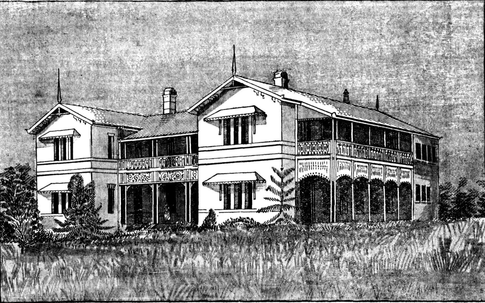
Gympie Hospital, 1891
Gympie ( ) is a city and a Suburbs and localities (Australia), locality in the Gympie Region, Queensland, Australia. In the Wide Bay-Burnett District, Gympie is about north of the state capital, Brisbane. The city lies on the Mary River (Queensland), Mary River, which floods Gympie occasionally. The locality of Gympie is the central business district for the city of Gympie and also the administrative centre for the Gympie Region local government area. As of June 2021, Gympie had a population of 53,851. Gympie is famous for its gold field. It contains a number of historic buildings registered on the Queensland Heritage Register. History ''Gabi-Gabi language, Gubbi Gubbi (Kabi Kabi, Cabbee, Carbi, Gabi Gabi)'' is an Australian Aboriginal language formerly spoken by the indigenous peoples of the Sunshine Coast Region and Gympie Region, particularly the towns of Caloundra, Noosa Heads, Queensland, Noosa Heads, Gympie and extending north towards Maryborough, Queensland, Marybor ... [...More Info...] [...Related Items...] OR: [Wikipedia] [Google] [Baidu] |
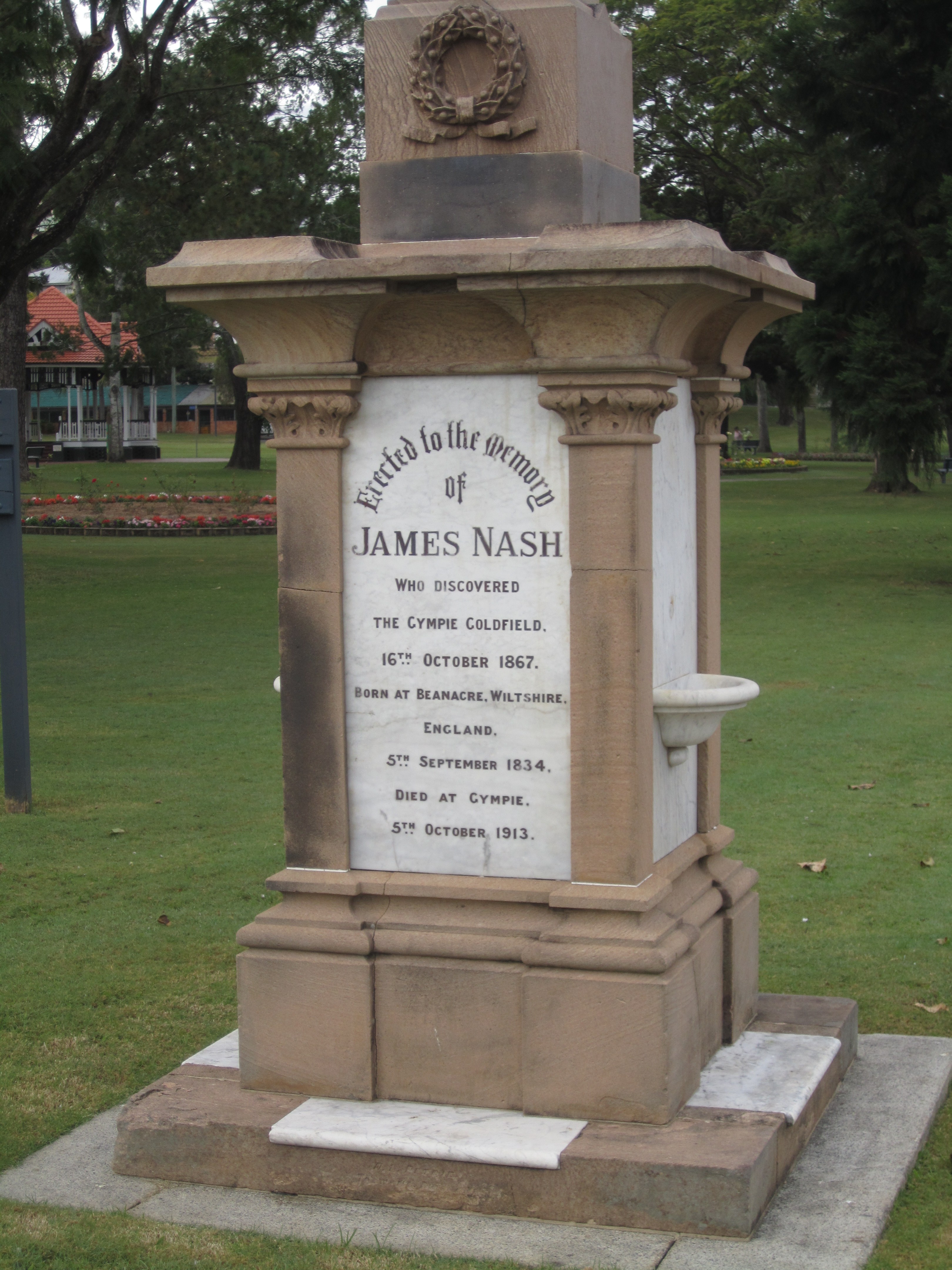
James Nash (prospector)
James Nash (5 September 1834 – 5 October 1913) is popularly acknowledged as the first person to discover gold in 1867,''The Gympie Goldfields 1867–2008'', John Ferguson and Elaine Brown, Gympie Regional Council in the area of Queensland, Australia now known as Gympie. Nash was born in Beanacre, Wiltshire, England, and migrated to Sydney, New South Wales, at the age of 23. In 1863 he moved to Queensland, working at Calliope and Nanango Nanango is a rural town and locality in the South Burnett Region, Queensland, Australia. In the , the locality of Nanango had a population of 3,599 people. Geography Nanango is situated north-west of the state capital, Brisbane, at the junc .... Nash found rich gold deposits on an extended prospecting tour in 1867 near the Mary River, and his report on 16 October started 'one of the wildest rushes in Queensland history'. Nash died in Gympie, Queensland on 5 October 1913. James Nash State High School (opened in 1977) and the Electora ... [...More Info...] [...Related Items...] OR: [Wikipedia] [Google] [Baidu] |
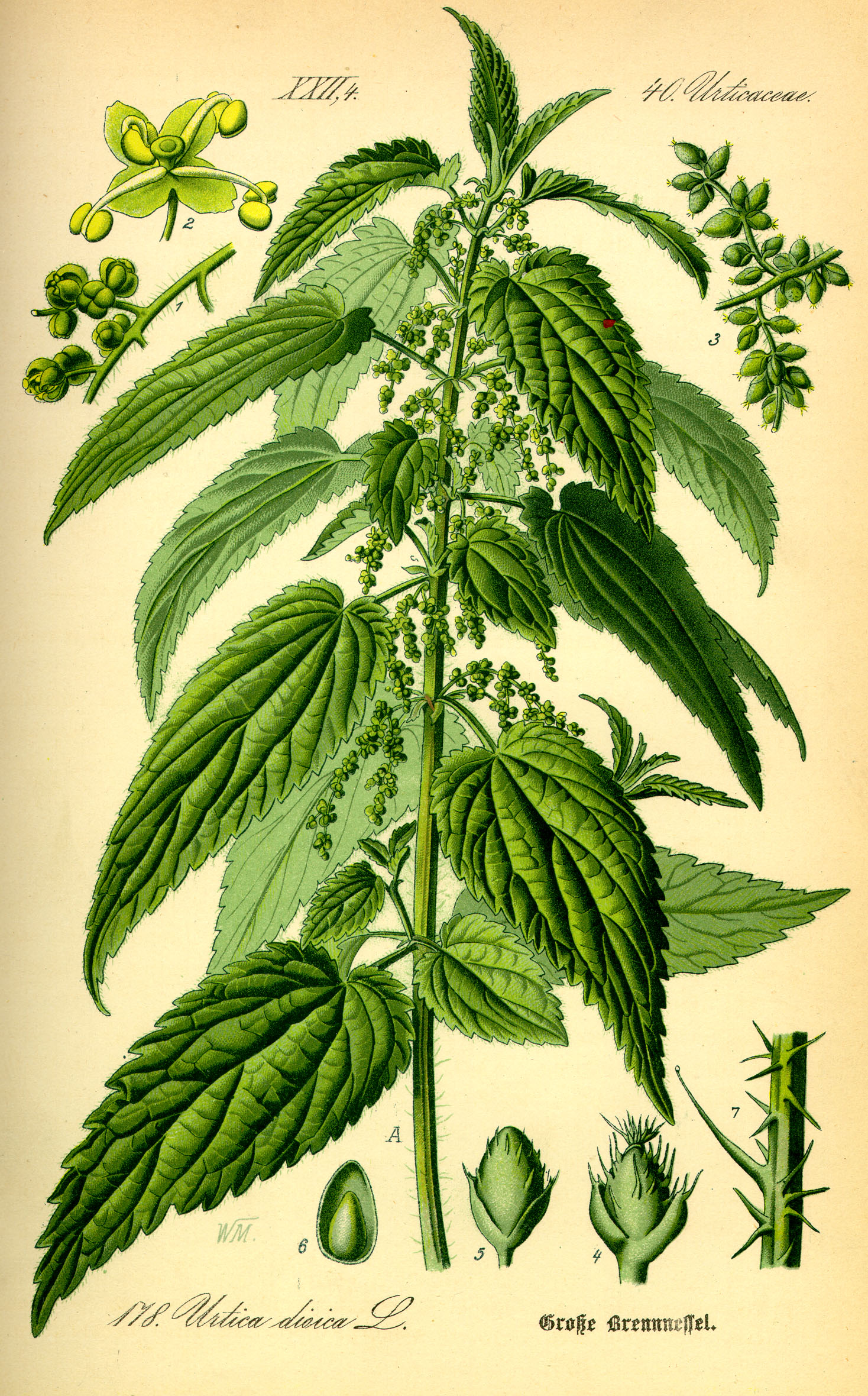
Stinging Nettles
''Urtica dioica'', often known as common nettle, burn nettle, stinging nettle (although not all plants of this species sting) or nettle leaf, or just a nettle or stinger, is a herbaceous perennial flowering plant in the family Urticaceae. Originally native to Europe, much of temperate Asia and western North Africa, it is now found worldwide, including New Zealand and North America. The species is divided into six subspecies, five of which have many hollow stinging hairs called trichomes on the leaves and stems, which act like hypodermic needles, injecting histamine and other chemicals that produce a stinging sensation upon contact ("contact urticaria", a form of contact dermatitis). The plant has a long history of use as a source for traditional medicine, food, tea, and textile raw material in ancient (such as Saxon) and modern societies. Description ''Urtica dioica'' is a dioecious, herbaceous, perennial plant, tall in the summer and dying down to the ground in winter. ... [...More Info...] [...Related Items...] OR: [Wikipedia] [Google] [Baidu] |
Dendrocnide Moroides
''Dendrocnide moroides'', commonly known in Australia as the stinging tree, stinging bush, Queensland Stinger or gympie-gympie, is a plant in the nettle family Urticaceae found in rainforest areas of Malaysia and Australia. It is notorious for its extremely painful and long-lasting sting. The common name gympie-gympie comes from the language of the Indigenous Gubbi Gubbi people of south-eastern Queensland. Description ''D. moroides'' is a straggly perennial understory shrub, usually flowering and fruiting when less than tall, but it may reach up to in height. It is superficially similar to '' Dendrocnide cordifolia'', with the most obvious difference being the point of attachment of the petiole to the leaf blade—where ''D. moroides'' is peltate, i.e. the stalk attaches to the underside of the leaf and not at the edge, ''D. cordifolia'' is cordate. The stem, branches, petioles, leaves, and fruits are all covered in stinging hairs. It has large, heart-shaped, simple leave ... [...More Info...] [...Related Items...] OR: [Wikipedia] [Google] [Baidu] |
Caboolture, Queensland
Caboolture () is a town and suburb in Moreton Bay Region, Queensland, Australia. In the , the suburb of Caboolture had a population of 26,433 people. It is located on the north side of the Caboolture River, which separates the town from Morayfield and Caboolture South. Geography Caboolture is an urban centre or satellite city approximately north of Brisbane, the state capital of Queensland. Caboolture is now considered to be the northernmost urban area of the greater Brisbane metropolitan region within South East Queensland, and it marks the end of the Brisbane suburban commuter railway service along the North Coast railway line. The urban extent of the town of Caboolture is not formally defined but is generally regarded as including the following suburbs: * Bellmere * Caboolture (as a suburb) * Caboolture South * Morayfield (northern section, west of Bruce Highway) * Upper Caboolture History Indigenous history '' Duungidjawu (''also known as ''Kabi Kabi, Cabbee, Carb ... [...More Info...] [...Related Items...] OR: [Wikipedia] [Google] [Baidu] |
Noosa Heads, Queensland
Noosa Heads is a coastal town and suburb in the Shire of Noosa, Queensland, Australia. In the , the suburb of Noosa Heads had a population of 4,484 people. It is a popular holiday destination. Geography The suburb is bounded to the west by Weyba Creek and the Noosa River and to the north and east by the Coral Sea. The northeast of the locality is within the Noosa National Park. Noosa Heads, Noosaville and Tewantin form a continuous urban area at the northern end of the Sunshine Coast. Noosa Hill in the national park is the highest point of the suburb () at above sea level. There is also Laguna Lookout () on a low hill near the town. Coastal features There are a number of headlands, lookouts, bays, and other coastal features along the Noosa Heads coastline, many of them on the coastal walking track through the national park, including (from north to south): * Noosa Inlet, the mouth of the Noosa River () * Laguna Bay () * Noosa Beach () * Boiling Pot Lookout () * Tea Tree B ... [...More Info...] [...Related Items...] OR: [Wikipedia] [Google] [Baidu] |
Sunshine Coast Region
The Sunshine Coast Region is a local government area located in the Sunshine Coast district of South East Queensland, Australia. It was created by the amalgamation in 2008 of the City of Caloundra and the Shires of Maroochy and Noosa. It contains of roads, of coastline and a population of 351,424 in January 2021. The budget for the 2020–2021 financial year totals A$782 million including $243 million for Capital Works. On 1 January 2014, the Shire of Noosa was re-established independent of the Sunshine Coast Regional council. History ''Gubbi Gubbi (Kabi Kabi, Cabbee, Carbi, Gabi Gabi)'' is an Australian Aboriginal language spoken on Gubbi Gubbi country. The Gubbi Gubbi language region includes the landscape within the local government boundaries of the Sunshine Coast Region and Gympie Region, particularly the towns of Caloundra, Noosa Heads, Gympie and extending north towards Maryborough and south to Caboolture''.'' Prior to 2008, the new Sunshine Coast Region was an ... [...More Info...] [...Related Items...] OR: [Wikipedia] [Google] [Baidu] |
Australian Aboriginal Language
The Indigenous languages of Australia number in the hundreds, the precise number being quite uncertain, although there is a range of estimates from a minimum of around 250 (using the technical definition of 'language' as non-mutually intelligible varieties) up to possibly 363. The Indigenous languages of Australia comprise numerous language families and isolates, perhaps as many as 13, spoken by the Indigenous peoples of mainland Australia and a few nearby islands. The relationships between the language families are not clear at present although there are proposals to link some into larger groupings. Despite this uncertainty, the Indigenous Australian languages are collectively covered by the technical term "Australian languages", or the "Australian family". The term can include both Tasmanian languages and the Western Torres Strait language, but the genetic relationship to the mainland Australian languages of the former is unknown, while the latter is Pama–Nyungan, thoug ... [...More Info...] [...Related Items...] OR: [Wikipedia] [Google] [Baidu] |
Gabi-Gabi Language
Kabi Kabi, also spelt Gabi-Gabi/Gubbi Gubbi, is a language of Queensland in Australia, formerly spoken by the Kabi Kabi people of South-east Queensland. The main dialect, Kabi Kabi, is extinct, but there are still 24 people with knowledge of the Butchulla dialect (also spelt Batjala, Batyala, Badjala, and variants), a language spoken by the Butchulla people of Fraser Island. Words According to Norman Tindale (1974), the word Kabi ( kabi, means "no". "Wunya ngulum" means "Welcome, everyone" in Kabi Kabi/Gabi-Gabi. Language status The main dialect is extinct, but there were still 24 people with knowledge of the Batjala dialect (a language spoken by the Butchulla people of Fraser Island) as of the 2016 Australian census. Phonology The following is in the Badjala/Butchulla dialect: Consonants * /n̪/ is always heard as palatal �when preceding /i/, and in word-final position. * /d̪/ can be heard in free variation with palatal � * /b d̪ ɡ/ can have lenited allophones � ð ... [...More Info...] [...Related Items...] OR: [Wikipedia] [Google] [Baidu] |
Plan Of Leases And Claims On The Deep Lead, Gympie, 1869
A plan is typically any diagram or list of steps with details of timing and resources, used to achieve an objective to do something. It is commonly understood as a temporal set of intended actions through which one expects to achieve a goal. For spatial or planar topologic or topographic sets see map. Plans can be formal or informal: * Structured and formal plans, used by multiple people, are more likely to occur in projects, diplomacy, careers, economic development, military campaigns, combat, sports, games, or in the conduct of other business. In most cases, the absence of a well-laid plan can have adverse effects: for example, a non-robust project plan can cost the organization time and money. * Informal or ad hoc plans are created by individuals in all of their pursuits. The most popular ways to describe plans are by their breadth, time frame, and specificity; however, these planning classifications are not independent of one another. For instance, there is a close rel ... [...More Info...] [...Related Items...] OR: [Wikipedia] [Google] [Baidu] |


