|
Gundlupete
Gundlupet also known as Land of Tigers (''Gundlupētē'' in Kannada) is a municipal town situated in the Chamarajanagar district of Karnataka, India. It is also known as "''The flower pot of India''". It is situated 60 km away from NH 766 and approximately 200 km from the state administrative capital, Bangalore. Gundlupet is the last town in Karnataka on the National Highway 766 which goes through Mysore, Ooty, Wayanad, and Calicut. It is situated very close to the Tamil Nadu and Kerala state borders. NH 181 begins from Gundlupet and ends in Nagapattinam in Tamil Nadu via Ooty and Coimbatore. The Bandipur National Park is situated 17 km away from Gundlupet. Gundlupet was previously known as ''Vijayapura'', named after the ancient Vijayanarayana Temple. Geography Gundlupet is located at . It has an average elevation of 816 metres (2,677 feet). Demographics Religion-wise Population - Gundlupet Taluka Agriculture The main crops grown are jowar, ragi, sugar cane, tur ... [...More Info...] [...Related Items...] OR: [Wikipedia] [Google] [Baidu] |
Gopalaswamy Hills
Himavad Gopalaswamy Betta, is a hill (betta in Kannada) located in the Gundlupete Taluk, Chamarajanagar district of the state of Karnataka, India at a height of 1450m and is extensively wooded. It is also the highest peak in the Bandipur National Park. It lies in the core area of the Bandipur National Park and is frequented by wild life including elephants. Dense fog predominates and covers the hills round the year and thus gets the prefix ''Himavad''(in the language of Kannada) and the temple of Venugopalaswamy (Lord Krishna) gives the full name of Himavad Gopalaswamy Betta. Its geographic coordinates are: Latitude 12.97°Ne and longitude 77.56°E. Access It is approximately 220 km from Bangalore and 75 km from Mysore on the Mysore Ooty road -10 km away from Gundlupete, which is 60 km away from Mysore. There is a motorable road all the way to the top of the hill. No entry for private vehicles, visitors have to take the Govt bus organised by the Kar ... [...More Info...] [...Related Items...] OR: [Wikipedia] [Google] [Baidu] |
Chamarajanagar District
Chamarajanagar or Chamarajanagara is the southernmost district in the state of Karnataka, India. It was carved out of the original larger Mysore District in 1998. Chamarajanagar town is the headquarters of this district. It is the third least populous district in Karnataka (out of 30), after Kodagu and Bangalore Rural. History Chamarajanagar was earlier known as Sri Arikottara. Chamaraja Wodeyar, the Wodeyar of Mysuru was born here and hence this place was renamed after him. The Vijaya Parsvanath Basadi, a holy Jain shrine was constructed by Punisadandanayaka, the commander of the Hoysala king Gangaraja in the year 1117 AD. Geography Being the southernmost district of Karnataka, Chamarajanagar district borders the state of Tamil Nadu and Kerala. Specifically, it borders Mysore district of Karnataka to the west and north, Mandya and Ramanagara districts of Karnataka to the north-east, Dharmapuri and Krishnagiri districts of Tamil Nadu to the east, Salem to south-east, Erode ... [...More Info...] [...Related Items...] OR: [Wikipedia] [Google] [Baidu] |
Huligina Maradi
Huligina Maradi is a hill located in the Gundlupete Taluk, Chamarajanagar district of the state of Karnataka. It has a temple dedicated to Lord Srinivasa. It is also known as Huligadri, Dakshina Seshadri and Vyagrachala. This place is popularly known as "''Dakshina Sheshadri''", as narrated in ‘ Srimad Varaha Purana’. Lord Sri Srinivasa, worshipped by Lord Sri Rama in Treta Yuga, Pandavas in Dvapara Yuga, Agasthya maharishi and Adishesha. Lord Venkataramana blessed the great saint ‘Mandavya Mandavya (), also called Aṇi Māṇḍavya, is a sage in Hinduism. He is best known for a legend where he is wrongfully punished by a king by impalement. Legend Impalement According to the Mahabharata, Mandavya was once performing a tap ... Maharishi’ on his performance of long penance. Villages in Chamarajanagar district {{chamarajanagar-geo-stub ... [...More Info...] [...Related Items...] OR: [Wikipedia] [Google] [Baidu] |
Nagapattinam
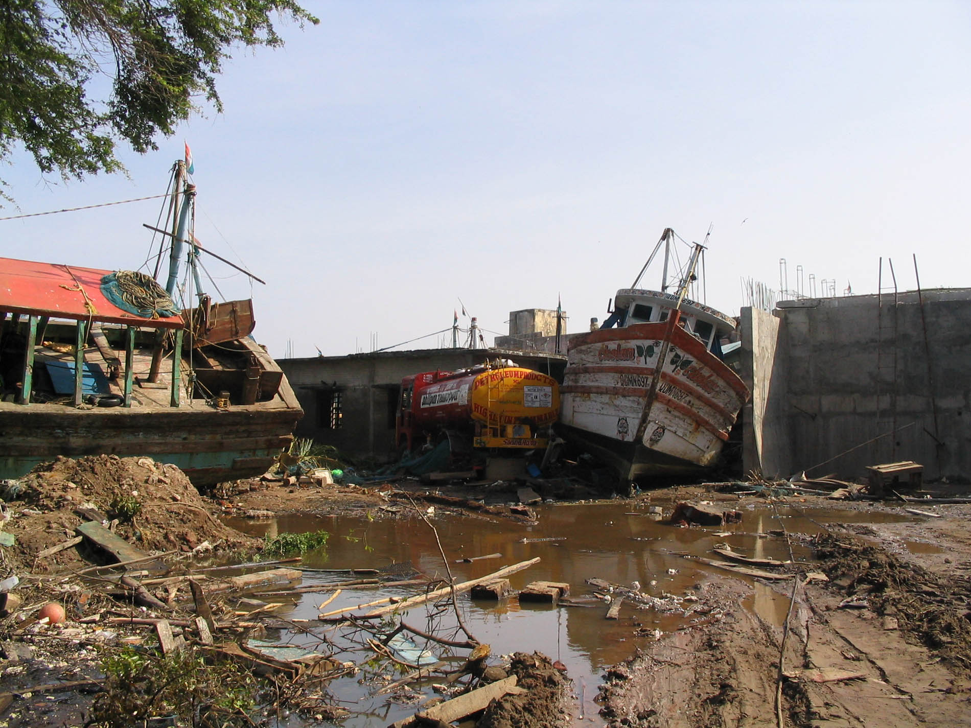
Nagapattinam (''nākappaṭṭinam'', previously spelt Nagapatnam or Negapatam) is a town in the Indian state of Tamil Nadu and the administrative headquarters of Nagapattinam District. The town came to prominence during the period of Medieval Cholas (9th–12th century CE) and served as their important port for commerce and east-bound naval expeditions. The Chudamani Vihara in Nagapattinam constructed by the Srivijayan king Sri Mara Vijayattungavarman of the Sailendra dynasty with the help of Rajaraja Chola I was an important Buddhist structure in those times. Nagapattinam was settled by the Portuguese and, later, the Dutch under whom it served as the capital of Dutch Coromandel from 1660 to 1781. In November 1781, the town was conquered by the British East India Company. It served as the capital of Tanjore district from 1799 to 1845 under Madras Presidency of the British. It continued to be a part of Thanjavur district in Independent India. In 1991, it was made the headquar ... [...More Info...] [...Related Items...] OR: [Wikipedia] [Google] [Baidu] |
National Highway 181 (India)
National Highway 181, commonly referred to as NH 181, is a highway connecting the city of Coimbatore in Tamil Nadu to Gundlupete in Karnataka state, South India. The city of Mysuru is connected to Ooty by road via Nanjanagudu, Gundlupete, Bandipur and Gudalur. The national highway 181 passes through Bandipur Tiger Reserve (National Park) and Mudumalai Tiger Reserve, hence vehicular traffic is restricted at night. Wild animals like elephants, bison, bears, tiger, and leopards can be spotted sometimes on this highway in the tiger reserve stretches. NH 181 after Ooty goes to Coonoor, Mettupalayam, Karamadai and ends in Coimbatore city. See also * National Highway 766 (India) * National Highway 948 (India) National Highway 948 (previously designated NH 209), is a highway in India which connects Coimbatore in Tamil Nadu with the city of Bengaluru. It is a spur road of National Highway 48. It passes through Sathyamangalam Wildlife Sanctuary. The r ... References 81 Na ... [...More Info...] [...Related Items...] OR: [Wikipedia] [Google] [Baidu] |
National Highway 766 (India)
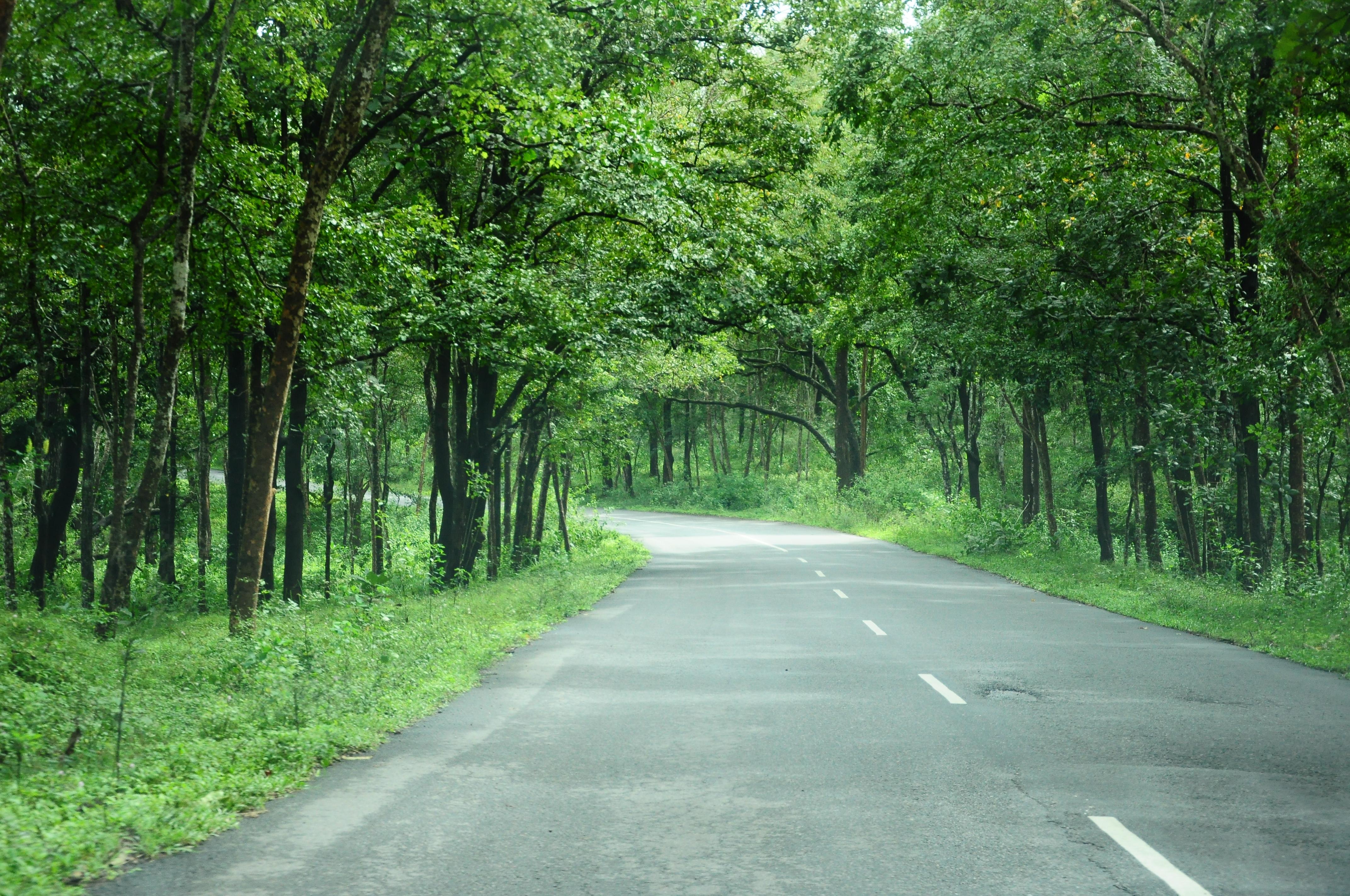
National Highway 766 (NH 766) (previously NH-212) is a National Highway in Southern India. NH 766 connects Kozhikode in Kerala with Kollegal in Karnataka via Mysore. Of the total distance of 272 km, 117 km is in Kerala and 155 is in Karnataka. At Kollegal, it joins National Highway 948, which connects Bengaluru and Coimbatore. The highway passes through dense forests of Western ghats of India. The NH-766 passes through 19.7 km Bandipur National Park and Wayanad wild life sanctuary. The section of the road from Lakkidi in Wayanad to Adivaram (Thamarassery) called as Thamarassery Churam (A hill highway with nine hairpin bends) offers a scenic drive. Route In Kerala * Kozhikode * Kunnamangalam * Koduvally * Thamarassery * Vythiri * Kalpetta * Meenangadi * Sultan Bathery * Muthanga In Karnataka * Gundlupete * Begur * Nanjangud * Mysore * T Narsipur * Kollegal Night Traffic ban at Bandipura The Karnataka government banned night traffic through the road passin ... [...More Info...] [...Related Items...] OR: [Wikipedia] [Google] [Baidu] |
WikiProject Indian Cities
A WikiProject, or Wikiproject, is a Wikimedia movement affinity group for contributors with shared goals. WikiProjects are prevalent within the largest wiki, Wikipedia, and exist to varying degrees within sister projects such as Wiktionary, Wikiquote, Wikidata, and Wikisource. They also exist in different languages, and translation of articles is a form of their collaboration. During the COVID-19 pandemic, CBS News noted the role of Wikipedia's WikiProject Medicine in maintaining the accuracy of articles related to the disease. Another WikiProject that has drawn attention is WikiProject Women Scientists, which was profiled by '' Smithsonian'' for its efforts to improve coverage of women scientists which the profile noted had "helped increase the number of female scientists on Wikipedia from around 1,600 to over 5,000". On Wikipedia Some Wikipedia WikiProjects are substantial enough to engage in cooperative activities with outside organizations relevant to the field at issue. For ex ... [...More Info...] [...Related Items...] OR: [Wikipedia] [Google] [Baidu] |
Wayanad
Wayanad () is a district in the north-east of Indian state Kerala with administrative headquarters at the municipality of Kalpetta. It is the only plateau in Kerala. The Wayanad Plateau forms a continuation of the Mysore Plateau, the southern portion of Deccan Plateau. It is set high in the Western Ghats with altitudes ranging from 700 to 2100 meters. Vellari Mala, a high peak situated on the trijunction of Wayanad, Malappuram, and Kozhikode districts, is the highest point in Wayanad district. The district was formed on 1 November 1980 as the 12th district in Kerala, by carving out areas from Kozhikode and Kannur districts. An area of 885.92 km2 of the district is forested. Wayanad has three municipal towns—Kalpetta, Mananthavady and Sulthan Bathery. There are many indigenous tribes in this area. The Kabini River, a tributary of Kaveri River, originates at Wayanad. Wayanad district, along with the Chaliyar valley in neighbouring Nilambur (Eastern Eranad region) in Ma ... [...More Info...] [...Related Items...] OR: [Wikipedia] [Google] [Baidu] |
Vijayanarayana Temple, Gundlupet
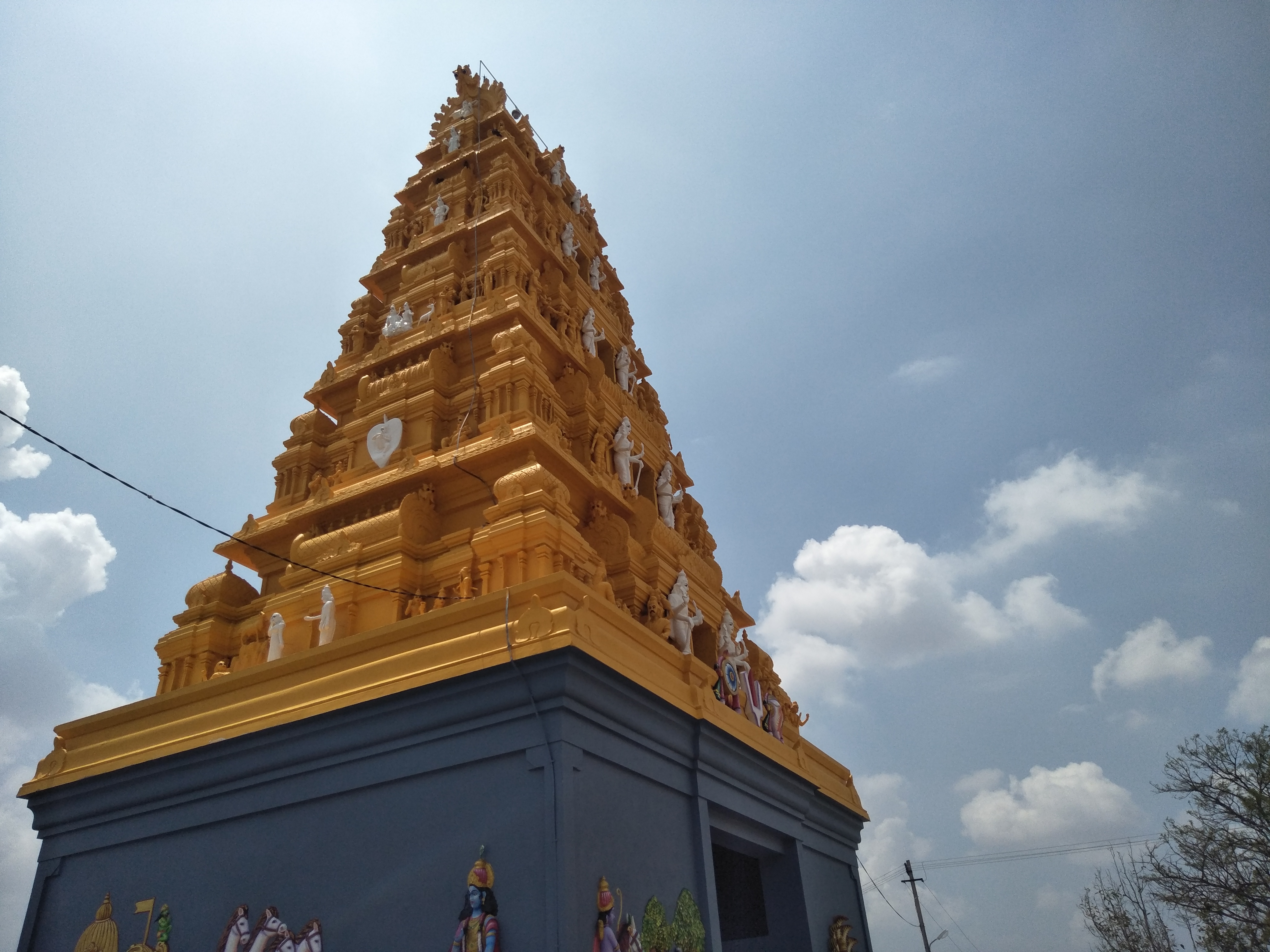
The Vijayanarayana Temple is located in the town of Gundlupet of Chamarajanagar district, Karnataka state, India. The temple dates back to the 10th century rule of the Western Ganga Dynasty, though it has received continuous patronage from later kingdoms as well, up to the 15th century Vijayanagara period. Tradition has it that the Hoysala Empire King Vishnuvardhana was responsible for the consecration of the deity Vijayanarayana, a version of the Hindu god Narayana (or Vishnu). Temple plan The temple consists of a sanctum (''garbhagriha''), a vestibule (called ''sukhanasi'') that connects the sanctum to the ''navaranga'' (closed hall where devotees gather for prayers) and an open hall ('' mandapa''). The base on which the walls of the ''navaranga'' are built (called ''adhisthana'') has the several moldings. The walls that rise from this have slender decorative pilasters. The open ''mantapa'' that has several ornate pillars appears to have modified the original north–south e ... [...More Info...] [...Related Items...] OR: [Wikipedia] [Google] [Baidu] |
Bandipur National Park
Bandipur National Park is a national park covering in Chamarajnagar district in the Indian state of Karnataka. It was established as a tiger reserve under Project Tiger in 1973. It is part of the Nilgiri Biosphere Reserve since 1986. History The Maharaja of the Kingdom of Mysore created a sanctuary of in 1931 and named it the Venugopala Wildlife Park. The Bandipur Tiger Reserve was established under Project Tiger in 1973 by adding nearly to the Venugopala Wildlife park. Geography Bandipur National Park is located between 75° 12’ 17" E to 76° 51’ 32" E and 11° 35’ 34" N to 11° 57’ 02" N where the Deccan Plateau meets the Western Ghats, and the altitude of the park ranges from to . As a result, the park has a variety of biomes including Tropical and subtropical dry broadleaf forests, dry deciduous forests, Tropical and subtropical moist broadleaf forests, moist deciduous forests and Tropical and subtropical grasslands, savannas, and shrublands, shrublands. The wi ... [...More Info...] [...Related Items...] OR: [Wikipedia] [Google] [Baidu] |
Kerala
Kerala ( ; ) is a state on the Malabar Coast of India. It was formed on 1 November 1956, following the passage of the States Reorganisation Act, by combining Malayalam-speaking regions of the erstwhile regions of Cochin, Malabar, South Canara, and Thiruvithamkoor. Spread over , Kerala is the 21st largest Indian state by area. It is bordered by Karnataka to the north and northeast, Tamil Nadu to the east and south, and the Lakshadweep Sea to the west. With 33 million inhabitants as per the 2011 census, Kerala is the 13th-largest Indian state by population. It is divided into 14 districts with the capital being Thiruvananthapuram. Malayalam is the most widely spoken language and is also the official language of the state. The Chera dynasty was the first prominent kingdom based in Kerala. The Ay kingdom in the deep south and the Ezhimala kingdom in the north formed the other kingdoms in the early years of the Common Era (CE). The region had been a prominent spic ... [...More Info...] [...Related Items...] OR: [Wikipedia] [Google] [Baidu] |


