|
Gulph Mills Station
Gulph Mills station is a SEPTA rapid transit station in Gulph Mills, Pennsylvania. It serves the Norristown High Speed Line (Route 100) and is officially located at Trinity Road and Crest Lane in Upper Merion Township, Pennsylvania, Upper Merion Township, however another parking lot can be found across the tracks on South Gulph Road. This parking lot is only accessible for northbound drivers along South Gulph Road, though. All trains stop at Gulph Mills. Transfers are available for buses to the King of Prussia (shopping mall), King of Prussia mall. The station lies from 69th Street Terminal. There is off-street parking available at this station. Station layout SEPTA Suburban Bus connections *SEPTA Route 95: to Plymouth Meeting Mall and Willow Grove Park Mall. *SEPTA Route 124: Center City Philadelphia, Center City to King of Prussia (shopping mall), King of Prussia mall or Chesterbrook, Pennsylvania, Chesterbrook *SEPTA Route 125: Center City to King of Prussia mall or Valley F ... [...More Info...] [...Related Items...] OR: [Wikipedia] [Google] [Baidu] |
Upper Merion Township, Pennsylvania
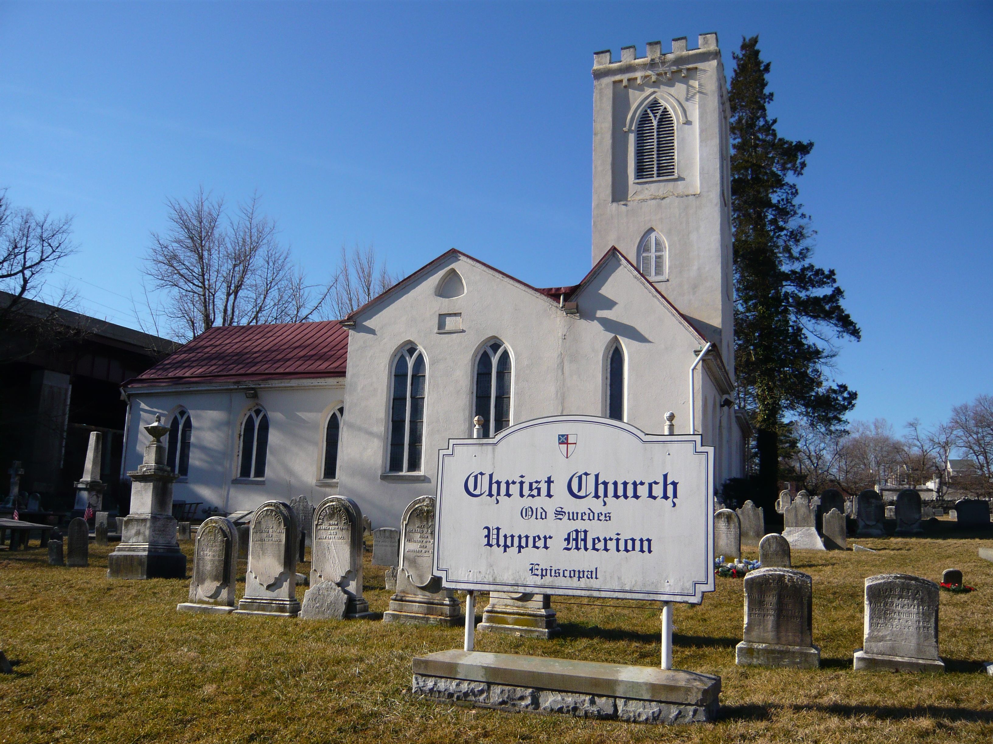
Upper Merion Township is a township in Montgomery County, Pennsylvania. The population was 28,395 at the 2010 U.S. Census. Located from Philadelphia, it consists of the villages of Gulph Mills, King of Prussia, Swedeland, Swedesburg, and portions of Radnor, and Wayne. The westernmost part of the township comprises the largest part of the Valley Forge National Historical Park. The township is the home of the King of Prussia mall. King of Prussia also contains a major office park hosting firms such as Lockheed Martin and GlaxoSmithKline. The name Merion originates with the county of Merioneth in north Wales. ''Merioneth'' is an English-language translation of the Welsh ''Meirionnydd'', itself named after ''Meirchion'' (or ''Meirion''), grandson of ''Cunedda Wledig'' (b. ca. 380 A.D.), King of North Wales. History The township's incorporation dates to 1713 when the King of Prussia Inn, the Bird-In-Hand Inn in Gulph Mills, and later the Swedes Ford Inn were required to pay 6 ... [...More Info...] [...Related Items...] OR: [Wikipedia] [Google] [Baidu] |
69th Street Transportation Center
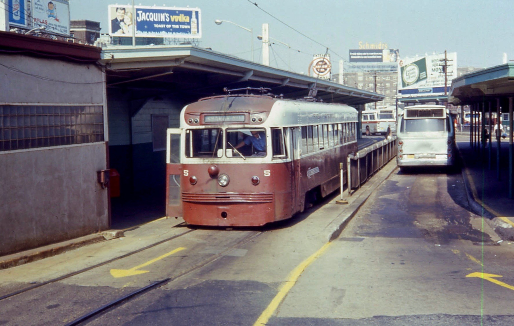
The 69th Street Transportation Center is a SEPTA terminal in the Terminal Square section of Upper Darby, Pennsylvania, just west of the city limits of Philadelphia. The terminal serves the Market–Frankford Line, Norristown High Speed Line, and the Media–Sharon Hill Line trolleys, and multiple bus routes. It is located at the end of 69th Street, a major retail corridor in Upper Darby, across Market Street ( Route 3) from the Tower Theater. Until 2011, the station was primarily known as 69th Street Terminal. 69th Street is the second busiest transfer point in the SEPTA system (after 15th Street/ City Hall station) serving 35,000 passengers every weekday. It is also the only SEPTA facility to serve both City Transit and Suburban Transit routes. History 69th Street is one of the original Market Street Elevated stations built by the Philadelphia Rapid Transit Company; the line opened for service on March 4, 1907 between here and stations. Shortly after on May 22 of the sam ... [...More Info...] [...Related Items...] OR: [Wikipedia] [Google] [Baidu] |
SEPTA Route 125
The Southeastern Pennsylvania Transportation Authority operates or contracts operations of these routes serving points in Bucks County, Pennsylvania, Bucks, Chester County, Pennsylvania, Chester, Delaware County, Pennsylvania, Delaware, and Montgomery County, Pennsylvania, Montgomery counties, with a few routes operating into the city of Philadelphia. The Suburban Transit Division is broken down into three districts: Victory (Formerly: Red Arrow Division), Frontier, and Contract Operations. Routes Victory District These routes are operated from the Victory District, located at the 69th Street Transportation Center in Upper Darby Township, Delaware County. This also includes Norristown High Speed Line (Route 100 before 2009), SEPTA Route 101, 101 Media, and SEPTA Route 102, 102 Sharon Hill rail operations. These routes were once operated by the Philadelphia Suburban Transportation Company, better known by its nickname "Red Arrow Lines". Routes in the Chester area of Delaware Coun ... [...More Info...] [...Related Items...] OR: [Wikipedia] [Google] [Baidu] |
Chesterbrook, Pennsylvania
Chesterbrook is a census-designated place (CDP) in Chester County, Pennsylvania. It is located within the Philadelphia metropolitan area and just south of Valley Forge National Historical Park. The population was 4,589 at the 2010 census. Geography According to the U.S. Census Bureau, Chesterbrook has a total area of , all of it land. Chesterbrook is located about 23 miles away from Philadelphia. Demographics At the 2000 census there were 4,625 people, 2,356 households, and 1,175 families living in the CDP. The population density was 2,871.7 people per square mile (1,109.1/km). There were 2,413 housing units at an average density of 1,498.3/sq mi (578.7/km). The racial makeup of the CDP was 89.71% White, 1.84% African American, 0.17% Native American, 7.07% Asian, 0.52% from other races, and 0.69% from two or more races. Hispanic or Latino of any race were 2.03%. There were 2,356 households, 20.4% had children under the age of 18 living with them, 39.2% were married coup ... [...More Info...] [...Related Items...] OR: [Wikipedia] [Google] [Baidu] |
Center City Philadelphia
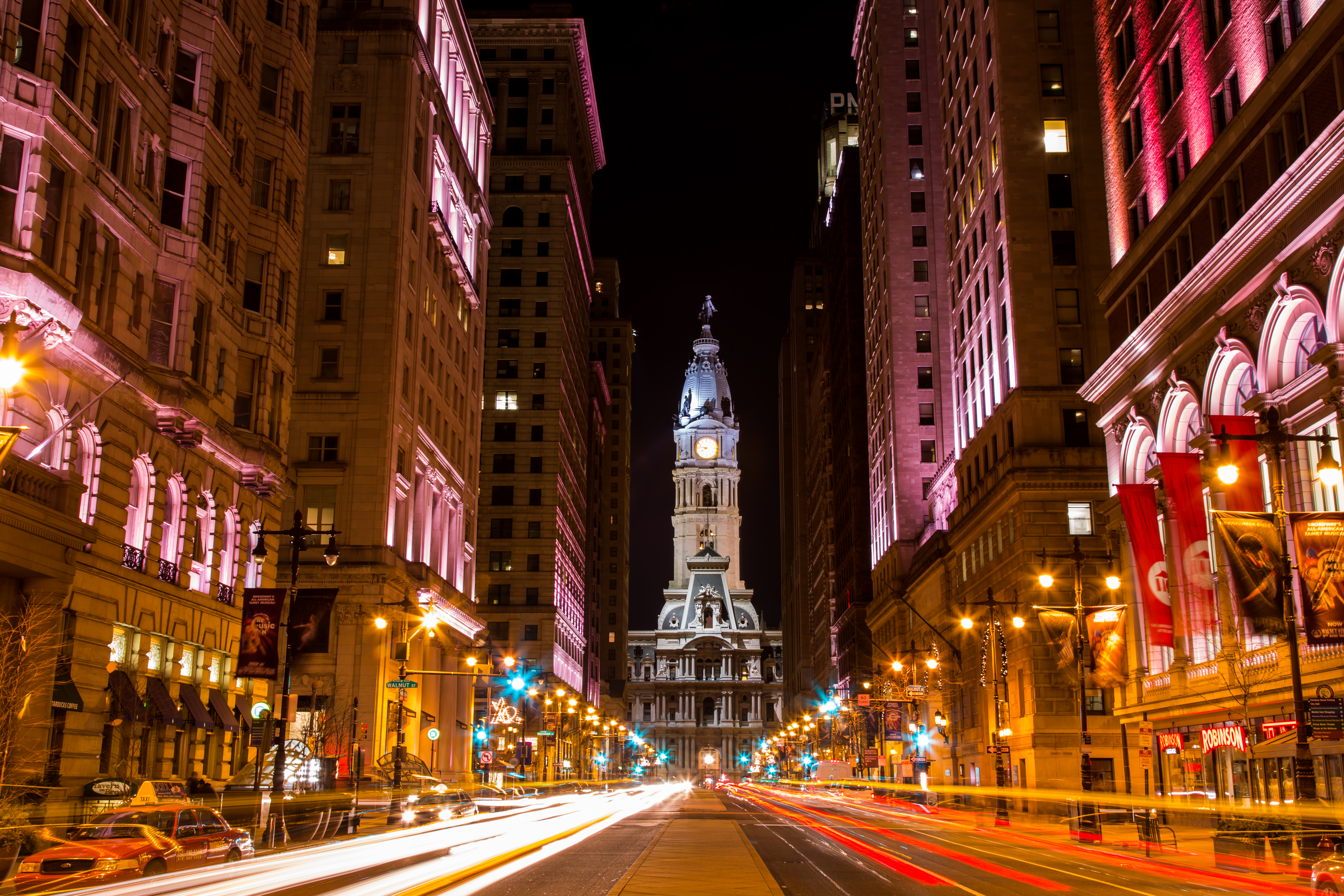
Center City includes the central business district and central neighborhoods of Philadelphia. It comprises the area that made up the City of Philadelphia prior to the Act of Consolidation, 1854, which extended the city borders to be coterminous with Philadelphia County. Greater Center City (defined from Girard Avenue to Tasker Street) has grown into the second-most densely populated downtown area in the United States, after Midtown Manhattan in New York City, with an estimated 202,100 residents in 2020 and a population density of 26,284 per square mile. Geography Boundaries Center City is bounded by South Street to the south, the Delaware River to the east, the Schuylkill River to the west, and Vine Street to the north. The district occupies the old boundaries of the City of Philadelphia before the city was made coterminous with Philadelphia County in 1854. The Center City District, which has special powers of taxation, has a complicated, irregularly shaped boundary that in ... [...More Info...] [...Related Items...] OR: [Wikipedia] [Google] [Baidu] |
SEPTA Route 124
The Southeastern Pennsylvania Transportation Authority operates or contracts operations of these routes serving points in Bucks, Chester, Delaware, and Montgomery counties, with a few routes operating into the city of Philadelphia. The Suburban Transit Division is broken down into three districts: Victory (Formerly: Red Arrow Division), Frontier, and Contract Operations. Routes Victory District These routes are operated from the Victory District, located at the 69th Street Transportation Center in Upper Darby Township, Delaware County. This also includes Norristown High Speed Line (Route 100 before 2009), 101 Media, and 102 Sharon Hill rail operations. These routes were once operated by the Philadelphia Suburban Transportation Company, better known by its nickname "Red Arrow Lines". Routes in the Chester area of Delaware County as well as Chester Pike operations were once operated by Southern Penn Bus Lines, which the Red Arrow took control of on June 30, 1960. Today, Route ... [...More Info...] [...Related Items...] OR: [Wikipedia] [Google] [Baidu] |
Willow Grove Park Mall
Willow Grove Park Mall is a three-story shopping mall located in the community of Willow Grove in Abington Township, Pennsylvania at the intersection of Easton Road and Moreland Road (Pennsylvania Route 63) in the Philadelphia suburbs. The Willow Grove Park Mall contains over 120 stores - with Bloomingdale's, Primark, Macy's, and Nordstrom Rack as anchor stores - along with several restaurants including The Cheesecake Factory, TGI Fridays, and Yard House. It is owned by Pennsylvania Real Estate Investment Trust (PREIT) and is the third most profitable mall in the Philadelphia area. The mall features a carousel, scenic elevator, and formerly featured a fountain (since removed). In October, the fountain was illuminated pink for Breast Cancer Awareness Month. Location The Willow Grove Park Mall is located on the site of the previous Willow Grove Amusement Park in the census-designated place of Willow Grove in Abington Township, Montgomery County, Pennsylvania, north of Center C ... [...More Info...] [...Related Items...] OR: [Wikipedia] [Google] [Baidu] |
Plymouth Meeting Mall
Plymouth Meeting Mall is a shopping mall in the community of Plymouth Meeting in Plymouth Township, Pennsylvania, approximately northwest of Center City, Philadelphia. It is located at Germantown Pike and Hickory Road, near the Mid-County Interchange between the Pennsylvania Turnpike (I-276) and the Northeast Extension/Blue Route ( I-476). The mall was built by The Rouse Company in 1966. The mall features a fountain and a carousel. Plymouth Meeting Mall currently contains more than 70 specialty stores and restaurants, including a central Food Court, and outlying restaurants California Pizza Kitchen, P.F. Chang's, Redstone American Grill, Dave & Buster's, and Benihana. Its original anchor stores Strawbridge & Clothier and Lit Brothers are now occupied by Burlington, Dick's Sporting Goods, Michaels, and Edge Fitness - which all occupy an anchor space that was Macy's until 2017 - and Boscov's. The Boscov's site was home to one of the largest branches of Hess's until 1993. Th ... [...More Info...] [...Related Items...] OR: [Wikipedia] [Google] [Baidu] |
SEPTA Route 95
The Southeastern Pennsylvania Transportation Authority operates or contracts operations of these routes serving points in Bucks, Chester, Delaware, and Montgomery counties, with a few routes operating into the city of Philadelphia. The Suburban Transit Division is broken down into three districts: Victory (Formerly: Red Arrow Division), Frontier, and Contract Operations. Routes Victory District These routes are operated from the Victory District, located at the 69th Street Transportation Center in Upper Darby Township, Delaware County. This also includes Norristown High Speed Line (Route 100 before 2009), 101 Media, and 102 Sharon Hill rail operations. These routes were once operated by the Philadelphia Suburban Transportation Company, better known by its nickname "Red Arrow Lines". Routes in the Chester area of Delaware County as well as Chester Pike operations were once operated by Southern Penn Bus Lines, which the Red Arrow took control of on June 30, 1960. Today, Route ... [...More Info...] [...Related Items...] OR: [Wikipedia] [Google] [Baidu] |
Matsonford Station
Matsonford station is a SEPTA rapid transit station in Lower Merion Township, Pennsylvania. It serves the Norristown High Speed Line (Route 100) and is located at Matsonford Road and Montgomery Avenue ( PA 320). Local, Hughes Park Express, and Norristown Express trains all stop at Matsonford. The station lies 9.4 track miles from 69th Street Terminal The 69th Street Transportation Center is a SEPTA terminal in the Terminal Square section of Upper Darby, Pennsylvania, just west of the city limits of Philadelphia. The terminal serves the Market–Frankford Line, Norristown High Speed Line, and t .... There is off-street parking available at this station, over the southwest corner of Matsonford & Montgomery. The tracks run above the southeast corner and bridges can be found over both streets. Until October 1995, the station was named Conshohocken Road. Station layout References External linksSEPTA - Matsonford NHSL StationMontgomery Avenue entrance from Google Maps Stree ... [...More Info...] [...Related Items...] OR: [Wikipedia] [Google] [Baidu] |
Radnor Station (Norristown High Speed Line)
Radnor station is a SEPTA rapid transit station in Radnor, Pennsylvania. It is in Radnor Township. It serves the Norristown High Speed Line (Route 100) and is located on King of Prussia Road. All trains stop at Radnor. The station is located near the Paoli/Thorndale Line Radnor station, and is close to Radnor High School and Archbishop John Carroll High School. Trains running northwest of this station cross under the Keystone Corridor (Philadelphia to Harrisburg Main Line) that carries the Paoli/Thorndale Line as well as Amtrak's Pennsylvanian and Keystone Service trains. The station lies from 69th Street Terminal The 69th Street Transportation Center is a SEPTA terminal in the Terminal Square section of Upper Darby, Pennsylvania, just west of the city limits of Philadelphia. The terminal serves the Market–Frankford Line, Norristown High Speed Line, and t .... The station has off-street parking available. Station layout SEPTA Suburban bus connections * References ... [...More Info...] [...Related Items...] OR: [Wikipedia] [Google] [Baidu] |
Hughes Park Station
Hughes Park station is a SEPTA rapid transit station in Upper Merion Township, Pennsylvania. It serves the Norristown High Speed Line (Route 100) and is located at Yerkes Road and Crooked Lane. All trains stop at Hughes Park. Trains known as the ''Hughes Park Express'' terminate here and operate to 69th Street, skipping certain stops along the way. The station lies from 69th Street Terminal The 69th Street Transportation Center is a SEPTA terminal in the Terminal Square section of Upper Darby, Pennsylvania, just west of the city limits of Philadelphia. The terminal serves the Market–Frankford Line, Norristown High Speed Line, and t .... Station layout External linksSEPTA - Hughes Park NHSL StationYerkes Road entrance from Google Maps Street View SEPTA Norristown High Speed Line stations {{Pennsylvania-railstation-stub ... [...More Info...] [...Related Items...] OR: [Wikipedia] [Google] [Baidu] |


