|
Gschwandtkopf
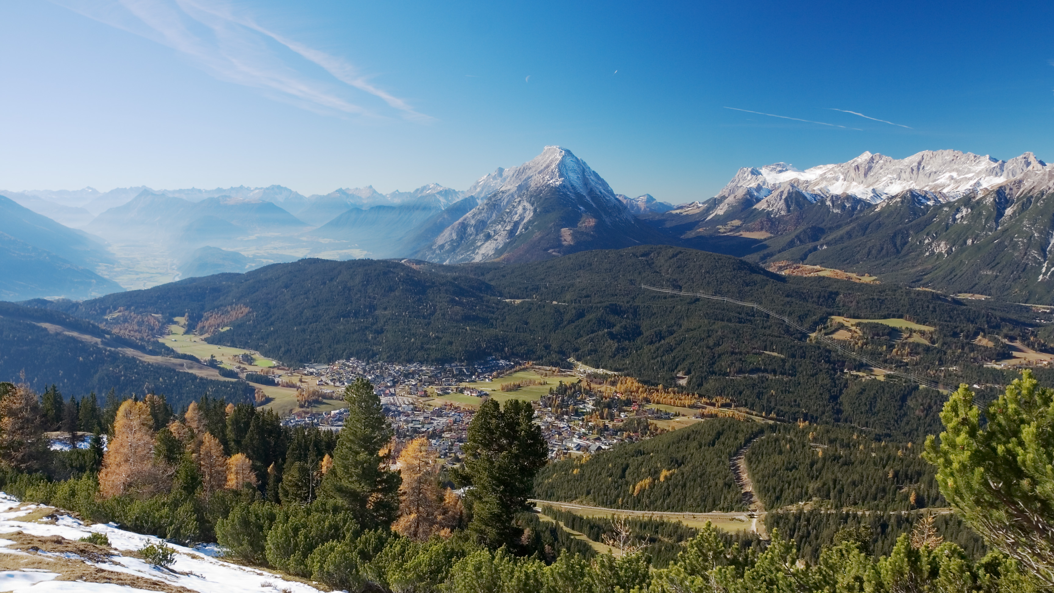
The Gschwandtkopf is a mountain south of the ski resort of Seefeld in Tirol in the Austrian state of Tyrol. It is 1,495 metres high. There are two inns at the summit: the ''Ötzi Hut'' and the ''Sonnenalm''.''Seefeld Leutasch'' 1:25,000 hiking map, Wanderland-Verlag, 4th edn., 2011. Geography The Gschwandtkopf rises prominently above the surrounding Seefeld Plateau by some 300-400 metres. The summit is located about 1.5 kilometres south-southwest of the centre of Seefeld, about 1.5 km west-northwest of the village of Auland and 2.5 kilometres east-northeast of Mösern. The mountain is bounded to the west and northwest by the ''Möserer Tal'' valley, to the east and northeast by the Seefeld Plateau and to the south by the ''Hoher Wand'', a high rock face above the Inn valley. At the northeastern foot of the Geschwandtkopf is the picturesque bathing lake of Wildsee. Winter sports The Geschwandtkopf has an Olympic ski jump at the foot of its northern slopes. It is also one of s ... [...More Info...] [...Related Items...] OR: [Wikipedia] [Google] [Baidu] |
Seefeld In Tirol
Seefeld in Tirol is an old farming village, now a major tourist resort, in Innsbruck-Land District in the Austrian state of Tyrol (state), Tyrol with a local population of 3,312 (as of 1 January 2013). The village is located about northwest of Innsbruck on a plateau between the Wetterstein mountains and the Karwendel on a historic road from Mittenwald to Innsbruck that has been important since the Middle Ages. It was first mentioned in 1022 and since the 14th century has been a pilgrimage church, pilgrimage site, benefiting not only from the visit of numerous pilgrims but also from its stacking rights as a trading station between Augsburg and the Republic of Venice, Venice. Also since the 14th century, Tyrolean shale oil has been extracted in the area. Seefeld was a popular holiday resort even before 1900 and, since the 1930s, has been a well known winter sports area, winter sports centres and amongst the most popular tourist resorts in Austria. The municipality, which has been the ... [...More Info...] [...Related Items...] OR: [Wikipedia] [Google] [Baidu] |
Wildsee (Seefeld)
The Wildsee, occasionally also called the ''Seefelder See'' ("Lake Seefeld"), is a lake near the Austrian resort of Seefeld in Tirol at the foot of the Gschwandtkopf (1,495 m). It has an area of 6.1 hectares and a maximum depth of 5.1 metres. The majority of the lake belongs to the municipality of Seefeld, its south and west shores are part of Reith bei Seefeld. The lake is fed from the Haglbach, which rises below the col of the Seefelder Joch and empties into the lake in the southeast, and water from the bog of ''Reither Moor'' and other smaller springs. Its catchment area is just under 7 km². It is drained northwards by the Seebach which empties into the River Isar. On the east shore of the lake are small beds of reed and sedge; on the west shore mixed forest runs down to the lake. South of the lake is the ''Reither Moor'', a raised bog resulting from the silting up of the Wildsee in which mountain pine trees grow. The south shore and the ''Reither Moor'' are a ... [...More Info...] [...Related Items...] OR: [Wikipedia] [Google] [Baidu] |
Seefeld Plateau
The Seefeld Plateau (german: Seefelder Plateau) is a montane valley and basin landscape in the North Tyrolean Limestone Alps about 500 metres above the Inn valley in the Austrian state of Tyrol. The plateau covers the valley basin around the villages of Seefeld in Tirol and Scharnitz as well as the valley of ''Leutaschtal''. Location The Seefeld Plateau runs northwards from the edge of the Inn graben at the Zirler Berg. It lies at a height of around in the North Tyrolean Limestone Alps between the Wetterstein Mountains to the northwest, the Mieming Mountains to the west and the Karwendel to the east. The Seefeld Saddle (), a mountain pass and saddle south of Seefeld, forms a watershed, north of which the plateau drains towards the Isar and south of which it drains into the Inn. Geology and flora The dominant rocks of the Seefeld Plateaus are Wetterstein limestone and main dolomite with scattered occurrences of bituminous slate. A branch of the ice age Inn Glacie ... [...More Info...] [...Related Items...] OR: [Wikipedia] [Google] [Baidu] |
Bundesamt Für Eich- Und Vermessungswesen
The Federal Office of Metrology and Surveying of Austria (german: Bundesamt für Eich- und Vermessungswesen, BEV) is the body responsible for official surveying, geo-information and weights and measures (metrology) in Austria. It belongs to the ' (Federal Ministry of the Economy Location and Digitization). Its headquarters is in Vienna en, Viennese , iso_code = AT-9 , registration_plate = W , postal_code_type = Postal code , postal_code = , timezone = CET , utc_offset = +1 , timezone_DST ... and it has 67 branches spread across all the Austrian federal states. at www.bev.gv.at. Accessed on 30 Dec 10. List of Surveying offices [...More Info...] [...Related Items...] OR: [Wikipedia] [Google] [Baidu] |
Mountains Of Tyrol (state)
A mountain is an elevated portion of the Earth's crust, generally with steep sides that show significant exposed bedrock. Although definitions vary, a mountain may differ from a plateau in having a limited summit area, and is usually higher than a hill, typically rising at least 300 metres (1,000 feet) above the surrounding land. A few mountains are isolated summits, but most occur in mountain ranges. Mountains are formed through tectonic forces, erosion, or volcanism, which act on time scales of up to tens of millions of years. Once mountain building ceases, mountains are slowly leveled through the action of weathering, through slumping and other forms of mass wasting, as well as through erosion by rivers and glaciers. High elevations on mountains produce colder climates than at sea level at similar latitude. These colder climates strongly affect the ecosystems of mountains: different elevations have different plants and animals. Because of the less hospitable terrain and ... [...More Info...] [...Related Items...] OR: [Wikipedia] [Google] [Baidu] |
Cross-country Skiing
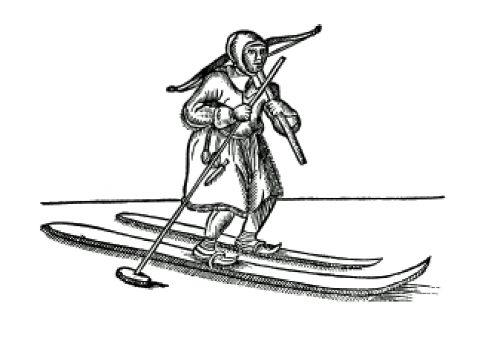
Cross-country skiing is a form of skiing where skiers rely on their own locomotion to move across snow-covered terrain, rather than using ski lifts or other forms of assistance. Cross-country skiing is widely practiced as a sport and recreational activity; however, some still use it as a means of transportation. Variants of cross-country skiing are adapted to a range of terrain which spans unimproved, sometimes mountainous terrain to groomed courses that are specifically designed for the sport. Modern cross-country skiing is similar to the original form of skiing, from which all skiing disciplines evolved, including alpine skiing, ski jumping and Telemark skiing. Skiers propel themselves either by striding forward (classic style) or side-to-side in a skating motion (skate skiing), aided by arms pushing on ski poles against the snow. It is practised in regions with snow-covered landscapes, including Europe, Canada, Russia, the United States, Australia and New Zealand. Competiti ... [...More Info...] [...Related Items...] OR: [Wikipedia] [Google] [Baidu] |
Rodelbahn
A toboggan is a simple sled traditionally used by children. It is also a traditional form of transport used by the Innu and Cree of northern Canada. In modern times, it is used on snow to carry one or more people (often children) down a hill or other slope for recreation. Designs vary from simple, traditional models to modern engineered composites. A toboggan differs from most sleds or sleighs in that it has no runners or skis (or only low ones) on the underside. The bottom of a toboggan rides directly on the snow. Some parks include designated toboggan hills where ordinary sleds are not allowed and which may include toboggan runs similar to bobsleigh courses. Toboggans can vary depending on the climate and geographical region. Such examples are Tangalooma (Australia) where toboggans are made from Masonite boards and used for travelling down steep sand dunes at speeds up to . Design and use Before white colonists arrived in America, toboggan was a Native Indian term fo ... [...More Info...] [...Related Items...] OR: [Wikipedia] [Google] [Baidu] |
T-bar Lift
A surface lift is a type of cable transport for snow sports in which skiers and snowboarders remain on the ground as they are pulled uphill. While they were once prevalent, they have been overtaken in popularity by higher-capacity and higher-comfort aerial lifts, such as chairlifts and gondola lifts. Today, surface lifts are most often found on beginner slopes, small ski areas, and peripheral slopes. They are also often used to access glacier ski slopes because their supports can be anchored in glacier ice due to the lower forces and realigned due to glacier movement. Surface lifts have some disadvantages compared to aerial lifts: they require more passenger skill and may be difficult for some beginners (especially snowboarders, whose boards point at an angle different than the direction of travel) and children; sometimes they lack a suitable route back to the piste; the snow surface must be continuous; they can get in the way of skiable terrain; they are relatively slow in spee ... [...More Info...] [...Related Items...] OR: [Wikipedia] [Google] [Baidu] |
Chairlift
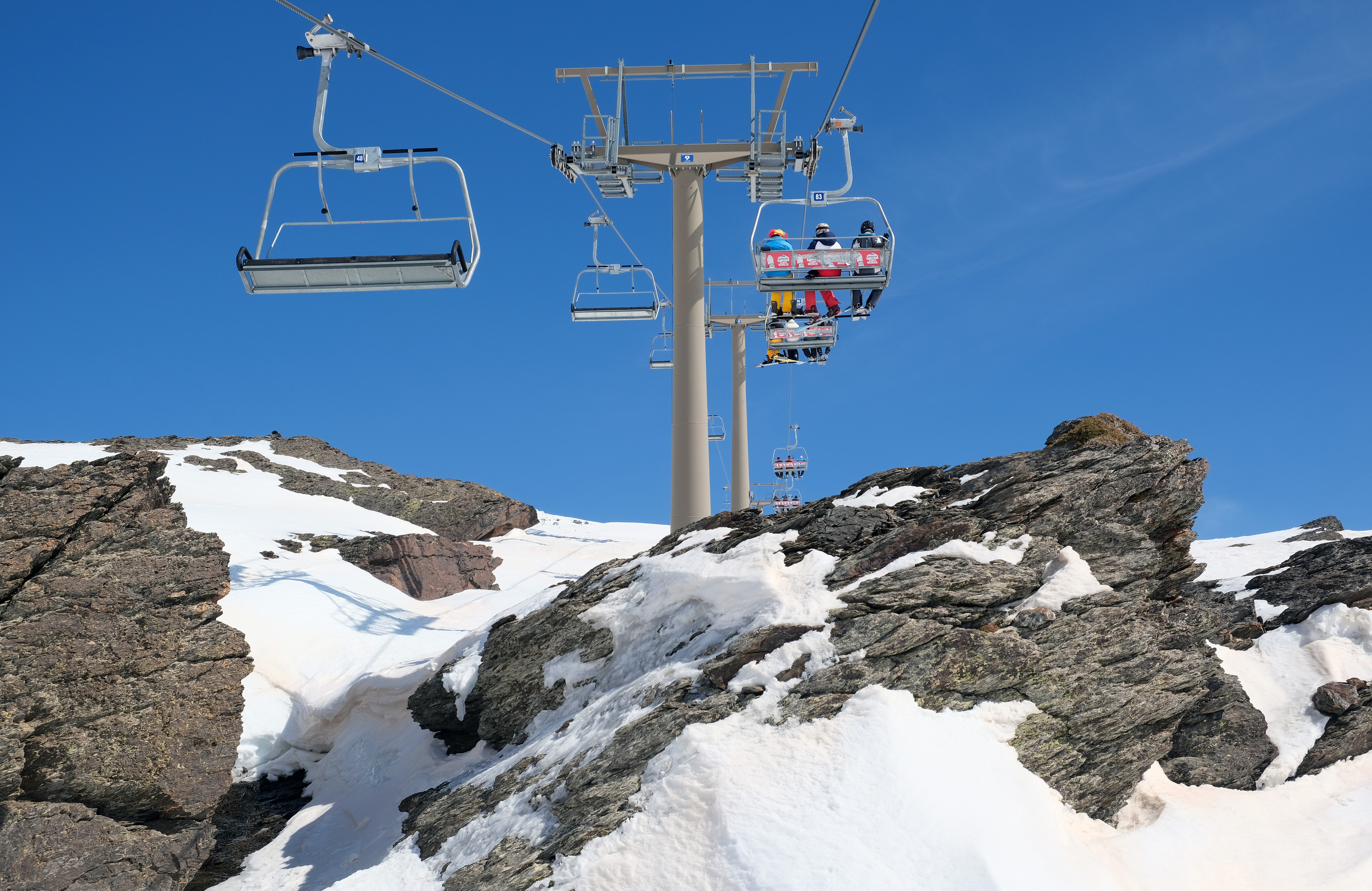
An elevated passenger ropeway, or chairlift, is a type of aerial lift, which consists of a continuously circulating steel wire rope loop strung between two end terminals and usually over intermediate towers, carrying a series of chairs. They are the primary onhill transport at most ski areas (in such cases referred to as 'ski lifts'), but are also found at amusement parks, various tourist attractions, and increasingly in urban transport. Depending on carrier size and loading efficiency, a passenger ropeway can move up to 4000 people per hour, and the fastest lifts achieve operating speeds of up to or . The two-person double chair, which for many years was the workhorse of the ski industry, can move roughly 1200 people per hour at rope speeds of up to . The four person detachable chairlift ("high-speed quad") can transport 2400 people per hour with an average rope speed of . Some bi and tri cable elevated ropeways and reversible tramways achieve much greater operating speeds ... [...More Info...] [...Related Items...] OR: [Wikipedia] [Google] [Baidu] |
Ski Area
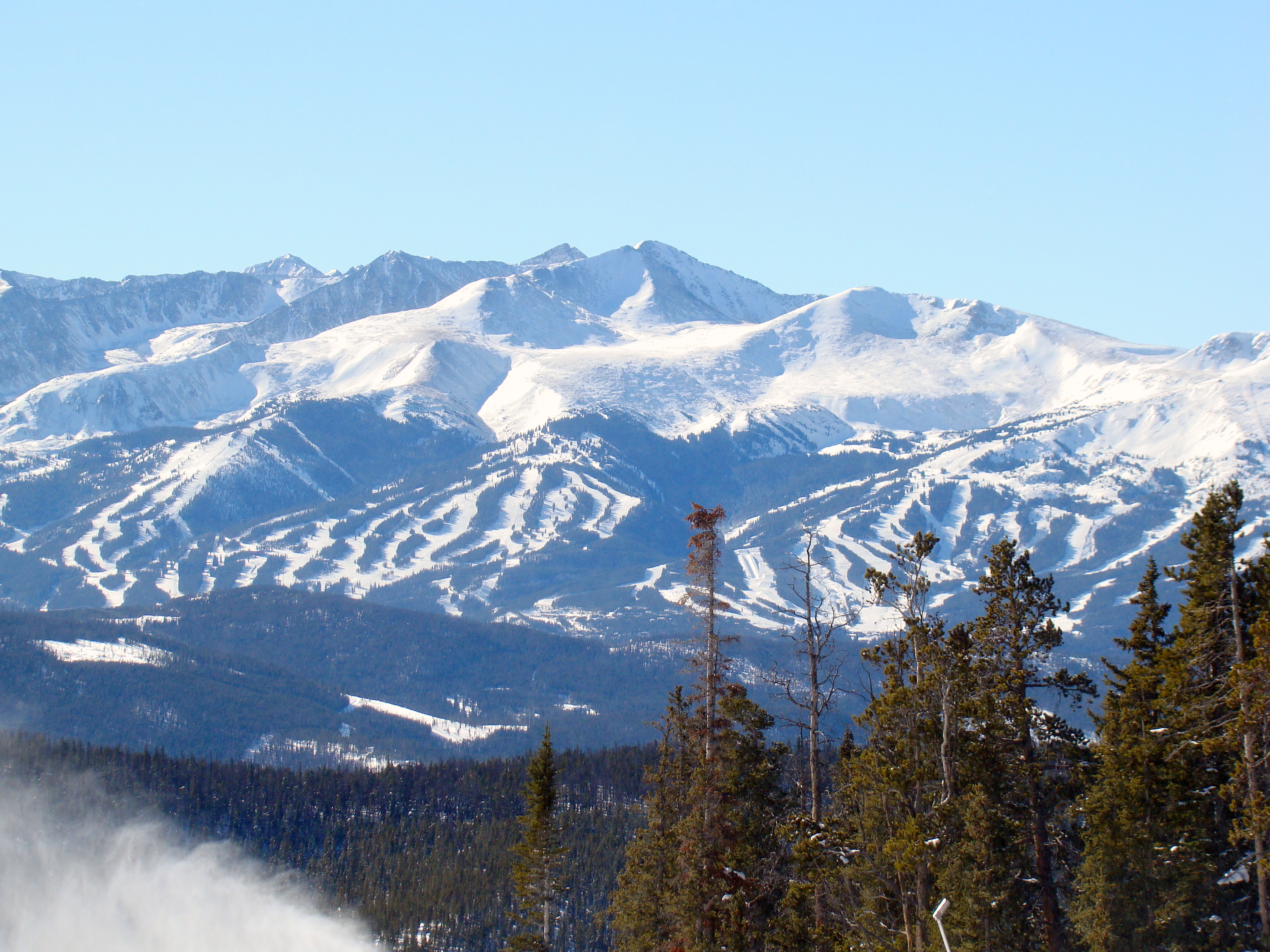
A ski area is the terrain and supporting infrastructure where skiing and other snow sports take place. Such sports include alpine and cross-country skiing, snow boarding, tubing, sledding, etc. Ski areas may stand alone or be part of a ski resort. Scope of activities The US Forest Service defines a ski area as: "a site and associated facilities that has been primarily developed for alpine or Nordic skiing and other snow sports, but may also include, in appropriate circumstances, facilities necessary for other seasonal or year-round natural resource-based recreation activities, provided that a preponderance of revenue generated by the ski area derives from the sale of alpine and Nordic ski area passes and lift tickets, revenue from alpine, Nordic, and other snow sport instruction, and gross revenue from ancillary facilities that support alpine or Nordic skiing and other snow sports." Notable examples Ski areas can extend over several municipalities (ex: La Plagne in France, A ... [...More Info...] [...Related Items...] OR: [Wikipedia] [Google] [Baidu] |
Inn Valley
, image = UnterinntalWest.JPG , image_caption = Lower Inn valley from Rattenberg castle , source1_location = Swiss Alps (Lägh dal Lunghin) , source1_elevation = , source1_coordinates= , mouth_location = Danube (Passau) , mouth_elevation = , mouth_coordinates = , progression = , subdivision_type1 = Countries , subdivision_name1 = , subdivision_type2 = Cities , subdivision_name2 = , length = , discharge1_location= mouth , discharge1_avg = , basin_size = The Inn ( la, Aenus; rm, En) is a river in Switzerland, Austria and Germany. The river is long. It is a right tributary of the Danube and it is the third largest tributary of the Danube by discharge. The highest point of its drainage basin is the summit of Piz Bernina at . The Engadine, the valley of the En, is the only Swiss valley whose waters end up in the Black Sea (via the Danube). Etymology The name Inn is derived from the old Celtic words ''en'' and ''enios'', ... [...More Info...] [...Related Items...] OR: [Wikipedia] [Google] [Baidu] |


