|
Grill, Pennsylvania
Grill is a census-designated place in Cumru Township, Berks County, Pennsylvania, United States. It is located just to the east of the borough of Kenhorst at the intersection of PA routes 625 __NOTOC__ Year 625 ( DCXXV) was a common year starting on Tuesday (link will display the full calendar) of the Julian calendar. The denomination 625 for this year has been used since the early medieval period, when the Anno Domini calendar er ... and 724. The area is generally suburban in nature, and is served by the Governor Mifflin School District. As of the 2010 census, the population was 1,468 residents.https://www.census.gov/# Demographics References Populated places in Berks County, Pennsylvania {{BerksCountyPA-geo-stub ... [...More Info...] [...Related Items...] OR: [Wikipedia] [Google] [Baidu] |
Census-designated Place
A census-designated place (CDP) is a concentration of population defined by the United States Census Bureau for statistical purposes only. CDPs have been used in each decennial census since 1980 as the counterparts of incorporated places, such as self-governing cities, towns, and villages, for the purposes of gathering and correlating statistical data. CDPs are populated areas that generally include one officially designated but currently unincorporated community, for which the CDP is named, plus surrounding inhabited countryside of varying dimensions and, occasionally, other, smaller unincorporated communities as well. CDPs include small rural communities, edge cities, colonias located along the Mexico–United States border, and unincorporated resort and retirement communities and their environs. The boundaries of any CDP may change from decade to decade, and the Census Bureau may de-establish a CDP after a period of study, then re-establish it some decades later. Most unin ... [...More Info...] [...Related Items...] OR: [Wikipedia] [Google] [Baidu] |
Area Codes 484 And 610
Area codes 610, 484, and 835 are telephone area codes in the North American Numbering Plan (NANP) for the eastern and southeastern regions of Pennsylvania. The numbering plan area (NPA) includes regions to the west of Philadelphia and the cities Allentown, Bethlehem, and Reading. It includes much of the Delaware Valley, including almost all of Delaware County, most of the Philadelphia Main Line, and all of the Lehigh Valley. History Area code 610 was created on January 8, 1994 as a split from numbering plan area 215, which had been the entire southeast quadrant of Pennsylvania since 1947. Permissive dialing of both 215 and 610 continued until the morning of January 7, 1995. It was Pennsylvania's first new area code since the implementation of the area code system in 1947. Three exchanges which would have switched to 610 were instead switched to 717, the area code for most of the eastern half of the state outside of the lower Delaware and Lehigh Valleys. They were 267 ... [...More Info...] [...Related Items...] OR: [Wikipedia] [Google] [Baidu] |
Governor Mifflin School District
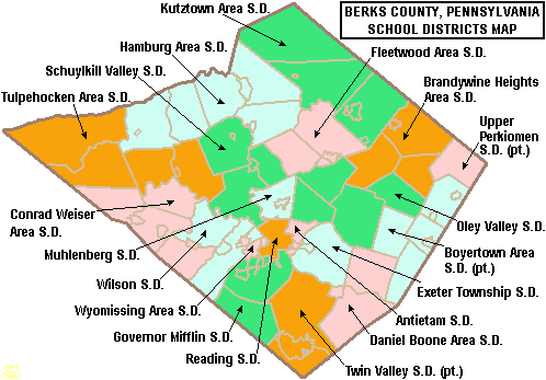
The Governor Mifflin School District is located in southern Berks County in southeastern Pennsylvania in the United States. Schools The district comprises 6 schools, located throughout the district. Governor Mifflin Senior High School serving grades 9–12, located in Shillington. The principal is Mr. Steve Murray.Governor Mifflin Middle School serving grades 7–8, located in Shillington. The principal is Mr. Tony Alvarez.Governor Mifflin Intermediate School serving grades 5–6, located iCumru Township(the listed address is Shillington). The principal is Mr. Cory Crider (former Asst. Principal until 2021).Mifflin Park Elementary serving grades K–4, located in Cumru Township (the listed address is Shillington). The principal is Mrs. Melissa Paparella.Cumru Elementary serving grades K–4, located in Cumru Township (the listed address is Shillington). The principal is Mr. Chad Curry.Brecknock Elementary serving grades K–4, located in Brecknock Township (the listed address ... [...More Info...] [...Related Items...] OR: [Wikipedia] [Google] [Baidu] |
Pennsylvania Route 724
Pennsylvania Route 724 (PA 724) is a road in the U.S. commonwealth of Pennsylvania that runs from U.S. Route 422 (US 422) in Sinking Spring southeast to PA 23 near Phoenixville. PA 724 travels through Berks and Chester counties. The route runs through the southern suburbs of Reading, passing through Shillington and Kenhorst. Past the Reading area, PA 724 continues southeast parallel to the Schuylkill River, passing through or near Birdsboro, Pottstown, and Spring City. The route intersects many roads including US 222 near Shillington, PA 10 and Interstate 176 (I-176) southeast of Reading, PA 345 in Birdsboro, and PA 100 and US 422 near Pottstown. The portion of PA 724 between Poplar Neck Road southeast of Reading and PA 23 was designated as part of PA 83 in 1927. By 1966, PA 724 was assigned to its current alignment and replaced the portion of PA 183 (which replaced PA 83 in 1961) between the Reading area and Phoenixville. PA 724 was referenced in Hall & Oates' 1973 ... [...More Info...] [...Related Items...] OR: [Wikipedia] [Google] [Baidu] |
Pennsylvania Route 625
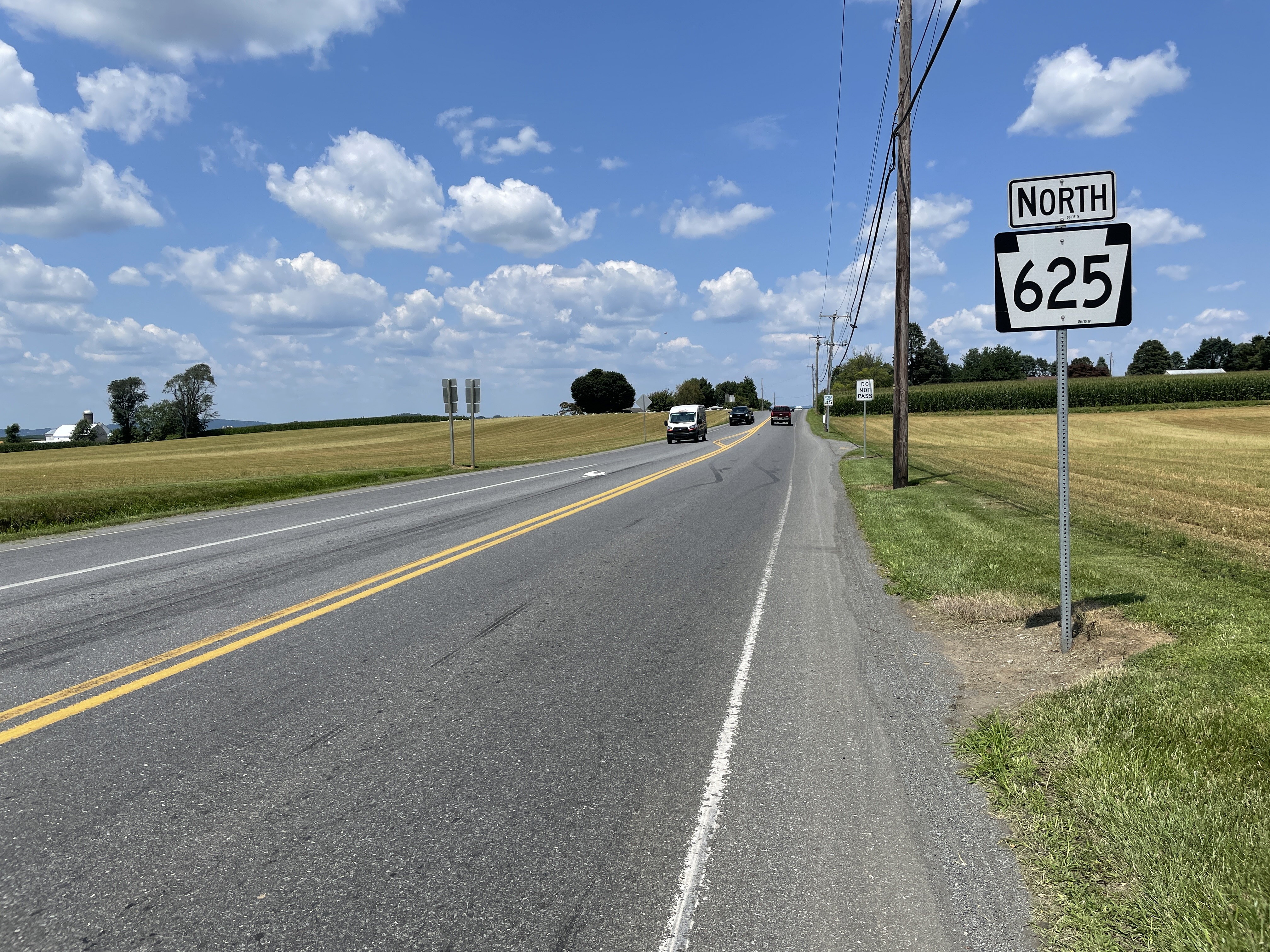
Pennsylvania Route 625 (PA 625) is a state route in east central Pennsylvania, United States. The southern terminus is at PA 23 in East Earl Township. The northern terminus is U.S. Route 222 Business (US 222 Bus.) in Reading. PA 625 is a two-lane undivided road its entire length. The route runs through rural areas in the Pennsylvania Dutch Country of northeastern Lancaster County, passing through Bowmansville. PA 625 continues into Berks County and runs through more rural areas, intersecting PA 568 in Knauers before coming to a junction with PA 724. Past this intersection, the route heads into developed areas and passes through Kenhorst before coming to its northern terminus. The route was designated as the westernmost of segment of PA 73 in 1928, which continued past Reading to Philadelphia. By 1940, the entire length of PA 73 between Blue Ball and Reading was completely paved. PA 625 was designated onto its current alignment by 1966 following the rerouting of PA 73 to i ... [...More Info...] [...Related Items...] OR: [Wikipedia] [Google] [Baidu] |
Kenhorst, Pennsylvania
Kenhorst ( ) is a borough in Berks County, Pennsylvania, United States. The population was 2,877 at the 2010 census. Geography Kenhorst is located in central Berks County at (40.308092, -75.944042). It is bordered by the city of Reading to the north and east and by Cumru Township to the south and west, including the census-designated place of Grill to the southeast. According to the United States Census Bureau, the borough has a total area of , all land. Demographics As of the census of 2000, there were 2,679 people, 1,215 households, and 789 families living in the borough. The population density was 4,551.8 people per square mile (1,753.2/km2). There were 1,254 housing units at an average density of 2,130.6 per square mile (820.6/km2). The racial makeup of the borough was 95.86% White, 0.82% African American, 0.04% Native American, 1.61% Asian, 1.05% from other races, and 0.63% from two or more races. Hispanic or Latino of any race were 2.02% of the population. There w ... [...More Info...] [...Related Items...] OR: [Wikipedia] [Google] [Baidu] |
Census-designated Place
A census-designated place (CDP) is a concentration of population defined by the United States Census Bureau for statistical purposes only. CDPs have been used in each decennial census since 1980 as the counterparts of incorporated places, such as self-governing cities, towns, and villages, for the purposes of gathering and correlating statistical data. CDPs are populated areas that generally include one officially designated but currently unincorporated community, for which the CDP is named, plus surrounding inhabited countryside of varying dimensions and, occasionally, other, smaller unincorporated communities as well. CDPs include small rural communities, edge cities, colonias located along the Mexico–United States border, and unincorporated resort and retirement communities and their environs. The boundaries of any CDP may change from decade to decade, and the Census Bureau may de-establish a CDP after a period of study, then re-establish it some decades later. Most unin ... [...More Info...] [...Related Items...] OR: [Wikipedia] [Google] [Baidu] |
Geographic Names Information System
The Geographic Names Information System (GNIS) is a database of name and locative information about more than two million physical and cultural features throughout the United States and its territories, Antarctica, and the associated states of the Marshall Islands, Federated States of Micronesia, and Palau. It is a type of gazetteer. It was developed by the United States Geological Survey (USGS) in cooperation with the United States Board on Geographic Names (BGN) to promote the standardization of feature names. Data were collected in two phases. Although a third phase was considered, which would have handled name changes where local usages differed from maps, it was never begun. The database is part of a system that includes topographic map names and bibliographic references. The names of books and historic maps that confirm the feature or place name are cited. Variant names, alternatives to official federal names for a feature, are also recorded. Each feature receives a per ... [...More Info...] [...Related Items...] OR: [Wikipedia] [Google] [Baidu] |
Federal Information Processing Standard
The Federal Information Processing Standards (FIPS) of the United States are a set of publicly announced standards that the National Institute of Standards and Technology (NIST) has developed for use in computer systems of non-military, American government agencies and contractors. FIPS standards establish requirements for ensuring computer security and interoperability, and are intended for cases in which suitable industry standards do not already exist. Many FIPS specifications are modified versions of standards the technical communities use, such as the American National Standards Institute (ANSI), the Institute of Electrical and Electronics Engineers (IEEE), and the International Organization for Standardization (ISO). Specific areas of FIPS standardization The U.S. government has developed various FIPS specifications to standardize a number of topics including: * Codes, e.g., FIPS county codes or codes to indicate weather conditions or emergency indications. In 1994, Nat ... [...More Info...] [...Related Items...] OR: [Wikipedia] [Google] [Baidu] |
List Of Sovereign States
The following is a list providing an overview of sovereign states around the world with information on their status and recognition of their sovereignty. The 206 listed states can be divided into three categories based on membership within the United Nations System: 193 UN member states, 2 UN General Assembly non-member observer states, and 11 other states. The ''sovereignty dispute'' column indicates states having undisputed sovereignty (188 states, of which there are 187 UN member states and 1 UN General Assembly non-member observer state), states having disputed sovereignty (16 states, of which there are 6 UN member states, 1 UN General Assembly non-member observer state, and 9 de facto states), and states having a special political status (2 states, both in free association with New Zealand). Compiling a list such as this can be a complicated and controversial process, as there is no definition that is binding on all the members of the community of nations concerni ... [...More Info...] [...Related Items...] OR: [Wikipedia] [Google] [Baidu] |
North American Eastern Time Zone
The Eastern Time Zone (ET) is a time zone encompassing part or all of 23 states in the eastern part of the United States, parts of eastern Canada, the state of Quintana Roo in Mexico, Panama, Colombia, mainland Ecuador, Peru, and a small portion of westernmost Brazil in South America, along with certain Caribbean and Atlantic islands. Places that use: * Eastern Standard Time (EST), when observing standard time (autumn/winter), are five hours behind Coordinated Universal Time ( UTC−05:00). * Eastern Daylight Time (EDT), when observing daylight saving time (spring/summer), are four hours behind Coordinated Universal Time ( UTC−04:00). On the second Sunday in March, at 2:00 a.m. EST, clocks are advanced to 3:00 a.m. EDT leaving a one-hour "gap". On the first Sunday in November, at 2:00 a.m. EDT, clocks are moved back to 1:00 a.m. EST, thus "duplicating" one hour. Southern parts of the zone (Panama and the Caribbean) do not observe daylight saving time. ... [...More Info...] [...Related Items...] OR: [Wikipedia] [Google] [Baidu] |


