|
Greenvale Reservoir
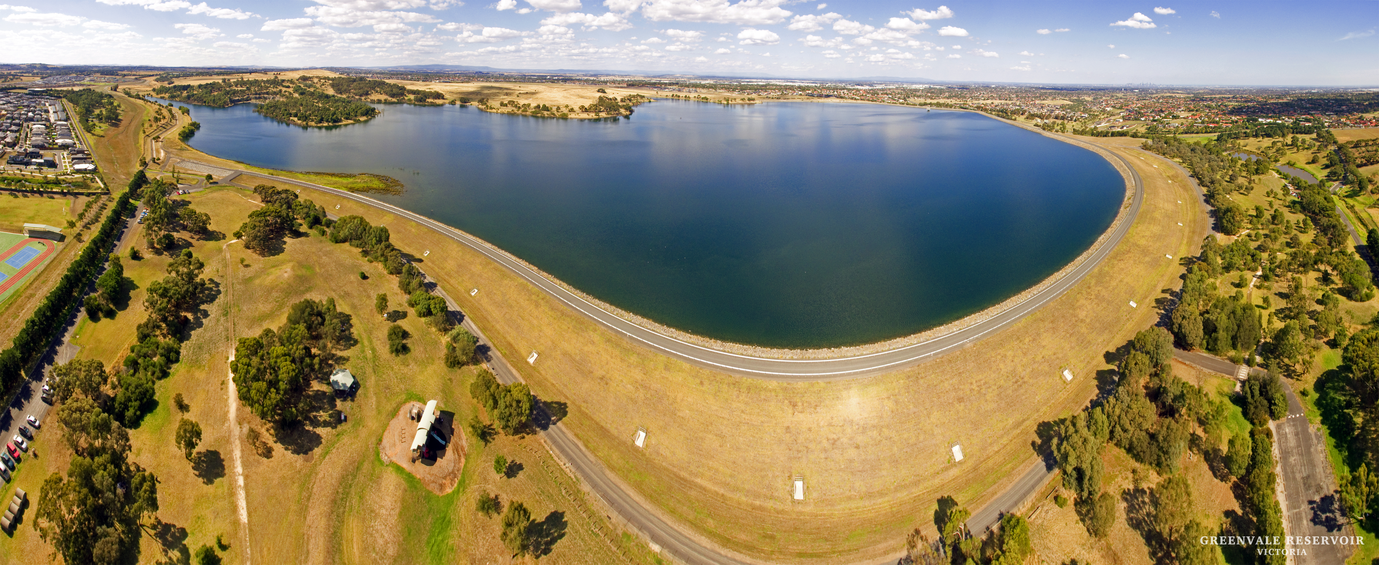
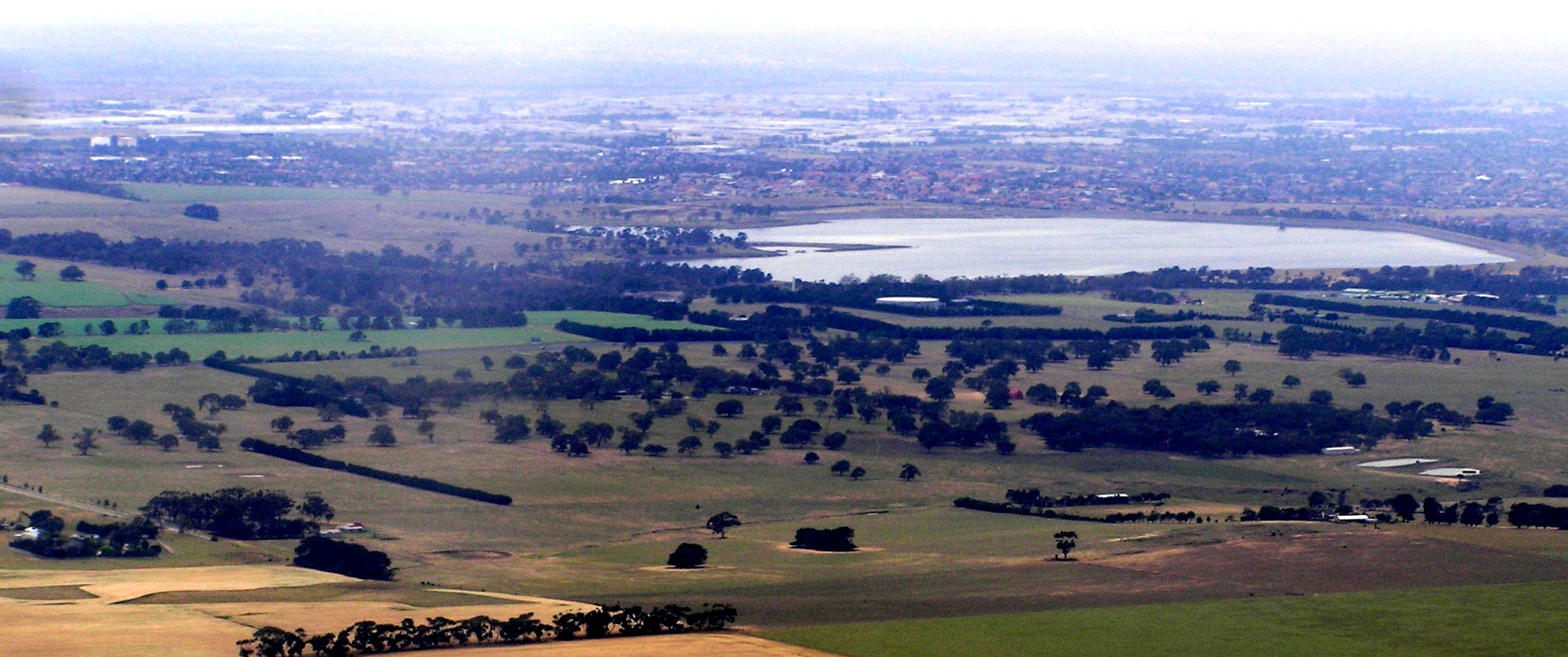
Greenvale Reservoir is an off-stream water storage dam in northern Melbourne, Victoria, Australia. It has a capacity of . The dam was opened 18 April 1973 and is now managed by Melbourne Water. It is situated in the upper Yuroke Creek catchment, the major tributary of the Moonee Ponds Creek. It is in the north of the suburb of Greenvale and to the west of Roxburgh Park. The Greenvale Reservoir Park contains picnic tables, a playground and barbecues, and is managed by Parks Victoria Parks Victoria is a government agency of the state of Victoria, Australia. Parks Victoria was established in December 1996 as a statutory authority, reporting to the Victorian Minister for Environment and Climate Change. The ''Parks Victoria Ac .... It lies to the south and west of the dam. References External linksGreenvale Reservoir Park Parks VictoriaGreenvale Reservoir Fact Sheet from Melbourne Water Reservoirs in Victoria (Australia) Melbourne Water catchment Rivers of Great ... [...More Info...] [...Related Items...] OR: [Wikipedia] [Google] [Baidu] |
Roxburgh Park
Roxburgh Park is a suburb in Melbourne, Victoria (Australia), Victoria, Australia, north of Melbourne's Melbourne city centre, Central Business District, located within the City of Hume Local government areas of Victoria, local government area. Roxburgh Park recorded a population of 24,129 at the 2021 Australian census, 2021 census. The suburb is bound by Craigieburn, Victoria, Craigieburn to the north, to the west by Aitken Boulevard skirting the Greenvale Reservoir, to the east by the Craigieburn railway line and to the south by Somerton Road. History Originally part of Somerton, Victoria, Somerton, Roxburgh Park gets its name from the property "Roxburgh", which was named by local farmer Thomas Brunton in about 1885, after his house in Scotland. Prior to the construction of Roxburgh Park, the area was the subject of a design by architect Philip Treeby for a garden suburb called "Hopetoun" in 1889. Plans for the suburb included parks, schools, tennis courts and shops. The ea ... [...More Info...] [...Related Items...] OR: [Wikipedia] [Google] [Baidu] |
Moonee Ponds Creek
Moonee is a coastal suburb of the Central Coast region of New South Wales, Australia. It is part of the local government area. Moonee is largely unpopulated, with nearly all of its land area being part of the Munmorah State Conservation Area. In the west of the area is the decommissioned Moonee Colliery Moonee is a coastal suburb of the Central Coast region of New South Wales, Australia. It is part of the local government area A local government area (LGA) is an administrative division of a country that a local government is responsible for .... Suburbs of the Central Coast (New South Wales) {{CentralCoastNSW-geo-stub ... [...More Info...] [...Related Items...] OR: [Wikipedia] [Google] [Baidu] |
Parks In Victoria (Australia)
A park is an area of natural, semi-natural or planted space set aside for human enjoyment and recreation or for the protection of wildlife or natural habitats. Urban parks are urban green space, green spaces set aside for recreation inside towns and cities. National parks and country parks are green spaces used for recreation in the countryside. State parks and provincial parks are administered by sub-national government states and agencies. Parks may consist of grassy areas, rocks, soil and trees, but may also contain buildings and other artifacts such as monuments, fountains or playground structures. Many parks have fields for playing sports such as baseball and football, and paved areas for games such as basketball. Many parks have trails for walking, biking and other activities. Some parks are built adjacent to bodies of water or watercourses and may comprise a beach or boat dock area. Urban parks often have benches for sitting and may contain picnic tables and barbecue gr ... [...More Info...] [...Related Items...] OR: [Wikipedia] [Google] [Baidu] |
Rivers Of Greater Melbourne (region)
A river is a natural flowing watercourse, usually freshwater, flowing towards an ocean, sea, lake or another river. In some cases, a river flows into the ground and becomes dry at the end of its course without reaching another body of water. Small rivers can be referred to using names such as creek, brook, rivulet, and rill. There are no official definitions for the generic term river as applied to geographic features, although in some countries or communities a stream is defined by its size. Many names for small rivers are specific to geographic location; examples are "run" in some parts of the United States, "burn" in Scotland and northeast England, and "beck" in northern England. Sometimes a river is defined as being larger than a creek, but not always: the language is vague. Rivers are part of the water cycle. Water generally collects in a river from precipitation through a drainage basin from surface runoff and other sources such as groundwater recharge, springs, a ... [...More Info...] [...Related Items...] OR: [Wikipedia] [Google] [Baidu] |
Melbourne Water Catchment
Melbourne ( ; Boonwurrung/Woiwurrung: ''Narrm'' or ''Naarm'') is the capital and most populous city of the Australian state of Victoria, and the second-most populous city in both Australia and Oceania. Its name generally refers to a metropolitan area known as Greater Melbourne, comprising an urban agglomeration of 31 local municipalities, although the name is also used specifically for the local municipality of City of Melbourne based around its central business area. The metropolis occupies much of the northern and eastern coastlines of Port Phillip Bay and spreads into the Mornington Peninsula, part of West Gippsland, as well as the hinterlands towards the Yarra Valley, the Dandenong and Macedon Ranges. It has a population over 5 million (19% of the population of Australia, as per 2021 census), mostly residing to the east side of the city centre, and its inhabitants are commonly referred to as "Melburnians". The area of Melbourne has been home to Aboriginal Victori ... [...More Info...] [...Related Items...] OR: [Wikipedia] [Google] [Baidu] |
Reservoirs In Victoria (Australia)
A reservoir (; from French ''réservoir'' ) is an enlarged lake behind a dam. Such a dam may be either artificial, built to store fresh water or it may be a natural formation. Reservoirs can be created in a number of ways, including controlling a watercourse that drains an existing body of water, interrupting a watercourse to form an embayment within it, through excavation, or building any number of retaining walls or levees. In other contexts, "reservoirs" may refer to storage spaces for various fluids; they may hold liquids or gasses, including hydrocarbons. ''Tank reservoirs'' store these in ground-level, elevated, or buried tanks. Tank reservoirs for water are also called cisterns. Most underground reservoirs are used to store liquids, principally either water or petroleum. Types Dammed valleys Dammed reservoirs are artificial lakes created and controlled by a dam constructed across a valley, and rely on the natural topography to provide most of the basin of the res ... [...More Info...] [...Related Items...] OR: [Wikipedia] [Google] [Baidu] |
Parks Victoria
Parks Victoria is a government agency of the state of Victoria, Australia. Parks Victoria was established in December 1996 as a statutory authority, reporting to the Victorian Minister for Environment and Climate Change. The ''Parks Victoria Act 2018'' updates the previous act, ''Parks Victoria Act 1998''. Under the new ''Act'' Parks Victoria is responsible for managing over '...4 million hectares including 3,000 land and marine parks and reserves making up 18 per cent of Victoria’s landmass, 75 per cent of Victoria’s wetlands and 70 per cent of Victoria’s coastline'. History Parks Victoria replaced many of the functions and absorbed the staff of the then Department of Natural Resources and Environment (which managed National and State parks) and Melbourne Parks & Waterways, which itself was originally part of the former Melbourne and Metropolitan Board of Works, which mostly managed urban parklands, some of which were formerly MMBW facilities, such as Braeside Park. The ... [...More Info...] [...Related Items...] OR: [Wikipedia] [Google] [Baidu] |
Roxburgh Park, Victoria
Roxburgh Park is a suburb in Melbourne, Victoria, Australia, north of Melbourne's Central Business District, located within the City of Hume local government area. Roxburgh Park recorded a population of 24,129 at the 2021 census. The suburb is bound by Craigieburn to the north, to the west by Aitken Boulevard skirting the Greenvale Reservoir, to the east by the Craigieburn railway line and to the south by Somerton Road. History Originally part of Somerton, Roxburgh Park gets its name from the property "Roxburgh", which was named by local farmer Thomas Brunton in about 1885, after his house in Scotland. Prior to the construction of Roxburgh Park, the area was the subject of a design by architect Philip Treeby for a garden suburb called "Hopetoun" in 1889. Plans for the suburb included parks, schools, tennis courts and shops. The early 1890s economic depression prevented the construction of this design. In January 1951 the Moonee Valley Racing Club bought the "Roxburgh Park ... [...More Info...] [...Related Items...] OR: [Wikipedia] [Google] [Baidu] |
Greenvale, Victoria
Greenvale is a suburb in Melbourne, Victoria, Australia, north of Melbourne's Central Business District, located within the City of Hume local government area. Greenvale recorded a population of 21,274 at the 2021 census. Greenvale is located between Yuroke and Attwood, on Mickleham Road. History Greenvale gets it name from a farm named "Greenvale", owned by local farmer John McKerchar. It was located in the parish of Yuroke, from which the area first took its name. Greenvale Post Office originally opened in a rural area on 1 January 1871 and closed in 1969. As the suburb developed the post office reopened in 1996. Although subdivisions began in 1972, Greenvale expanded largely in the 1980s and now has two shopping centres, three primary schools, a community centre and two kindergartens. Greenvale has a privately-owned school called Aitken College. Greenvale Reservoir in the north was built in 1973. Greenvale Sanatorium Greenvale Sanatorium was built in 1905 primarily f ... [...More Info...] [...Related Items...] OR: [Wikipedia] [Google] [Baidu] |
Yuroke Creek
Yuroke is a bounded rural locality in Victoria, Australia, north-west of Melbourne's Central Business District, located within the City of Hume local government area. Yuroke recorded a population of 123 at the . Yuroke is located adjacent to the Melbourne Metropolitan Area, beyond the Urban Growth Boundary. It is located between Mickleham and Greenvale, on Mickleham Road. History Yuroke gets its name from an Indigenous word, "Eurok Iguana", the meaning of which remains unclear. Yuroke Post Office opened around 1902 and closed in 1975. Yuroke was the filming location for Melbourne band Painters & Dockers' single '' Nude School''. See also * Shire of Bulla – Yuroke was previously within this former local government area. * former Electoral district of Yuroke The electoral district of Yuroke was an electoral district of the Victorian Legislative Assembly. It was situated in the outer northern suburbs of Melbourne and was created in a redistribution before the 2002 Vi ... [...More Info...] [...Related Items...] OR: [Wikipedia] [Google] [Baidu] |
Reservoir
A reservoir (; from French ''réservoir'' ) is an enlarged lake behind a dam. Such a dam may be either artificial, built to store fresh water or it may be a natural formation. Reservoirs can be created in a number of ways, including controlling a watercourse that drains an existing body of water, interrupting a watercourse to form an embayment within it, through excavation, or building any number of retaining walls or levees. In other contexts, "reservoirs" may refer to storage spaces for various fluids; they may hold liquids or gasses, including hydrocarbons. ''Tank reservoirs'' store these in ground-level, elevated, or buried tanks. Tank reservoirs for water are also called cisterns. Most underground reservoirs are used to store liquids, principally either water or petroleum. Types Dammed valleys Dammed reservoirs are artificial lakes created and controlled by a dam A dam is a barrier that stops or restricts the flow of surface water or underground streams ... [...More Info...] [...Related Items...] OR: [Wikipedia] [Google] [Baidu] |


