|
Greens Farms School
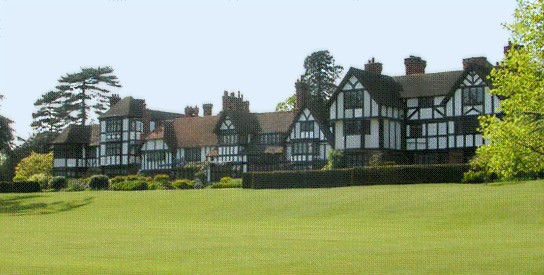
The Greens Farms School is a historic school building at Morningside Drive South and Boston Post Road in the Greens Farms neighborhood of Westport, Connecticut. It was built in 1925 and received an addition in 1950. It was designed by architect Charles Cutler in a Tudor Revival style, and is a fine example of such style. It is the only Tudor Revival school building in Westport. It was listed on the National Register of Historic Places in 1991. Its interior includes a Works Project Administration art project from c. 1935. It is located on the Boston Post Road. Due to declining enrollment the school closed in June 1983, after which it was leased by the Westport Arts Center. and In 1996 with increasing enrollment school officials in Westport began looking at options including reopening the Greens Farms School and brought in a consultant in the process. The Westport Arts Center representatives recommended that they stay in the building as the educational needs of Westport ... [...More Info...] [...Related Items...] OR: [Wikipedia] [Google] [Baidu] |
Westport, Connecticut
Westport is a town in Fairfield County, Connecticut, United States, along the Long Island Sound within Connecticut's Gold Coast. It is northeast of New York City. The town had a population of 27,141 according to the 2020 U.S. Census. History The earliest known inhabitants of the Westport area as identified through archaeological finds date back 7,500 years. Records from the first white settlers report the Pequot Indians living in the area which they called ''Machamux'' translated by the colonialists as ''beautiful land''. Settlement by colonialists dates back to the five ''Bankside Farmers''; whose families grew and prospered into a community that continued expanding. The settlers arrived in 1693, having followed cattle to the isolated area. The community had its own ecclesiastical society, supported by independent civil and religious elements, enabling it to be independent from the Town of Fairfield. As the settlement expanded its name changed: it was briefly known as "Banksid ... [...More Info...] [...Related Items...] OR: [Wikipedia] [Google] [Baidu] |
Greens Farms, Connecticut
Green's Farms is the oldest neighborhood in the town of Westport in Fairfield County, Connecticut, United States. It was listed as a census-designated place prior to the 2020 census. Geography Boundary The boundaries of the neighborhood, like those of most neighborhoods with no governmental status, are vague, but according to a ''New York Times'' article in 2001, "generally, a resident can confidently claim a Green's Farms address if the property lies within the area bounded by Hillspoint Road, the Fairfield town line and the Post Road". The Greens Farms census-designated place as drawn in 2020 follows the same boundaries. According to the same article, Turkey Hill Road and Morningside Drive are the heart of the neighborhood. Prevost, Lisa, "If You're Thinking of Living In/Green's Farms; A Co ... [...More Info...] [...Related Items...] OR: [Wikipedia] [Google] [Baidu] |
Charles Cutler
Lieutenant-Colonel Sir Charles Benjamin Cutler KBE, ED (20 April 1918 – 23 September 2006) was an Australian politician, holding office for 28 years as an elected member of the New South Wales Legislative Assembly for Orange. Cutler was Country Party leader for sixteen years and became Minister for Education and Deputy Premier for ten years under Premiers Robert Askin and Tom Lewis. Early life Charles Cutler was born in Forbes in 1918, the son of George Cutler and Elizabeth Booth Cutler. His cousin, Sir Arthur Roden Cutler, was a Victoria Cross recipient and a long-serving Governor of New South Wales. Charles' ministerial service including as Deputy Premier commenced the year before his cousin's appointment as governor, meaning that Charles was in the cabinet that recommended Roden as governor to the Queen and that later Charles was sworn in as a minister in by his governor cousin. At an early age, Charles moved to the nearby regional city of Orange with his family, w ... [...More Info...] [...Related Items...] OR: [Wikipedia] [Google] [Baidu] |
Tudor Revival Architecture
Tudor Revival architecture (also known as mock Tudor in the UK) first manifested itself in domestic architecture in the United Kingdom in the latter half of the 19th century. Based on revival of aspects that were perceived as Tudor architecture, in reality it usually took the style of English vernacular architecture of the Middle Ages that had survived into the Tudor period. The style later became an influence elsewhere, especially the British colonies. For example, in New Zealand, the architect Francis Petre adapted the style for the local climate. In Singapore, then a British colony, architects such as R. A. J. Bidwell pioneered what became known as the Black and White House. The earliest examples of the style originate with the works of such eminent architects as Norman Shaw and George Devey, in what at the time was considered Neo-Tudor design. Tudorbethan is a subset of Tudor Revival architecture that eliminated some of the more complex aspects of Jacobethan in favour of m ... [...More Info...] [...Related Items...] OR: [Wikipedia] [Google] [Baidu] |
National Register Of Historic Places
The National Register of Historic Places (NRHP) is the United States federal government's official list of districts, sites, buildings, structures and objects deemed worthy of preservation for their historical significance or "great artistic value". A property listed in the National Register, or located within a National Register Historic District, may qualify for tax incentives derived from the total value of expenses incurred in preserving the property. The passage of the National Historic Preservation Act (NHPA) in 1966 established the National Register and the process for adding properties to it. Of the more than one and a half million properties on the National Register, 95,000 are listed individually. The remainder are contributing resources within historic districts. For most of its history, the National Register has been administered by the National Park Service (NPS), an agency within the U.S. Department of the Interior. Its goals are to help property owners and inte ... [...More Info...] [...Related Items...] OR: [Wikipedia] [Google] [Baidu] |
Works Project Administration
The Works Progress Administration (WPA; renamed in 1939 as the Work Projects Administration) was an American New Deal agency that employed millions of jobseekers (mostly men who were not formally educated) to carry out public works projects, including the construction of public buildings and roads. It was set up on May 6, 1935, by presidential order, as a key part of the Second New Deal. The WPA's first appropriation in 1935 was $4.9 billion (about $15 per person in the U.S., around 6.7 percent of the 1935 GDP). Headed by Harry Hopkins, the WPA supplied paid jobs to the unemployed during the Great Depression in the United States, while building up the public infrastructure of the US, such as parks, schools, and roads. Most of the jobs were in construction, building more than 620,000 miles (1,000,000 km) of streets and over 10,000 bridges, in addition to many airports and much housing. The largest single project of the WPA was the Tennessee Valley Authority. At its peak ... [...More Info...] [...Related Items...] OR: [Wikipedia] [Google] [Baidu] |
Boston Post Road
The Boston Post Road was a system of mail-delivery routes between New York City and Boston, Massachusetts that evolved into one of the first major highways in the United States. The three major alignments were the Lower Post Road (now U.S. Route 1 (US 1) along the shore via Providence, Rhode Island), the Upper Post Road (now US 5 and US 20 from New Haven, Connecticut by way of Springfield, Massachusetts), and the Middle Post Road (which diverged from the Upper Road in Hartford, Connecticut and ran northeastward to Boston via Pomfret, Connecticut). In some towns, the area near the Boston Post Road has been placed on the National Register of Historic Places, since it was often the first road in the area, and some buildings of historical significance were built along it. The Boston Post Road Historic District, including part of the road in Rye, New York, has been designated a National Historic Landmark. The Post Road is also famous for milestones that da ... [...More Info...] [...Related Items...] OR: [Wikipedia] [Google] [Baidu] |
Westport Arts Center
Westport is the name of several communities around the world. Canada *Westport, Nova Scotia * Westport, Ontario **Westport Rideaus, local junior "B" ice hockey team ** Westport/Rideau Lakes Airport *Westport, Newfoundland and Labrador Ireland *Westport, County Mayo ** Westport House ** Westport railway station, Mayo **Westport United F.C., football club **Westport CFE – Carrowbeg College Malaysia *West Port, Malaysia New Zealand *Westport, New Zealand **Westport News **Westport Airport (New Zealand) **Westport Rugby Football Club United Kingdom * Westport, Somerset ** Westport Canal *Westport, Wiltshire United States * Westport, California * Westport, Connecticut ** Westport Country Playhouse, a theatre **Westport (Metro-North station) **Westport Bank and Trust Company, a historic place **Westport Public Library *Westport, Indiana *Westport Township, Dickinson County, Iowa *Westport, Kentucky, in Oldham Co. **Westport High School (Kentucky), in Louisville, named for the Wes ... [...More Info...] [...Related Items...] OR: [Wikipedia] [Google] [Baidu] |
Saugatuck River
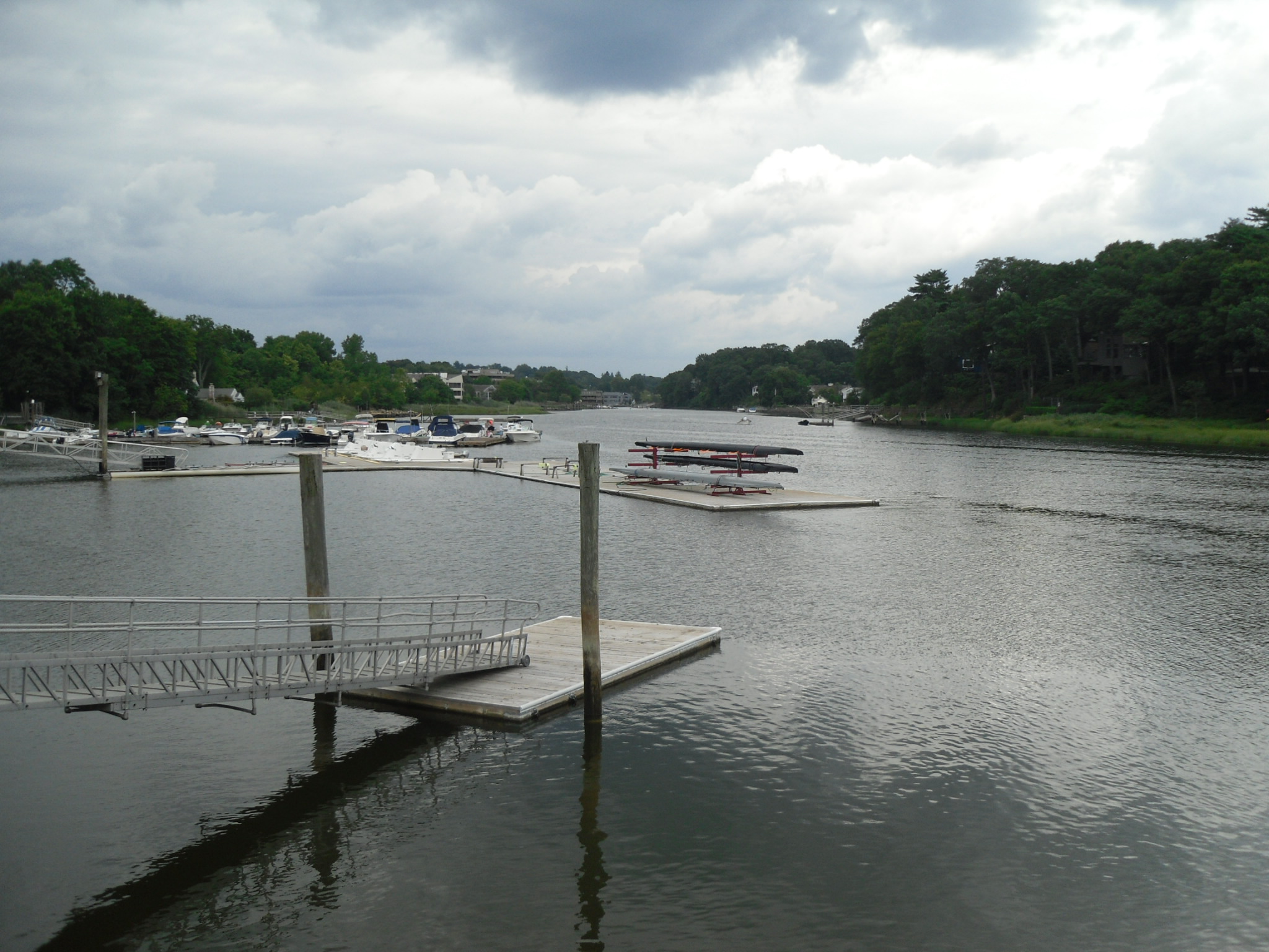
The Saugatuck River is a river in southwestern Connecticut in the United States. It drains part of suburban and rural Fairfield County west of Bridgeport, emptying into Long Island Sound. , a U.S. Navy oiler that saw service in World War II, was named after the river. Description The Saugatuck River issues from Sugar Hollow Pond approximately southwest of downtown Danbury. It flows generally southeast, passing through the Saugatuck Reservoir ( above sea level), then turns south-southwest. In Westport, it broadens into a navigable estuary along its lower and enters Long Island Sound approximately southeast of Norwalk. Interstate 95 crosses the river near its mouth downstream from Westport center. The river is wadeable along much of its course and is a popular seasonal destination for trout fishing, with the state of Connecticut stocking the river annually. In the 17th century the river was the site of a Paugusset settlement. The name of the river means "river that flows ... [...More Info...] [...Related Items...] OR: [Wikipedia] [Google] [Baidu] |
National Register Of Historic Places Listings In Fairfield County, Connecticut
__NOTOC__ This is intended to be a complete list of the properties and districts on the National Register of Historic Places in Fairfield County, Connecticut, United States. The locations of National Register properties and districts for which the latitude and longitude coordinates are included below may be seen in an online map. There are 293 properties and districts listed on the National Register in the county, including 9 National Historic Landmarks. Of these, 55 are located in the city of Bridgeport and covered separately in National Register of Historic Places listings in Bridgeport, Connecticut. Thirty-four are covered in National Register of Historic Places listings in Greenwich, Connecticut and another 34 are covered in National Register of Historic Places listings in Stamford, Connecticut. There are 171 properties and districts which are entirely outside those three cities or which span outside, and which are covered here in this list (Merritt Parkway is listed here as ... [...More Info...] [...Related Items...] OR: [Wikipedia] [Google] [Baidu] |
School Buildings On The National Register Of Historic Places In Connecticut
A school is an educational institution designed to provide learning spaces and learning environments for the teaching of students under the direction of teachers. Most countries have systems of formal education, which is sometimes compulsory. In these systems, students progress through a series of schools. The names for these schools vary by country (discussed in the '' Regional terms'' section below) but generally include primary school for young children and secondary school for teenagers who have completed primary education. An institution where higher education is taught is commonly called a university college or university. In addition to these core schools, students in a given country may also attend schools before and after primary (elementary in the U.S.) and secondary (middle school in the U.S.) education. Kindergarten or preschool provide some schooling to very young children (typically ages 3–5). University, vocational school, college or seminary may be availab ... [...More Info...] [...Related Items...] OR: [Wikipedia] [Google] [Baidu] |
National Register Of Historic Places In Fairfield County, Connecticut
__NOTOC__ This is intended to be a complete list of the properties and districts on the National Register of Historic Places in Fairfield County, Connecticut, United States. The locations of National Register properties and districts for which the latitude and longitude coordinates are included below may be seen in an online map. There are 293 properties and districts listed on the National Register in the county, including 9 National Historic Landmarks. Of these, 55 are located in the city of Bridgeport and covered separately in National Register of Historic Places listings in Bridgeport, Connecticut. Thirty-four are covered in National Register of Historic Places listings in Greenwich, Connecticut and another 34 are covered in National Register of Historic Places listings in Stamford, Connecticut. There are 171 properties and districts which are entirely outside those three cities or which span outside, and which are covered here in this list (Merritt Parkway is listed here as ... [...More Info...] [...Related Items...] OR: [Wikipedia] [Google] [Baidu] |


