|
Graveney
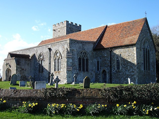
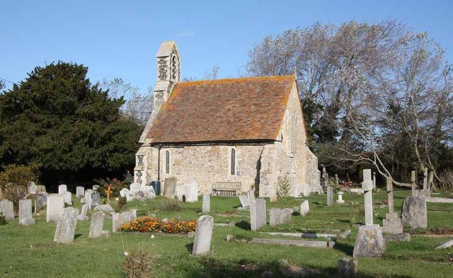
Graveney is a relatively small but widely dispersed village located between Faversham and Whitstable in Kent, England. The main part of the village is located along the intersection of Seasalter Road, Sandbanks Road and Head Hill Road (at the railway crossing), which is surrounded by farmland. The rest of the village is dispersed amongst this farmland. Features include a local Pub ('The Four Horseshoes'), a primary school and a church. There is also a regular bus service that runs through the village. The Saxon Shore Way (long-distance path) passes around the Graveney Marshes (between Seasalter and Faversham). The marshes are part of the South Swale SSSI. History The first records of Graveney are as land acquired in 811 by Wilfred, archbishop of Canterbury, from Cenulph, King of Mercia. Graveney is listed in the Domesday Book in 1086 and was held by the de Gravene and de Feversham families and from 1408 by the Botiller family. Anne Botiller married John Martyn (d.1436) who bui ... [...More Info...] [...Related Items...] OR: [Wikipedia] [Google] [Baidu] |
Graveney With Goodnestone
Graveney is a relatively small but widely dispersed village located between Faversham and Whitstable in Kent, England. The main part of the village is located along the intersection of Seasalter Road, Sandbanks Road and Head Hill Road (at the railway crossing), which is surrounded by farmland. The rest of the village is dispersed amongst this farmland. Features include a local Pub ('The Four Horseshoes'), a primary school and a church (building), church. There is also a regular bus service that runs through the village. The Saxon Shore Way (long-distance path) passes around the Graveney Marshes (between Seasalter and Faversham). The marshes are part of the South Swale SSSI. History The first records of Graveney are as land acquired in 811 by Wilfred, archbishop of Canterbury, from Cenulph, King of Mercia. Graveney is listed in the Domesday Book in 1086 and was held by the de Gravene and de Feversham families and from 1408 by the Botiller family. Anne Botiller married John Martyn ... [...More Info...] [...Related Items...] OR: [Wikipedia] [Google] [Baidu] |
Saxon Shore Way
The Saxon Shore Way is a long-distance footpath in England. It starts at Gravesend, Kent, and traces the coast of South-East England as it was in Roman times as far as Hastings, East Sussex, in total. This means that around Romney Marsh the route runs significantly inland from the modern coastline. History The line of the Roman fortification that the route traces includes ancient forts, modern towns, nature reserves and coastline: four Roman forts built in the fourth century lie along the route, at Reculver, Richborough, Dover and Lympne. At Seasalter there is an internationally important area for geese, ducks, and waders. The diversity of scenery along the route includes the wide expanses of marshland bordering the Thames and Medway estuaries, the White cliffs of Dover, and panoramic views over Romney Marsh from the escarpment that marks the ancient coastline between Folkestone and Rye. The Saxon Shore Way was originally opened in 1980, but has since been re-established, ... [...More Info...] [...Related Items...] OR: [Wikipedia] [Google] [Baidu] |
South Swale
South Swale is a Local Nature Reserve (as South Bank of the Swale) north of Faversham in Kent. It is owned by Kent County Council and managed by Kent Wildlife Trust. It is part of The Swale Ramsar site, Special Protection Area and Site of Special Scientific Interest This coastal site has wetland and grassland, with mudflats which attract a large population of waders and wildfowl in winter. Flora include Yellow horned-popies, sea-lavender, golden samphires and wild carrots. The Saxon Shore Way public footpath follows the top of the sea wall for the entire length of the reserve, around the village of Graveney, for about 3 miles in total. See also * Oare Marshes Oare Marshes is a Local Nature Reserve north of Faversham in Kent. It is owned and managed by Kent Wildlife Trust. It is part of The Swale Nature Conservation Review site, Grade I, National Nature Reserve, Ramsar internationally important we ... - across Faversham Creek from South Swale References {{Kent W ... [...More Info...] [...Related Items...] OR: [Wikipedia] [Google] [Baidu] |
Seasalter
Seasalter is a village (and district council ward) in the Canterbury District of Kent, England. Seasalter is on the north coast of Kent, between the towns of Whitstable and Faversham, facing the Isle of Sheppey across the estuary of the River Swale. The settlement of Yorkletts is included in the ward. It is approximately north of Canterbury. History Seasalter came to prominence as a centre for salt production in the Iron Age, and the resulting prosperity resulted in Viking raids on the area. Later, the Domesday Book recorded that Seasalter "properly belongs to the kitchen of the Archbishop" f Canterbury The church was dedicated to a martyred Archbishop of Canterbury, Alphege (Ælfheah), first built in the 12th century, its nave was demolished in the 1840s but its chancel still stands and is a Grade II listed building. In the 18th century, the marshes were drained to create the Seasalter Levels. In 2017, the Old Brig, a well-preserved 18th century merchant ship wreck was expos ... [...More Info...] [...Related Items...] OR: [Wikipedia] [Google] [Baidu] |
Faversham
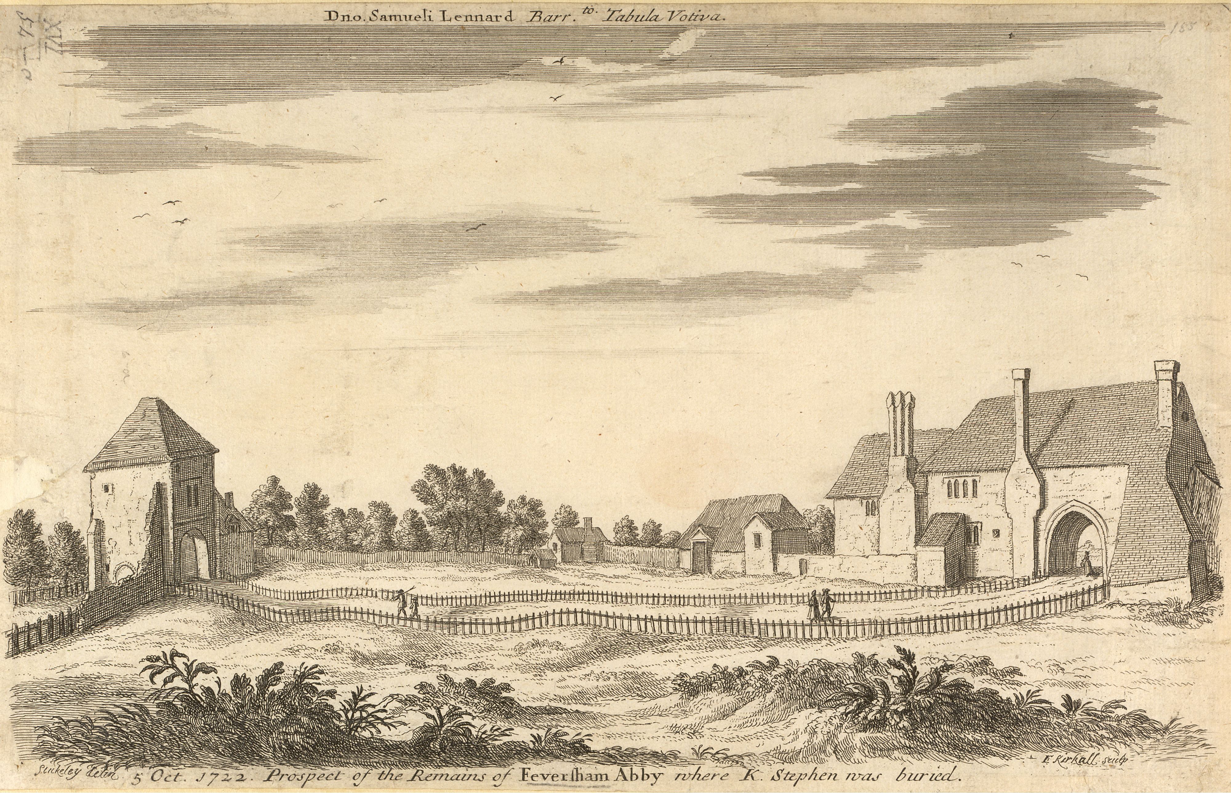
Faversham is a market town in Kent, England, from London and from Canterbury, next to the Swale, a strip of sea separating mainland Kent from the Isle of Sheppey in the Thames Estuary. It is close to the A2, which follows an ancient British trackway which was used by the Romans and the Anglo-Saxons, and known as Watling Street. The name is of Old English origin, meaning "the metal-worker's village". There has been a settlement at Faversham since pre-Roman times, next to the ancient sea port on Faversham Creek. It was inhabited by the Saxons and mentioned in the Domesday Book of 1086 as ''Favreshant''. The town was favoured by King Stephen who established Faversham Abbey, which survived until the Dissolution of the Monasteries in 1538. Subsequently, the town became an important seaport and established itself as a centre for brewing, and the Shepherd Neame Brewery, founded in 1698, remains a significant major employer. The town was also the centre of the explosives industry ... [...More Info...] [...Related Items...] OR: [Wikipedia] [Google] [Baidu] |
Whitstable
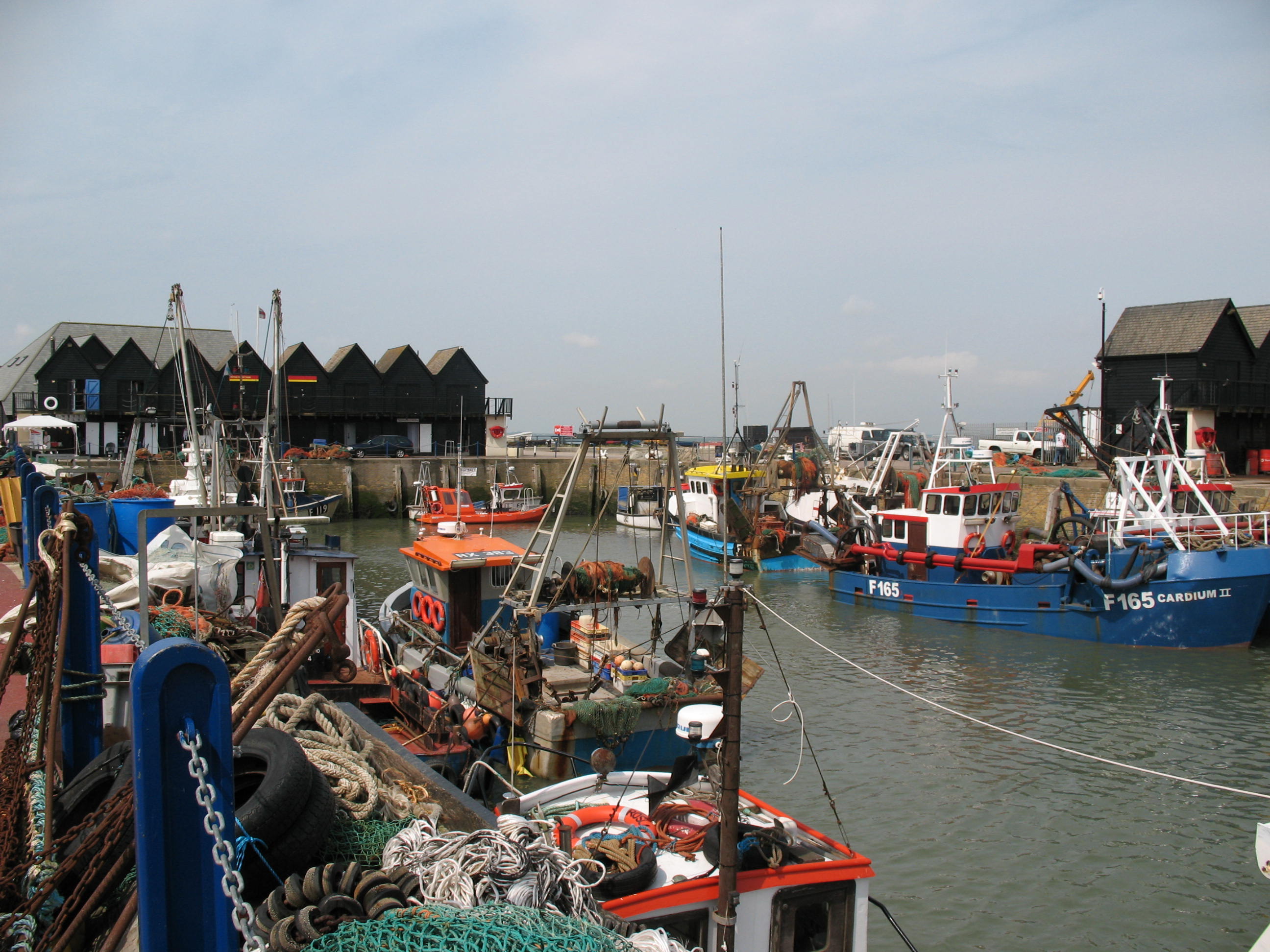
Whitstable () is a town on the north coast of Kent adjoining the convergence of the Swale Estuary and the Greater Thames Estuary in southeastern England, north of Canterbury and west of Herne Bay. The 2011 Census reported a population of 32,100. The town, formerly known as Whitstable-on-Sea, was famous for its 'Native Oysters' which were collected from beds beyond the low water mark from Roman times until the mid-20th century. The annual Whitstable Oyster Festival takes place during the summer. In 1830, one of the earliest passenger railway services was opened by the Canterbury and Whitstable Railway Company. In 1832 the company built a harbour and extended the line to handle coal and other bulk cargos for the City of Canterbury. The railway has closed but the harbour still plays an important role in the town's economy. The railway route, known as The Crab and Winkle Line, is now a cycle path which leads to the neighbouring city of Canterbury. History Archaeological finds ... [...More Info...] [...Related Items...] OR: [Wikipedia] [Google] [Baidu] |
Borough Of Swale
Swale is a local government district with borough status in Kent, England and is bounded by Medway to the west, Canterbury to the east, Ashford to the south and Maidstone to the south west. Its council is based in Sittingbourne. The district is named after the narrow channel called The Swale, that separates the mainland of Kent from the Isle of Sheppey, and which occupies the central part of the district. The district was formed in 1974 under the Local Government Act 1972, from the Borough of Faversham; the Borough of Queenborough-in-Sheppey, which covered the whole of Sheppey; the Sittingbourne and Milton Urban District; and Swale Rural District. Most of the southern half of the Borough lies within the Kent Downs Area of Outstanding Natural Beauty, whilst Sittingbourne and the Isle of Sheppey forms the concluding part of the Thames Gateway growth area. There are four towns in the borough: Sittingbourne and Faversham on the mainland, and Sheerness and Queenborough on S ... [...More Info...] [...Related Items...] OR: [Wikipedia] [Google] [Baidu] |
Ditches On Graveney Marshes - Geograph
A ditch is a small to moderate divot created to channel water. A ditch can be used for drainage, to drain water from low-lying areas, alongside roadways or fields, or to channel water from a more distant source for plant irrigation. Ditches are commonly seen around farmland, especially in areas that have required drainage, such as The Fens in eastern England and much of the Netherlands. Roadside ditches may provide a hazard to motorists and cyclists, whose vehicles may crash into them and get damaged, flipped over, or stuck and cause major injury, especially in poor weather conditions and rural areas. Etymology In Anglo-Saxon, the word ''dïc'' already existed and was pronounced "deek" in northern England and "deetch" in the south. The origins of the word lie in digging a trench and forming the upcast soil into a bank alongside it. This practice has meant that the name ''dïc'' was given to either the excavation or the bank, and evolved to both the words "dike"/"dyke" and ... [...More Info...] [...Related Items...] OR: [Wikipedia] [Google] [Baidu] |
Germany
Germany,, officially the Federal Republic of Germany, is a country in Central Europe. It is the second most populous country in Europe after Russia, and the most populous member state of the European Union. Germany is situated between the Baltic and North seas to the north, and the Alps to the south; it covers an area of , with a population of almost 84 million within its 16 constituent states. Germany borders Denmark to the north, Poland and the Czech Republic to the east, Austria and Switzerland to the south, and France, Luxembourg, Belgium, and the Netherlands to the west. The nation's capital and most populous city is Berlin and its financial centre is Frankfurt; the largest urban area is the Ruhr. Various Germanic tribes have inhabited the northern parts of modern Germany since classical antiquity. A region named Germania was documented before AD 100. In 962, the Kingdom of Germany formed the bulk of the Holy Roman Empire. During the 16th ce ... [...More Info...] [...Related Items...] OR: [Wikipedia] [Google] [Baidu] |
Mary Rose Trust
The Mary Rose Trust is a limited charitable trust based in Portsmouth in the United Kingdom. Its primary aims are to preserve, display and spread knowledge about the 16th century warship ''Mary Rose'' which sank in the Solent on 19 July 1545 and was salvaged by the Trust in October 1982. The Mary Rose Trust runs the Mary Rose Museum in Portsmouth Historic Dockyard. History The Mary Rose Trust traces its origins back to the Mary Rose Committee, founded in 1968 with the intent "to find, excavate, raise and preserve for all time such remains of the ship ''Mary Rose'' as may be of historical or archaeological interest". Rule 1983, p. 54. The wrecksite was scouted and surveyed with side scan sonar in 1967-68, revealing a hidden feature, the first loose timber was located in 1970 and the buried wreck of the ''Mary Rose'' finally located on 5 May 1971. Throughout the 1970s volunteer divers and archaeologists surveyed the ship and conducted some limited excavations. Marsden 2003, pp. 3 ... [...More Info...] [...Related Items...] OR: [Wikipedia] [Google] [Baidu] |
National Grid (Great Britain)
In the electricity sector in the United Kingdom, the National Grid is the high-voltage electric power transmission network serving Great Britain, connecting power stations and major substations and ensuring that electricity generated anywhere on it can be used to satisfy demand elsewhere. The network covers the great majority of Great Britain and several of the surrounding islands. It does not cover Northern Ireland, which is part of a single electricity market with the Republic of Ireland. The GB grid is connected as a wide area synchronous grid nominally running at 50 hertz. There are also undersea interconnections to other grids in the Isle of Man, Northern Ireland, the Republic of Ireland, France, Belgium, the Netherlands and Norway. On the breakup of the Central Electricity Generating Board in 1990, the ownership and operation of the National Grid in England and Wales passed to National Grid Company plc, later to become National Grid Transco, and now National Grid plc. In ... [...More Info...] [...Related Items...] OR: [Wikipedia] [Google] [Baidu] |
