|
Graun Im Vinschgau
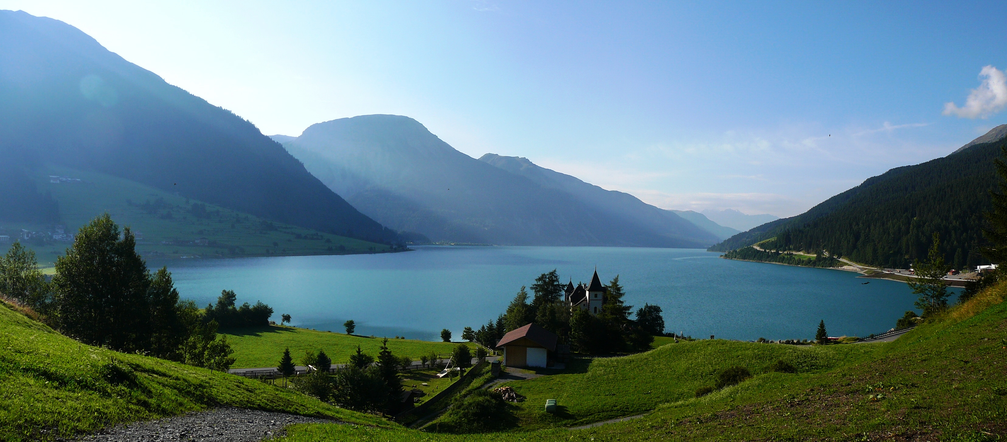
Graun im Vinschgau (; it, Curon Venosta ; rm, La Carun) is a ''comune'' (municipality) and a village in South Tyrol in northern Italy, located about northwest of Bolzano, on the border with Austria and Switzerland. Geography At 1 January 2011, it had a registered population of 2,447 and an area of .All demographics and other statistics: Italian statistical institute Istat. The municipality contains the subdivisions Langtaufers/Vallelunga, Reschen/Resia, Rojen/Roja and Sankt Valentin auf der Haide/San Valentino alla Muta. Adjacent municipalities: Mals, Kaunertal (Austria), Nauders (Austria), Pfunds (Austria), Sölden (Austria), Ramosch (Switzerland), Sent (Switzerland), and Tschlin (Switzerland). The village of Graun borders the Reschensee, which was massively deepened and extended when the valley was dammed in order to produce hydro-electricity. The original village was flooded after the dam's completion in July 1950; it had been abandoned and largely demolished, and Graun ... [...More Info...] [...Related Items...] OR: [Wikipedia] [Google] [Baidu] |
Trentino-Alto Adige/Südtirol
it, Trentino (man) it, Trentina (woman) or it, Altoatesino (man) it, Altoatesina (woman) or it, Sudtirolesegerman: Südtiroler (man)german: Südtirolerin (woman) , population_note = , population_blank1_title = Official languages , population_blank1 = ItalianGerman (South Tyrol) , population_blank2_title = Other languages , population_blank2 = in some municipalities:Ladin MochenoCimbrian , demographics_type1 = Citizenship , demographics1_footnotes = , demographics1_title1 = Italian , demographics1_info1 = 93% , timezone1 = CET , utc_offset1 = +1 , timezone1_DST = CEST , utc_offset1_DST = +2 , postal_code_type = , postal_code = , area_code_type = ISO 3166 code , area_code = IT-32 , blank_name_sec1 ... [...More Info...] [...Related Items...] OR: [Wikipedia] [Google] [Baidu] |
Reschensee
Reschensee (; ; Italian: ''Lago di Resia'' ) or Lake Reschen is an artificial lake in the western portion of South Tyrol, Italy, approximately south of the Reschen Pass, which forms the border with Austria, and east of the mountain ridge forming the border with Switzerland. With its capacity of 120 million cubic metres (97,000 ac·ft) it is the largest lake in the province. Its surface area of makes it also the largest lake above in the Alps.Schweizerischer Wasserwirtschaftsverband, Wasser- und Energiewirtschaft', Vol. 43-44, p.115 It is fed by the Adige, Rojenbach and Karlinbach and drained by the Adige. The lake is famous for the steeple of a submerged 14th-century church; when the water freezes, this can be reached on foot. A legend says that during winter one can still hear church bells ring. In reality the bells were removed from the tower on July 18, 1950, a week before the demolition of the church nave and the creation of the lake. Origins Plans for a smaller (5 m deep) ... [...More Info...] [...Related Items...] OR: [Wikipedia] [Google] [Baidu] |
Azure (heraldry)
In heraldry, azure ( , ) is the tincture with the colour blue, and belongs to the class of tinctures called "colours". In engraving, it is sometimes depicted as a region of horizontal lines or else is marked with either az. or b. as an abbreviation. The term azure shares origin with the Spanish word "azul", which refers to the same color, deriving from hispanic Arabic ''lazawárd'' the name of the deep blue stone now called lapis lazuli. The word was adopted into Old French by the 12th century, after which the word passed into use in the blazon of coats of arms. As an heraldic colour, the word ''azure'' means "blue", and reflects the name for the colour in the language of the French-speaking Anglo-Norman nobles following the Norman Conquest of England. A wide range of colour values is used in the depiction of azure in armory and flags, and in common usage it is often referred to simply as 'blue'. In addition to the standard blue tincture called azure, there is a lighter blue ... [...More Info...] [...Related Items...] OR: [Wikipedia] [Google] [Baidu] |
Division Of The Field
In heraldry, the field (background) of a shield can be divided into more than one area, or subdivision, of different tinctures, usually following the lines of one of the ordinaries and carrying its name (e.g. a shield divided in the shape of a chevron is said to be parted "per chevron"). Shields may be divided this way for ''differencing'' (to avoid conflict with otherwise similar coats of arms) or for purposes of '' marshalling'' (combining two or more coats of arms into one), or simply for style. The lines that divide a shield may not always be straight, and there is a system of terminology for describing patterned lines, which is also shared with the heraldic ordinaries. French heraldry takes a different approach in many cases from the one described in this article. Common divisions of the field Common partitions of the field are: * ''parted'' (or ''party'') ''per fess'' (halved horizontally) * ''party per pale'' (halved vertically) * ''party per bend'' (diagonally fr ... [...More Info...] [...Related Items...] OR: [Wikipedia] [Google] [Baidu] |
Romansh Language
Romansh (; sometimes also spelled Romansch and Rumantsch; Sursilvan: ; Vallader, Surmiran, and Rumantsch Grischun: ; Putèr: ; Sutsilvan: , , ; Jauer: ) is a Gallo-Romance language spoken predominantly in the Swiss canton of the Grisons (Graubünden). Romansh has been recognized as a national language of Switzerland since 1938, and as an official language in correspondence with Romansh-speaking citizens since 1996, along with German, French, and Italian. It also has official status in the canton of the Grisons alongside German and Italian and is used as the medium of instruction in schools in Romansh-speaking areas. It is sometimes grouped by linguists with Ladin and Friulian as the Rhaeto-Romance languages, though this is disputed. Romansh is one of the descendant languages of the spoken Latin language of the Roman Empire, which by the 5th century AD replaced the Celtic and Raetic languages previously spoken in the area. Romansh retains a small number of words fro ... [...More Info...] [...Related Items...] OR: [Wikipedia] [Google] [Baidu] |
Val Müstair
Val Müstair (german: Münstertal) is a municipality in the Engiadina Bassa/Val Müstair Region in the Swiss canton of Graubünden. It was formed on 1 January 2009 through the merger of Tschierv, Fuldera, Lü, Valchava, Santa Maria Val Müstair and Müstair. Demographics Val Müstair has a population (as of ) of . Geography The Val Müstair (German: ''Münstertal'', it, Val Monastero) is a mountain valley in the Swiss Alps. It connects the Fuorn Pass, () with the Italian province of South Tyrol and the Vinschgau (). The Benedictine Convent of Saint John at Müstair (''monastery''), a World Heritage Site, was probably founded by Charlemagne, sharing history with its neighbor, the Marienberg Abbey. The most important villages in the Val Müstair are: Tschierv (), Valchava (), Sta. Maria (), Müstair () (all Swiss) and Taufers im Münstertal in South Tyrol. There are no other inhabited connected valleys, but the road over the Umbrail Pass (and the Stelvio Pass) is ... [...More Info...] [...Related Items...] OR: [Wikipedia] [Google] [Baidu] |
Black Death
The Black Death (also known as the Pestilence, the Great Mortality or the Plague) was a bubonic plague pandemic occurring in Western Eurasia and North Africa from 1346 to 1353. It is the most fatal pandemic recorded in human history, causing the deaths of people, peaking in Europe from 1347 to 1351. Bubonic plague is caused by the bacterium ''Yersinia pestis'' spread by fleas, but it can also take a secondary form where it is spread by person-to-person contact via aerosols causing septicaemic or pneumonic plagues. The Black Death was the beginning of the second plague pandemic. The plague created religious, social and economic upheavals, with profound effects on the course of European history. The origin of the Black Death is disputed. The pandemic originated either in Central Asia or East Asia before spreading to Crimea with the Golden Horde army of Jani Beg as he was besieging the Genoese trading port of Kaffa in Crimea (1347). From Crimea, it was most likely carried ... [...More Info...] [...Related Items...] OR: [Wikipedia] [Google] [Baidu] |
Chur
, neighboring_municipalities= Arosa, Churwalden, Tschiertschen-Praden, Domat/Ems, Felsberg, Malix, Trimmis, Untervaz, Pfäfers , twintowns = Bad Homburg (Germany), Cabourg (France), Mayrhofen (Austria), Mondorf-les-Bains (Luxembourg), Terracina (Italy) '' Chur (, locally ; it, Coira ; rm, label= Sursilvan, Cuera ; rm, label=Vallader, Cuoira ; rm, label= Puter and Rumantsch Grischun, Cuira ; rm, label=Surmiran, Coira; rm, label= Sutsilvan, Cuera or ; french: Coire ) la, CVRIA, and . is the capital and largest town of the Swiss canton of the Grisons and lies in the Grisonian Rhine Valley, where the Rhine turns towards the north, in the northern part of the canton. The city, which is located on the right bank of the Rhine, is reputedly the oldest town of Switzerland. The official language of Chur is German,In this context, the term "German" is used as an umbrella term for any variety of German. A person is allowed to communicate with the authorities by using any ... [...More Info...] [...Related Items...] OR: [Wikipedia] [Google] [Baidu] |
Via Claudia Augusta
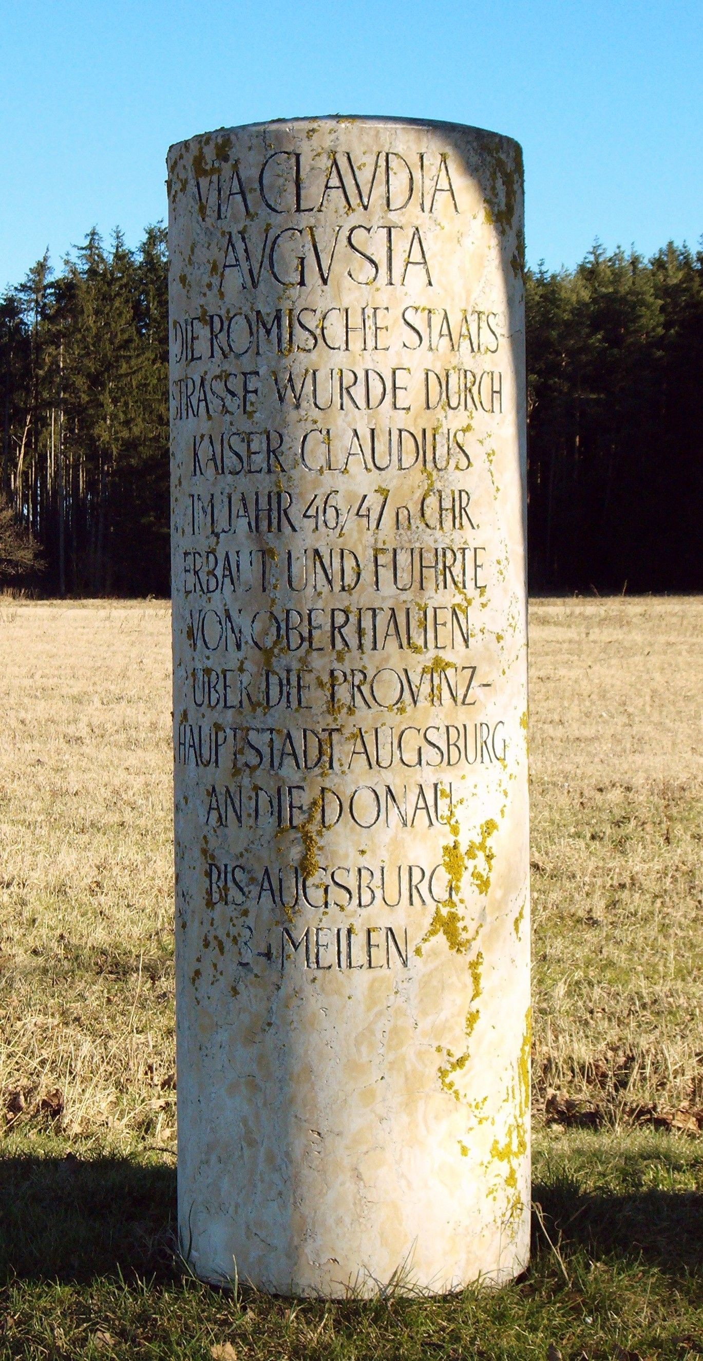
The Via Claudia Augusta is an ancient Roman road, which linked the valley of the Po River with Rhaetia (encompassing parts of modern Eastern Switzerland, Northern Italy, Western Austria, Southern Germany and all of Liechtenstein) across the Alps. The route still exists, and since the 1990s increased interest in long-distance hiking and cycling have made the German and Austrian stretches of the Via Claudia Augusta popular among tourists, with the result that modern signage (''illustration'') identifies the revitalised track. Since 2007, the ''Giontech Archeological Site'', in Mezzocorona/Kronmetz (Italy) serves as the Via Claudia Augusta International Research Center with the support of the ''Foundation Piana Rotaliana'' and the Government of the City of Mezzocorona/Kronmetz. History In 15 BC, the Roman general Nero Claudius Drusus, the stepson of Augustus, got orders from his stepfather to improve the passage through the Alps for military purposes and to increase Roman control ... [...More Info...] [...Related Items...] OR: [Wikipedia] [Google] [Baidu] |
Reschen Pass
Reschen Pass (german: Reschenpass, ; it, Passo di Resia ) is a mountain pass across the main chain of the Alps, connecting the Upper Inn Valley in the northwest with the Vinschgau region in the southeast. Since 1919, the border between South Tyrol, Italy and Tyrol, Austria has approximately followed the watershed, the pass summit at a height of being completely on Italian territory. Geography Location Reschen is one of the principal passes of the Alps, located between Brenner Pass to the east and the Splügen to the west. It is part of the drainage divide between the Danube in the north and the Adige in the south. The village of Reschen (''Resia'') is directly located on the watershed, on the shore of the Reschensee reservoir, built in 1950 and famous for the bell tower which emerges from the water in front of Graun municipality. The border with Nauders, Austria runs about north of the pass summit towards the tripoint with Valsot, Switzerland in the west. Climate Reschen has ... [...More Info...] [...Related Items...] OR: [Wikipedia] [Google] [Baidu] |
Alps
The Alps () ; german: Alpen ; it, Alpi ; rm, Alps ; sl, Alpe . are the highest and most extensive mountain range system that lies entirely in Europe, stretching approximately across seven Alpine countries (from west to east): France, Switzerland, Italy, Liechtenstein, Austria, Germany, and Slovenia. The Alpine arch generally extends from Nice on the western Mediterranean to Trieste on the Adriatic and Vienna at the beginning of the Pannonian Basin. The mountains were formed over tens of millions of years as the African and Eurasian tectonic plates collided. Extreme shortening caused by the event resulted in marine sedimentary rocks rising by thrusting and folding into high mountain peaks such as Mont Blanc and the Matterhorn. Mont Blanc spans the French–Italian border, and at is the highest mountain in the Alps. The Alpine region area contains 128 peaks higher than . The altitude and size of the range affect the climate in Europe; in the mountains, precipitation ... [...More Info...] [...Related Items...] OR: [Wikipedia] [Google] [Baidu] |
Roman Empire
The Roman Empire ( la, Imperium Romanum ; grc-gre, Βασιλεία τῶν Ῥωμαίων, Basileía tôn Rhōmaíōn) was the post-Republican period of ancient Rome. As a polity, it included large territorial holdings around the Mediterranean Sea in Europe, North Africa, and Western Asia, and was ruled by emperors. From the accession of Caesar Augustus as the first Roman emperor to the military anarchy of the 3rd century, it was a Principate with Italia as the metropole of its provinces and the city of Rome as its sole capital. The Empire was later ruled by multiple emperors who shared control over the Western Roman Empire and the Eastern Roman Empire. The city of Rome remained the nominal capital of both parts until AD 476 when the imperial insignia were sent to Constantinople following the capture of the Western capital of Ravenna by the Germanic barbarians. The adoption of Christianity as the state church of the Roman Empire in AD 380 and the fall of the Western ... [...More Info...] [...Related Items...] OR: [Wikipedia] [Google] [Baidu] |


